Category:Abermule with Llandyssil
English: Abermule with Llandyssil is a community in the principal area of Powys, Wales.
community in Powys, Wales  | |||||
| Upload media | |||||
| Instance of | |||||
|---|---|---|---|---|---|
| Location | Powys, Wales | ||||
| Population |
| ||||
| Area |
| ||||
| official website | |||||
 | |||||
Subcategories
This category has the following 4 subcategories, out of 4 total.
A
- Aberbechan (20 F)
L
Media in category "Abermule with Llandyssil"
The following 200 files are in this category, out of 219 total.
(previous page) (next page)-
 A483 - geograph.org.uk - 4442000.jpg 640 × 304; 32 KB
-
 A483 and Severn valley, from the railway - geograph.org.uk - 4553689.jpg 1,600 × 846; 247 KB
-

-
 A483 at Bryn-y-Maes - geograph.org.uk - 3194615.jpg 640 × 407; 49 KB
-
 A483 looking east near Cil-Gwrgan - geograph.org.uk - 3288298.jpg 640 × 480; 42 KB
-
 A483 near Brynderwyn - geograph.org.uk - 3288300.jpg 640 × 479; 49 KB
-
 A483 near Glan Hafren - geograph.org.uk - 3288302.jpg 640 × 480; 43 KB
-
 A483 near Glenhafren - geograph.org.uk - 5489346.jpg 640 × 480; 408 KB
-
 A483 near Maeshafren - geograph.org.uk - 5488193.jpg 640 × 480; 338 KB
-
 A483 north of Llanmerewig - geograph.org.uk - 5488184.jpg 640 × 480; 354 KB
-
 A483 south at Glanhafren bridge - geograph.org.uk - 2961558.jpg 640 × 510; 133 KB
-
 A483 through the trees - geograph.org.uk - 4448723.jpg 640 × 426; 57 KB
-
 Abermule - geograph.org.uk - 4628951.jpg 640 × 349; 36 KB
-
 Abermule village sign - geograph.org.uk - 1903863.jpg 640 × 480; 66 KB
-

-
 B4386 junction with A483 - geograph.org.uk - 3194612.jpg 640 × 382; 61 KB
-
 B4389 approaching overhead lines - geograph.org.uk - 4839218.jpg 640 × 434; 112 KB
-
 B4389 junction from A483 southbound - geograph.org.uk - 2674816.jpg 640 × 493; 55 KB
-
 B4568 junction from B4389 - geograph.org.uk - 4839226.jpg 640 × 461; 46 KB
-
 Barns at Little Pentre - geograph.org.uk - 1934098.jpg 640 × 480; 69 KB
-
 Bechan Brook - geograph.org.uk - 1321964.jpg 480 × 640; 341 KB
-
 Bechan Brook - geograph.org.uk - 1321996.jpg 480 × 640; 263 KB
-
 Beef cattle at Upper Bryntalch farm - geograph.org.uk - 4866405.jpg 640 × 480; 111 KB
-
 Beef cattle drinking beer - geograph.org.uk - 4866435.jpg 640 × 480; 89 KB
-

-
 Bridge 150, Montgomery Canal - geograph.org.uk - 6026523.jpg 5,184 × 3,888; 7.29 MB
-
 Bridge over Kerry Branch Railway - geograph.org.uk - 1951940.jpg 3,648 × 2,736; 3.34 MB
-
 Brooklyn, Llandyssil.JPG 1,600 × 1,200; 639 KB
-
 Brooklyn, Llandysssil.JPG 1,546 × 1,064; 596 KB
-
 Brynderwen - geograph.org.uk - 4441991.jpg 640 × 426; 42 KB
-
 Brynderwen Bridge over River Severn, Abermule - geograph.org.uk - 5697002.jpg 1,280 × 720; 890 KB
-
 Brynhyfryd - geograph.org.uk - 5737863.jpg 3,264 × 2,448; 5.45 MB
-
 Butterbur flower by Llandyssil bridge - geograph.org.uk - 2866039.jpg 640 × 480; 141 KB
-
 Butterbur flowers by Llandyssil bridge - geograph.org.uk - 2866041.jpg 480 × 640; 162 KB
-
 Cadw car park below Dolforwyn Castle - geograph.org.uk - 2702262.jpg 640 × 480; 61 KB
-
 Castell Dolforwyn - Dolforwyn Castle - geograph.org.uk - 5713055.jpg 640 × 480; 98 KB
-
 Castell y Gwynt - geograph.org.uk - 2403847.jpg 640 × 480; 80 KB
-
 Cefnbryntalch - geograph.org.uk - 203602.jpg 640 × 480; 119 KB
-
 Chapel in Abermule - geograph.org.uk - 4863584.jpg 640 × 480; 67 KB
-
 Cherry Orchard Bungalow from B4385 - geograph.org.uk - 3597084.jpg 640 × 480; 66 KB
-
 Cherry Orchard on B4385 - geograph.org.uk - 3597087.jpg 640 × 480; 61 KB
-
 Closed Gate - geograph.org.uk - 906619.jpg 640 × 399; 89 KB
-
 Country lane near Montgomery - geograph.org.uk - 1934094.jpg 640 × 480; 75 KB
-
 Court Close, Abermule - geograph.org.uk - 3266121.jpg 640 × 480; 76 KB
-
 Dead trees on the Severn river bank - geograph.org.uk - 1227572.jpg 640 × 429; 126 KB
-
 Dolforwyn Castle - geograph.org.uk - 2618267.jpg 2,592 × 1,944; 1.91 MB
-
 Dolforwyn Castle - geograph.org.uk - 6026534.jpg 1,080 × 810; 189 KB
-
 Dolforwyn Castle ruins - geograph.org.uk - 6026531.jpg 5,184 × 3,888; 4.65 MB
-
 Dormer Window dated 1630, Phipp's Tenement , Llandyssil.JPG 1,600 × 1,200; 261 KB
-
 Double gate and track on minor road - geograph.org.uk - 3597227.jpg 640 × 480; 65 KB
-
 Driveway to Gate Farm - geograph.org.uk - 1934045.jpg 640 × 480; 123 KB
-
 Entrance to Cefn Bryntalch - geograph.org.uk - 3597211.jpg 640 × 480; 89 KB
-
 Entrance to Green Lane Burial ground - geograph.org.uk - 3597102.jpg 640 × 480; 75 KB
-

-
 Ewe and twin lambs - geograph.org.uk - 4837855.jpg 640 × 480; 80 KB
-
 Ewes and lambs north of Llandyssil - geograph.org.uk - 2868147.jpg 640 × 480; 83 KB
-
 Ewes and lambs north of Llandyssil - geograph.org.uk - 2868149.jpg 640 × 480; 90 KB
-
 Exposed river bed - geograph.org.uk - 1227364.jpg 429 × 640; 148 KB
-

-
 Farmland by the B4386 - geograph.org.uk - 4441999.jpg 640 × 426; 41 KB
-
 Farmland in the Severn Valley - geograph.org.uk - 4628947.jpg 640 × 426; 59 KB
-
 Ffarm Pwll Coch - Pwll Coch Farm - geograph.org.uk - 5713027.jpg 640 × 480; 81 KB
-
 Field barn in the Severn Valley - geograph.org.uk - 4441975.jpg 640 × 426; 48 KB
-
 Fields beside the A483 - geograph.org.uk - 2988573.jpg 4,288 × 3,216; 3.75 MB
-
 Fields of silage bales - geograph.org.uk - 1975088.jpg 3,008 × 2,000; 1.45 MB
-
 Flat field near Abermule - geograph.org.uk - 4866487.jpg 640 × 480; 55 KB
-
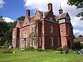
 Fronfraith Hall, 2014.JPG 4,928 × 3,264; 6.56 MB
-
 Fronfraith Hall, Llandyssil.png 580 × 315; 148 KB
-
 Frost on oak twigs - geograph.org.uk - 1115872.jpg 514 × 640; 115 KB
-
 Gates ^ drive at Cefnbryntalch - geograph.org.uk - 4837875.jpg 640 × 480; 135 KB
-

-
 Goetre Hill - geograph.org.uk - 801287.jpg 640 × 480; 80 KB
-
 Goetre Hill - geograph.org.uk - 803761.jpg 640 × 359; 57 KB
-
 Gorse beside the track - geograph.org.uk - 4863539.jpg 640 × 480; 128 KB
-
 Gorse bushes in field north of B4389 - geograph.org.uk - 6026530.jpg 5,184 × 3,888; 4.99 MB
-
 Green burial ground, Cefnbryntalch - geograph.org.uk - 2865938.jpg 640 × 480; 144 KB
-
 Green burial ground, Cefnbryntalch - geograph.org.uk - 2865944.jpg 640 × 480; 92 KB
-
 Green burial ground, Cefnbryntalch - geograph.org.uk - 2865953.jpg 640 × 480; 154 KB
-
 Gwern-yr-ychain - geograph.org.uk - 1115322.jpg 640 × 480; 116 KB
-
 Gwern-yr-ychain Dingle - geograph.org.uk - 1115460.jpg 640 × 480; 110 KB
-
 Hafod Farm - geograph.org.uk - 1934063.jpg 640 × 480; 80 KB
-
 Hedgeline below Upper Bolbro farm - geograph.org.uk - 4861749.jpg 640 × 480; 56 KB
-
 Hedgerow near Abermule - geograph.org.uk - 4837793.jpg 640 × 480; 152 KB
-
 Hillside track - geograph.org.uk - 4862463.jpg 640 × 480; 92 KB
-
 Hips by Gwern-yr-ychain Dingle - geograph.org.uk - 1115819.jpg 640 × 480; 111 KB
-
 House at Aberbechan - geograph.org.uk - 2127655.jpg 640 × 480; 83 KB
-
 House in Abermule, Powys - geograph.org.uk - 4863554.jpg 640 × 480; 79 KB
-
 Houses in Glan Hafren - geograph.org.uk - 5737869.jpg 3,264 × 2,448; 3.15 MB
-
 Ifor and his Welsh Wagyu - geograph.org.uk - 4866474.jpg 640 × 480; 139 KB
-

-
 Junction at Green Lane near Abermule - geograph.org.uk - 4837822.jpg 640 × 480; 67 KB
-
 Lambs exploring the bank of the brook - geograph.org.uk - 2866050.jpg 640 × 480; 124 KB
-
 Lane on the edge of Abermule - geograph.org.uk - 4628955.jpg 640 × 426; 48 KB
-
 Llandyssil Churchyard. Grave of Richard Jones and his wife Catharina..jpg 995 × 1,143; 894 KB
-
 Llandyssil Churchyard. Grave of Walter Buckley Jones and his wife Edith ('Covie').jpg 1,123 × 1,498; 1.35 MB
-
 Llandyssil Montgomery. - geograph.org.uk - 5628175.jpg 3,264 × 2,448; 2.58 MB
-
 Llandyssil old church (4171302077).jpg 750 × 637; 132 KB
-
 Llandyssil Rectory from the SW 01.jpg 1,943 × 1,867; 1.32 MB
-
 Llandyssil. Village Hall with extension IMG 3035.JPG 1,600 × 1,200; 235 KB
-

-
 Looking upstream from Llandyssil bridge - geograph.org.uk - 2866004.jpg 640 × 480; 172 KB
-
 Lower Bolbro farm house - geograph.org.uk - 4861729.jpg 640 × 480; 61 KB
-
 Lych Gate, St Tysul's Old curchyard, Llandyssil.JPG 1,600 × 1,200; 430 KB
-
 Mill Mound, Llandyssil.JPG 1,600 × 1,200; 167 KB
-
 Minor road at Bryntalch Villa - geograph.org.uk - 3597218.jpg 640 × 522; 65 KB
-
 Minor road junction with B4386 - geograph.org.uk - 3597229.jpg 640 × 479; 67 KB
-
 Minor road to Fron - geograph.org.uk - 3804913.jpg 640 × 449; 66 KB
-

-
 Monkey-puzzle trees in Abermule - geograph.org.uk - 4863590.jpg 640 × 480; 96 KB
-
 Montgomery Canal - geograph.org.uk - 6026512.jpg 5,184 × 3,888; 5.3 MB
-
 Montgomery Canal in winter - geograph.org.uk - 6026516.jpg 5,184 × 3,888; 6.7 MB
-
 Montgomery Canal near Aberbechan - geograph.org.uk - 6026525.jpg 5,184 × 3,888; 5.64 MB
-
 Montgomery Canal north of Abermule - geograph.org.uk - 2907327.jpg 1,500 × 1,125; 1.79 MB
-

-
 Nestled in the woods - geograph.org.uk - 6026510.jpg 5,184 × 3,888; 7.03 MB
-
 No Longer Required - geograph.org.uk - 807376.jpg 640 × 480; 93 KB
-
 Old barns at Cefnllan farm - geograph.org.uk - 3082477.jpg 640 × 480; 96 KB
-

-

-
 Otter Hunt.png 830 × 626; 758 KB
-
 Overgrown canal near Brynderwen - geograph.org.uk - 2004699.jpg 640 × 480; 150 KB
-

-
 Pant-y-maen Farm near Montgomery - geograph.org.uk - 5608460.jpg 5,184 × 2,920; 4.07 MB
-
 Part of Fron farm - geograph.org.uk - 3082453.jpg 640 × 480; 108 KB
-

-

-
 Pasture by the brook - geograph.org.uk - 2866046.jpg 640 × 480; 121 KB
-
 Pasture on Cefn y Coed - geograph.org.uk - 2868177.jpg 640 × 480; 139 KB
-
 Phipp's Tenement and Barn, Llandyssil.JPG 1,600 × 1,200; 703 KB
-
 Phipp's Tenement Llandyssil.JPG 1,600 × 1,200; 917 KB
-
 Phone box near Upper Pentre - geograph.org.uk - 3804912.jpg 640 × 471; 75 KB
-

-
 Presbyterian church by B4389 - geograph.org.uk - 4842713.jpg 640 × 437; 73 KB
-
 Pylon by the hedge - geograph.org.uk - 4628939.jpg 640 × 426; 61 KB
-
 Pylon in the Severn Valley - geograph.org.uk - 4441965.jpg 640 × 426; 39 KB
-
 Pylon in the Severn Valley - geograph.org.uk - 4441990.jpg 640 × 426; 34 KB
-
 Red House Crossing Abermule. - geograph.org.uk - 2142812.jpg 3,648 × 2,736; 2.51 MB
-
 River Mule at Abermule - geograph.org.uk - 1368608.jpg 640 × 426; 130 KB
-
 River Severn - geograph.org.uk - 1759320.jpg 2,048 × 1,536; 721 KB
-
 River Severn at Abermule, 1949 - geograph.org.uk - 4228095.jpg 2,272 × 1,448; 1.86 MB
-

-
 Road junction by Goron-ddu - geograph.org.uk - 3597090.jpg 640 × 480; 124 KB
-
 Road Junction near Brynderwen Farm - geograph.org.uk - 5488196.jpg 640 × 427; 345 KB
-

-
 Road To Llandyssil - geograph.org.uk - 906640.jpg 640 × 399; 112 KB
-
 Roadside chapel - geograph.org.uk - 941818.jpg 640 × 480; 66 KB
-
 Rough shrine at Dolforwyn Castle - geograph.org.uk - 2702345.jpg 640 × 480; 128 KB
-
 Scene at Upper Bryntalch farm - geograph.org.uk - 4866417.jpg 640 × 480; 82 KB
-

-
 Severn Valley - geograph.org.uk - 4441961.jpg 640 × 426; 56 KB
-
 Severn valley at Abermule - Aber-miwl - geograph.org.uk - 5025510.jpg 1,600 × 687; 135 KB
-
 Severn valley downstream of Abermule - geograph.org.uk - 4553696.jpg 1,600 × 619; 249 KB
-
 Sheep and Pasture - geograph.org.uk - 807629.jpg 640 × 480; 50 KB
-
 Sheep grazing - geograph.org.uk - 4628934.jpg 640 × 426; 40 KB
-
 Sheltered by trees - geograph.org.uk - 6026518.jpg 5,184 × 3,888; 5.47 MB
-

-

-
 Snowdrops on the bank ^ verge - geograph.org.uk - 4837839.jpg 640 × 480; 177 KB
-
 Some of Harry Potter's Dementors^ - geograph.org.uk - 1076710.jpg 640 × 506; 121 KB
-
 Spring Sowing - geograph.org.uk - 807377.jpg 640 × 480; 67 KB
-
 Stile and waymarker - geograph.org.uk - 1076573.jpg 640 × 429; 144 KB
-
 Strange dead tree - geograph.org.uk - 1076582.jpg 460 × 640; 135 KB
-
 Stream and path near Cwminkin - geograph.org.uk - 1076566.jpg 640 × 429; 168 KB
-
 Swans in the Snow - geograph.org.uk - 2615453.jpg 720 × 405; 205 KB
-
 Tan House - geograph.org.uk - 906305.jpg 383 × 640; 106 KB
-
 The A483 at Glan Hafren - geograph.org.uk - 2988561.jpg 3,696 × 2,502; 2.39 MB
-

-
 The downstream side of Llandyssil bridge - geograph.org.uk - 2866018.jpg 480 × 640; 123 KB
-
 The Former Wesleyan Chapel, Llandyssil.JPG 1,600 × 1,200; 171 KB
-

-

-
 The re-built porch of the Old Church, Llandyssil.JPG 1,600 × 1,200; 460 KB
-
 The Severn Valley near Aberbechan - geograph.org.uk - 4448721.jpg 640 × 372; 34 KB
-

-
 The Upper House, Public House, Llandyssil.JPG 1,600 × 1,200; 258 KB
-
 The upstream side of Llandyssil bridge - geograph.org.uk - 2866008.jpg 640 × 480; 131 KB
-
 The Village of Llandyssil - geograph.org.uk - 5877805.jpg 1,920 × 1,080; 1,016 KB
-
 The Waterloo Abermule - geograph.org.uk - 1368631.jpg 640 × 426; 79 KB
-

-

-
 Track by Gwern-yr-ychain Dingle - geograph.org.uk - 1115689.jpg 480 × 640; 103 KB
-
 Track in the wood - geograph.org.uk - 4861909.jpg 640 × 480; 119 KB
-
 Trees along the River Severn - geograph.org.uk - 4441971.jpg 640 × 426; 47 KB
-
 Tributary near Abermule - geograph.org.uk - 4863610.jpg 640 × 480; 115 KB
-
 Twisted willows by the brook - geograph.org.uk - 2866051.jpg 640 × 480; 129 KB
-
 Upper Bolbro farm house - geograph.org.uk - 4861786.jpg 640 × 480; 67 KB
-

-

-

-
 View down the field - geograph.org.uk - 4837943.jpg 640 × 480; 56 KB
-

-

-
 View From Castle Wood - geograph.org.uk - 819592.jpg 640 × 480; 73 KB
-

-
 View from the green burial ground - geograph.org.uk - 2865898.jpg 640 × 480; 143 KB
-

-

-

-

-
 View over Llandyssil from the old churchyard..JPG 1,600 × 1,200; 729 KB


.jpg)

.jpg)


