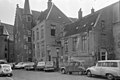
Category:Achter de Dom 5, Utrecht
| Object location | | View all coordinates using: OpenStreetMap |
|---|
building in Utrecht, Netherlands  | |||||
| Upload media | |||||
| Instance of | |||||
|---|---|---|---|---|---|
| Location | Utrecht, Netherlands | ||||
| Street address |
| ||||
| Heritage designation |
| ||||
 | |||||
|
This is a category about rijksmonument number 35975
|
| Address |
|
Media in category "Achter de Dom 5, Utrecht"
The following 3 files are in this category, out of 3 total.
-
 Achter de Dom 5.JPG 3,456 × 2,592; 4.27 MB
-
 Universiteitsaula oost-gevel aan de Achter de Dom - Utrecht - 20212583 - RCE.jpg 954 × 1,200; 236 KB
-
 Voorgevels - Utrecht - 20235358 - RCE.jpg 1,200 × 802; 146 KB

