Category:Adstone

village and civil parish in Northamptonshire, United Kingdom  | |||||
| Upload media | |||||
| Instance of | |||||
|---|---|---|---|---|---|
| Location | West Northamptonshire, Northamptonshire, East Midlands, England | ||||
 | |||||
Subcategories
This category has only the following subcategory.
A
- All Saints' church, Adstone (2 F)
Media in category "Adstone"
The following 36 files are in this category, out of 36 total.
-
 Adstone - geograph.org.uk - 187661.jpg 640 × 480; 129 KB
-
 Adstone - geograph.org.uk - 308384.jpg 640 × 480; 145 KB
-
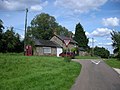 Adstone crossroads - geograph.org.uk - 923157.jpg 640 × 480; 83 KB
-
 Bridleway to Moreton Pinkney - geograph.org.uk - 5368472.jpg 1,024 × 768; 239 KB
-
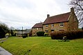 Cottages at Adstone - geograph.org.uk - 5711569.jpg 640 × 427; 197 KB
-
 Entrance to Adstone - geograph.org.uk - 3823088.jpg 640 × 480; 48 KB
-
 Entrance to Highfields Farm - geograph.org.uk - 5394121.jpg 1,024 × 785; 255 KB
-
 Field View Farm, Adstone - geograph.org.uk - 4973712.jpg 1,600 × 996; 465 KB
-
 Footbridge over a stream near Fulling Mill - geograph.org.uk - 5392418.jpg 1,024 × 768; 306 KB
-
 Footpath to Maidford - geograph.org.uk - 5368466.jpg 1,024 × 768; 129 KB
-
 Footpath to Maidford - geograph.org.uk - 5392427.jpg 1,024 × 768; 173 KB
-
 Fulling Mill - geograph.org.uk - 5368470.jpg 1,024 × 768; 119 KB
-
 House near Highfields Farm - geograph.org.uk - 5368471.jpg 1,024 × 768; 196 KB
-
 New fence and stile - geograph.org.uk - 5392406.jpg 1,024 × 768; 268 KB
-
 Oxford Lane - geograph.org.uk - 493907.jpg 640 × 477; 83 KB
-
 Road near Adstone Lodge - geograph.org.uk - 5711571.jpg 640 × 427; 181 KB
-
 Shallow dip east of Adstone - geograph.org.uk - 5394131.jpg 1,024 × 768; 167 KB
-
 Stratford and Midland Junction Railway Near Blakesley - geograph.org.uk - 4715975.jpg 1,600 × 1,200; 963 KB
-
 The hamlet of Adstone - geograph.org.uk - 2929616.jpg 3,648 × 2,639; 1.68 MB
-

-
 Un-named road crosses un-named stream south of Maidford - geograph.org.uk - 2929662.jpg 3,648 × 2,556; 1.5 MB
-
 Un-named road northeast of Fourwinds - geograph.org.uk - 2929598.jpg 3,450 × 2,395; 1.14 MB
-
 Use for an old roadside pit - geograph.org.uk - 5394137.jpg 1,024 × 768; 308 KB
-
 Willows by a stream near Fulling Mill - geograph.org.uk - 5392459.jpg 1,024 × 768; 353 KB
-
 Adstone - geograph.org.uk - 187699.jpg 640 × 480; 140 KB
-
 Adstone - geograph.org.uk - 187701.jpg 640 × 480; 132 KB
-
 Adstone - geograph.org.uk - 308399.jpg 640 × 480; 181 KB
-
 Bluebells in Ashby Gorse - geograph.org.uk - 493910.jpg 640 × 477; 158 KB
-
 Junction with Oxford Lane - geograph.org.uk - 493913.jpg 640 × 477; 105 KB
-
 Lane south of Little Preston - geograph.org.uk - 493895.jpg 640 × 477; 107 KB
-
 Macmillan Way near Adstone - geograph.org.uk - 493902.jpg 640 × 477; 87 KB
-
 Maidford - geograph.org.uk - 308378.jpg 640 × 480; 101 KB
-
 Moreton Pinkney - geograph.org.uk - 413639.jpg 640 × 480; 124 KB
-
 Moreton Pinkney - geograph.org.uk - 413645.jpg 640 × 480; 125 KB
-
 Plumpton Wood - geograph.org.uk - 308461.jpg 640 × 480; 145 KB
-
 Plumpton Wood - geograph.org.uk - 308604.jpg 640 × 480; 140 KB


