Category:Aerial photographs of Essex County, Massachusetts
Subcategories
This category has the following 11 subcategories, out of 11 total.
Media in category "Aerial photographs of Essex County, Massachusetts"
The following 9 files are in this category, out of 9 total.
-
 Aerial view of Marblehead Harbor, August 2017.jpg 3,600 × 2,400; 3.39 MB
-
 Aerial view of Newburyport Branch causeway in Lynnfield, March 2022.JPG 2,827 × 2,121; 3.43 MB
-
 Aerial view of Swampscott Quarry, March 2022.JPG 3,880 × 2,911; 6.35 MB
-
 Aerial view of Swampscott, March 2022.JPG 4,034 × 3,027; 7.39 MB
-
 Greenwood farm 1920, Ipswich, Mass.jpg 1,045 × 1,404; 136 KB
-
 Northshore Mall aerial photo, July 2016.JPG 1,900 × 1,433; 709 KB
-
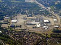 Northshore Mall and surroundings aerial photo, July 2016.JPG 3,301 × 2,481; 1.87 MB
-
 Swampscott, MA aerial view.JPG 4,320 × 3,240; 5.94 MB
-
 The Crane Estate at Castle Hill in Ipswich, Massachusetts.jpg 5,472 × 3,648; 10.49 MB


