Category:Aerial photographs of Landkreis Northeim

Deutsch: Luftbilder aus dem Landkreis Northeim, Niedersachsen
Subcategories
This category has only the following subcategory.
Media in category "Aerial photographs of Landkreis Northeim"
The following 38 files are in this category, out of 38 total.
-
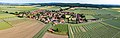
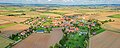
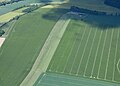
 2021-06-11 Luftaufnahme Andershausen.jpg 8,013 × 3,374; 21.37 MB
-
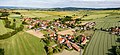
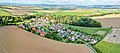
 2021-06-11 Luftaufnahme Kuventhal.jpg 9,591 × 4,180; 25.99 MB
-
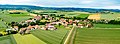
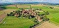
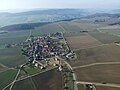
 2021-06-15 Luftaufnahme Dassensen.jpg 10,053 × 3,211; 22.99 MB
-
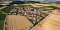
 2021-06-15 Luftaufnahme Ellensen.jpg 7,012 × 3,196; 16.51 MB
-
 2021-06-15 Luftaufnahme Krimmensen.jpg 8,452 × 3,277; 20.46 MB
-
 2021-06-22 Luftaufnahme Edemissen.jpg 7,176 × 3,035; 16.99 MB
-
 2021-06-22 Luftaufnahme Eilensen.jpg 9,222 × 2,908; 20.27 MB
-
 2021-06-22 Luftaufnahme Odagsen.jpg 8,570 × 3,114; 22.02 MB
-
 2021-07-18 Luftaufnahme Kohnsen.jpg 8,413 × 3,185; 18.1 MB
-
 2021-07-23 Luftaufnahme Bartshausen.jpg 9,873 × 3,645; 27.27 MB
-
 2021-07-23 Luftaufnahme Hallensen.jpg 7,976 × 3,602; 24.48 MB
-
 2021-07-23 Luftaufnahme Vardeilsen.jpg 7,048 × 3,612; 18.21 MB
-
 2021-09-26 Luftaufnahme Buensen.jpg 7,007 × 3,204; 22.02 MB
-
 2021-09-26 Luftaufnahme Dörrigsen.jpg 7,984 × 3,178; 20.83 MB
-
 2021-09-26 Luftaufnahme Rotenkirchen.jpg 7,137 × 3,174; 20.91 MB
-
 2021-09-26 Luftaufnahme Strodthagen.jpg 7,020 × 3,333; 20.83 MB
-
 2021-09-26 Luftaufnahme Wenzen.jpg 9,935 × 3,260; 25.54 MB
-
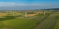 2023-06-23 - Windpark Holtensen-Hullersen.png 10,000 × 4,871; 74.33 MB
-
 2023-06-28 - Luftaufnahme Naensen.jpg 12,852 × 4,470; 41.39 MB
-
 2023-08-01 - Spezialkran für den Aufbau von Windkraftanlagen.jpg 8,083 × 4,426; 23 MB
-
 2023-08-01 - Windpark Holtensen-Hullersen.jpg 9,262 × 3,351; 19.75 MB
-
 Aerial image of the Bad Gandersheim airfield.jpg 5,200 × 2,800; 4.65 MB
-
 Aerial image of the Hoppensen airfield.jpg 4,500 × 3,000; 5.25 MB
-
 Aerial image of the Northeim airfield.jpg 5,000 × 3,000; 6.01 MB
-
 Aerial image of the Sultmer Berg gliding site.jpg 4,500 × 2,800; 5.58 MB
-
 Aerial image of the Uslar airfield (view from the southeast).jpg 5,000 × 3,200; 7.12 MB
-
 Aerial image of the Uslar airfield.jpg 4,200 × 3,000; 3.12 MB
-
 Aerial image of the Weper gliding site.jpg 3,800 × 3,000; 6.21 MB
-
 Einbeck Germany aerial view.jpg 1,600 × 1,200; 419 KB
-
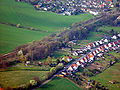
 Heckenbeck und Hilprechtshausen aus der Luft.jpg 2,848 × 2,136; 1.43 MB
-
 Kassel Ferry Lippoldsberg Aerial Pan180.jpg 8,192 × 2,700; 21.01 MB
-
 LuftbildKatlenburg.jpg 1,704 × 2,272; 840 KB
-
 Northeim und Northeimer Seenplatte.jpg 1,600 × 812; 322 KB
-
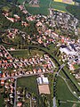
 Uslar Alleestraße01a.jpg 2,368 × 1,920; 2.9 MB
-
 Uslar Allershausen02a.jpg 2,560 × 1,920; 3.68 MB
-
 Uslar Allershausen04a.jpg 1,564 × 1,920; 2.3 MB
-
 Uslar Graftplatz1.jpg 1,070 × 828; 286 KB
-
 Uslar kernstadt.jpg 2,560 × 1,920; 1.77 MB


.jpg)


