Category:Aerial photographs of Moscow Oblast
Wikimedia category | |||||
| Upload media | |||||
| Instance of | |||||
|---|---|---|---|---|---|
| Category combines topics | |||||
| Moscow Oblast | |||||
administrative division (oblast) in central Russia  someja satełitar in agosto  .svg)  | |||||
| Instance of | |||||
| Part of | |||||
| Named after | |||||
| Location |
| ||||
| Capital | |||||
| Legislative body | |||||
| Executive body | |||||
| Head of government | |||||
| Inception |
| ||||
| Population |
| ||||
| Area |
| ||||
| official website | |||||
 | |||||

Federal subjects of the Russian Federation:
Republics: Altai · Bashkortostan · (Crimea) · Dagestan · Karachay–Cherkessia · Karelia · Mordovia · Tatarstan · UdmurtiaKrais: Altai · Kamchatka · Khabarovsk · Krasnodar · Krasnoyarsk · Perm · Primorsky ·
Oblasts: Arkhangelsk · Astrakhan · Chelyabinsk · Irkutsk · Ivanovo · Kaliningrad · Kaluga · Kemerovo · Kostroma · Leningrad · Lipetsk · Magadan · Moscow · Murmansk · Nizhny Novgorod · Novgorod · Novosibirsk · Orenburg · Penza · Pskov · Rostov · Ryazan · Sakhalin · Saratov · Smolensk · Sverdlovsk · Tambov · Tomsk · Tula · Tver · Tyumen · Vladimir · Volgograd · Vologda · Voronezh · Yaroslavl
Federal cities: Moscow · Saint Petersburg ·
Autonomous oblast: Jewish
Autonomous okrugs: Chukotka ·
Subcategories
This category has the following 6 subcategories, out of 6 total.
P
S
- Aerial photographs of Serpukhov (26 F)
Media in category "Aerial photographs of Moscow Oblast"
The following 200 files are in this category, out of 250 total.
(previous page) (next page)-
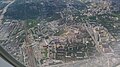
 0038 25th of July 2016 in Moscow Oblast.jpg 4,948 × 3,280; 10.01 MB
-
 0039 25th of July 2016 in Moscow Oblast.jpg 4,948 × 3,280; 11.73 MB
-
 0040 25th of July 2016 in Moscow Oblast.jpg 4,948 × 3,280; 13.51 MB
-
 0041 25th of July 2016 in Moscow Oblast.jpg 4,948 × 3,280; 9.6 MB
-
 0042 25th of July 2016 in Moscow Oblast.jpg 3,280 × 4,948; 12.14 MB
-
 0043 25th of July 2016 in Moscow Oblast.jpg 3,280 × 4,948; 13.17 MB
-
 0044 25th of July 2016 in Moscow Oblast.jpg 4,948 × 3,280; 9.42 MB
-
 0045 25th of July 2016 in Moscow Oblast.jpg 4,948 × 3,280; 11.08 MB
-

-
 2019-07-25-3001-Brussels-Moscow-Buildings.jpg 3,882 × 2,477; 5.11 MB
-
 2019-07-25-3005-Brussels-Moscow-Buildings.jpg 3,912 × 2,598; 6.06 MB
-
 2019-07-25-3006-Brussels-Moscow-Buildings.jpg 4,014 × 2,666; 6.96 MB
-
 2019-07-25-3007-Brussels-Moscow-Buildings.jpg 3,722 × 2,472; 6.28 MB
-
 2019-07-25-3008-Brussels-Moscow-Buildings.jpg 3,577 × 2,376; 5.1 MB
-
 20190218 104338 Aeroflot.jpg 4,608 × 2,592; 3.1 MB
-
 20190218 113155 Russia.jpg 4,608 × 2,592; 4.9 MB
-
 20190218 113207 Russia.jpg 4,608 × 2,592; 3.53 MB
-
 20190218 113803 Moscow Oblast.jpg 4,608 × 2,592; 5.49 MB
-
 20190218 114032 Moscow Oblast.jpg 4,608 × 2,592; 4.89 MB
-
 AbramtsevoEstate 0379.jpg 5,459 × 3,624; 21.39 MB
-
 Aerial view of a forest 1 (Unsplash).jpg 3,721 × 2,481; 11.82 MB
-
 Akseno-Butyrki, Moskovskaya oblast', Russia, 142434 - panoramio (1).jpg 3,264 × 2,448; 2.29 MB
-
 Aviation museum in Monino.jpg 801 × 530; 189 KB
-
 Balashikha Pekhra-Yakovlevskoye 0263.jpg 8,401 × 5,989; 45.19 MB
-
 Balashikha TransfigurationChurch 0248.jpg 5,459 × 3,640; 19.61 MB
-
 Banner LeninskyDistrict 100 0829.jpg 8,400 × 1,200; 12.42 MB
-
 Banner PodolskyDistrict 0147.jpg 9,450 × 1,350; 10.3 MB
-
 Banner Zvenigorod DJI 0348.jpg 7,000 × 1,000; 6.76 MB
-
 Bykovo Church 0384.jpg 4,602 × 3,274; 12.49 MB
-
 Bykovo Church 0465.jpg 4,346 × 3,627; 13.9 MB
-
 Bykovo Church 0495.jpg 4,084 × 2,895; 11.29 MB
-
 Bykovo MainHouse 0440.jpg 5,404 × 3,591; 18.3 MB
-
 Central Square and road to Zelenograd - panoramio.jpg 3,072 × 2,304; 1.28 MB
-
 Church in Igumnovo.jpg 3,954 × 2,221; 7.28 MB
-
 Church. Night.Moscow. (13975461680).jpg 1,200 × 806; 732 KB
-
 ChurchOfTheIntercessionOfTheBlessedVirginMaryAtIgumnovo.jpg 3,992 × 2,242; 7.32 MB
-
 Climbing from Sheremetyevo - Moscow, Russia - panoramio.jpg 2,250 × 1,500; 817 KB
-
 DJI 0868111.jpg 2,925 × 1,643; 6.39 MB
-
 Dmitrovskoye StDemetriusChurch DJI 0821.jpg 3,595 × 3,251; 9.56 MB
-
 Dmitrovskoye StDemetriusChurch DJI 0826.jpg 5,464 × 3,640; 12.83 MB
-
 Domodedovo Cemetery and villages Istomiha and Novlyanskoe.jpg 2,940 × 1,191; 690 KB
-
 Domodedovo city aerial view (17912071394).jpg 4,608 × 2,592; 6.71 MB
-
 Domodedovo city aerial view (18347077140).jpg 4,608 × 2,592; 7.44 MB
-
 Domodedovo city aerial view (18348586599).jpg 4,608 × 2,592; 7.4 MB
-
 Domodedovo railway depot aerial view (17914089943).jpg 2,592 × 4,608; 6.8 MB
-
 Dubrovitsy Estate 0147.jpg 7,220 × 4,689; 22.88 MB
-
 DubrovitsyChurch DJI 0180.jpg 6,635 × 5,694; 26.87 MB
-
 Dubtovitsy House 0122.jpg 5,384 × 3,611; 16.17 MB
-
 IgumnovoTserkovPokrovaPresvyatoyBogoroditsy.jpg 3,992 × 2,242; 8.11 MB
-
 IlyinskyPogost Church 0841.jpg 5,464 × 3,640; 15.54 MB
-
 IlyinskyPogost Church 0851.jpg 5,464 × 3,635; 16.17 MB
-
 Industry in Dolgoprudny, Russia.jpg 2,133 × 1,314; 598 KB
-
 Istra and MoskvaRiver DJI 0786.jpg 5,464 × 3,640; 15.77 MB
-
 Istra and MoskvaRiver DJI 0804.jpg 5,464 × 3,640; 16.4 MB
-
 Ivashevo Church 0294.jpg 5,449 × 3,620; 15.27 MB
-
 Klimovsk town aerial view.JPG 640 × 480; 141 KB
-
 Kolomna Staro-GolutvinMon 0016.jpg 5,020 × 3,466; 14.85 MB
-
 Kolomna Staro-GolutvinMon 0019.jpg 5,445 × 3,616; 16.38 MB
-
 Kuzyaevo, Moskovskaya oblast', Russia, 141865 - panoramio (1).jpg 3,248 × 2,420; 2.8 MB
-
 Kuzyaevo, Moskovskaya oblast', Russia, 141865 - panoramio (2).jpg 3,234 × 2,422; 2.22 MB
-
 Kuzyaevo, Moskovskaya oblast', Russia, 141865 - panoramio (3).jpg 3,264 × 1,836; 1.73 MB
-
 Kuzyaevo, Moskovskaya oblast', Russia, 141865 - panoramio (4).jpg 3,264 × 1,836; 1.99 MB
-
 Kuzyaevo, Moskovskaya oblast', Russia, 141865 - panoramio.jpg 3,238 × 2,414; 2.48 MB
-
 LeninDistrictMO Gorki estate 05-2017 img5.jpg 4,545 × 3,029; 7.48 MB
-
 Ljalovo Mountain - panoramio.jpg 1,600 × 1,200; 336 KB
-
 Luzhetsky Monastery 101 0041.jpg 5,323 × 3,640; 15.93 MB
-
 Luzhetsky Monastery 101 0071.jpg 5,448 × 3,635; 19.1 MB
-
 Luzhetsky Monastery 101 0086.jpg 5,240 × 3,437; 19.62 MB
-
 Lytkarino Estate 0984.jpg 5,464 × 3,640; 16.28 MB
-
 Lytkarino StNicholasChurch 0954.jpg 4,139 × 2,759; 10.14 MB
-
 Lytkarino StPeter&PaulChurch 0929.jpg 5,460 × 3,640; 15.39 MB
-
 Maslovka, Moskovskaya oblast', Russia, 142350 - panoramio (1).jpg 3,264 × 2,448; 2.51 MB
-
 Moscow cloud 2013-09-25 (10003353733).jpg 7,316 × 4,100; 8.91 MB
-
 Moscow from plane (April 2024) - 1.jpg 2,268 × 2,685; 1.75 MB
-
 Moscow from plane (April 2024) - 2.jpg 2,268 × 2,291; 1.36 MB
-
 Moscow from plane (April 2024) - 3.jpg 6,947 × 3,328; 3.52 MB
-
 Moscow from plane (April 2024) - 4.jpg 7,630 × 4,290; 6.36 MB
-
 Moscow from plane (April 2024) - 5.jpg 4,357 × 5,885; 5.77 MB
-
 Moscow from plane (April 2024) - 6.jpg 4,460 × 5,862; 4.24 MB
-
 Moscow from plane (April 2024) - 7.jpg 5,687 × 3,435; 3.97 MB
-
 Moscow from plane (April 2024) - 8.jpg 3,868 × 5,528; 3.32 MB
-
 Moscow from plane (April 2024) - 9.jpg 2,230 × 3,278; 1.81 MB
-
 Moscow, Sheremetyevo Airport - construction of a new runway (40758222130).jpg 1,024 × 683; 358 KB
-
 Mozhaysk Joachim&AnnaChurch 0975.jpg 5,464 × 3,630; 18.75 MB
-
 Mozhaysk TheotokosAkhtyrkaChurch 0995.jpg 4,699 × 3,266; 13.65 MB
-
 MozhayskKremlin 0919.jpg 5,464 × 3,640; 17 MB
-
 MozhayskKremlin 0934.jpg 5,450 × 3,635; 18.07 MB
-
 MozhayskKremlin 0944.jpg 7,784 × 5,041; 40.34 MB
-
 Muranovo MainHouse 0615.jpg 3,428 × 3,635; 10.26 MB
-
 Muranovo MainHouse 0643.jpg 6,581 × 4,317; 25.63 MB
-
 Nice flight! Auto Gyro MTO Sport RA-0148A. (14764344935).jpg 1,200 × 803; 725 KB
-
 Nicholskoye-Arkhangelskoye Church 0314.jpg 5,464 × 3,640; 19.46 MB
-
 Nicholskoye-Arkhangelskoye Church 0348.jpg 5,443 × 3,635; 17.13 MB
-
 Nikolskoe village and Chashnikovo town - panoramio.jpg 3,072 × 2,304; 655 KB
-
 Novokharitonovo Church 0823.jpg 5,438 × 3,635; 14.93 MB
-
 Odintsovo, Domodedovskiy raion aerial view (18348583789).jpg 4,608 × 2,592; 6.4 MB
-
 Odintsovo, Domodedovskiy raion aerial view (18508378176).jpg 4,608 × 2,592; 6.65 MB
-
 Ostafyevo International Airport.JPG 1,280 × 960; 281 KB
-
 Ostrov Estate 100 0829.jpg 8,491 × 6,552; 45.32 MB
-
 Ostrov TransfigurationChurch 0613.jpg 5,464 × 3,640; 12.97 MB
-
 Ostrov TransfigurationChurch 0638.jpg 4,032 × 3,558; 8.52 MB
-
 Ostrov TransfigurationChurch 0658.jpg 5,464 × 3,640; 12.98 MB
-
 Ostrov TransfigurationChurch 0851.jpg 3,989 × 3,456; 10.41 MB
-
 Ostrov TransfigurationChurch 100 0794.jpg 5,064 × 3,941; 16.27 MB
-
 Pestovskoe and Uchinskoe water reservoirs north of Moscow (10595676155).jpg 4,288 × 2,848; 4.21 MB
-
 Puschino.jpg 625 × 416; 204 KB
-
 Raketa-102 hydrofoil memorial 2022-04 Myachkovo.jpg 3,089 × 2,048; 5 MB
-
 Savvino-StorozhevskyMonastery DJI 0314.jpg 5,464 × 3,640; 13.65 MB
-
 Savvino-StorozhevskyMonastery DJI 0317.jpg 5,464 × 3,640; 14.38 MB
-
 Savvino-StorozhevskyMonastery DJI 0322.jpg 5,464 × 3,640; 16.07 MB
-
 Sheremetyevo view.JPG 2,415 × 1,360; 1.71 MB
-
 Smoke over Moscow ESA205278.tiff 2,539 × 1,728; 12.09 MB
-
 Smoke over Moscow.jpg 2,539 × 1,728; 1.26 MB
-
 Sofrino SmolenskayaChurch 0517.jpg 5,454 × 3,625; 16.28 MB
-
 Sofrino SmolenskayaChurch 0530.jpg 8,458 × 5,558; 44.64 MB
-
 Sofrino SmolenskayaChurch 0578.jpg 5,362 × 3,572; 17.19 MB
-
 Sofrino SmolenskayaChurch 0603.jpg 5,459 × 3,635; 18.6 MB
-
 Somiz - 8034875477.jpg 2,592 × 1,936; 1.28 MB
-
 TaininskoyeChurch 0551.jpg 3,226 × 2,583; 5.15 MB
-
 TaininskoyeChurch 0578b.jpg 3,793 × 3,384; 7.84 MB
-
 The Left-Bank Street buildings and Ljalovo Mountain - panoramio.jpg 3,072 × 2,304; 848 KB
-
 Trostenskoe lake.jpg 1,800 × 1,400; 623 KB
-
 Ubory ChurchHolyMandylion DJI 0702.jpg 4,790 × 3,345; 13.56 MB
-
 Ubory ChurchHolyMandylion DJI 0725.jpg 5,237 × 3,359; 14.34 MB
-
 Ubory ChurchHolyMandylion DJI 0740.jpg 5,459 × 3,630; 15.04 MB
-
 Udelnaya TrinityChurch 0841.jpg 3,134 × 2,481; 6.04 MB
-
 Ustyanovo Church 0873.jpg 5,464 × 3,640; 13.91 MB
-
 Ustyanovo Church 0888.jpg 4,829 × 3,249; 14.15 MB
-
 Vadimrazumov copter - Arkhangelskoe 7.jpg 2,000 × 1,499; 2.91 MB
-
 Vadimrazumov copter - Boldino 2.jpg 2,000 × 1,499; 3.94 MB
-
 Vadimrazumov copter - Boldino.jpg 2,000 × 1,499; 3.8 MB
-
 Vadimrazumov copter - Klin, muzey Chaykovskogo 2.jpg 2,000 × 1,499; 5.21 MB
-
 Vadimrazumov copter - Klin, muzey Chaykovskogo.jpg 2,000 × 1,499; 4.11 MB
-
 VerkhneeMyachkovo Church 0876.jpg 4,941 × 3,336; 11.79 MB
-
 VerkhneeMyachkovo Church 0898.jpg 4,409 × 3,064; 11.82 MB
-
 View down to the small park - panoramio.jpg 2,304 × 3,072; 1.62 MB
-
 View to the Central Square - panoramio.jpg 2,304 × 3,072; 1.88 MB
-
 View towards Chashnikovo - panoramio.jpg 3,072 × 2,304; 1.34 MB
-
 Visjnyakovskie dachi aerial.jpg 4,288 × 2,848; 6.71 MB
-
 Vnukovo airport under renovation aerial view.JPG 1,024 × 768; 180 KB
-
 Wreckage of Ural Airlines Flight 178 (4).jpg 2,010 × 1,310; 903 KB
-
 Yegoryevsk 0901.jpg 5,412 × 3,536; 13.12 MB
-
 Yegoryevsk SecondarySchool 0926.jpg 5,464 × 3,640; 16.47 MB
-
 Yegoryevsk SecondarySchool 0936.jpg 5,464 × 3,640; 17.37 MB
-
 Yegoryevsk SecondarySchool 0943.jpg 5,464 × 3,640; 17.88 MB
-
 Yegoryevsk SecondarySchool 0946.jpg 5,464 × 3,640; 17.6 MB
-
 Yegoryevsk SecondarySchool 0956.jpg 5,429 × 3,473; 18.82 MB
-
 Yegoryevsk SecondarySchool 0961.jpg 5,444 × 3,614; 16.29 MB
-
 Yegoryevsk Sovetskaya174 0896.jpg 5,459 × 3,629; 17.71 MB
-
 Zaharkovskaja pojma.jpg 4,056 × 3,040; 5.39 MB
-
 Zaharkovskij karer.jpg 4,056 × 3,040; 5.48 MB
-
 Zeleznodoroznyi aerial 2020.jpg 3,992 × 2,992; 2.53 MB
-
 Zhukovsky Urban Okrug Zhukovsky 2023-06 1687851207.tif 3,872 × 2,592; 43.33 MB
-
 Алабушево1.JPG 2,816 × 2,112; 439 KB
-
 Ансамбль Спасо-Бородинского монастыря, вид с воздуха.jpg 3,288 × 3,288; 4.7 MB
-
 Ансамбль Спасо-Бородинского монастыря, вид сверху.jpg 3,288 × 3,288; 4.07 MB
-
 Аэродром авиамоделистов - panoramio.jpg 2,601 × 1,644; 3.53 MB
-
 Башня водонапорная в Мытищах-2.jpg 1,920 × 1,078; 2.49 MB
-
 Вид аэродрома (май 2011) - panoramio.jpg 3,447 × 2,480; 2.1 MB
-
 Вид на верхнеяузские болота на территории Лосиного Острова (49599899007).jpg 4,608 × 2,592; 6.57 MB
-
 Вид на Москву с северо-запада (49599638031).jpg 4,608 × 2,592; 7.33 MB
-
 Вид на Москву с северо-запада (49599640156).jpg 4,608 × 2,592; 6.03 MB
-
 Вид на Москву с северо-запада (49599896207).jpg 4,608 × 2,592; 6.5 MB
-
 Вид на Мытищи (Волковское шоссе, ТЭЦ-27) (49599637486) (cropped).jpg 2,074 × 1,197; 1.57 MB
-
 Вид на Мытищи (Волковское шоссе, ТЭЦ-27) и север Москвы (49599637486).jpg 4,608 × 2,592; 7.31 MB
-
 Вид на Мытищи, микрорайон Шитикова (49599142383).jpg 4,608 × 2,592; 7.48 MB
-
 Вид на Мытищи, микрорайон Шитикова (49599639126).jpg 4,608 × 2,592; 7.94 MB
-
 Вид на Мытищи, микрорайон Шитикова (49599897052).jpg 4,608 × 2,592; 7.32 MB
-
 Вид на Мытищи, микрорайон Шитикова, станция Мытищи (49599142988).jpg 4,608 × 2,592; 7.52 MB
-
 Вид на Мытищи, микрорайон Шитикова, станция Мытищи (49599143528).jpg 4,608 × 2,592; 7.63 MB
-
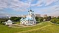
 Воскресенский Ново-Иерусалимский монастырь с высоты птичьего полета.jpg 5,315 × 3,543; 15.14 MB
-
 Воскресенский Ново-Иерусалимский монастырь, вид на закате (cropped).jpg 5,314 × 760; 1.39 MB
-
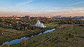
 Воскресенский Ново-Иерусалимский монастырь, вид на закате.jpg 5,330 × 3,553; 3.78 MB
-
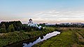
 Воскресенский Ново-Иерусалимский монастырь.jpg 5,315 × 3,543; 14.55 MB
-
 Дворец^ Интересно, для кого такая роскошь - panoramio.jpg 2,736 × 1,725; 3.28 MB
-
 Лосино-Петровский. Скорбящинский храм.1.jpg 2,739 × 1,541; 1.41 MB
-
 Лосино-Петровский. Скорбящинский храм.2.jpg 2,735 × 2,051; 1.93 MB
-
 Мытищи (Церковь Благовещения)-06.jpg 3,992 × 2,242; 4.62 MB
-
 Мытищи (Церковь Благовещения)-11.jpg 3,992 × 2,242; 6.05 MB
-
 Мытищи (Церковь Благовещения)-12.jpg 3,992 × 2,242; 7.66 MB
-
 Мытищи (Церковь Благовещения)-54.jpg 1,920 × 1,078; 1.69 MB
-
 Мытищи (Церковь Благовещения)-55.jpg 1,920 × 1,078; 1.75 MB
-
 Мытищи (Церковь Благовещения)-93.jpg 1,920 × 1,078; 1.72 MB
-
 Мытищи (Церковь Благовещения)-95.jpg 1,920 × 1,078; 1.91 MB
-
 Николо-Берлюковская пустынь. Аэросъемка.jpg 2,796 × 2,809; 6.14 MB
-
 Николо-Угрешский монастырь с воздуха 2.jpg 2,731 × 1,820; 3.19 MB
-
 Николо-Угрешский монастырь с воздуха 3.jpg 2,225 × 1,483; 2.55 MB
-
 Николо-Угрешский монастырь с воздуха.jpg 3,909 × 2,606; 6.82 MB
-
 Парк с прудом с квадрокоптера.jpg 1,920 × 1,080; 394 KB
-
 Подлетая к Москве (из Калининграда). Апрель 2013.jpg 2,272 × 1,704; 517 KB
-
 Полёт над Балашихой (49599150268).jpg 4,608 × 2,592; 7.29 MB
-
 Полёт над Балашихой (49599646486).jpg 4,608 × 2,592; 7.18 MB
-
 Полёт над Жуковским 2015 (49599155688).jpg 4,608 × 2,592; 7.16 MB
-
 Полёт над Жуковским 2015 (49599155903).jpg 4,608 × 2,592; 6.21 MB
-
 Полёт над Жуковским 2015 (49599157703).jpg 4,608 × 2,592; 6.26 MB
-
 Полёт над Жуковским 2015 (49599159183).jpg 4,608 × 2,592; 5.94 MB
-
 Полёт над Жуковским 2015 (49599159923).jpg 4,608 × 2,592; 5.94 MB
-
 Полёт над Жуковским 2015 (49599160103).jpg 4,608 × 2,592; 6.1 MB
-
 Полёт над Жуковским 2015 (49599160598).jpg 4,608 × 2,592; 5.89 MB
-
 Полёт над Жуковским 2015 (49599160913).jpg 4,608 × 2,592; 6.09 MB


-8.jpg)


.jpg)
.jpg)


.jpg)


.jpg)
.jpg)
.jpg)
.jpg)


.jpg)
.jpg)
.jpg)
.jpg)


.jpg)
.jpg)
_-_1.jpg)
_-_2.jpg)
_-_3.jpg)
_-_4.jpg)
_-_5.jpg)
_-_6.jpg)
_-_7.jpg)
_-_8.jpg)
_-_9.jpg)
.jpg)


.jpg)


.jpg)
.jpg)


.jpg)


.jpg)


_-_panoramio.jpg)
.jpg)
.jpg)
.jpg)
.jpg)
_(49599637486)_(cropped).jpg)
_%D0%B8_%D1%81%D0%B5%D0%B2%D0%B5%D1%80_%D0%9C%D0%BE%D1%81%D0%BA%D0%B2%D1%8B_(49599637486).jpg)
.jpg)
.jpg)
.jpg)
.jpg)
.jpg)


-06.jpg)
-11.jpg)
-12.jpg)
-54.jpg)
-55.jpg)
-93.jpg)
-95.jpg)


._%D0%90%D0%BF%D1%80%D0%B5%D0%BB%D1%8C_2013.jpg)
.jpg)
.jpg)
.jpg)
.jpg)
.jpg)
.jpg)
.jpg)
.jpg)
.jpg)
.jpg)
.jpg)