Category:Aerial photographs of Norfolk, England
Subcategories
This category has the following 9 subcategories, out of 9 total.
Media in category "Aerial photographs of Norfolk, England"
The following 175 files are in this category, out of 175 total.
-
 -2022-07-19 Cropmarks, Walton Highway, Norfolk.jpg 1,024 × 683; 138 KB
-
 -2022-07-19 Dismantled railway, Marshland Saint James, Norfolk.jpg 1,024 × 683; 152 KB
-
 2011-08-11 Coastline of the parish of Overstrand, Norfolk.jpg 4,288 × 2,848; 4.87 MB
-
 2011-08-11 Coastline of the parish of Sidestrand, Norfolk.jpg 4,288 × 2,848; 4.4 MB
-
 2011-08-11 East end of the village of Overstrand, Norfolk.jpg 4,288 × 2,848; 5.24 MB
-
 Aerial All Saints Church in Beeston Regis aerial Norfolk aerial image (9408627801).jpg 3,423 × 2,312; 2.67 MB
-
 Aerial Oxburgh Hall aerial image (9009015883).jpg 2,500 × 1,710; 1.58 MB
-

-
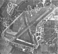
 Aerial Pickenham Airfield.jpeg 1,024 × 660; 381 KB
-
 Arial View of Wolterton Hall 17 August 2014.JPG 2,907 × 2,485; 2.3 MB
-
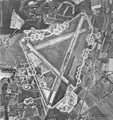
 Attlebridgeairfield 16apr1946.png 725 × 600; 534 KB
-
 Barton Broad Staithe (20631857033).jpg 4,526 × 2,856; 4.23 MB
-
 Barton Broad, Norfolk (21061345280).jpg 4,904 × 3,248; 4.22 MB
-
 Bob Hall's Sand - geograph.org.uk - 860311.jpg 451 × 640; 63 KB
-
 Bodneyairfield-july0646.png 864 × 600; 627 KB
-
 BuckenhamTofts Norfolk AerialPanorama.jpg 640 × 427; 63 KB
-
 Burnham Harbour mouth, Norfolk (45738670755).jpg 2,002 × 3,000; 2.69 MB
-
 Castle Acre Castle (9138870594).jpg 4,124 × 2,809; 5.17 MB
-
 Castle Acre Castle (9138873528).jpg 4,208 × 2,888; 6.05 MB
-
 Castle Acre Priory (9122895269).jpg 4,620 × 2,892; 6.35 MB
-
 Castle Acre Priory (9127528645).jpg 3,989 × 2,719; 4.22 MB
-
 Church of Saint Andrew, Framingham Pigot.jpg 5,472 × 3,648; 11.76 MB
-

-
 Deophamgreen-9jul46.png 600 × 571; 412 KB
-
 East Ruston Gardens, Norfolk (21392019305).jpg 4,313 × 3,032; 2.75 MB
-
 Eastwretham-5feb46.png 600 × 439; 300 KB
-
 Environment Agency 110809 130743.jpg 4,288 × 2,848; 4.34 MB
-
 Environment Agency 110809 130749.jpg 4,288 × 2,848; 4.83 MB
-
 Environment Agency 110809 130755.jpg 4,288 × 2,848; 4.9 MB
-
 Environment Agency 110809 130803a.jpg 4,288 × 2,848; 5.02 MB
-
 Environment Agency 110809 130810.jpg 4,288 × 2,848; 5.31 MB
-
 Environment Agency 110809 130819.jpg 4,288 × 2,848; 5.13 MB
-
 Environment Agency 110809 130829.jpg 4,288 × 2,848; 4.84 MB
-
 Environment Agency 110809 130834.jpg 4,288 × 2,848; 4.24 MB
-
 Environment Agency 110809 130849.jpg 4,288 × 2,848; 4.35 MB
-
 Environment Agency 110809 130859.jpg 4,288 × 2,848; 5.31 MB
-
 Environment Agency 110809 130907.jpg 4,288 × 2,848; 4.92 MB
-
 Environment Agency 110809 130944a.jpg 4,288 × 2,848; 4.55 MB
-
 Environment Agency 110809 130948a.jpg 4,288 × 2,848; 4.82 MB
-
 Environment Agency 110809 130954a.jpg 4,288 × 2,848; 4.8 MB
-
 Environment Agency 110809 131000.jpg 4,288 × 2,848; 4.74 MB
-
 Environment Agency 110809 131004.jpg 4,288 × 2,848; 5.16 MB
-
 Environment Agency 110809 131010a.jpg 4,288 × 2,848; 4.41 MB
-
 Environment Agency 110809 131014.jpg 4,288 × 2,848; 4.71 MB
-
 Environment Agency 110809 131026.jpg 4,288 × 2,848; 4.64 MB
-
 Environment Agency 110809 131034.jpg 4,288 × 2,848; 4.56 MB
-
 Environment Agency 110809 131039a.jpg 4,288 × 2,848; 4.8 MB
-
 Environment Agency 110809 131043.jpg 4,288 × 2,848; 4.59 MB
-
 Environment Agency 110809 131049a.jpg 4,288 × 2,848; 4.48 MB
-
 Environment Agency 110809 131055.jpg 4,288 × 2,848; 4.33 MB
-
 Environment Agency 110809 131058.jpg 4,288 × 2,848; 4.24 MB
-
 Environment Agency 110809 131105.jpg 4,288 × 2,848; 4.61 MB
-
 Environment Agency 110809 131110.jpg 4,288 × 2,848; 4.15 MB
-
 Environment Agency 110809 131124.jpg 4,288 × 2,848; 4.36 MB
-
 Environment Agency 110809 131516.jpg 4,288 × 2,848; 4.2 MB
-
 Environment Agency 110809 131526.jpg 4,288 × 2,848; 4.11 MB
-
 Environment Agency 110809 131537.jpg 4,288 × 2,848; 4.73 MB
-
 Environment Agency 110809 131544.jpg 4,288 × 2,848; 5.51 MB
-
 Environment Agency 110809 131547.jpg 4,288 × 2,848; 5.63 MB
-
 Environment Agency 110809 131551.jpg 4,288 × 2,848; 4.81 MB
-
 Environment Agency 110809 131555.jpg 4,288 × 2,848; 4.72 MB
-
 Environment Agency 110809 131559.jpg 4,288 × 2,848; 4.89 MB
-
 Environment Agency 110809 131604.jpg 4,288 × 2,848; 5.1 MB
-
 Environment Agency 110809 131609.jpg 4,288 × 2,848; 5.1 MB
-
 Environment Agency 110809 131614.jpg 4,288 × 2,848; 5.39 MB
-
 Environment Agency 110809 131618.jpg 4,288 × 2,848; 4.72 MB
-
 Environment Agency 110809 131622a.jpg 4,288 × 2,848; 5.01 MB
-
 Environment Agency 110809 131626.jpg 4,288 × 2,848; 4.45 MB
-
 Environment Agency 110809 131631.jpg 4,288 × 2,848; 4.28 MB
-
 Environment Agency 110809 131638.jpg 4,288 × 2,848; 4.65 MB
-
 Environment Agency 110809 131645.jpg 4,288 × 2,848; 4.27 MB
-
 Environment Agency 110809 131649.jpg 4,288 × 2,848; 3.99 MB
-
 Environment Agency 110809 131653a.jpg 4,288 × 2,848; 5.16 MB
-
 Environment Agency 110809 131656a.jpg 4,288 × 2,848; 5.08 MB
-
 Environment Agency 110809 131704.jpg 4,288 × 2,848; 4.44 MB
-
 Environment Agency 110809 131709.jpg 4,288 × 2,848; 4.1 MB
-
 Environment Agency 110809 131712.jpg 4,288 × 2,848; 4.57 MB
-
 Environment Agency 110809 131716.jpg 4,288 × 2,848; 4.2 MB
-
 Environment Agency 110809 131722.jpg 4,288 × 2,848; 4.21 MB
-
 Environment Agency 110809 131727.jpg 4,288 × 2,848; 4.21 MB
-
 Environment Agency 110809 131731.jpg 4,288 × 2,848; 5.02 MB
-
 Environment Agency 110809 131736.jpg 4,288 × 2,848; 5.29 MB
-
 Environment Agency 110809 131742a.jpg 4,288 × 2,848; 4.49 MB
-
 Environment Agency 110809 131748.jpg 4,288 × 2,848; 4.53 MB
-
 Environment Agency 110809 131755.jpg 4,288 × 2,848; 4.49 MB
-
 Environment Agency 110809 131758.jpg 4,288 × 2,848; 4.68 MB
-
 Environment Agency 110809 131810.jpg 4,288 × 2,848; 4.31 MB
-
 Environment Agency 110809 131847.jpg 4,288 × 2,848; 5.93 MB
-
 Environment Agency 110809 131856a.jpg 4,288 × 2,848; 5.58 MB
-
 Environment Agency 110809 131904.jpg 4,288 × 2,848; 5.84 MB
-
 Environment Agency 110809 131912.jpg 4,288 × 2,848; 5.72 MB
-
 Environment Agency 110809 131919.jpg 4,288 × 2,848; 6.16 MB
-
 Environment Agency 110809 131925.jpg 4,288 × 2,848; 5.95 MB
-
 Environment Agency 110809 131932.jpg 4,288 × 2,848; 5.03 MB
-
 Environment Agency 110809 131942a.jpg 4,288 × 2,848; 5.11 MB
-
 Environment Agency 110809 131950.jpg 4,288 × 2,848; 6.44 MB
-
 Environment Agency 110809 131952.jpg 4,288 × 2,848; 5.52 MB
-
 Environment Agency 110809 131955.jpg 4,288 × 2,848; 6.03 MB
-
 Environment Agency 110809 131958.jpg 4,288 × 2,848; 5.75 MB
-
 Environment Agency 110809 132003.jpg 4,288 × 2,848; 6.49 MB
-
 Environment Agency 110809 132012.jpg 4,288 × 2,848; 5.31 MB
-
 Environment Agency 110809 132017.jpg 4,288 × 2,848; 5.2 MB
-
 RAF Feltwell aerial photograph WWII IWM HU 93048.jpg 800 × 622; 76 KB
-
 Foundry Plant Centre, Tasburgh, Norfolk (32536472458).jpg 3,000 × 2,039; 3.98 MB
-
 Foundry Plant Centre, Tasburgh, Norfolk (45495878985).jpg 3,000 × 1,992; 4.07 MB
-
 Fritton aerial image - Saint Edmund's Church (16827391855).jpg 4,000 × 2,649; 3.41 MB
-
 Gorleston On Sea aerial image - Norfolk UK beach (14610803220).jpg 4,723 × 3,128; 4.51 MB
-
 Grime's Graves Clarke 1963 Aerial View.tif 4,192 × 3,065; 40.66 MB
-
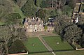
 Hall with Moat, Cringleford - geograph.org.uk - 73630.jpg 640 × 458; 138 KB
-
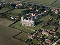
 Happisburgh Church (20924882593).jpg 4,181 × 2,795; 3.51 MB
-
 Hardwickairfield-16apr46.png 600 × 876; 569 KB
-
 Hethel-16-Apr-1946.png 600 × 561; 365 KB
-
 Heydon Hall (16460071826).jpg 4,000 × 2,650; 3.68 MB
-
 Hickling Broad, Norfolk (21224752475).jpg 4,700 × 3,029; 3.33 MB
-
 Hopton Holiday Park aerial image - Suffolk UK (14804735895).jpg 4,152 × 2,628; 3.7 MB
-
 Houghton Hall (9071379594).jpg 3,000 × 2,164; 2.99 MB
-
 Houghton Hall (9078201169).jpg 4,928 × 3,264; 4.04 MB
-
 Houghton Hall water tower (9086007093).jpg 3,186 × 2,253; 2.71 MB
-
 How Hill, River Ant, Norfolk (21294131972).jpg 4,512 × 2,988; 4.35 MB
-
 Hunstanton - Kings Lynn, Norflok UK (46454553075).jpg 2,592 × 1,944; 809 KB
-
 King's Lynn and River Ouse, Norfolk, UK (46454553215).jpg 1,156 × 867; 229 KB
-
 Looking South from St Mary's tower - geograph.org.uk - 481247.jpg 640 × 480; 77 KB
-
 Looking South West from St Mary's Tower - geograph.org.uk - 481252.jpg 640 × 480; 110 KB
-
 Lowestoft and Great Yarmouth at night.jpg 1,674 × 2,509; 1.43 MB
-
 Melton Constable Hall (30538322847).jpg 3,000 × 1,992; 3.76 MB
-
 Melton Constable Hall (30538323377).jpg 3,000 × 1,749; 3.54 MB
-
 Melton Constable Hall (30538324047).jpg 3,000 × 1,999; 4.15 MB
-
 Melton Constable Hall (30538324617).jpg 3,000 × 1,992; 3.57 MB
-
 Melton Constable Hall (44563933675).jpg 3,000 × 1,992; 3.85 MB
-
 Middleton Towers, Norfolk (9436518159).jpg 2,000 × 1,362; 1.51 MB
-
 Morston and Blakeney Point area - geograph.org.uk - 696361.jpg 640 × 480; 66 KB
-
 Mouth of The Run - geograph.org.uk - 860234.jpg 482 × 640; 98 KB
-

-
 NorfolkAndNorwichUniversityHospital(KatyAppleton)Aug2005.jpg 640 × 426; 90 KB
-
 Northpickenham-31jan46.png 551 × 600; 378 KB
-
 Oldbuckenham-30march1946.png 601 × 819; 650 KB
-

-
 Rackheathairfield 9july1946.png 600 × 638; 459 KB
-
 RAF Fersfield - 29 Aug 1946 Airfield.jpg 1,857 × 1,655; 1.01 MB
-
 RAF Marham aerial photograph 1944 IWM C 5469.jpg 800 × 786; 136 KB
-
 Reedham railway station (16451830552).jpg 4,359 × 2,760; 4.72 MB
-
 Rollesby Broad, Norfolk (21198925175).jpg 4,749 × 3,025; 4.53 MB
-
 Runhall All Saints in Norfolk - aerial (16437752893).jpg 4,928 × 3,264; 5.5 MB
-
 Salthouse Church, Norfolk (6277251183).jpg 1,800 × 1,350; 994 KB
-
 Salthouse Church, Norfolk (6277252179).jpg 1,800 × 1,350; 1.11 MB
-
 Seethingairfield-16oct1945.png 600 × 551; 383 KB
-
 Shadwell Court aerial image - Brettenham Norfolk UK 01 (15978360882).jpg 4,928 × 3,264; 5.58 MB
-
 Shipdham-31jan46.png 600 × 392; 280 KB
-
 Shotesham aerial image Church of St Mary in Shotesham Norfolk UK (12466148573).jpg 3,276 × 2,346; 3.1 MB
-
 Snetterton Racing Circuit (9096594820).jpg 3,000 × 1,971; 1.6 MB
-
 Snettertonheath-5feb46.jpg 600 × 418; 61 KB
-
 Snettertonheath-5feb46.png 600 × 418; 299 KB
-
 Snowsports Club in Trowse, Norwich with real snow (40482004822).jpg 2,400 × 1,602; 2.31 MB
-
 St Andrew, Quidenham (9201808199).jpg 3,000 × 2,238; 2.84 MB
-
 St George's Church, Rollesby, Norfolk (20853587423).jpg 4,656 × 3,084; 4.49 MB
-
 St James, Castle Acre, Norfolk (9204596986).jpg 3,516 × 2,387; 4.04 MB
-
 St Martin's Church in Thompson - aerial Norfolk UK (46396663341).jpg 2,993 × 1,997; 3.74 MB
-
 St Michael in Bunwell, Norfolk aerial image (9150984804).jpg 4,337 × 2,475; 3.36 MB
-
 St Michael's Church of England Academy, King's Lynn, Norfolk (45945063211).jpg 3,000 × 2,052; 3.9 MB
-
 Stiffkey High Sands Creek Campsite, Norfolk (44984948815).jpg 3,000 × 1,965; 3.52 MB
-
 The main village of East Harling - geograph.org.uk - 358350.jpg 640 × 442; 75 KB
-
 The Wash, Hunstanton (L) to Snettisham, Norfolk UK (46646275634).jpg 2,592 × 1,944; 1 MB
-
 The Wash, Hunstanton to Heacham, Norfolk UK (47316716362).jpg 2,592 × 1,944; 1,017 KB
-
 Thickthorn Interchange - geograph.org.uk - 73633.jpg 640 × 457; 164 KB
-
 Thorpeabbotsafld-13nov46.png 600 × 388; 291 KB
-
 Tibenhamairfield-1945.png 600 × 521; 355 KB
-
 Tibenhamairfield-original.jpg 600 × 521; 79 KB
-
 Trinity Methodist Church in Dereham - Aerial (16852102958).jpg 2,557 × 1,884; 1.49 MB
-
 Wattonafld-1945.png 497 × 600; 382 KB
-
 Wells-next-the-Sea, Norfolk (51725666436).jpg 3,264 × 2,448; 2.46 MB
-
 Wendlingairfield-30-mar-1946.png 693 × 600; 479 KB
-
 Wendlingairfield-original.jpg 600 × 693; 95 KB
-
 Eaton (aerial) - geograph.org.uk - 44826.jpg 640 × 479; 78 KB
-
 Lacons Corner, Mautby - geograph.org.uk - 356561.jpg 640 × 480; 93 KB
-
 Market Street, East Harling (B1111) - geograph.org.uk - 358355.jpg 640 × 442; 78 KB


.jpg)
.jpg)


.jpg)
.jpg)


.jpg)
.jpg)
.jpg)
.jpg)
.jpg)

_from_the_air_-_geograph.org.uk_-_358346.jpg)

.jpg)


.jpg)
.jpg)
.jpg)
.jpg)

.jpg)


.jpg)
.jpg)
.jpg)
.jpg)
.jpg)
.jpg)
.jpg)
.jpg)
.jpg)


.jpg)
.jpg)
.jpg)
.jpg)
.jpg)
.jpg)


_-_geograph.org.uk_-_40520.jpg)
Aug2005.jpg)


.jpg)
.jpg)
.jpg)
.jpg)
.jpg)

.jpg)

.jpg)
.jpg)


.jpg)
.jpg)
.jpg)
.jpg)
.jpg)
.jpg)
.jpg)
.jpg)

_to_Snettisham,_Norfolk_UK_(46646275634).jpg)
.jpg)


.jpg)

.jpg)


_-_geograph.org.uk_-_44826.jpg)

_-_geograph.org.uk_-_358355.jpg)