Category:Aerial photographs of Sault Ste. Marie, Ontario
Media in category "Aerial photographs of Sault Ste. Marie, Ontario"
The following 10 files are in this category, out of 10 total.
-
 Sault Ste. Marie satellite.jpg 900 × 900; 735 KB
-
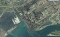 Algoma Steel Sault Ste Marie USGS.jpg 1,254 × 775; 297 KB
-
 Bushplane heritage centre.jpg 1,229 × 712; 301 KB
-
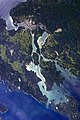
 ISS-56 Michigan and Ontario, St. Mary's River.jpg 3,712 × 5,568; 4.06 MB
-
 Neebish Island, Michigan.JPG 1,936 × 2,608; 6.03 MB
-
 Sault Ste Marie, Ontario and Michigan.JPG 2,848 × 4,288; 8.47 MB
-
 Sault-Ste Marie banner).png 511 × 73; 22 KB
-
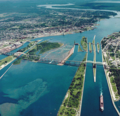
 Soo Locks International Bridge 2010-04 USACE.jpg 6,144 × 4,088; 8.66 MB
-
 Soo Locks-Sault-Ste Marie.png 511 × 494; 132 KB
-
 St Marys Paper Sault Ste Marie ON National Map.jpg 1,278 × 774; 313 KB


.png)