Category:Aerial photographs of Staten Island, New York City
Boroughs of New York City: Bronx · Brooklyn · Manhattan · Queens · Staten Island
Counties of New York City:
Counties of New York City:
Subcategories
This category has only the following subcategory.
Media in category "Aerial photographs of Staten Island, New York City"
The following 28 files are in this category, out of 28 total.
-

-
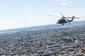
 Aerial views of Ground Zero and Fresh Kills Landfill 011003-Z-AL508-005.jpg 2,144 × 1,544; 1.93 MB
-
 Aerial views of Ground Zero and Fresh Kills Landfill 011003-Z-AL508-006.jpg 2,472 × 1,556; 2.16 MB
-
 Aerial views of Ground Zero and Fresh Kills Landfill 011003-Z-AL508-007.jpg 2,445 × 1,558; 1.98 MB
-
-
 Arthur Kill Pralls Island.jpg 3,504 × 2,336; 7.45 MB
-
 ArthurKill VerticalLift Goethals bridges.jpg 3,000 × 2,040; 912 KB
-
 December 6, 2012 Fresh Kills Landfill Flyover, Staten Island, New York (8392483666).jpg 5,052 × 3,302; 8.73 MB
-

-

-
 Lau 000397 169101 512949 4578 (36792951822).jpg 1,920 × 1,280; 1.05 MB
-
 New York - Verrazano-Narrows Bridge from Air.jpg 1,050 × 701; 304 KB
-
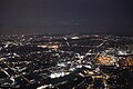
 New York aerial night 2018a.jpg 4,608 × 3,456; 3.26 MB
-

-
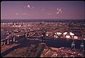
 Staten Island from 5000 feet, looking south.JPG 3,072 × 1,728; 1.23 MB
-

-

-

-

-

-
 Verazzano Narrows Bridge aerial 01 (9454485435).jpg 4,288 × 2,848; 5.04 MB
-
 Verazzano Narrows Bridge aerial 01 - white balanced (9457282678).jpg 4,288 × 2,848; 9.55 MB
-

-
 View of New York from the Air (October 2023) 23.jpg 6,000 × 4,000; 9.4 MB
-

-

-
 Wpdms usgs photo fresh kills.jpg 460 × 350; 68 KB
-
 Wpdms usgs photo raritan bay.jpg 300 × 370; 73 KB
_(16043216974).jpg)


.jpg)


.jpg)


.jpg)


.jpg)
.jpg)

_23.jpg)

