Category:Aerial photographs of Upper Austria
Subcategories
This category has the following 4 subcategories, out of 4 total.
Media in category "Aerial photographs of Upper Austria"
The following 200 files are in this category, out of 200 total.
-
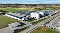
 1987 Firmengebäude B&R.jpg 841 × 633; 1.86 MB
-
 2000 Firmengebäude B&R.jpg 1,878 × 1,305; 4.31 MB
-
 2011-08-17 14-16-43 Austria Krispl.jpg 4,288 × 2,848; 6.9 MB
-
 2011-08-17 14-17-16 Austria Hinterwiestal.jpg 2,848 × 4,288; 6.4 MB
-
 2011-08-17 14-18-46 Austria Korb.jpg 3,837 × 2,548; 5.69 MB
-
 20200611 06 X.jpg 4,000 × 2,250; 3.88 MB
-
 Aerial image of Reichersberg Abbey (view from the south).jpg 4,400 × 3,500; 6.88 MB
-
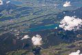
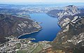
 Aerial image of the Attersee (view from the southwest).jpg 5,400 × 3,300; 5.95 MB
-
 Aerial image of the Burg Altpernstein (view from the south).jpg 3,600 × 2,400; 5.03 MB
-
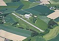
 Aerial image of the Eferding airfield.jpg 4,000 × 3,000; 4.88 MB
-
 Aerial image of the Freistadt airfield.jpg 4,300 × 2,500; 3.99 MB
-
 Aerial image of the Gmunden-Laakirchen airfield.jpg 4,500 × 3,200; 4.95 MB
-
 Aerial image of the Hofkirchen airfield.jpg 4,000 × 3,200; 4.9 MB
-
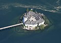
 Aerial image of the Landschloss and Seeschloss Ort (view from the southeast).jpg 4,900 × 2,800; 4.28 MB
-
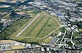
 Aerial image of the Linz-Ost airfield.jpg 4,500 × 3,200; 6.95 MB
-
 Aerial image of the Micheldorf airfield.jpg 4,200 × 2,800; 4.54 MB
-
 Aerial image of the Mondsee (view from the southeast).jpg 5,300 × 3,204; 6.7 MB
-
 Aerial image of the Ried-Kirchheim airfield.jpg 4,200 × 3,200; 5.43 MB
-
 Aerial image of the Scharnstein airfield.jpg 5,300 × 3,300; 6.84 MB
-
 Aerial image of the Schloss Cumberland (view from the south).jpg 3,900 × 2,200; 4.94 MB
-
 Aerial image of the Schärding-Suben airfield.jpg 4,500 × 3,000; 5.15 MB
-
 Aerial image of the Seeschloss Ort (view from the south).jpg 3,900 × 2,800; 2.67 MB
-
 Aerial image of the Traunsee (view from the south).jpg 5,000 × 3,200; 6.38 MB
-
 Aerial image of the Wels airfield.jpg 5,000 × 3,200; 7.15 MB
-
 Aerial image of the Wolfgangsee (view from the southeast).jpg 5,300 × 3,200; 5.76 MB
-
 Agrarium Steinerkirchen.jpg 3,008 × 2,000; 4.72 MB
-
 Aistersheim - Luftaufnahme.JPG 3,980 × 2,505; 7.97 MB
-
 Aistersheim - Schloss.JPG 3,900 × 2,600; 8.04 MB
-
 Alberndorf NordOst.jpg 4,000 × 2,250; 4.32 MB
-
 Aschach - Donaubrücke.JPG 4,900 × 2,757; 9.78 MB
-
 Aschach - Donaukraftwerk.JPG 4,700 × 2,644; 8.56 MB
-
 Aschach an der Donau - Schloss.JPG 3,720 × 2,480; 9.61 MB
-
 Attersee DSC04012.jpg 3,648 × 5,472; 9.54 MB
-
 Attersee-Flugzeug2.jpg 1,600 × 1,200; 675 KB
-
 Attersee-Luftaufnahme3 retouched.jpg 1,600 × 1,200; 1.06 MB
-
 Attersee-Luftaufnahme3.jpg 1,600 × 1,200; 664 KB
-
 Augusthochwasser2002 baumgartenberg.jpg 600 × 450; 196 KB
-
 Augustiner Chorherrenstift Reichersberg, Luftbild.JPG 2,837 × 1,861; 5.31 MB
-
 Autumn Dream.jpg 4,000 × 2,250; 6.73 MB
-
 B130 mit Schlögener Schlinge 2010.jpg 1,280 × 960; 406 KB
-
 Backaldrin DJI 0206a.jpg 5,472 × 1,992; 7.25 MB
-
 Bad Goisern - Ortsansicht (a).JPG 5,180 × 2,915; 9.14 MB
-
 Bad Goisern - Ortsansicht (b).JPG 5,280 × 2,970; 10.37 MB
-
 Bad Schallerbach - Eurotherme.JPG 3,640 × 2,824; 9.91 MB
-
 Bad Schallerbach - Luftaufnahme.JPG 3,960 × 2,760; 9.66 MB
-
 Bayern Austria Inn river Schärding E56 Innkreis Autobahn IMG 9049.JPG 3,456 × 5,184; 8.33 MB
-
 Biohort Werk 1 Neufelden.jpg 3,992 × 2,430; 4.06 MB
-
 BRG Wels Wallererstraße von oben.jpg 4,000 × 2,250; 4 MB
-
 Burgruine Prandegg by TheTokl 1.jpg 4,000 × 2,250; 4.09 MB
-
 Burgruine Prandegg by TheTokl 2.jpg 4,000 × 2,250; 3.87 MB
-
 Burgruine Prandegg by TheTokl 3.jpg 4,000 × 2,250; 3.87 MB
-
 Burgruine Prandegg by TheTokl 4.jpg 4,000 × 2,250; 4.01 MB
-
 Burgruine Prandegg by TheTokl 5.jpg 4,000 × 2,250; 3.84 MB
-
 Burgruine Prandegg by TheTokl 6.jpg 4,000 × 2,250; 3.95 MB
-
 Burgruine Prandegg by TheTokl 7.jpg 4,000 × 2,250; 4.11 MB
-
 Burgruine Prandegg by TheTokl 8.jpg 4,000 × 2,250; 3.89 MB
-
 Burgruine Windhaag by TheTokl 1.jpg 3,889 × 2,204; 8.6 MB
-
 Burgruine Windhaag by TheTokl 2.jpg 3,939 × 2,104; 8 MB
-
 Burgruine Windhaag by TheTokl 3.jpg 3,352 × 2,250; 7.67 MB
-
 Desselbrunn - Luftaufnahme.JPG 3,990 × 2,570; 9.21 MB
-
 Donaukraftwerk Jochenstein.JPG 1,856 × 1,392; 715 KB
-
 Engelhartszell - Pfarrkirche 1.jpg 2,560 × 1,920; 3.9 MB
-
 Eschelberg - Schloss.JPG 4,660 × 2,800; 9.76 MB
-
 ETH-BIB-Bad Ischl, Totes Gebirge-LBS H1-020348.tif 4,654 × 5,878; 78.35 MB
-
 ETH-BIB-Bad Ischl, Totes Gebirge-LBS H1-020349.tif 5,881 × 4,614; 77.73 MB
-
 ETH-BIB-Bischofsmütze und Gosausee, Anflug von Norden-Inlandflüge-LBS MH01-007520.tif 6,684 × 4,915; 94.1 MB
-
 ETH-BIB-Dachstein, Hoher Krippenstein, Hallsättersee-LBS H1-020358.tif 5,853 × 4,633; 77.67 MB
-
 ETH-BIB-Donau, Blick ins Mühlviertel Richtung Norden-Weitere-LBS MH02-29-0001.tif 4,961 × 3,304; 46.97 MB
-
 ETH-BIB-Donau, Blick ins Mühlviertel Richtung Norden-Weitere-LBS MH02-29-0002.tif 4,961 × 3,304; 46.98 MB
-
 ETH-BIB-Donau, Blick ins Mühlviertel Richtung Norden-Weitere-LBS MH02-29-0003.tif 4,961 × 3,302; 46.96 MB
-
 ETH-BIB-Hallstatt mit Salzberg-LBS H1-020351.tif 5,868 × 4,674; 78.54 MB
-
 ETH-BIB-Hallstatt mit Salzberg-LBS H1-020352.tif 5,911 × 4,689; 79.37 MB
-
 ETH-BIB-Hallstatt und Hallstätter See-Inlandflüge-LBS MH01-007521.tif 6,753 × 4,930; 95.36 MB
-
 ETH-BIB-Oberösterreich, Donau bei Grein-Weitere-LBS MH02-30-0019.tif 4,961 × 3,301; 46.96 MB
-
 ETH-BIB-Oberösterreich, Donau bei Grein-Weitere-LBS MH02-30-0020.tif 4,961 × 3,306; 47.03 MB
-
 ETH-BIB-Salzberg, Lahn, Hallstatt-LBS H1-020353.tif 5,921 × 4,709; 79.84 MB
-
 ETH-BIB-Schloss in Österreich-Weitere-LBS MH02-14-0034.tif 4,961 × 3,313; 47.14 MB
-
 ETH-BIB-St Florian bei Linz, Stift St. Florian-Weitere-LBS MH05-84-13.tif 4,686 × 3,122; 41.91 MB
-
 ETH-BIB-Städtchen an Fluss (Grein an der Donau) in Österreich-Weitere-LBS MH02-14-0039.tiff 4,961 × 3,291; 46.81 MB
-
 ETH-BIB-Städtchen an Fluss in Österreich-Weitere-LBS MH02-14-0040.tif 4,961 × 3,319; 47.2 MB
-
 ETH-BIB-Traunsee-Weitere-LBS MH02-20-0001.tif 3,286 × 4,961; 46.7 MB
-
 ETH-BIB-Traunsee-Weitere-LBS MH02-20-0004.tif 3,282 × 4,961; 46.67 MB
-
 ETH-BIB-Traunsee-Weitere-LBS MH02-20-0005.tif 4,961 × 3,282; 46.67 MB
-
 ETH-BIB-Traunsee-Weitere-LBS MH02-20-0006.tif 4,961 × 3,279; 46.63 MB
-
 ETH-BIB-Wolfgangsee-LBS H1-020346.tif 5,967 × 4,739; 80.97 MB
-
 Fill 1972, 25 Mitarbeiter.jpg 1,299 × 945; 890 KB
-
 Fill 2006, 345 Mitarbeiter.jpg 1,299 × 945; 1.01 MB
-
 Fill Gesellschaft m.b.H. .jpg 5,079 × 3,386; 15.21 MB
-
 Fill Gesellschaft m.b.H., 2013.jpg 2,362 × 1,701; 4.34 MB
-
 Fill Luftaufnahme.jpg 5,272 × 3,948; 3.6 MB
-
 Firma B&R 2009.jpg 3,386 × 1,260; 5.94 MB
-
 Flightlog - Gemeinde Hoersching mit Flughafen Linz.jpg 3,872 × 2,592; 4.76 MB
-
 Flightlog - Linz und Steyregg 2012 -2-.jpg 3,648 × 2,736; 3.48 MB
-
 Flightlog - Linz und Steyregg 2012.jpg 3,648 × 2,736; 3.63 MB
-
 Flugplatz Hofkirchen DJI 0178a.jpg 3,947 × 3,346; 7.26 MB
-
 Flugplatz Hofkirchen DJI 0181a.jpg 4,536 × 2,914; 7.17 MB
-
 Fuchsenhof Freistadt.jpg 3,264 × 2,448; 967 KB
-
 Geiersberg - Ortsansicht.JPG 3,890 × 1,615; 4.35 MB
-
 Gmunden aus der Vogelperspektive.jpg 4,288 × 2,848; 5.03 MB
-
 Gmunden-Luftbild.jpg 1,840 × 1,348; 624 KB
-
 Gory Martwe aerial 1.jpg 2,816 × 1,626; 3.12 MB
-
 Gory Martwe aerial 2.jpg 2,816 × 1,551; 3.26 MB
-
 Grieskirchen - Schloss Parz.JPG 3,690 × 2,202; 6.77 MB
-
 Grieskirchen - Schlosskomplex Parz (a).JPG 4,000 × 2,250; 8.08 MB
-
 Grieskirchen - Schlosskomplex Parz (b).JPG 3,990 × 2,245; 7.88 MB
-
 Grieskirchen - Wasserschloss Parz.JPG 3,000 × 2,250; 6.66 MB
-
 Gusen I and II aerial.jpg 865 × 1,115; 49 KB
-
 Hallstatt by TheTokl 1.jpg 4,000 × 2,250; 3.95 MB
-
 Hallstatt by TheTokl 2.jpg 4,000 × 2,250; 3.9 MB
-
 Hallstatt by TheTokl 3.jpg 4,000 × 2,250; 4.09 MB
-
 Hallstatt by TheTokl 4.jpg 4,000 × 2,250; 3.84 MB
-
 Hallstatt Salzberghochtal 1957.jpg 1,500 × 1,500; 661 KB
-
 Hocher Dachstein aerial.jpg 2,782 × 1,633; 3.42 MB
-
 Hohenzell Luftaufnahme.jpg 3,711 × 2,474; 1.85 MB
-
 Höllersberg Luftbild.jpg 1,500 × 1,124; 1.76 MB
-
 Inn bei Suben.jpg 960 × 1,280; 238 KB
-
 Innspitz 2.jpeg 3,261 × 2,211; 1.82 MB
-
 Kneidinger 1880 Agrarfrühling 2019.jpg 4,000 × 2,250; 3.66 MB
-
 Knoblinger früher.jpg 3,504 × 2,480; 2.99 MB
-
 Kobernaußerwald.jpg 2,272 × 1,704; 273 KB
-
 Kraftwerk Abwinden-Asten DJI 0171a.jpg 4,407 × 2,781; 7.77 MB
-
 Kraftwerk Garsten-St. Ulrich DJI 0226a.jpg 4,299 × 3,073; 7.61 MB
-
 Kraftwerk Staning DJI 0186a.jpg 4,100 × 2,971; 7.72 MB
-
 Krenglbach - Ortsansicht.JPG 4,913 × 2,764; 10.36 MB
-
 Lambach Luftbild.jpg 4,060 × 2,707; 2.5 MB
-
 Lederer Haufen DJI 0268b.jpg 4,466 × 3,179; 8.83 MB
-
 Lederer Haufen DJI 0273.jpg 5,472 × 3,648; 7.99 MB
-
 Leitner-Leinen-Unternehmen.jpg 1,700 × 1,200; 1.86 MB
-
 Lenzing - Werk Lenzing AG (b).JPG 4,950 × 2,784; 9.15 MB
-
 Lenzing - Werk Lenzing AG.JPG 4,780 × 2,619; 9.62 MB
-
 Linz - Pöstlingberg (a).JPG 4,800 × 2,700; 9.66 MB
-
 Linz - Pöstlingberg (b).JPG 4,922 × 2,769; 9.3 MB
-
 Linz - Pöstlingberg (c).JPG 5,082 × 2,858; 9.56 MB
-
 LKH Vöcklabruck Luftaufnahme.jpg 2,816 × 2,112; 1.51 MB
-
 Luftaufnahme 2021.jpg 5,274 × 3,948; 11.63 MB
-
 Luftaufnahme des Test- und Eventcenter Burgkirchen.jpg 5,282 × 2,971; 11.13 MB
-
 Luftaufnahme Fill.jpg 5,293 × 3,529; 17.05 MB
-
 Luftaufnahme Haag am Hausruck.jpg 4,148 × 2,766; 3.98 MB
-
 Luftaufnahme Pramet.jpg 4,172 × 2,781; 3.72 MB
-
 Luftaufnahme vom Landschloss Ort (April 2023).jpg 4,000 × 3,000; 5.24 MB
-
 Luftaufnahme vom Schloss Ort (April 2023).jpg 4,000 × 3,000; 5.61 MB
-
 Luftbild Steyregg 2012.jpg 2,375 × 868; 2.06 MB
-
 Luftbildaufnahme vom Werksgelände.jpg 3,946 × 3,629; 3.43 MB
-
 Maria Winkling im Dialekt "Mitzi im Eck".jpg 4,000 × 2,250; 6.51 MB
-
 Mondsee cut.jpg 900 × 676; 176 KB
-
 Mondsee-lake.jpg 4,320 × 3,144; 6.68 MB
-
 Mondseer Flyschberge.jpg 2,272 × 1,704; 381 KB
-
 Munderfing Luftansicht von Norden.jpg 2,500 × 1,874; 3.68 MB
-
 Mühldorf - Schloss.JPG 4,640 × 2,610; 8.35 MB
-
 Ohlsdorf - Ortsansicht.JPG 5,100 × 2,870; 8.57 MB
-
 Ortschaft Gschwandt in der Gemeinde Bad Goisern am Hallstättersee.jpg 1,800 × 1,198; 2.78 MB
-
 Ottensheim - Ortsansicht (a).JPG 4,960 × 2,790; 8.52 MB
-
 Ottensheim - Ortsansicht (b).JPG 4,800 × 2,852; 9.94 MB
-
 Pasching Waldstadion Luftbild.jpg 616 × 410; 50 KB
-
 Pfarrkirche in Traunkirchen.jpg 4,000 × 3,000; 5.22 MB
-
 Prandegg sueden.jpg 4,000 × 2,250; 3.86 MB
-
 Reichenstein SuedWest.jpg 4,000 × 2,250; 3.9 MB
-
 Roitham - Luftaufnahme.JPG 3,970 × 2,324; 6.57 MB
-
 Rutzenmoos - Ortsansicht.JPG 5,280 × 2,970; 8.98 MB
-
 Rüstorf - Ortsansicht.JPG 4,930 × 2,773; 9.25 MB
-
 Salzach 2018.jpg 5,184 × 3,888; 5.16 MB
-
 Salzachmündung.jpg 5,780 × 3,251; 4.04 MB
-
 Sankt Georgen Attergau.jpg 1,704 × 2,272; 672 KB
-
 Schleißheim - Kirche mit Pfarrhof.JPG 5,000 × 2,976; 9.32 MB
-
 Schleißheim - Ortsansicht.JPG 4,800 × 2,700; 9.43 MB
-
 Schloss Hohenbrunn - DJI 0120inta.jpg 4,981 × 3,569; 7.58 MB
-
 Schlögener Schlinge 2010a.jpg 1,280 × 960; 389 KB
-
 Schlögener Schlinge 2010b.jpg 1,280 × 960; 274 KB
-
 Schmiding - Schloss.JPG 5,000 × 2,918; 8.92 MB
-
 Schustergraben in Langenstein DJI 0284a 01.jpg 5,217 × 3,477; 14.43 MB
-
 Schustergraben in Langenstein DJI 0287a.jpg 5,472 × 3,648; 15.14 MB
-
 Schörfling am Attersee - Ortsansicht.JPG 5,020 × 2,860; 9.38 MB
-
 Schörfling am Attersee - Schloss Kammer.JPG 4,880 × 2,925; 9.51 MB
-
 Spital am Pyhrn - Ortsansicht.JPG 5,280 × 2,970; 9.93 MB
-
 St pantaleon luftbild 2015.jpg 3,510 × 2,340; 6.19 MB
-
 St. Florian - Stift (1).JPG 4,000 × 2,869; 7.54 MB
-
 St. Wolfgang im Salzkammergut - Ortsansicht.JPG 3,970 × 2,234; 7.64 MB
-
 SteinakirchenAmForst2021-02.jpg 4,608 × 2,592; 2.3 MB
-
 Steinhaus (OÖ) - Ortsansicht.JPG 4,750 × 2,923; 9.52 MB
-
 Steinhaus - Firma Kremsmüller, Zentrale.JPG 4,780 × 2,993; 8.61 MB
-
 Stift Lambach Luftbild.jpg 3,995 × 2,663; 3.58 MB
-
 Struden - Panoramaansicht.JPG 4,460 × 2,859; 8.95 MB
-
 Stubwieswipfel20210213.jpg 4,608 × 3,456; 4.18 MB
-
 Taborteich DJI 0246a.jpg 5,472 × 3,648; 12.95 MB
-
 Thalheim bei Wels - Kirche mit Pfarrhof.JPG 5,000 × 2,872; 9.34 MB
-
 Totes Gebirge 10km.jpg 1,600 × 1,067; 391 KB
-
 Traun Luftbild Zentrum.jpg 1,024 × 1,001; 235 KB
-
 Vertikalansicht vom Schloss Ort (April 2023).jpg 4,000 × 3,000; 5.01 MB
-

-
 Voecklabruck.jpg 4,288 × 2,848; 5.92 MB
-
 Vogelperspektive PferdezentrumStadlPaura c-KatharinaBrandstetter.jpg 1,600 × 900; 363 KB
-
 Vöcklabruck - Luftaufnahme.JPG 3,990 × 2,660; 9.11 MB
-
 Weißkirchen an der Traun - Ortsansicht.JPG 4,470 × 2,980; 9.79 MB
-
 Wels - Luftaufnahme, kontrastverstärkt.jpeg 3,648 × 1,763; 2.99 MB
-
 Wels - Felbermayr Holding GmbH, Zentrale.JPG 4,080 × 2,295; 9.16 MB
-
 Wels - Luftaufnahme II.jpg 3,648 × 1,763; 2.6 MB
-
 Wels - Luftaufnahme.jpg 3,648 × 1,763; 2.25 MB
-
 Wöhrsee Orthophoto.jpg 1,412 × 1,295; 674 KB
-
 Zeugner Öst Großl 075 Alpenvorland St. Florian.jpg 4,150 × 2,767; 3.94 MB
-
 „Underground Sun Storage“ bei Gampern von oben.jpg 3,713 × 2,474; 1.72 MB


.jpg)
.jpg)
.jpg)


.jpg)


.jpg)


.jpg)

.jpg)
.jpg)

.jpg)


.JPG)
.JPG)


.JPG)
.JPG)


.JPG)

.JPG)
.JPG)
.JPG)


.jpg)
.jpg)


.JPG)
.JPG)


.JPG)


_-_Ortsansicht.JPG)


.jpg)
.jpg)


