Category:Aerial photographs of the Royal Borough of Kensington and Chelsea
Media in category "Aerial photographs of the Royal Borough of Kensington and Chelsea"
The following 40 files are in this category, out of 40 total.
-
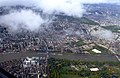
 Aerial view of London from LHR approach (08).jpg 5,184 × 3,456; 12.77 MB
-
 Aerial view of London from LHR approach (09).jpg 5,184 × 3,456; 12.47 MB
-
 Battersea from the air - geograph.org.uk - 4418580.jpg 640 × 480; 189 KB
-
 Battersea Park and Chelsea from the air - geograph.org.uk - 2646390.jpg 640 × 415; 132 KB
-
 Battersea Power Station and Grosvenor Bridge - geograph.org.uk - 5775787.jpg 3,740 × 2,714; 3.26 MB
-
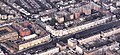
 Bird Eye Pictures of Sloane Square in 1909.jpg 968 × 712; 157 KB
-
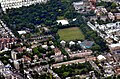
 Brompton Cemetery from the air - geograph.org.uk - 4262017.jpg 480 × 640; 173 KB
-
 Chelsea and Hyde Park from the air - geograph.org.uk - 5074075.jpg 640 × 480; 209 KB
-
 Chelsea from the air - geograph.org.uk - 3893238.jpg 640 × 480; 196 KB
-
 Chelsea from the air - geograph.org.uk - 6080119.jpg 1,024 × 768; 777 KB
-
 Chelsea Harbour from the air - geograph.org.uk - 2246834.jpg 640 × 494; 207 KB
-
 Earl's Court and Chelsea from the air - geograph.org.uk - 2357264.jpg 640 × 387; 196 KB
-

-
 Earls court.jpg 465 × 374; 97 KB
-
 Garden Lodge (Freddy Mercury) - Explored - Flickr - M McBey.jpg 2,303 × 1,061; 2.44 MB
-
 Holland Park aerial 2011.jpg 1,234 × 812; 739 KB
-
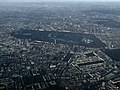
 Hyde Park from the air - geograph.org.uk - 4604504.jpg 640 × 380; 174 KB
-

-
 Kensington from the air - geograph.org.uk - 4598723.jpg 480 × 640; 251 KB
-
 Kensington from the air in 1909.jpg 970 × 650; 308 KB
-
 Kensington High Street from the air - geograph.org.uk - 2624079.jpg 2,592 × 1,944; 2.25 MB
-
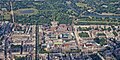
 Kensington Museums aerial 2011 a.jpg 4,288 × 2,848; 4.58 MB
-
 Kensington Museums aerial 2011 b.jpg 2,513 × 1,749; 1.71 MB
-
 Kensington museums from the air - geograph.org.uk - 2623993.jpg 2,592 × 1,944; 2.55 MB
-

-

-
 Kensington, London.jpg 1,989 × 993; 1.08 MB
-
 London aerial view 5 (438740059).jpg 1,024 × 768; 199 KB
-
 London from the air, 2001 - geograph.org.uk - 5571188.jpg 897 × 587; 135 KB
-

-
 Royal Hospital Chelsea-5919027264.jpg 3,072 × 2,304; 1.74 MB
-
 Royal Hospital, Chelsea from the air - geograph.org.uk - 4418583.jpg 480 × 640; 171 KB
-
 Sloane Street and Cadogan Place from the air - geograph.org.uk - 6080115.jpg 768 × 1,024; 715 KB
-
 South Kensington from the air - geograph.org.uk - 5074100.jpg 640 × 480; 209 KB
-
 South Kensington from the air - geograph.org.uk - 6365561.jpg 847 × 1,024; 435 KB
-
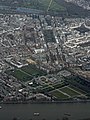
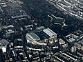 Stamford Bridge stadium from the air - geograph.org.uk - 4262036.jpg 640 × 480; 176 KB
-
 Stamford Bridge stadium from the air - geograph.org.uk - 4351685.jpg 640 × 480; 123 KB
-
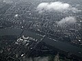
 The Thames and Chelsea from the air - geograph.org.uk - 3893228.jpg 640 × 480; 168 KB
-
 West London from the air - geograph.org.uk - 4262007.jpg 640 × 480; 152 KB
-
 West London from the air - geograph.org.uk - 4351648.jpg 640 × 480; 120 KB
.jpg)
.jpg)


_-_Explored_-_Flickr_-_M_McBey.jpg)


.jpg)


