Category:Agout
tributary of the Tarn in France  .png) | |||||
| Upload media | |||||
| Instance of | |||||
|---|---|---|---|---|---|
| Location | Hérault, Occitania, Metropolitan France, France | ||||
| Length |
| ||||
| Elevation above sea level |
| ||||
| Mouth of the watercourse | |||||
| Drainage basin |
| ||||
| Tributary |
| ||||
 | |||||
Subcategories
This category has the following 18 subcategories, out of 18 total.
B
- Pont vieux de Brassac (12 F)
D
- Durenque (river) (2 F)
G
- Gijou (9 F)
L
- Lac de la Raviège (6 F)
- Pont de Lavaur (7 F)
P
- Pont Antoinette (4 F)
- Pont de Burlats (1 F)
- Pont de Metz (Castres) (3 F)
- Pont Miredames (Castres) (4 F)
- Pont Neuf (Castres) (6 F)
- Pont neuf de Brassac (1 F)
- Pont Vieux (Castres) (2 F)
R
S
T
V
- Viaduc de Salles (3 F)
Media in category "Agout"
The following 40 files are in this category, out of 40 total.
-
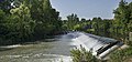 (Lavaur) - Seuil(barrage) du moulin sur l'Agout.jpg 11,532 × 5,381; 75.78 MB
-
 Agout (rivière).png 1,044 × 434; 929 KB
-
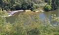
 Agout source.JPG 3,264 × 2,448; 3 MB
-
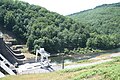
 Angles (Tarn) barrage la Raviege.JPG 3,456 × 2,304; 3.91 MB
-
 Angles (Tarn) barrage Raviege.JPG 3,456 × 2,304; 5.03 MB
-
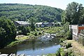 Brassac Agout.JPG 3,456 × 2,304; 4.69 MB
-
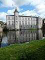
 Brassac chateau.JPG 3,456 × 2,304; 2.92 MB
-
 Brassac sous la neige.JPG 4,608 × 3,456; 5.86 MB
-
 Brassac sur Agout (cropped).JPG 3,500 × 500; 665 KB
-
 Brassac sur Agout.JPG 4,608 × 3,456; 5.63 MB
-
 Burlats - L'Agoût -01.jpg 4,896 × 2,752; 4.13 MB
-
 Burlats - L'Agoût -02.jpg 4,896 × 2,752; 3.45 MB
-
 Burlats - L'Agoût -03.jpg 3,656 × 2,119; 1.49 MB
-
 Cambon (34) St-Pierre Paul.JPG 3,456 × 2,304; 4.54 MB
-
 Castres (Tarn, Fr) confluence Durenque et Agout.JPG 4,000 × 3,000; 4.31 MB
-
 Evêché, Cathédrale et berges sur l'Agout.JPG 2,816 × 2,112; 2.51 MB
-
-
 Fraisse-sur-Agout pont.JPG 3,351 × 2,149; 3.41 MB
-
 Fraisse-sur-Agout riviere.JPG 3,456 × 2,304; 3.84 MB
-
 Fraisse-sur-Agout vue 1.JPG 3,393 × 2,209; 3.46 MB
-
 France - Giroussens - Agout.jpg 2,048 × 1,536; 1.38 MB
-
 France - Giroussens - vallée de l'Agout.jpg 1,536 × 2,048; 1.43 MB
-
 Fraïsse-sur-Agoût - L'Agoût -01.jpg 2,752 × 4,896; 4.46 MB
-
 Fraïsse-sur-Agoût - L'Agoût -02.jpg 4,445 × 2,750; 3.36 MB
-
 Fraïsse-sur-Agoût - L'Agoût -03.jpg 4,896 × 2,752; 4.24 MB
-
 Giroussens - L'Agout - 2016-08-07 - 03.jpg 3,958 × 5,705; 14.71 MB
-
 La Mairie de Brassac.JPG 4,608 × 3,456; 5.55 MB
-
 La Marquise.JPG 6,016 × 4,000; 6.2 MB
-
 La Salvetat pont.JPG 1,280 × 853; 185 KB
-
 La Salvetat-sur-Agout (Hérault, Fr) l'Agout.JPG 4,000 × 3,000; 4.37 MB
-
 Lavaur-vue-Cathédrale Saint-Alain-et-Agout.JPG 3,264 × 2,448; 2.51 MB
-
 Le Camboussel.JPG 4,608 × 3,456; 5.8 MB
-
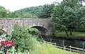
 Le Vieux Pont.JPG 4,608 × 3,456; 5.34 MB
-
 Pêche à la mouche sur l'Agout.JPG 6,016 × 4,000; 5.73 MB
-
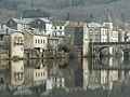
 Reflets d'Agout.JPG 3,456 × 4,608; 5.78 MB
-
 Riviere-Agout-St-Alain-Lavaur-01.jpg 1,289 × 903; 1.24 MB
-
 Riviere-Agout-St-Alain-Lavaur-02.jpg 1,290 × 789; 1.37 MB
-
 Saint-Sulpice-la-Pointe (Tarn) - La chaussée du moulin sur l'Agout.jpg 9,107 × 4,105; 19.76 MB
-
 Saint-Sulpice-la-Pointe (Tarn) - Le pont du chemin de fer sur l'Agout.jpg 5,504 × 4,507; 17.36 MB
-
 Saint-Sulpice-la-Pointe (Tarn) - Wikivoyage Banner.jpg 5,504 × 922; 7.31 MB
_-_Seuil(barrage)_du_moulin_sur_l%27Agout.jpg)

_barrage_la_Raviege.JPG)
_barrage_Raviege.JPG)


_St-Pierre_Paul.JPG)
_confluence_Durenque_et_Agout.JPG)


_l%27Agout.JPG)


_-_La_chauss%C3%A9e_du_moulin_sur_l%27Agout.jpg)
_-_Le_pont_du_chemin_de_fer_sur_l%27Agout.jpg)
.JPG)
_-_Wikivoyage_Banner.jpg)