Category:Agriculture in Argyll and Bute
Council areas (municipalities) of Scotland: Aberdeen · Aberdeenshire · Angus · Argyll and Bute · Clackmannanshire · Dumfries and Galloway · Dundee · East Ayrshire · East Dunbartonshire · East Lothian · East Renfrewshire · Edinburgh · Falkirk · Fife · Glasgow · Highland · Inverclyde · Midlothian · Moray · North Ayrshire · North Lanarkshire · Outer Hebrides · Orkney Islands · Perth and Kinross · Renfrewshire · Scottish Borders · Shetland Islands · South Ayrshire · South Lanarkshire · Stirling · West Dunbartonshire · West Lothian
Subcategories
This category has the following 5 subcategories, out of 5 total.
Media in category "Agriculture in Argyll and Bute"
The following 12 files are in this category, out of 12 total.
-
 Farmland, Ardlussa - geograph.org.uk - 760076.jpg 640 × 480; 82 KB
-
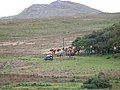 Herding cattle on Ardlussa Estate - geograph.org.uk - 1444322.jpg 640 × 481; 81 KB
-
 Plantation, Tobermory - geograph.org.uk - 199894.jpg 640 × 480; 71 KB
-
 Shearing shed - geograph.org.uk - 40373.jpg 640 × 480; 60 KB
-
 The trusty old tractor - geograph.org.uk - 756818.jpg 640 × 366; 65 KB
-
 Tractor - geograph.org.uk - 175948.jpg 640 × 480; 161 KB
-
 Tractor at Eskechraggan Farm - geograph.org.uk - 909408.jpg 640 × 480; 53 KB
-
 Forest boundary - geograph.org.uk - 206885.jpg 640 × 480; 58 KB
-
 Plantation beside the Allt a Chaorainn - geograph.org.uk - 85623.jpg 640 × 416; 61 KB
-
 Plantation on Druim Buidhe - geograph.org.uk - 454299.jpg 640 × 427; 65 KB
-
 Stream entering plantation - geograph.org.uk - 206909.jpg 640 × 480; 102 KB
-
 Trees at foot of Ben Dorain - geograph.org.uk - 429147.jpg 640 × 480; 81 KB


