Category:Alberbury with Cardeston
English: Alberbury with Cardeston is a civil parish in Shropshire, England. According to the 2001 census it had a population of 645 (though in 2005 the parish expanded with the annexation of half of the former Wollaston parish). It includes the villages and hamlets of Alberbury, Cardeston, Little Shrawardine, Wollaston, Halfway House, Wattlesborough Heath and Rowton, and has Alberbury Castle and Wattlesborough Castle within its borders. To the west the parish borders Wales, whilst to the north it is bounded by the River Severn.

civil parish in Shropshire, England  | |||||
| Upload media | |||||
| Instance of | |||||
|---|---|---|---|---|---|
| Named after | |||||
| Location | Shropshire, West Midlands, England | ||||
 | |||||
Subcategories
This category has the following 6 subcategories, out of 6 total.
Media in category "Alberbury with Cardeston"
The following 148 files are in this category, out of 148 total.
-
 A458 approaching Rowton junction - geograph.org.uk - 3112996.jpg 640 × 368; 52 KB
-
-

-
 A458 at Halfway House - geograph.org.uk - 3113020.jpg 640 × 494; 63 KB
-
 A458 at Ivyend Farm entrance - geograph.org.uk - 3113003.jpg 640 × 371; 62 KB
-
 A458 at Rock Villa entrance - geograph.org.uk - 3112979.jpg 640 × 484; 52 KB
-
 A458 from Teggs Farm - geograph.org.uk - 3113012.jpg 640 × 431; 84 KB
-
 A458 passing woods by Whiston Priory - geograph.org.uk - 3112965.jpg 640 × 385; 55 KB
-
 A458 through Wattlesborough Heath - geograph.org.uk - 3113015.jpg 640 × 424; 57 KB
-
 Across the fields to Eyton Farm - geograph.org.uk - 2093739.jpg 640 × 480; 127 KB
-
 Activity Centre entrance sign - geograph.org.uk - 2089264.jpg 640 × 480; 90 KB
-

-

-
 Alberbury, St. Michael's Church, The c14th south chapel - geograph.org.uk - 5746398.jpg 7,360 × 4,912; 5.34 MB
-
 Alberbury, St. Michael's Church, The c15th roof - geograph.org.uk - 5746392.jpg 6,737 × 4,495; 5.61 MB
-
 Alberbury, St. Michael's Church, The font (detail) - geograph.org.uk - 5746388.jpg 7,359 × 4,912; 5.28 MB
-
 Alberbury, St. Michael's Church, The font - geograph.org.uk - 5746386.jpg 4,425 × 6,631; 4.51 MB
-
 Alberbury, St. Michael's Church, The nave - geograph.org.uk - 5746382.jpg 7,360 × 4,912; 6.12 MB
-

-
 Amaston Holding - geograph.org.uk - 4431472.jpg 640 × 426; 50 KB
-

-
 B4393, Alberbury Road - geograph.org.uk - 4475099.jpg 640 × 480; 92 KB
-
 Barn amid trees at Stretton Heath level crossing - geograph.org.uk - 4558347.jpg 1,600 × 1,064; 323 KB
-
 Barn in field at Benthall - geograph.org.uk - 2151744.jpg 640 × 480; 66 KB
-
 Barn, Plas-y-Court - geograph.org.uk - 4431555.jpg 640 × 542; 44 KB
-
-
 Between the railway and A458 - geograph.org.uk - 4431521.jpg 640 × 426; 40 KB
-
 Bulthy Road junction - geograph.org.uk - 2089304.jpg 640 × 471; 93 KB
-
 Cottage at Halfway House - geograph.org.uk - 4599382.jpg 640 × 428; 80 KB
-

-
 Earthwork - geograph.org.uk - 4431545.jpg 640 × 426; 41 KB
-
 Edge of woodland off Hayes Lane - geograph.org.uk - 2151750.jpg 640 × 480; 77 KB
-
 Entrance to Brunant Farm - geograph.org.uk - 2089308.jpg 640 × 480; 99 KB
-

-
-
 Farm land near Little Heyford - geograph.org.uk - 2560568.jpg 640 × 480; 76 KB
-
 Farmland, Little Hayford Farm - geograph.org.uk - 4431476.jpg 640 × 296; 30 KB
-
 Farmland, Stretton Heath - geograph.org.uk - 4645405.jpg 640 × 426; 48 KB
-
 Farmland, Upper Wigmore - geograph.org.uk - 4431510.jpg 640 × 322; 26 KB
-
 Farmlands by the railway north of Stretton Heath - geograph.org.uk - 4558341.jpg 1,600 × 1,064; 251 KB
-

-
 Field of cattle in Alberbury with Cardeston, Shropshire, England.jpg 640 × 457; 134 KB
-
-
 Fields and woods south of Wattlesborough Heath - geograph.org.uk - 5028828.jpg 1,600 × 683; 104 KB
-
 Fields at Stretton Heath - geograph.org.uk - 5029086.jpg 1,600 × 836; 97 KB
-
 Fields at Stretton Heath - geograph.org.uk - 5029089.jpg 1,600 × 713; 89 KB
-
 Fields south of Wattlesborough, from the railway - geograph.org.uk - 4560032.jpg 1,600 × 594; 135 KB
-
 Fields south of Whitley Crest, from the railway - geograph.org.uk - 5028819.jpg 1,600 × 736; 123 KB
-
 Flood Damaged Crops - geograph.org.uk - 968894.jpg 640 × 457; 151 KB
-
 Garage at Halfway House (A458) - geograph.org.uk - 2093725.jpg 640 × 480; 59 KB
-
 Gate into Loton Park - geograph.org.uk - 2856290.jpg 640 × 480; 60 KB
-

-
 Hayes lane - geograph.org.uk - 2151752.jpg 480 × 640; 61 KB
-
 Heath Farm from the railway - geograph.org.uk - 4558258.jpg 1,600 × 1,064; 267 KB
-
 Hedge by the Cambrian Line - geograph.org.uk - 4431468.jpg 640 × 426; 71 KB
-
 High ladder stile in Loton Park - geograph.org.uk - 1520732.jpg 640 × 480; 112 KB
-
 Houses at Wattlesborough Heath - geograph.org.uk - 2093731.jpg 640 × 480; 77 KB
-
 Houses near Rowton Castle - geograph.org.uk - 2179746.jpg 3,648 × 2,736; 1.36 MB
-
 In the Breidden Hills in autumn - geograph.org.uk - 4207834.jpg 640 × 360; 69 KB
-
 Lane at Bulthy - geograph.org.uk - 2089268.jpg 640 × 480; 82 KB
-
 Lane past Rock Cottage - geograph.org.uk - 2089269.jpg 640 × 480; 100 KB
-
 Lane to Alberbury - geograph.org.uk - 2093735.jpg 640 × 480; 68 KB
-
 Lane to Hill Fort - geograph.org.uk - 2089300.jpg 640 × 480; 87 KB
-
 Lane to Mountain View - geograph.org.uk - 2089256.jpg 640 × 480; 52 KB
-
 Long straight on A458 near Wollaston - geograph.org.uk - 3113022.jpg 640 × 427; 99 KB
-
 Loton Park Hillclimb - geograph.org.uk - 5049467.jpg 1,500 × 1,000; 983 KB
-
 Loton Park towards the Wrekin - geograph.org.uk - 1396756.jpg 640 × 474; 96 KB
-
 Lower Wood - geograph.org.uk - 2093738.jpg 640 × 480; 85 KB
-
 Marche Lane crossing the railway - geograph.org.uk - 4599379.jpg 640 × 359; 96 KB
-
 Marche Lane entering Halfway House - geograph.org.uk - 4599380.jpg 640 × 449; 114 KB
-

-
 Minor junction ahead - geograph.org.uk - 790188.jpg 640 × 480; 85 KB
-
 Near Wood End Farm - geograph.org.uk - 4431461.jpg 640 × 426; 42 KB
-
 New house on the hill - geograph.org.uk - 1514135.jpg 640 × 480; 56 KB
-
 North of the railway line - geograph.org.uk - 4431499.jpg 640 × 426; 37 KB
-
 November Snow near Rowton - geograph.org.uk - 2180876.jpg 3,648 × 2,736; 1.11 MB
-
 Old Toll House by the A483, Middletown - geograph.org.uk - 6114792.jpg 600 × 450; 295 KB
-

-

-
 Opposite Rowton Barns - geograph.org.uk - 2179768.jpg 3,648 × 2,736; 1.7 MB
-
 Ordnance Survey Flush Bracket 12144 - geograph.org.uk - 5233669.jpg 3,887 × 2,915; 2.09 MB
-
 Over the Garden Wall - geograph.org.uk - 2179718.jpg 3,648 × 2,736; 1.01 MB
-
 Part of Golf Course - geograph.org.uk - 2089262.jpg 640 × 480; 70 KB
-
 Part of the A458 road - geograph.org.uk - 2787004.jpg 640 × 480; 55 KB
-
 Part Time Ponds - geograph.org.uk - 968853.jpg 640 × 457; 123 KB
-
 Patelia Cottage - geograph.org.uk - 4431549.jpg 640 × 426; 49 KB
-
 Plas-y-Court road junction from A458 - geograph.org.uk - 3113033.jpg 640 × 468; 77 KB
-

-
 Poultry shed - geograph.org.uk - 4431540.jpg 640 × 321; 50 KB
-
 Prince's Oak - geograph.org.uk - 2856035.jpg 640 × 480; 95 KB
-
 Red Abbey - geograph.org.uk - 2093740.jpg 640 × 480; 82 KB
-

-
 Ring of trees - geograph.org.uk - 4431518.jpg 640 × 426; 44 KB
-
 Road from Stretton Heath to Rowton - geograph.org.uk - 5233675.jpg 4,000 × 3,000; 3.96 MB
-
 Road junction at Rowton - geograph.org.uk - 3113000.jpg 640 × 355; 48 KB
-
-

-
 Road to Little Shrawardine - geograph.org.uk - 1513042.jpg 640 × 480; 56 KB
-
 Road to Little Shrawardine - geograph.org.uk - 2151742.jpg 640 × 495; 62 KB
-
 Road to Little Shrawardine - geograph.org.uk - 4475091.jpg 640 × 480; 95 KB
-
 Road to Stanford at Wollaston - geograph.org.uk - 2089245.jpg 640 × 480; 78 KB
-
 Roadside plaque at Prince's Oak - geograph.org.uk - 2856012.jpg 640 × 480; 103 KB
-
 Rolling hillside - geograph.org.uk - 4431512.jpg 640 × 426; 31 KB
-
 Rowton Barns - geograph.org.uk - 2179762.jpg 3,452 × 2,640; 1.11 MB
-

-
 Severn Valley view from Rowton Castle Hotel, 1990 - geograph.org.uk - 4150659.jpg 2,383 × 1,585; 3.8 MB
-
 Severn viewpoint at Shrawardine 1 - Shropshire - geograph.org.uk - 3606802.jpg 3,072 × 2,304; 2.26 MB
-
 Severn viewpoint at Shrawardine 3 - Shropshire - geograph.org.uk - 3606822.jpg 3,072 × 2,304; 2.16 MB
-
 Sheep, Little Hayford Farm - geograph.org.uk - 4431479.jpg 640 × 426; 58 KB
-
 Shropshire Farmland - geograph.org.uk - 4431484.jpg 640 × 426; 44 KB
-
 Shropshire Field - geograph.org.uk - 4431494.jpg 640 × 426; 34 KB
-
 Sign on the border - geograph.org.uk - 758401.jpg 640 × 480; 62 KB
-
 Six-spot burnet on a thistle - geograph.org.uk - 1397821.jpg 640 × 533; 98 KB
-
 Snowy Lane with Pampas Grass - geograph.org.uk - 2179776.jpg 3,648 × 2,736; 1.39 MB
-
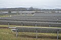 Solar Farm - geograph.org.uk - 4645399.jpg 640 × 426; 56 KB
-
 Solar panels - geograph.org.uk - 4645397.jpg 640 × 426; 48 KB
-
 Stile in the Breidden Hills - geograph.org.uk - 4207812.jpg 640 × 360; 106 KB
-

-
 Sunrise at Rowton Park - geograph.org.uk - 2179732.jpg 3,648 × 2,736; 993 KB
-
 The B4393 heads for the hills - geograph.org.uk - 5304721.jpg 640 × 428; 72 KB
-
 The Drain - geograph.org.uk - 968908.jpg 640 × 457; 126 KB
-
 The eastern ridge leading up to Middletown Hill - geograph.org.uk - 2148047.jpg 1,024 × 768; 241 KB
-
 The Windmill, Rowton - geograph.org.uk - 2882983.jpg 3,459 × 1,877; 1.84 MB
-
 Track to West Bulthy - geograph.org.uk - 2089276.jpg 640 × 480; 109 KB
-
 Trailer parked at White Abbey - geograph.org.uk - 2093743.jpg 640 × 480; 118 KB
-
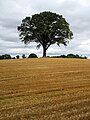 Tree in recently-harvested field - geograph.org.uk - 6255462.jpg 3,888 × 5,184; 4.09 MB
-
 Trees along a stream - geograph.org.uk - 4431562.jpg 640 × 426; 49 KB
-
 Trees in the Morning - geograph.org.uk - 2179756.jpg 3,648 × 2,736; 2.04 MB
-
 Victorian Methodist church - geograph.org.uk - 652316.jpg 640 × 480; 57 KB
-
 View from Rock Cottage Bulthy - geograph.org.uk - 2089271.jpg 640 × 480; 90 KB
-
 View from the railway towards Whitley Crest - geograph.org.uk - 4560033.jpg 1,600 × 718; 165 KB
-
 View from the railway towards Whitley Crest - geograph.org.uk - 4560034.jpg 1,600 × 748; 196 KB
-
 View from the railway towards Whitley Crest - geograph.org.uk - 5028037.jpg 1,600 × 876; 145 KB
-
 View of Wattlesborough Heath from the railway - geograph.org.uk - 4559879.jpg 1,600 × 997; 223 KB
-
 View of Wood End Farm from the railway - geograph.org.uk - 4558195.jpg 1,600 × 771; 163 KB
-
 View to Heath Farm - geograph.org.uk - 4431463.jpg 640 × 426; 36 KB
-
 View towards Wollaston from the railway - geograph.org.uk - 5028020.jpg 1,600 × 1,064; 176 KB
-

-

-

-
 Waste ground by the railway line - geograph.org.uk - 4431501.jpg 640 × 426; 51 KB
-
 We're off road again - geograph.org.uk - 2384143.jpg 480 × 640; 100 KB
-
 Whiteley Crest - geograph.org.uk - 4431515.jpg 640 × 426; 41 KB
-
 Wollaston from the railway - geograph.org.uk - 5028015.jpg 1,600 × 1,064; 171 KB
-
 Woodland south of Wattlesborough Heath - geograph.org.uk - 5029081.jpg 1,600 × 712; 78 KB
-
 Woodland, Lower Wedmore - geograph.org.uk - 4431487.jpg 640 × 426; 44 KB
-
 Yockleton road junction at Cardeston - geograph.org.uk - 3112971.jpg 640 × 496; 85 KB
-
 River Severn at the Royal Hill pub - geograph.org.uk - 1142.jpg 640 × 480; 45 KB


_-_geograph.org.uk_-_5746388.jpg)


_-_geograph.org.uk_-_2093725.jpg)


