Category:Albury, Hertfordshire
English: Albury is a village and civil parish in the East Hertfordshire district of Hertfordshire, England, about five miles west of Bishop's Stortford. According to the 2001 census it had a population of 537.
village and civil parish in Hertfordshire, England  | |||||
| Upload media | |||||
| Instance of | |||||
|---|---|---|---|---|---|
| Location | East Hertfordshire, Hertfordshire, East of England, England | ||||
| Different from | |||||
 | |||||
Media in category "Albury, Hertfordshire"
The following 53 files are in this category, out of 53 total.
-
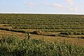
 A meadow between two woods - geograph.org.uk - 1290742.jpg 640 × 393; 50 KB
-
 Albury - geograph.org.uk - 82825.jpg 640 × 480; 108 KB
-
 Albury Road - geograph.org.uk - 3886224.jpg 640 × 480; 129 KB
-
 Albury Road, Clapgate - geograph.org.uk - 4831485.jpg 2,304 × 1,728; 1.28 MB
-
 Albury, Albury Water Tower - geograph.org.uk - 3818129.jpg 640 × 451; 68 KB
-
 Albury, Lane to Upwick Green - geograph.org.uk - 3825888.jpg 640 × 480; 115 KB
-
 Albury, The lane to Albury End - geograph.org.uk - 3818054.jpg 640 × 480; 105 KB
-
-
 Barn near to Albury Hall - geograph.org.uk - 4494237.jpg 4,320 × 3,240; 4.27 MB
-
 Bogs Cottage - geograph.org.uk - 3458470.jpg 3,648 × 2,736; 2.56 MB
-
 Bogs Wood - geograph.org.uk - 248343.jpg 640 × 480; 135 KB
-
 Church Cottages, Albury - geograph.org.uk - 4047892.jpg 4,320 × 3,240; 3.56 MB
-
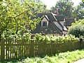
 Cottage in Patmore Heath - geograph.org.uk - 4829533.jpg 2,304 × 1,728; 1,006 KB
-
 Entering Gravesend - geograph.org.uk - 3886246.jpg 640 × 480; 153 KB
-
 Entrance to Gravesend - geograph.org.uk - 3297431.jpg 640 × 480; 92 KB
-
 Field by Albury Road, Clapgate - geograph.org.uk - 4832087.jpg 2,304 × 1,728; 908 KB
-
 Field by Albury Road, Clapgate - geograph.org.uk - 6219920.jpg 1,920 × 1,280; 1.65 MB
-
 Field by Albury Road, Clapgate - geograph.org.uk - 6219921.jpg 1,920 × 1,280; 1.45 MB
-
 Field by The Causeway - geograph.org.uk - 4831550.jpg 2,304 × 1,728; 877 KB
-
 Fields by Albury Road, Furneaux Pelham - geograph.org.uk - 6219919.jpg 1,920 × 1,280; 1.03 MB
-
 Finger post, Clapgate - geograph.org.uk - 3297438.jpg 640 × 480; 78 KB
-
 Gateway to Kitchers - geograph.org.uk - 4494208.jpg 4,320 × 3,240; 5.47 MB
-
 GOC The Pelhams 072 Heath End Cottage, Patmore Heath (28181933411).jpg 4,030 × 3,033; 3.06 MB
-
 Houses at High Hall - geograph.org.uk - 3886243.jpg 640 × 480; 106 KB
-

-
 Patmore Heath - geograph.org.uk - 82806.jpg 640 × 480; 173 KB
-
 Patmore Heath 1 2020-08-30.jpg 4,032 × 3,024; 5.25 MB
-
 Patmore Heath 2 2020-08-30.jpg 4,032 × 3,024; 6.96 MB
-
 Patmore Heath 3 2020-08-30.jpg 4,032 × 3,024; 6.81 MB
-
 Pillar Box Cottage - geograph.org.uk - 248351.jpg 640 × 480; 168 KB
-
 Private road to Hole Farm - geograph.org.uk - 4494186.jpg 4,320 × 3,240; 3.99 MB
-
 Public footpath 011 to Furneux Pelham - geograph.org.uk - 3886254.jpg 640 × 480; 120 KB
-
 Public footpath to Patmore Heath - geograph.org.uk - 1290749.jpg 640 × 480; 56 KB
-
 St Mary's church Albury - geograph.org.uk - 4047888.jpg 4,320 × 3,240; 3.63 MB
-
 The Catherine Wheel, Gravesend - geograph.org.uk - 3297432.jpg 640 × 480; 72 KB
-
 The main road through Gravesend - geograph.org.uk - 1300413.jpg 640 × 448; 58 KB
-
 The road that leads to Albury Hall - geograph.org.uk - 1214340.jpg 640 × 480; 72 KB
-

-
 The Village Hall - geograph.org.uk - 3458373.jpg 3,648 × 2,736; 2.79 MB
-
 Track junction - geograph.org.uk - 253399.jpg 640 × 480; 99 KB
-
 Turning for Upwick Green - geograph.org.uk - 3297440.jpg 640 × 480; 83 KB
-
 Upwick Farm House - geograph.org.uk - 248346.jpg 640 × 480; 190 KB
-
 View from Albury Road, Little Hadham - geograph.org.uk - 4832069.jpg 2,304 × 1,728; 899 KB
-
 Water tower and farmland near Albury - geograph.org.uk - 4047856.jpg 4,320 × 3,240; 4.4 MB
-
 Albury Hall - geograph.org.uk - 82817.jpg 640 × 480; 87 KB
-
 Clapgate - geograph.org.uk - 82826.jpg 640 × 480; 109 KB
-

-
 Lane up to Cockhampstead - geograph.org.uk - 579608.jpg 640 × 425; 83 KB
-
 Patmore Hall farm buildings - geograph.org.uk - 248339.jpg 640 × 480; 130 KB
-
 River Ash near Gravesend - geograph.org.uk - 82811.jpg 640 × 480; 194 KB
-
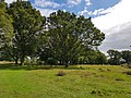
 The Common - geograph.org.uk - 248357.jpg 640 × 480; 119 KB
-
 The wood adjoining The Common - geograph.org.uk - 248360.jpg 640 × 480; 111 KB
-
 Wood adjoining The Common - geograph.org.uk - 248358.jpg 640 × 480; 127 KB


.jpg)


