Category:Aldfield
village and civil parish in the Harrogate district of North Yorkshire, England  | |||||
| Upload media | |||||
| Instance of | |||||
|---|---|---|---|---|---|
| Location | Harrogate, North Yorkshire, Yorkshire and the Humber, England | ||||
 | |||||
English: Aldfield is a village and civil parish in the Harrogate district of North Yorkshire, England, about three miles west of Ripon. It is the closest village to Fountains Abbey.
Subcategories
This category has only the following subcategory.
Media in category "Aldfield"
The following 92 files are in this category, out of 92 total.
-
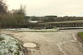
 Aldfield - geograph.org.uk - 6164528.jpg 4,128 × 2,006; 3.31 MB
-
 Aldfield.jpg 640 × 480; 139 KB
-
 B6265 and tree - geograph.org.uk - 3749547.jpg 800 × 658; 131 KB
-

-
 B6265 near Aldfield - geograph.org.uk - 3749544.jpg 640 × 480; 59 KB
-
 B6265 near Spa Gill Wood - geograph.org.uk - 6273974.jpg 1,024 × 683; 311 KB
-

-
 Bend near Fountains Hall - geograph.org.uk - 5640793.jpg 4,288 × 2,848; 2.29 MB
-
 Bridge over the River Skell at Spring Wood - geograph.org.uk - 3883933.jpg 1,600 × 1,200; 915 KB
-
 Bridge over the Skell - geograph.org.uk - 3520039.jpg 3,872 × 2,592; 4.8 MB
-
 Bridge Stone, Fountains Bridge - geograph.org.uk - 2066195.jpg 682 × 1,024; 237 KB
-
 Bridge Stone, Fountains Bridge - geograph.org.uk - 2066202.jpg 681 × 1,024; 241 KB
-
 Cat Crag Quarry - geograph.org.uk - 1631330.jpg 640 × 384; 49 KB
-
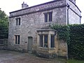
 Church House, Aldfield.jpg 4,723 × 3,293; 4.05 MB
-
 Cottage near Fountains Abbey - geograph.org.uk - 2466131.jpg 1,600 × 1,200; 651 KB
-
 Cottages near Fountains Abbey - geograph.org.uk - 3953313.jpg 1,920 × 1,325; 510 KB
-
 Cottages near Fountains Bridge - geograph.org.uk - 2682777.jpg 640 × 426; 75 KB
-
 Cut Bench Mark, Fountains Bridge - geograph.org.uk - 2066196.jpg 1,024 × 681; 316 KB
-
 Double Trouble - geograph.org.uk - 2196232.jpg 1,600 × 1,200; 287 KB
-
 East gate and lodge cottage, Grantley Hall - geograph.org.uk - 2003818.jpg 2,386 × 2,495; 1.39 MB
-
 Eavestone and B6265, aerial 2016 - geograph.org.uk - 5090680.jpg 640 × 479; 75 KB
-
 Farm track towards Spring Wood - geograph.org.uk - 2466142.jpg 1,600 × 1,200; 585 KB
-
 Field above Spa Gill Woods - geograph.org.uk - 118585.jpg 640 × 480; 108 KB
-
 Footpath - geograph.org.uk - 346042.jpg 480 × 640; 114 KB
-
 Footpath near Fountains Farm - geograph.org.uk - 6164525.jpg 4,128 × 2,006; 4.27 MB
-
 Footpath through long grass near Aldfield - geograph.org.uk - 6164527.jpg 2,006 × 4,128; 4.66 MB
-
 Foster Field - geograph.org.uk - 1610556.jpg 480 × 640; 154 KB
-
 Fountain's Bridge - geograph.org.uk - 1861001.jpg 2,048 × 1,536; 1.18 MB
-
 Fountains Abbey - geograph.org.uk - 5502322.jpg 427 × 640; 88 KB
-
 Fountains Bridge - geograph.org.uk - 2066189.jpg 1,024 × 681; 252 KB
-
 Fountains Bridge - geograph.org.uk - 3883936.jpg 1,600 × 1,200; 961 KB
-
 Fountains Bridge - geograph.org.uk - 4780492.jpg 640 × 427; 127 KB
-
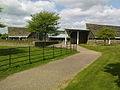
 Fountains Farm - geograph.org.uk - 5978304.jpg 640 × 480; 276 KB
-
 Fountains Farm - geograph.org.uk - 888799.jpg 640 × 427; 59 KB
-
 Fountains Farmhouse - geograph.org.uk - 5179748.jpg 4,000 × 3,000; 3.95 MB
-
 Fountains Gate at Ings Bridge - geograph.org.uk - 2003859.jpg 3,264 × 2,448; 2.88 MB
-
 Fountains Lane - geograph.org.uk - 2654601.jpg 640 × 425; 90 KB
-
 Fountains Lane - geograph.org.uk - 2657094.jpg 640 × 425; 57 KB
-
 Fountains Lane - geograph.org.uk - 4780495.jpg 640 × 427; 75 KB
-
 Harvest time - geograph.org.uk - 5928504.jpg 2,000 × 1,333; 2.24 MB
-
 High Lindrick Farm. - geograph.org.uk - 1024321.jpg 640 × 480; 61 KB
-
 Horsleygate Farm - geograph.org.uk - 1631329.jpg 640 × 292; 48 KB
-
 House near Fountains Bridge - geograph.org.uk - 5496585.jpg 1,024 × 768; 293 KB
-
 House near the entrance to Fountains Abbey - geograph.org.uk - 6010579.jpg 1,024 × 683; 518 KB
-
 Ings Bridge - geograph.org.uk - 1610518.jpg 640 × 480; 126 KB
-
 Ings Bridge in dappled sunlight - geograph.org.uk - 6154129.jpg 3,968 × 2,976; 6.08 MB
-
 Junction near Fountains Farm - geograph.org.uk - 5641134.jpg 2,354 × 1,532; 497 KB
-
 Lane near Fountains Hall - geograph.org.uk - 5640758.jpg 2,426 × 1,472; 806 KB
-
 Leaving Fountains Abbey - geograph.org.uk - 5928534.jpg 2,000 × 1,333; 1.78 MB
-
 Mallard Grange - geograph.org.uk - 1024322.jpg 640 × 404; 70 KB
-
 Mature Oak, near the river Skell - geograph.org.uk - 1716885.jpg 1,088 × 1,429; 584 KB
-
 Mill Bridge, Fountains Abbey - geograph.org.uk - 256359.jpg 640 × 480; 137 KB
-
 Moor Lane - geograph.org.uk - 6273980.jpg 1,024 × 683; 234 KB
-
 Moor Lane - geograph.org.uk - 889464.jpg 640 × 427; 63 KB
-
 Morning Sun - geograph.org.uk - 686521.jpg 640 × 412; 81 KB
-
 Muddy field off Fountains Lane - geograph.org.uk - 4780499.jpg 640 × 427; 84 KB
-
 Muddy Lane - geograph.org.uk - 1610576.jpg 640 × 480; 118 KB
-
 Neptune. - geograph.org.uk - 493288.jpg 480 × 640; 141 KB
-
 New growth in the field - geograph.org.uk - 5928507.jpg 2,000 × 1,333; 2.34 MB
-
 Picnic anyone^ - geograph.org.uk - 1610566.jpg 640 × 480; 150 KB
-
 Pile of logs below Skell Bank Wood - geograph.org.uk - 3520071.jpg 3,872 × 2,592; 6.8 MB
-
 Pond near Aldfield - geograph.org.uk - 6164530.jpg 4,128 × 2,006; 3.39 MB
-
 Postbox, Moor Lane, Aldfield - geograph.org.uk - 5508981.jpg 1,024 × 768; 807 KB
-
 Racing towards Harrogate - geograph.org.uk - 6284490.jpg 2,782 × 2,114; 1.47 MB
-
 Redwood in Rookery Wood - geograph.org.uk - 856949.jpg 395 × 640; 153 KB
-
 Ribbed Arches under Fountain's Bridge - geograph.org.uk - 1861086.jpg 2,048 × 1,536; 877 KB
-
 Ripon Rowel Walk meets National Byway - geograph.org.uk - 5641154.jpg 4,288 × 2,848; 1.41 MB
-
 Ripon Rowel Walk near Fountains Abbey - geograph.org.uk - 5640804.jpg 2,514 × 1,418; 747 KB
-
 Ripon Rowel Walk near Fountains Farm - geograph.org.uk - 5641129.jpg 4,248 × 2,375; 1,009 KB
-
 Road junction near Horsley Gate Farm - geograph.org.uk - 6164534.jpg 4,128 × 2,006; 4.81 MB
-
 Road to Fountains Hall - geograph.org.uk - 5640817.jpg 4,288 × 2,848; 1.74 MB
-
 Skell Bank Wood - geograph.org.uk - 1716871.jpg 1,024 × 768; 288 KB
-
 Skell valley - geograph.org.uk - 5640810.jpg 4,288 × 2,848; 1.79 MB
-
 Spa Gill Footbridge - geograph.org.uk - 2005856.jpg 3,648 × 2,736; 3.13 MB
-
 Spa Gill Wood - geograph.org.uk - 1972337.jpg 3,648 × 2,736; 4.08 MB
-
 Spa Gill Wood - geograph.org.uk - 2003827.jpg 2,448 × 3,264; 3.32 MB
-
 Studley Royal Park, aerial 2016 - geograph.org.uk - 5090700.jpg 640 × 427; 60 KB
-
 Sun Wood - geograph.org.uk - 2002922.jpg 2,448 × 3,264; 2.71 MB
-
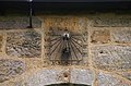 Sundial at Aldfield - geograph.org.uk - 889474.jpg 640 × 419; 90 KB
-
 The Gardener's House - geograph.org.uk - 524376.jpg 640 × 480; 91 KB
-
 The River Skell - geograph.org.uk - 3520063.jpg 3,872 × 2,592; 6.29 MB
-
 The road to Grantley - geograph.org.uk - 2002926.jpg 2,448 × 3,264; 2.31 MB
-
 Track over Bridge - geograph.org.uk - 1716854.jpg 768 × 1,024; 415 KB
-
 Track through Spa Gill Wood - geograph.org.uk - 2003743.jpg 2,448 × 3,264; 3.03 MB
-
 Tree next to the Skell - geograph.org.uk - 4780490.jpg 640 × 427; 127 KB
-
 Tudor Hall by Fountain's Abbey - geograph.org.uk - 950734.jpg 437 × 640; 81 KB
-
 Victorian Postbox, Fountains Bridge - geograph.org.uk - 2066190.jpg 681 × 1,024; 252 KB
-
 Visitors Centre - geograph.org.uk - 817097.jpg 640 × 480; 88 KB
-
 Wall in Skell valley - geograph.org.uk - 5640851.jpg 2,926 × 1,728; 1.03 MB
-
 Well-Head at Aldfield Spa - geograph.org.uk - 3268986.jpg 5,184 × 3,456; 7.15 MB
-
 Well-Head at Aldfield Spa - geograph.org.uk - 3269000.jpg 5,184 × 3,456; 7 MB
-
 West Gate Ticket Office - geograph.org.uk - 524470.jpg 480 × 640; 122 KB


