Category:All Saints Parish Church, Edge Hill
| Object location | | View all coordinates using: OpenStreetMap |
|---|
church building in Liverpool, Merseyside, UK  | |||||
| Upload media | |||||
| Instance of | |||||
|---|---|---|---|---|---|
| Location | Liverpool, Merseyside, North West England, England | ||||
| Diocese | |||||
| Heritage designation |
| ||||
| Religion or worldview | |||||
 | |||||
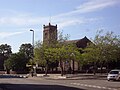
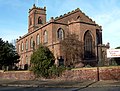
Founded in 1812, this was for many years St Mary's church and as a result of reorganisation in the parish was renamed in 2011.
Subcategories
This category has the following 4 subcategories, out of 4 total.
C
I
V
W
Media in category "All Saints Parish Church, Edge Hill"
The following 24 files are in this category, out of 24 total.
-
 All Saints, Edge Hill 2018.jpg 5,029 × 3,259; 10.17 MB
-
 Benchmark at entrance of St Mary's, Irvine Street.jpg 5,152 × 3,864; 7.4 MB
-
 Clock face, All Saints, Edge Hill.jpg 4,908 × 3,384; 12.45 MB
-
 Dated waterspout, All Saints, Edge Hill.jpg 3,456 × 5,184; 9.73 MB
-
 East end of St Mary's, Edge Hill 2.jpg 4,740 × 3,174; 9.74 MB
-
 East end of St Mary's, Edge Hill.jpg 4,704 × 3,696; 8.23 MB
-
 Edge Hill Church (St Mary's) - geograph.org.uk - 386504.jpg 640 × 480; 75 KB
-
 St Mary's, Irvine Street.jpg 1,984 × 1,488; 573 KB
-
 St Mary's Church, Edge Hill, Liverpool (1).JPG 4,608 × 3,456; 3.52 MB
-
 St Mary's Church, Edge Hill, Liverpool (3).JPG 4,608 × 3,456; 3.44 MB
-
 St Mary's Church, Edge Hill, Liverpool (4).JPG 4,608 × 3,456; 3.57 MB
-
 St Mary's Church, Edge Hill, Liverpool (5).JPG 4,608 × 3,456; 3.55 MB
-
 St Mary's Church, Edge Hill, Liverpool (6).JPG 4,608 × 3,456; 3.56 MB
-
 St Mary's Church, Edge Hill, Liverpool (7).JPG 4,608 × 3,456; 3.61 MB
-
 St Mary's Edge Hill 1.jpg 1,488 × 1,984; 534 KB
-
 St Mary's Edge Hill 2.jpg 1,984 × 1,488; 440 KB
-
 St Mary's Edge Hill 3.JPG 1,984 × 1,488; 669 KB
-
 St Mary's Edge Hill, June 25, 2012.jpg 3,648 × 2,736; 2.03 MB
-
 St Mary's, Edge Hill 201710.jpg 4,920 × 3,330; 10.61 MB
-
 St Marys Edge Hill 2017-1.jpg 4,301 × 3,536; 7.42 MB
-
 St Marys Edge Hill 2017-2.jpg 3,010 × 3,484; 5.12 MB
-
 St Marys Edge Hill 2017-3.jpg 3,584 × 3,510; 5.92 MB
-
 St. Marys church, from Towerlands Street (109167663).jpg 2,021 × 1,291; 1.52 MB
-
 St. Marys Church, Irvine Street (109167133).jpg 1,861 × 1,408; 1.2 MB


_-_geograph.org.uk_-_386504.jpg)

.JPG)
.JPG)
.JPG)
.JPG)
.JPG)
.JPG)


.jpg)
.jpg)