Category:Alpe Varoo
|
Alpe Varoo has an entry on OpenStreetMap (show). |
shieling in the Italian municipality of Plesio | |||||
| Upload media | |||||
| Instance of | |||||
|---|---|---|---|---|---|
| Location | Plesio, Province of Como, Lombardy, Italy | ||||
| Located on street | |||||
| Elevation above sea level |
| ||||
 | |||||
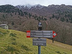
Italiano: L'Alpe Varoo (1141 m.) (detta anche Alpe Varò) è un ex alpeggio nel comune di Plesio in Valle Varò (affluente del torrente Sanagra). Vi transita il Sentiero delle Quattro Valli (3 barrato).
Subcategories
This category has only the following subcategory.
H
Media in category "Alpe Varoo"
The following 17 files are in this category, out of 17 total.
-
Alpe Varoo on the background of Monte Grona.jpg 3,648 × 2,736; 2.84 MB
-
Alpe Varoo seen from trail 27 Alpe Logone - Alpe Erba.jpg 1,734 × 1,292; 915 KB
-
Alpe Varoo with its fountain.jpg 3,488 × 1,936; 3.91 MB
-
Buildings of Alpe Varoo 01.jpg 4,518 × 2,581; 6.38 MB
-
Buildings of Alpe Varoo 02.jpg 3,648 × 2,736; 5.46 MB
-
Buildings of Alpe Varoo 03.jpg 5,280 × 1,842; 4.64 MB
-
Buildings of Alpe Varoo 04.jpg 4,972 × 2,870; 5.15 MB
-
Buildings of Alpe Varoo 05.jpg 3,648 × 2,736; 5.82 MB
-
Drinking fountain at Alpe Varoo 01.jpg 3,648 × 2,736; 7.08 MB
-
Drinking fountain at Alpe Varoo 02.jpg 2,399 × 2,053; 3.59 MB
-
Guidepost Alpe Varoo 1140 m.jpg 1,976 × 2,202; 1.39 MB
-
Photosphere in Alpe Varoo 01.jpg 5,322 × 2,661; 4.01 MB
-
Photosphere in Alpe Varoo 02.jpg 5,322 × 2,661; 4.42 MB
-
Photosphere in Alpe Varoo 03.jpg 5,322 × 2,661; 5.38 MB
-
Place name sign Alpe Varoo.jpg 3,277 × 1,177; 669 KB
-
View from path 27 Alpe Logone - Alpe Erba.jpg 5,312 × 1,873; 5.2 MB
-
Wayside cross at Alpe Varoo.jpg 1,181 × 1,356; 640 KB


