Category:Alte Kirche Lungern
| Object location | | View all coordinates using: OpenStreetMap |
|---|
church tower in Lungern in the canton of Obwalden, Switzerland   | |||||
| Upload media | |||||
| Instance of | |||||
|---|---|---|---|---|---|
| Part of | |||||
| Location | Lungern, Obwalden, Switzerland | ||||
| Street address |
| ||||
| Heritage designation | |||||
| Replaced by | |||||
 | |||||
Media in category "Alte Kirche Lungern"
The following 6 files are in this category, out of 6 total.
-
 Alte Kirche Lungern 360 Panorama.jpg 19,464 × 3,650; 9.66 MB
-
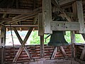 Alte Kirche Lungern Plattform.jpg 4,000 × 3,000; 2.88 MB
-
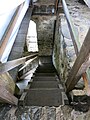 Alte Kirche Lungern Treppe.jpg 3,000 × 4,000; 2.79 MB
-
 Alte Kirche Lungern.JPG 3,000 × 4,000; 3.48 MB
-
 CH-NB - Lungern, Kirche, vue partielle extérieure - Collection Max van Berchem - EAD-6796.tif 3,744 × 5,087; 18.19 MB
-
 LungernAlterKirchturm 2011-07.jpg 2,080 × 4,243; 3.16 MB

