Category:Anachronistic maps
This category is intended for historical maps based on modern or otherwise anachronistic topography. It might include other anachronisms, though. MJSmit (talk) 10:00, 26 July 2008 (UTC)
Media in category "Anachronistic maps"
The following 70 files are in this category, out of 70 total.
-
 (mapa)ElevadorMunicípio.png 621 × 621; 197 KB
-
 1624 map of the Ancient World based upon the Bible by Abraham Ortelius.jpg 13,020 × 8,862; 22.85 MB
-
 Albania Greek occupation.png 330 × 355; 17 KB
-
 Albanians as a migrant Dacian people.png 1,584 × 1,140; 455 KB
-
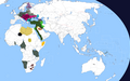
 All areas of the world that were once part of the Portuguese Empire V01.png 1,425 × 625; 79 KB
-
 All areas of the world that were once part of the Portuguese Empire.png 1,425 × 629; 38 KB
-
 Anachronistic map of Mercurion and Latinion.png 2,500 × 1,377; 633 KB
-
 Anachronistic Map of the Balkans (English).svg 1,873 × 1,245; 2.79 MB
-
 AnachronisticMapBalkans.png 755 × 550; 160 KB
-
 Anachronous map of the All French Empire (1534 -1970).png 2,000 × 1,015; 505 KB
-
 Ancient Epirus & Modern Borders (Colored)-pt.svg 688 × 1,002; 168 KB
-
 Ancient Epirus & Modern Borders (Colored).svg 688 × 1,002; 175 KB
-
 Ancient Epirus & Modern Borders zh (Colored).svg 860 × 1,252; 252 KB
-
 Ancient Epirus & Modern Borders.svg 688 × 1,002; 200 KB
-
 Ancient Greek & Roman cities in Albania.png 600 × 600; 58 KB
-
 AncientgrsetlinAlb.svg 744 × 1,052; 198 KB
-
 Austria locator map (1000).svg 1,875 × 1,815; 5.74 MB
-
 Bavaria locator map (1000).svg 4,431 × 3,875; 4.7 MB
-
 Bayern im 10.Jh.png 663 × 368; 100 KB
-
 Bayern um 788.png 663 × 368; 106 KB
-
 British Empire Historical Overlap territory.svg 2,560 × 1,299; 426 KB
-
 Carte anachronique des colonies françaises.png 7,648 × 3,886; 2.75 MB
-
 Carte-Anachronique-des-tout-les-empires-francais(1534-1980).png 2,000 × 1,015; 677 KB
-
 Dardanian Kingdom (English).svg 837 × 582; 1.62 MB
-
 Dardanian Kingdom (Portuguese).svg 837 × 582; 1.62 MB
-
 Dardanian Kingdom under Bardyllis I (English).svg 837 × 582; 1.62 MB
-
 Dardanian Kingdom under Bardyllis II (English).svg 837 × 582; 1.62 MB
-
 Dardanian Kingdom under Bato (English).svg 837 × 582; 1.62 MB
-
 Dardanian Kingdom under Cleitus (English).svg 837 × 582; 1.62 MB
-
 Dardanian Kingdom under Longarus (English).svg 837 × 582; 1.62 MB
-
 Dardanian Kingdom under Monunius I (English).svg 837 × 582; 1.62 MB
-
 Dardanian Kingdom under Monunius II (English).svg 837 × 582; 1.62 MB
-
 Dardanian Kingdom under Mytilus (English).svg 837 × 582; 1.63 MB
-
 Ddf1368668983190.png 2,753 × 1,400; 198 KB
-
 Deutschland um das Jahr 1000-es.svg 5,247 × 4,115; 5.66 MB
-
 Deutschland um das Jahr 1000.svg 5,247 × 4,115; 4.92 MB
-
 Droysens-22-23.jpg 5,544 × 4,543; 4.44 MB
-
 EmpireFrench.png 2,753 × 1,400; 193 KB
-
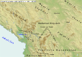
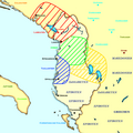
 Epirus & modern borders.jpg 410 × 600; 182 KB
-
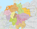
 Epirus across Greece Albania4-es.svg 819 × 1,063; 267 KB
-
 Epirus across Greece Albania4-fr.svg 744 × 1,052; 161 KB
-
 Epirus across Greece Albania4.svg 744 × 1,052; 76 KB
-
 EuropeanColonialism.png 1,280 × 561; 134 KB
-
 Flag Map Of The United States With Military Occupations Included.png 7,030 × 3,542; 166 KB
-
 Fr Epirus across Greece Albania4.svg 744 × 1,052; 144 KB
-
 Holy Roman Empire 1000CE.svg 485 × 340; 1.25 MB
-
 Imperio español diacrónico (es).svg 2,753 × 1,399; 1.01 MB
-
 Imperios centrales diacronico.png 2,965 × 1,845; 389 KB
-
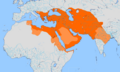 Iranian Empire.png 1,585 × 957; 117 KB
-
 Italian Empire total.png 1,425 × 625; 22 KB
-
 Karte Herzogtum Bayern im 10. Jahrhundert.png 2,844 × 3,008; 13.67 MB
-
 Kingdom of Sikkim map.png 774 × 600; 105 KB
-
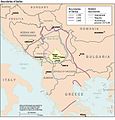
 Kosovo 1913-1992 CIA.jpg 978 × 827; 296 KB
-
 Location of the Spanish Empire.png 1,425 × 625; 23 KB
-

-
 Map of the Spanish Empire.png 1,920 × 975; 272 KB
-
 Mapepirus2hl5.jpg 800 × 1,169; 516 KB
-
 Meyers b4 s0851a.jpg 2,048 × 1,675; 653 KB
-
 Nordgau 1000.PNG 544 × 496; 193 KB
-
 Nordgau locator map (1000).svg 1,875 × 1,815; 5.74 MB
-
 Serbia boundaries CIA.jpg 655 × 686; 103 KB
-
 Spanish Empire Anachronous en.png 2,753 × 1,400; 608 KB
-
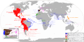 Spanish Empire Anachronous en.svg 2,753 × 1,399; 1.12 MB
-
 Südillyrer auf Albanien.png 1,700 × 1,700; 467 KB
-
 The British Empire 3.png 1,920 × 976; 685 KB
-
 V02.png 1,425 × 625; 101 KB
-
 V03.png 1,425 × 625; 96 KB
-
 V05.png 1,425 × 625; 36 KB
-
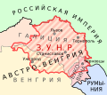
 West ukraine.png 874 × 929; 62 KB
-
 West Ukrainian People's Republic map.svg 540 × 480; 147 KB
ElevadorMunic%C3%ADpio.png)


.svg)

.png)
-pt.svg)
.svg)
.svg)


.svg)
.svg)


.png)
.svg)
.svg)
.svg)
.svg)
.svg)
.svg)
.svg)
.svg)
.svg)
.svg)


.svg)


.svg)


