Category:Andraid
English: Andraid is a townland of 753 acres in the Electoral Division of Drumanaway, in Civil Parish of Drummaul, in the Barony of Toome Upper, in the County of Antrim
human settlement in Northern Ireland | |||||
| Upload media | |||||
| Instance of | |||||
|---|---|---|---|---|---|
| Location |
| ||||
 | |||||
Media in category "Andraid"
The following 6 files are in this category, out of 6 total.
-
 Along caddy road - geograph.org.uk - 3586612.jpg 3,824 × 2,263; 1.62 MB
-
 Andraid Townland - geograph.org.uk - 636977.jpg 640 × 479; 41 KB
-
 Andraid Townland - geograph.org.uk - 636978.jpg 640 × 479; 55 KB
-
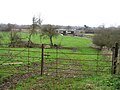
 Andraid Townland - geograph.org.uk - 636979.jpg 640 × 279; 33 KB
-
 Andraid Townland - geograph.org.uk - 636980.jpg 640 × 479; 67 KB
-
 Caddy Road - geograph.org.uk - 3586624.jpg 4,000 × 3,000; 4.9 MB


