Category:Andrichsfurt
municipality in Ried im Innkreis District, Upper Austria, Austria   | |||||
| Upload media | |||||
| Instance of |
| ||||
|---|---|---|---|---|---|
| Location | Ried District, Upper Austria, Austria | ||||
| Population |
| ||||
| Area |
| ||||
| Elevation above sea level |
| ||||
| official website | |||||
 | |||||
Subcategories
This category has the following 4 subcategories, out of 4 total.
Media in category "Andrichsfurt"
The following 8 files are in this category, out of 8 total.
-
 AUT Andrichsfurt COA.jpg 100 × 123; 5 KB
-
 Andrichsfurt - CoA - 01.jpg 1,524 × 1,462; 801 KB
-
 Andrichsfurt - Freiwillige Feuerwehr - 01.jpg 4,107 × 3,014; 3.29 MB
-
 Andrichsfurt - Gemeindehaus - 01.jpg 4,974 × 3,349; 3.04 MB
-
 Andrichsfurt - Gemeindehaus - 02.jpg 4,000 × 3,000; 3.18 MB
-
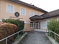
 Andrichsfurt - Pfarrheim - 01.jpg 4,808 × 4,394; 4.44 MB
-
 Andrichsfurt - Volksschule, Kindergarten - 01.jpg 5,184 × 3,456; 4.91 MB
-
 Andrichsfurt im Bezirk RI.png 645 × 645; 28 KB


