Category:Animated maps showing changing boundaries over time
Media in category "Animated maps showing changing boundaries over time"
The following 66 files are in this category, out of 66 total.
-
 Achaemenid Empire.gif 1,359 × 1,035; 405 KB
-
 AnimatieGraniteRomania 1859-2010.gif 1,000 × 861; 3.33 MB
-
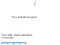
 Australia history.gif 795 × 595; 208 KB
-
 Australia history2.gif 795 × 595; 447 KB
-
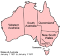 Australia states evolution.gif 500 × 468; 38 KB
-
 Australian states history blank.gif 300 × 279; 42 KB
-
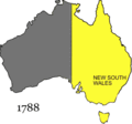 Australian states history.gif 300 × 279; 82 KB
-
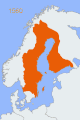
 Border changes in Finland.gif 175 × 247; 179 KB
-
 Brazil states.gif 370 × 330; 28 KB
-
 Byzantine Empire animated-ar.gif 800 × 370; 434 KB
-
 Byzantine Empire animated-zh.gif 800 × 370; 442 KB
-
 Byzantine Empire animated.gif 800 × 370; 490 KB
-
 Byzantine Empire map.gif 800 × 760; 66 KB
-
 Cambios territoriales de Colombia.gif 1,082 × 1,154; 488 KB
-
 Canada provinces evolution - ru.gif 1,000 × 864; 310 KB
-
 Canada provinces evolution 2.gif 1,000 × 864; 243 KB
-
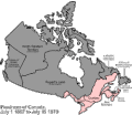 Canada provinces evolution-250.gif 250 × 216; 211 KB
-
 Canada provinces evolution.gif 1,000 × 864; 247 KB
-
 China Dynasties.gif 956 × 676; 1.4 MB
-
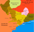 County of Nice animated.gif 1,136 × 1,080; 1.88 MB
-
 Der deutsche staat seit 1867.gif 1,052 × 673; 656 KB
-
 Evolucion territorial Arquidiocesis de Medellin.gif 1,272 × 1,166; 304 KB
-
 Evolucion Territorio Mexicano.gif 626 × 599; 1.28 MB
-
 Evolucion VLN.gif 404 × 340; 923 KB
-
 Evolución territorial de Colombia.gif 889 × 803; 905 KB
-
 Evolución territorial de México (1821-1981).gif 800 × 760; 466 KB
-
Evolution of United States standard time zone boundaries.webm 29 s, 3,507 × 2,480; 4.58 MB
-
 ExpansionOtomana.gif 276 × 176; 19 KB
-
 ExpansionOtomanaMejorado.gif 276 × 176; 5 KB
-
 Frontiere francaise 985 1947 small.gif 466 × 430; 1.19 MB
-
 Frontiere francaise 985 1947.gif 931 × 859; 2.02 MB
-
 Hundred years war.gif 541 × 621; 140 KB
-
 Maps of China 1912-Now.gif 412 × 293; 25 KB
-
 Mexico states evolution.gif 1,000 × 957; 331 KB
-
 Mohammad adil rais-Rashidun Caliphate-different phases.gif 1,400 × 675; 62 KB
-
 Mohammad adil-Rashidun empire-slide.gif 1,196 × 580; 84 KB
-
 Mongol Empire map 2.gif 752 × 591; 165 KB
-
 Mongol Empire map.gif 752 × 591; 162 KB
-
 Naher Osten historisch - Osmanisches Reich 1830-1923.gif 1,104 × 834; 128 KB
-
 Non-Native American Nations Control over South America 1700 and on.gif 800 × 1,100; 262 KB
-

-
 Ottoman small animation.gif 300 × 240; 10 KB
-
 OttomanEmpire1300-1923.svg 512 × 285; 165 KB
-
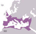
 Parthian Empire.gif 1,359 × 1,035; 309 KB
-
 Penang.gif 461 × 604; 18 KB
-
 Political Evolution of Central America and the Caribbean 1700 and on.gif 850 × 638; 348 KB
-
 Pre-Achaemenid Era.gif 1,359 × 1,035; 168 KB
-
 Quezon province territorial evolution.gif 382 × 678; 631 KB
-
 Rise and Fall of the Ottoman Empire 1300-1923int.gif 656 × 600; 179 KB
-
 RomaniaBorderHistoryAnnimation 1859-2010 es.gif 1,000 × 861; 142 KB
-
 RomaniaBorderHistoryAnnimation 1859-2010 tr.gif 1,000 × 861; 166 KB
-
 RomaniaBorderHistoryAnnimation 1859-2010.gif 1,000 × 861; 162 KB
-
 Sasanian Empire.gif 1,359 × 1,037; 619 KB
-
 Sweden2.gif 398 × 599; 66 KB
-
Territorial evolution of San Jose, California, 1850–2022 in OpenHistoricalMap.webm 17 s, 2,880 × 1,800; 1,015 KB
-
Territorial evolution of San Jose, California, 1950–1969 in OpenHistoricalMap.webm 23 s, 2,880 × 1,800; 1.74 MB
-
 Territorial evolution of the Eastern Roman Empire.gif 1,200 × 675; 1.36 MB
-
 Territorial-changes-of-Poland-1635-2009-improved.gif 550 × 400; 4.11 MB
-
 Territorial-changes-of-Poland-1635-2009-small.gif 380 × 313; 673 KB
-
 Territorial-changes-of-Poland-1635-2009.gif 750 × 618; 5.38 MB
-
 Territories of Dynasties in China.gif 556 × 537; 1.32 MB
-
 The german state since 1867.gif 1,052 × 673; 642 KB
-
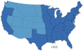 United States 1860-1870.gif 787 × 483; 49 KB
-
 USA Territorial Growth small.gif 431 × 287; 456 KB
-
 USA territorial growth.gif 921 × 573; 2.01 MB
-
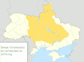 Территориальные изменения Украины.gif 1,400 × 1,035; 1.09 MB


.gif)


