Category:Anlaby with Anlaby Common
English: Anlaby with Anlaby Common is a civil parish in the East Riding of Yorkshire, England. It consists of the villages of Anlaby and Anlaby Common.
civil parish in England   | |||||
| Upload media | |||||
| Instance of | |||||
|---|---|---|---|---|---|
| Location | East Riding of Yorkshire, Yorkshire and the Humber, England | ||||
| official website | |||||
 | |||||
Subcategories
This category has the following 4 subcategories, out of 4 total.
A
- Anlaby Common (49 F)
T
- Tranby (25 F)
Media in category "Anlaby with Anlaby Common"
The following 200 files are in this category, out of 268 total.
(previous page) (next page)-
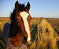 A horse - geograph.org.uk - 708847.jpg 640 × 532; 118 KB
-
 A horse on Anlaby Common - geograph.org.uk - 690271.jpg 640 × 461; 112 KB
-
 A park off Sycamore Close, Anlaby - geograph.org.uk - 3302578.jpg 800 × 600; 91 KB
-
-

-
 A path leading to Nunburnholme, Anlaby - geograph.org.uk - 3303154.jpg 800 × 600; 102 KB
-
 A path leading to Nunburnholme, Anlaby - geograph.org.uk - 3303162.jpg 800 × 600; 148 KB
-
 A path leading to Sycamore Close, Anlaby - geograph.org.uk - 3302577.jpg 800 × 600; 110 KB
-
-
 A vent pipe^ On Beverley Road, Willerby - geograph.org.uk - 3743735.jpg 681 × 1,024; 376 KB
-
 A walk from Hessle Square ^10 - geograph.org.uk - 2006134.jpg 800 × 600; 273 KB
-
 A walk from Hessle Square ^11 - geograph.org.uk - 2006147.jpg 800 × 600; 357 KB
-
 A walk from Hessle Square ^12 - geograph.org.uk - 2006154.jpg 800 × 600; 272 KB
-
 A walk from Hessle Square ^13 - geograph.org.uk - 2006158.jpg 800 × 600; 263 KB
-
 A walk from Hessle Square ^14 - geograph.org.uk - 2006165.jpg 800 × 600; 238 KB
-
 A walk from Hessle Square ^5 - geograph.org.uk - 2006106.jpg 800 × 600; 203 KB
-
 A walk from Hessle Square ^6 - geograph.org.uk - 2006114.jpg 800 × 600; 309 KB
-
 A walk from Hessle Square ^7 - geograph.org.uk - 2006119.jpg 800 × 600; 297 KB
-
 A walk from Hessle Square ^8 - geograph.org.uk - 2006122.jpg 800 × 600; 300 KB
-
 A walk from Hessle Square ^9 - geograph.org.uk - 2006130.jpg 800 × 600; 316 KB
-
 A164 approaching B1231 roundabout - geograph.org.uk - 3797640.jpg 1,600 × 956; 377 KB
-
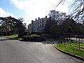 Anlaby House - geograph.org.uk - 6117730.jpg 800 × 600; 141 KB
-
 Anlaby Park Methodist Church - geograph.org.uk - 5197372.jpg 1,600 × 1,150; 527 KB
-
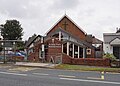
 Anlaby Village Hall - geograph.org.uk - 6117823.jpg 800 × 584; 100 KB
-
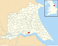 Anlaby with Anlaby Common UK parish locator map.svg 1,425 × 1,107; 1.68 MB
-
 Anlaby-Hessle Bridleway - geograph.org.uk - 488361.jpg 640 × 581; 213 KB
-
 B1232 towards Hessle - geograph.org.uk - 1774437.jpg 640 × 480; 85 KB
-
 Beverley Road B1232 into Anlaby (2) - geograph.org.uk - 5756487.jpg 2,907 × 2,065; 2.02 MB
-
 Beverley Road B1232 into Anlaby - geograph.org.uk - 5756482.jpg 3,072 × 2,302; 3.01 MB
-
 Beverley Road towards Anlaby - geograph.org.uk - 3743726.jpg 1,024 × 681; 222 KB
-
 Beverley Road towards Anlaby - geograph.org.uk - 3743747.jpg 1,024 × 681; 237 KB
-
 Beverley Road, Anlaby - geograph.org.uk - 6116562.jpg 3,730 × 2,862; 2.71 MB
-
 Beverley Road, Anlaby - geograph.org.uk - 6116563.jpg 4,141 × 2,886; 2.5 MB
-

-
 Bridleway to Beverley Road - geograph.org.uk - 2307609.jpg 640 × 427; 70 KB
-
 Bridleway to Kirk Ella - geograph.org.uk - 3253482.jpg 1,024 × 768; 189 KB
-

-
 Businesses on Pryme Street, Anlaby - geograph.org.uk - 4477532.jpg 2,448 × 1,624; 1.64 MB
-
 Cayley Road, Anlaby - geograph.org.uk - 6116041.jpg 800 × 543; 134 KB
-
 Cayley Road, Anlaby - geograph.org.uk - 6116044.jpg 4,745 × 2,926; 2.76 MB
-
 Cayley Road, Anlaby - geograph.org.uk - 6116046.jpg 4,469 × 3,179; 3.15 MB
-
 Church of Jesus Christ of Latter-Day Saints - geograph.org.uk - 5197354.jpg 1,600 × 1,065; 590 KB
-
 Church Street off Wilson Street, Anlaby - geograph.org.uk - 4477850.jpg 2,448 × 1,624; 1.03 MB
-
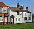
 Church Street, Anlaby, Yorkshire - geograph.org.uk - 6093485.jpg 2,592 × 1,944; 2.31 MB
-
 Church Street, Anlaby, Yorkshire - geograph.org.uk - 6093489.jpg 2,592 × 1,944; 2.29 MB
-
 Church Street, Anlaby, Yorkshire - geograph.org.uk - 6093497.jpg 2,518 × 1,840; 1.9 MB
-
 Church Street, Anlaby, Yorkshire - geograph.org.uk - 6093499.jpg 2,532 × 1,862; 2.7 MB
-
 Church Street, Anlaby, Yorkshire - geograph.org.uk - 6093501.jpg 2,267 × 1,657; 2.4 MB
-
 Church Street, Anlaby, Yorkshire - geograph.org.uk - 6093502.jpg 2,592 × 1,944; 3.09 MB
-
 Church Street, Anlaby, Yorkshire - geograph.org.uk - 6093504.jpg 2,491 × 1,837; 2.65 MB
-
 Church Street, Anlaby, Yorkshire - geograph.org.uk - 6093508.jpg 1,914 × 2,570; 3.25 MB
-
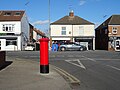
 Close up, Elizabeth II postbox on Lowfield Road, Anlaby - geograph.org.uk - 6117719.jpg 2,117 × 3,469; 1.57 MB
-

-
 Colville Avenue, Anlaby - geograph.org.uk - 3312521.jpg 800 × 600; 107 KB
-
 Colville Avenue, Anlaby - geograph.org.uk - 3312524.jpg 800 × 600; 92 KB
-

-
 Croft View from Tranby Lane - geograph.org.uk - 3745014.jpg 1,024 × 681; 314 KB
-
 Dawson Walk, Anlaby near Hull - geograph.org.uk - 2212332.jpg 800 × 600; 335 KB
-

-
 Ditmas Avenue off Hull Road, Anlaby - geograph.org.uk - 3312443.jpg 800 × 600; 97 KB
-
 Ditmas Avenue off Hull Road, Anlaby - geograph.org.uk - 3312444.jpg 800 × 600; 125 KB
-
 Ditmas Avenue off Hull Road, Anlaby - geograph.org.uk - 3312446.jpg 800 × 600; 99 KB
-
 Elizabeth II postbox on Cayley Road, Anlaby - geograph.org.uk - 6116039.jpg 2,586 × 4,930; 2.63 MB
-
 Elizabeth II postbox on Hull Road, Anlaby - geograph.org.uk - 6116566.jpg 2,616 × 4,386; 2.02 MB
-
 Elizabeth II postbox on Lowfield Road, Anlaby - geograph.org.uk - 6117717.jpg 4,211 × 2,509; 2.71 MB
-
 Elizabeth II postbox on Woodland Drive, Kirk Ella - geograph.org.uk - 6117635.jpg 2,501 × 4,634; 2.7 MB
-
 Entrance gates to the former Sydney Smith school - geograph.org.uk - 4713002.jpg 1,024 × 768; 144 KB
-
 Fields near Hessle Mount - geograph.org.uk - 461479.jpg 640 × 457; 172 KB
-
 Fields near Tranby Croft - geograph.org.uk - 542919.jpg 484 × 640; 209 KB
-
 Fields of Anlaby Butchers Van on Pryme Street - geograph.org.uk - 4477684.jpg 2,448 × 1,624; 1.43 MB
-
 Fields off St Thomas More Road, Anlaby - geograph.org.uk - 3311328.jpg 800 × 600; 108 KB
-
 Fir Trees off Tranby Lane - geograph.org.uk - 3744996.jpg 1,024 × 681; 322 KB
-
 First Lane Anlaby - geograph.org.uk - 4713000.jpg 1,024 × 642; 135 KB
-
 First Lane Anlaby near Hull - geograph.org.uk - 2212329.jpg 800 × 600; 247 KB
-
 Footpath off Hull Road, Anlaby - geograph.org.uk - 6129955.jpg 800 × 600; 156 KB
-
 Former Chapel on Wilson Street, Anlaby - geograph.org.uk - 4477739.jpg 2,448 × 1,624; 1.55 MB
-
 Former Sydney Smith School site, Anlaby - geograph.org.uk - 5059012.jpg 640 × 480; 360 KB
-
 Fraser Way, Anlaby - geograph.org.uk - 5660632.jpg 640 × 480; 42 KB
-
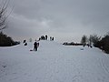 Fun in the snow at Anlaby - geograph.org.uk - 3309141.jpg 800 × 600; 60 KB
-
 Gateway to Anlaby House Estate - geograph.org.uk - 6117726.jpg 4,589 × 2,956; 2.51 MB
-
 George V postbox on Beverley Road, Anlaby - geograph.org.uk - 6116561.jpg 2,526 × 5,011; 3.22 MB
-
 George V postbox on Hull Road, Anlaby Common - geograph.org.uk - 6064284.jpg 2,289 × 4,450; 2.6 MB
-
 Graveyard at St Peter's Church, Anlaby - geograph.org.uk - 4477858.jpg 2,448 × 1,624; 1.7 MB
-
 Grove House, Anlaby - geograph.org.uk - 6129959.jpg 800 × 507; 78 KB
-
 Houses on Beverley Road towards Anlaby - geograph.org.uk - 3743750.jpg 1,024 × 681; 221 KB
-
 Houses on Beverley Road, Anlaby - geograph.org.uk - 6116564.jpg 4,675 × 2,819; 2.68 MB
-
 Houses on Manor Way, Anlaby - geograph.org.uk - 4477466.jpg 2,448 × 1,624; 1.94 MB
-
 Houses on Manor Way, Anlaby - geograph.org.uk - 6129961.jpg 800 × 539; 110 KB
-
 Houses on Manor Way, Anlaby - geograph.org.uk - 6129962.jpg 800 × 626; 109 KB
-
 Houses on Nunburnholme Park, Anlaby - geograph.org.uk - 3303158.jpg 800 × 600; 78 KB
-
 Houses on Tranby Lane (B1231) - geograph.org.uk - 6117500.jpg 800 × 496; 77 KB
-
 Houses on Tranby Lane - geograph.org.uk - 3745017.jpg 1,024 × 681; 309 KB
-
 Houses on Tranby Lane - geograph.org.uk - 6117496.jpg 800 × 525; 88 KB
-
 Houses on Wilson Street, Anlaby - geograph.org.uk - 4477735.jpg 2,448 × 1,624; 2.14 MB
-
 Houses on Woodland Drive, Kirk Ella - geograph.org.uk - 6117637.jpg 4,657 × 2,862; 2.89 MB
-
 Howden Pit (Disused) - geograph.org.uk - 912772.jpg 640 × 387; 69 KB
-
 Howden Pit (Disused) - geograph.org.uk - 920306.jpg 640 × 480; 97 KB
-
 Hull 6 - geograph.org.uk - 2733030.jpg 1,024 × 768; 351 KB
-
 Hull Hebrew Congregation Synagogue - geograph.org.uk - 6266562.jpg 5,456 × 3,632; 5.14 MB
-
 Hull Hebrew Congregation Synagogue - geograph.org.uk - 6266565.jpg 5,456 × 3,632; 5.11 MB
-
 Hull Hebrew Congregation Synagogue - geograph.org.uk - 6266566.jpg 5,456 × 3,632; 4.36 MB
-
 Hull Hebrew Congregation Synagogue - geograph.org.uk - 6266568.jpg 2,025 × 2,347; 1.3 MB
-
 Hull Hebrew Congregation Synagogue - geograph.org.uk - 6266569.jpg 2,100 × 2,454; 1.36 MB
-
 Hull Hebrew Congregation Synagogue - geograph.org.uk - 6266570.jpg 1,842 × 2,154; 1.05 MB
-
 Hull Hebrew Congregation Synagogue - geograph.org.uk - 6266572.jpg 5,456 × 3,632; 4.29 MB
-
 Hull Hebrew Congregation Synagogue - geograph.org.uk - 6266575.jpg 1,907 × 2,273; 1.03 MB
-
 Hull Hebrew Congregation Synagogue - geograph.org.uk - 6266577.jpg 5,456 × 3,632; 4.59 MB
-
 Hull Hebrew Congregation Synagogue - geograph.org.uk - 6266578.jpg 3,632 × 5,456; 3.36 MB
-
 Hull Hebrew Congregation Synagogue - geograph.org.uk - 6266580.jpg 5,456 × 3,632; 3.93 MB
-
 Hull Hebrew Congregation Synagogue - geograph.org.uk - 6266582.jpg 2,123 × 2,637; 1.33 MB
-
 Hull Hebrew Congregation Synagogue - geograph.org.uk - 6266587.jpg 2,197 × 2,680; 1.3 MB
-
 Hull Hebrew Congregation Synagogue - geograph.org.uk - 6266592.jpg 2,935 × 2,980; 2.48 MB
-
 Hull Hebrew Congregation Synagogue - geograph.org.uk - 6266596.jpg 2,935 × 2,669; 2.11 MB
-
 Hull Hebrew Congregation Synagogue - geograph.org.uk - 6266599.jpg 1,768 × 1,983; 973 KB
-
 Hull Hebrew Congregation Synagogue - geograph.org.uk - 6266604.jpg 2,324 × 2,689; 1.28 MB
-
 Hull Hebrew Congregation Synagogue - geograph.org.uk - 6266606.jpg 5,456 × 3,632; 3.91 MB
-
 Hull Hebrew Congregation Synagogue - geograph.org.uk - 6266612.jpg 3,203 × 4,084; 2.82 MB
-
 Hull Hebrew Congregation Synagogue - geograph.org.uk - 6266619.jpg 5,456 × 3,632; 4.17 MB
-
 Hull Hebrew Congregation Synagogue - geograph.org.uk - 6266621.jpg 5,456 × 3,632; 3.89 MB
-
 Hull Hebrew Congregation Synagogue - geograph.org.uk - 6266626.jpg 5,456 × 3,632; 3.85 MB
-
 Hull Hebrew Congregation Synagogue - geograph.org.uk - 6266628.jpg 5,456 × 3,632; 4.39 MB
-
 Hull Road, Anlaby - geograph.org.uk - 5197375.jpg 1,600 × 1,065; 459 KB
-
 Hull Road, Anlaby - geograph.org.uk - 5197402.jpg 1,600 × 1,065; 485 KB
-
 Hull Road, Anlaby - geograph.org.uk - 6116570.jpg 4,301 × 3,015; 2.41 MB
-
 Hull Road, Anlaby - geograph.org.uk - 6129957.jpg 800 × 600; 145 KB
-
 Hull Road, Anlaby, Yorkshire - geograph.org.uk - 6093513.jpg 2,429 × 1,752; 2.27 MB
-
 Jenny Brough Lane - geograph.org.uk - 5808836.jpg 1,024 × 768; 154 KB
-

-
 Jenny Brough Lane, Hessle - geograph.org.uk - 878884.jpg 640 × 459; 155 KB
-
 Jenny Brough Lane, Hessle - geograph.org.uk - 913177.jpg 640 × 480; 77 KB
-

-
 K6 telephone box on Hull Road, Anlaby - geograph.org.uk - 6117818.jpg 800 × 618; 105 KB
-
 K6 telephone box on Spring Gardens, Hull - geograph.org.uk - 6065837.jpg 3,376 × 2,990; 2.24 MB
-
 Lake near Tranby - geograph.org.uk - 708880.jpg 640 × 426; 109 KB
-

-

-
 Looking towards Tranby Croft - geograph.org.uk - 913115.jpg 640 × 480; 107 KB
-
 Lowfield Road, Anlaby - geograph.org.uk - 6117720.jpg 4,626 × 2,850; 3.82 MB
-
 Lowfield Road, Anlaby - geograph.org.uk - 6117722.jpg 4,454 × 3,157; 3.37 MB
-
 Lowfield Road, Anlaby - geograph.org.uk - 6117809.jpg 800 × 600; 146 KB
-
 Manor Way near Nandike Close, Anlaby - geograph.org.uk - 4477493.jpg 2,448 × 1,624; 1.4 MB
-
 Manor Way, Anlaby - geograph.org.uk - 4477475.jpg 2,448 × 1,624; 1.63 MB
-
 Manor Way, Anlaby - geograph.org.uk - 6129960.jpg 800 × 522; 92 KB
-

-
 Maplewood Avenue, Anlaby - geograph.org.uk - 3303124.jpg 800 × 600; 74 KB
-
 Maplewood Avenue, Anlaby - geograph.org.uk - 3303134.jpg 800 × 600; 80 KB
-
 Maplewood Avenue, Anlaby - geograph.org.uk - 3303145.jpg 800 × 600; 82 KB
-
 Nandike Close off Manor Way, Anlaby - geograph.org.uk - 4477498.jpg 2,448 × 1,624; 1.82 MB
-
 Nandike Close off Manor Way, Anlaby - geograph.org.uk - 4477508.jpg 2,448 × 1,624; 1.82 MB
-
 New Flats on Springfield Way - geograph.org.uk - 2195592.jpg 640 × 480; 57 KB
-
 New house, Hull Road, Anlaby Common - geograph.org.uk - 3019813.jpg 640 × 480; 59 KB
-

-
 Nissan Showroom, Anlaby - geograph.org.uk - 5197406.jpg 1,600 × 1,065; 592 KB
-

-
 Normaton Rise, Anlaby - geograph.org.uk - 3309121.jpg 800 × 600; 78 KB
-
 Normaton Rise, Anlaby - geograph.org.uk - 3309124.jpg 800 × 600; 77 KB
-
 Normaton Rise, Anlaby - geograph.org.uk - 3309130.jpg 800 × 600; 72 KB
-
 North Street, Anlaby, Yorkshire - geograph.org.uk - 6093516.jpg 2,592 × 1,944; 2.53 MB
-
 North Street, Anlaby, Yorkshire - geograph.org.uk - 6093517.jpg 2,226 × 1,904; 2.04 MB
-
 Northfield Close off Tranby Lane - geograph.org.uk - 3745009.jpg 1,024 × 681; 272 KB
-
 Nunburnholme Park, Anlaby - geograph.org.uk - 3303121.jpg 800 × 600; 58 KB
-
 Nunburnholme Park, Anlaby - geograph.org.uk - 3303164.jpg 800 × 600; 95 KB
-
 Nursery on Hull Road, Anlaby - geograph.org.uk - 6129951.jpg 800 × 543; 90 KB
-
 Off the rails, Hessle - geograph.org.uk - 878578.jpg 640 × 480; 246 KB
-

-
 One Stop shop on Hull Road - geograph.org.uk - 6065838.jpg 5,184 × 3,888; 5.23 MB
-
 Path from Springfield Way to Manor Way, Anlaby - geograph.org.uk - 4477462.jpg 2,448 × 1,624; 1.77 MB
-
 Path Leading to Hull Road, Anlaby - geograph.org.uk - 4477518.jpg 2,448 × 1,624; 1.74 MB
-
 Ponies on Anlaby Common - geograph.org.uk - 4507666.jpg 640 × 492; 195 KB
-
 Post Office and shops on Hull Road, Anlaby - geograph.org.uk - 6116567.jpg 4,599 × 3,181; 2.51 MB
-
 Post Office on Hull Road, Anlaby - geograph.org.uk - 6116569.jpg 4,007 × 2,913; 1.81 MB
-
 Private roadway - geograph.org.uk - 3289279.jpg 1,024 × 768; 215 KB
-
 Pryme Street off Hull Road, Anlaby - geograph.org.uk - 4477558.jpg 2,448 × 1,624; 2.26 MB
-
 Pryme Street off Hull Road, Anlaby - geograph.org.uk - 4477675.jpg 2,448 × 1,624; 1.43 MB
-
 Pryme Street off Hull Road, Anlaby - geograph.org.uk - 4477701.jpg 2,448 × 1,624; 1.38 MB
-
 Pryme Street, Anlaby, Yorkshire - geograph.org.uk - 6093523.jpg 2,454 × 1,634; 2.95 MB
-
 Public Footpath to Tranby Croft - geograph.org.uk - 913164.jpg 640 × 528; 86 KB
-
 Red Lion Court on Wilson Street, Anlaby - geograph.org.uk - 4477710.jpg 2,448 × 1,624; 1.78 MB
-
 Ripening wheat, Low Field - geograph.org.uk - 488357.jpg 640 × 457; 192 KB
-

-
 Rokerby Avenue, Anlaby - geograph.org.uk - 3311555.jpg 800 × 600; 103 KB
-
 Roundabout on A164 Tranby Lane B1231 on the left - geograph.org.uk - 5297039.jpg 2,304 × 1,728; 1.1 MB
-
 Route 65 - geograph.org.uk - 2307653.jpg 640 × 427; 95 KB
-
 Route 65 - geograph.org.uk - 2307667.jpg 427 × 640; 129 KB
-
 Route 65 - geograph.org.uk - 2307676.jpg 427 × 640; 101 KB
-
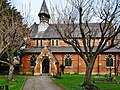
 S Mark's Church, Anlaby Common - geograph.org.uk - 5995674.jpg 1,024 × 768; 199 KB
-
 Sharp bend on Jenny Brough Lane - geograph.org.uk - 5666785.jpg 640 × 594; 69 KB
-
 Shops on Hull Road, Anlaby - geograph.org.uk - 3312428.jpg 800 × 600; 115 KB
-
 Shops on Hull Road, Anlaby - geograph.org.uk - 6117820.jpg 640 × 403; 54 KB
-
 Shops on Hull Road, Anlaby Common - geograph.org.uk - 6064290.jpg 5,184 × 3,888; 5.04 MB
-
 Showhouse on Lowfield Road, Anlaby - geograph.org.uk - 6117802.jpg 800 × 599; 133 KB
-
 Sign for the Red Lion Hotel, Anlaby - geograph.org.uk - 6117822.jpg 1,491 × 2,519; 517 KB
-
 Spire Hull and East Riding Hospital - geograph.org.uk - 6117734.jpg 5,184 × 3,888; 3.73 MB
-
 Spire Lowfield Clinic - geograph.org.uk - 6117737.jpg 4,448 × 2,936; 2.14 MB
-

-
-

-

-
-


_-_geograph.org.uk_-_5756487.jpg)


_-_geograph.org.uk_-_6117499.jpg)


_-_geograph.org.uk_-_6117500.jpg)


_-_geograph.org.uk_-_912772.jpg)
_-_geograph.org.uk_-_920306.jpg)


