Category:Ansty and Staplefield
English: Ansty and Staplefield is a civil parish in the Mid Sussex district of the county of West Sussex, England. The parish, the largest by area in West Sussex, contains the villages of Staplefield and Ansty, the hamlet of Slough Green, the Sandrocks southern part of Haywards Heath, and dispersed buildings, woodland and farms.

civil parish in West Sussex, United Kingdom | |||||
| Upload media | |||||
| Instance of | |||||
|---|---|---|---|---|---|
| Location | Mid Sussex, West Sussex, South East England, England | ||||
| Area |
| ||||
| official website | |||||
 | |||||
Subcategories
This category has the following 6 subcategories, out of 6 total.
Media in category "Ansty and Staplefield"
The following 200 files are in this category, out of 1,564 total.
(previous page) (next page)-
 "St John's" on Deak's Lane - geograph.org.uk - 5183596.jpg 800 × 600; 154 KB
-
 "The Lodge" at Holmsted Manor - geograph.org.uk - 5185053.jpg 800 × 600; 218 KB
-
 2011 London to Brighton Veteran Car Run on B2114 - geograph.org.uk - 2683724.jpg 1,024 × 683; 384 KB
-
 60-61, Borde Hill Lane - geograph.org.uk - 4352415.jpg 640 × 480; 78 KB
-

-
-
 A fine Oak tree in Seven Acre Hanger - geograph.org.uk - 1367869.jpg 640 × 480; 137 KB
-
 A Footpath through Jack Reeding's Wood - geograph.org.uk - 3915541.jpg 3,072 × 2,048; 2.35 MB
-
 A heron at Brewhouse Pond - geograph.org.uk - 3670591.jpg 2,048 × 1,360; 1.84 MB
-
 A House Name in Stairbridge Lane - geograph.org.uk - 3870277.jpg 3,072 × 2,048; 4.57 MB
-
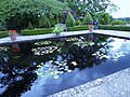
 A lake in the Nymans Estate - geograph.org.uk - 1830451.jpg 640 × 480; 147 KB
-
 A muddy field corner - geograph.org.uk - 5603384.jpg 640 × 480; 175 KB
-
 A sign in the trees - geograph.org.uk - 1893196.jpg 640 × 428; 193 KB
-
 A23 (T) - geograph.org.uk - 4183816.jpg 480 × 640; 66 KB
-
 A23 heading north - geograph.org.uk - 2866309.jpg 640 × 480; 64 KB
-
-
 A23 north to Crawley and the M23 - geograph.org.uk - 2380513.jpg 4,000 × 3,000; 3.36 MB
-
 A23 northbound - geograph.org.uk - 6166648.jpg 1,024 × 684; 350 KB
-
 A23 northbound - geograph.org.uk - 6166663.jpg 1,024 × 684; 238 KB
-
 A23 northbound, Markwell's - geograph.org.uk - 2866306.jpg 640 × 480; 50 KB
-

-
 A23(T) - geograph.org.uk - 4183805.jpg 640 × 480; 59 KB
-
 A23, northbound - geograph.org.uk - 4746991.jpg 640 × 426; 53 KB
-
 A23, northbound - geograph.org.uk - 4746996.jpg 640 × 336; 38 KB
-
 A23, northbound - geograph.org.uk - 4747251.jpg 640 × 392; 40 KB
-
 A23, Pitts Head - geograph.org.uk - 3649856.jpg 640 × 384; 57 KB
-
 A272 - geograph.org.uk - 5226314.jpg 640 × 393; 87 KB
-
 A272 - geograph.org.uk - 5226350.jpg 640 × 330; 50 KB
-
 A272 - geograph.org.uk - 5226360.jpg 640 × 393; 35 KB
-

-
 A272, Ansty - geograph.org.uk - 5226316.jpg 640 × 426; 67 KB
-
 A272, Haywards Heath - geograph.org.uk - 5226356.jpg 640 × 426; 36 KB
-
 A273 - geograph.org.uk - 5226346.jpg 640 × 348; 47 KB
-
 A273 Isaac's Lane south from Haywards Heath - geograph.org.uk - 2413782.jpg 4,000 × 3,000; 4.35 MB
-
 A273 south to Burgess Hill - geograph.org.uk - 2413251.jpg 4,000 × 3,000; 3.61 MB
-
 Abbots Farm Cottage, Brook Street - geograph.org.uk - 4290766.jpg 640 × 480; 88 KB
-

-
 Acre Plot Wood-Wood Field-Two Acres - geograph.org.uk - 4285044.jpg 640 × 480; 109 KB
-
 Allen's Farm - geograph.org.uk - 1133424.jpg 640 × 480; 91 KB
-

-
 An Ancient Highway - geograph.org.uk - 3915523.jpg 3,072 × 2,048; 2.22 MB
-

-

-

-

-
-

-

-

-

-
-

-

-

-
-

-
-

-

-

-

-

-

-

-

-

-

-

-

-
-
-

-

-

-

-

-
-

-

-

-

-

-

-

-

-

-

-

-

-

-

-

-

-

-

-
-

-

-

-

-

-

-

-

-

-

-
-
-

-

-

-

-

-

-

-

-

-

-

-

-

-

-

-
-

-
-

-
-

-

-

-

-

-

-

-

-

-

-
 Angling Pond near Pondtail Cottage - geograph.org.uk - 4263024.jpg 480 × 640; 73 KB
-
 Aniska Lodge - geograph.org.uk - 4183799.jpg 640 × 466; 45 KB
-
 Another wrong satnav warning - geograph.org.uk - 5142994.jpg 800 × 600; 157 KB
-
 Ansty Cross Inn (Demolished) - geograph.org.uk - 4297403.jpg 640 × 480; 52 KB
-

-
 Ansty Cross Public House - geograph.org.uk - 1975068.jpg 1,600 × 1,200; 358 KB
-
 Ansty Pressure Reducing Station - geograph.org.uk - 4201794.jpg 640 × 480; 118 KB
-
 Ansty Pressure Reducing Station - geograph.org.uk - 5185878.jpg 800 × 600; 206 KB
-
 Ansty Recreation Ground - geograph.org.uk - 4196999.jpg 640 × 480; 65 KB
-
 Ansty Recreation Ground - geograph.org.uk - 4295484.jpg 640 × 480; 63 KB
-

-
 Ansty Village Hall - geograph.org.uk - 4197005.jpg 640 × 488; 68 KB
-
 Ansty Village Hall - geograph.org.uk - 5985861.jpg 1,024 × 768; 256 KB
-
 Ansty Village Sign - geograph.org.uk - 4210458.jpg 430 × 640; 51 KB
-
 Anstye Place - geograph.org.uk - 4201738.jpg 640 × 480; 99 KB
-

-
 Approaching Cherry Lane - geograph.org.uk - 5722120.jpg 1,024 × 643; 197 KB
-
 Approaching Cleaver’s Lane - geograph.org.uk - 5721167.jpg 1,024 × 693; 280 KB
-
 Approaching Deak’s Lane - geograph.org.uk - 5985847.jpg 1,024 × 768; 317 KB
-
 Approaching Mizbrook’s Farm - geograph.org.uk - 5721412.jpg 1,024 × 641; 205 KB
-
 Approaching Pickwell Lane - geograph.org.uk - 5985374.jpg 1,600 × 1,200; 829 KB
-
 Approaching the A272 - geograph.org.uk - 5985473.jpg 1,024 × 768; 351 KB
-
 Approaching Walks Wood - geograph.org.uk - 5969279.jpg 1,600 × 1,200; 991 KB
-
 Arable land near Sidnye Cottages - geograph.org.uk - 2502645.jpg 4,000 × 3,000; 3.41 MB
-
 Arboretum Walk, Nymans Gardens - geograph.org.uk - 3660729.jpg 1,600 × 1,200; 1.17 MB
-
 Arches at Vale Bridge viaduct - geograph.org.uk - 2413209.jpg 4,000 × 3,000; 3.34 MB
-
 Around Slough Green from the air - geograph.org.uk - 5149916.jpg 2,045 × 1,357; 787 KB
-
 Autumn colours on Deak's Lane - geograph.org.uk - 5184692.jpg 800 × 600; 187 KB
-
 Autumn oaks - geograph.org.uk - 5602293.jpg 640 × 428; 123 KB
-
 Azalea in Borde Hill Gardens - geograph.org.uk - 3481618.jpg 1,600 × 1,200; 777 KB
-
 Azaleas in Borde Hill gardens - geograph.org.uk - 3481601.jpg 1,600 × 1,200; 820 KB
-
 Azaleas in Borde Hill gardens - geograph.org.uk - 3481635.jpg 1,600 × 1,200; 540 KB
-
 B2114 Cuckfield Road - geograph.org.uk - 5922216.jpg 1,024 × 1,024; 350 KB
-
 B2115 Staplefield Road east to Whitemans Green - geograph.org.uk - 2500915.jpg 4,000 × 3,000; 3.23 MB
-
 B2115 turning, A23 - geograph.org.uk - 5629600.jpg 640 × 426; 67 KB
-
 Balcombe Field - geograph.org.uk - 4439780.jpg 640 × 480; 52 KB
-
 Balcombe Lag - geograph.org.uk - 4439789.jpg 640 × 480; 60 KB
-
 Balcombe Mead (1) - geograph.org.uk - 4276672.jpg 640 × 480; 88 KB
-
 Balcombe Mead (2) - geograph.org.uk - 4276675.jpg 640 × 480; 82 KB
-
 Bankey Field - geograph.org.uk - 4297241.jpg 640 × 480; 76 KB
-
 Banky Field - geograph.org.uk - 4424833.jpg 640 × 480; 99 KB
-

-

-
 Barn at Allen's Farm - geograph.org.uk - 1469581.jpg 640 × 480; 92 KB
-
 Barn Field (1) - geograph.org.uk - 4195611.jpg 640 × 480; 83 KB
-
 Barn Field (1) - geograph.org.uk - 4197095.jpg 640 × 480; 77 KB
-
 Barn Field (2) - geograph.org.uk - 4229385.jpg 640 × 480; 79 KB
-
 Barn Field (2) - geograph.org.uk - 4295551.jpg 640 × 480; 70 KB
-
 Barn Field - geograph.org.uk - 4194255.jpg 640 × 480; 82 KB
-
 Barn Field - geograph.org.uk - 4195585.jpg 640 × 480; 84 KB
-
 Barn Field - geograph.org.uk - 4195727.jpg 640 × 480; 105 KB
-
 Barn Field - geograph.org.uk - 4295608.jpg 640 × 480; 83 KB
-
 Barn Field - geograph.org.uk - 4297254.jpg 640 × 480; 78 KB
-
 Barn Field - geograph.org.uk - 4423530.jpg 640 × 480; 56 KB
-
 Barn Field - geograph.org.uk - 4423568.jpg 640 × 480; 70 KB
-
 Barn Field-Park Field - geograph.org.uk - 4277698.jpg 640 × 480; 78 KB
-
 Barn Field-Pit Field - geograph.org.uk - 4209424.jpg 640 × 480; 76 KB
-
 Barn Mead - geograph.org.uk - 4195619.jpg 640 × 480; 78 KB
-
 Barn Mead - geograph.org.uk - 4227488.jpg 640 × 480; 105 KB
-
 Barn Mead - geograph.org.uk - 4295630.jpg 640 × 480; 109 KB
-

-
 Barn, Collin's Farm - geograph.org.uk - 4277655.jpg 640 × 480; 97 KB


_-_geograph.org.uk_-_4183816.jpg)


_-_geograph.org.uk_-_4183805.jpg)


_-_geograph.org.uk_-_5509564.jpg)
_-_geograph.org.uk_-_5510180.jpg)
_-_geograph.org.uk_-_5510182.jpg)
_-_geograph.org.uk_-_5510186.jpg)
_-_geograph.org.uk_-_5510188.jpg)
_-_geograph.org.uk_-_5510192.jpg)
_-_geograph.org.uk_-_5510196.jpg)
_-_geograph.org.uk_-_5510201.jpg)
_-_geograph.org.uk_-_5510202.jpg)
_-_geograph.org.uk_-_5510212.jpg)
_-_geograph.org.uk_-_5510213.jpg)
_-_geograph.org.uk_-_5509565.jpg)
_-_geograph.org.uk_-_5510214.jpg)
_-_geograph.org.uk_-_5510215.jpg)
_-_geograph.org.uk_-_5510217.jpg)
_-_geograph.org.uk_-_5510218.jpg)
_-_geograph.org.uk_-_5510219.jpg)
_-_geograph.org.uk_-_5510220.jpg)
_-_geograph.org.uk_-_5510222.jpg)
_-_geograph.org.uk_-_5510223.jpg)
_-_geograph.org.uk_-_5510225.jpg)
_-_geograph.org.uk_-_5510226.jpg)
_-_geograph.org.uk_-_5509568.jpg)
_-_geograph.org.uk_-_5510227.jpg)
_-_geograph.org.uk_-_5510230.jpg)
_-_geograph.org.uk_-_5510232.jpg)
_-_geograph.org.uk_-_5510233.jpg)
_-_geograph.org.uk_-_5510235.jpg)
_-_geograph.org.uk_-_5510237.jpg)
_-_geograph.org.uk_-_5510239.jpg)
_-_geograph.org.uk_-_5510240.jpg)
_-_geograph.org.uk_-_5510241.jpg)
_-_geograph.org.uk_-_5510243.jpg)
_-_geograph.org.uk_-_5509569.jpg)
_-_geograph.org.uk_-_5510245.jpg)
_-_geograph.org.uk_-_5510247.jpg)
_-_geograph.org.uk_-_5510250.jpg)
_-_geograph.org.uk_-_5510252.jpg)
_-_geograph.org.uk_-_5510255.jpg)
_-_geograph.org.uk_-_5510256.jpg)
_-_geograph.org.uk_-_5510257.jpg)
_-_geograph.org.uk_-_5510258.jpg)
_-_geograph.org.uk_-_5510263.jpg)
_-_geograph.org.uk_-_5510264.jpg)
_-_geograph.org.uk_-_5510166.jpg)
_-_geograph.org.uk_-_5510265.jpg)
_-_geograph.org.uk_-_5510266.jpg)
_-_geograph.org.uk_-_5510267.jpg)
_-_geograph.org.uk_-_5510268.jpg)
_-_geograph.org.uk_-_5510272.jpg)
_-_geograph.org.uk_-_5510273.jpg)
_-_geograph.org.uk_-_5510274.jpg)
_-_geograph.org.uk_-_5510276.jpg)
_-_geograph.org.uk_-_5510278.jpg)
_-_geograph.org.uk_-_5510281.jpg)
_-_geograph.org.uk_-_5510168.jpg)
_-_geograph.org.uk_-_5510282.jpg)
_-_geograph.org.uk_-_5510284.jpg)
_-_geograph.org.uk_-_5510285.jpg)
_-_geograph.org.uk_-_5510286.jpg)
_-_geograph.org.uk_-_5510287.jpg)
_-_geograph.org.uk_-_5510289.jpg)
_-_geograph.org.uk_-_5510290.jpg)
_-_geograph.org.uk_-_5510291.jpg)
_-_geograph.org.uk_-_5510296.jpg)
_-_geograph.org.uk_-_5510293.jpg)
_-_geograph.org.uk_-_5510171.jpg)
_-_geograph.org.uk_-_5510298.jpg)
_-_geograph.org.uk_-_5510300.jpg)
_-_geograph.org.uk_-_5510302.jpg)
_-_geograph.org.uk_-_5510305.jpg)
_-_geograph.org.uk_-_5510306.jpg)
_-_geograph.org.uk_-_5510308.jpg)
_-_geograph.org.uk_-_5510369.jpg)
_-_geograph.org.uk_-_5510371.jpg)
_-_geograph.org.uk_-_5510374.jpg)
_-_geograph.org.uk_-_5510377.jpg)
_-_geograph.org.uk_-_5510179.jpg)
_-_geograph.org.uk_-_5510379.jpg)
_-_geograph.org.uk_-_5510380.jpg)
_-_geograph.org.uk_-_5510381.jpg)
_-_geograph.org.uk_-_5510382.jpg)
_-_geograph.org.uk_-_5510384.jpg)
_-_geograph.org.uk_-_5510385.jpg)
_-_geograph.org.uk_-_5510387.jpg)
_-_geograph.org.uk_-_5510389.jpg)
_-_geograph.org.uk_-_5510390.jpg)
_-_geograph.org.uk_-_5510392.jpg)
_-_geograph.org.uk_-_5510175.jpg)
_-_geograph.org.uk_-_5510393.jpg)
_-_geograph.org.uk_-_5510395.jpg)
_-_geograph.org.uk_-_5510396.jpg)
_-_geograph.org.uk_-_5510397.jpg)
_-_geograph.org.uk_-_5510399.jpg)
_-_geograph.org.uk_-_5510401.jpg)
_-_geograph.org.uk_-_5510400.jpg)


_-_geograph.org.uk_-_4297403.jpg)


_-_geograph.org.uk_-_4276672.jpg)
_-_geograph.org.uk_-_4276675.jpg)


_-_geograph.org.uk_-_4195611.jpg)
_-_geograph.org.uk_-_4197095.jpg)
_-_geograph.org.uk_-_4229385.jpg)
_-_geograph.org.uk_-_4295551.jpg)


