Category:Apperley Bridge
village in West Yorkshire, England, UK | |||||
| Upload media | |||||
| Instance of | |||||
|---|---|---|---|---|---|
| Location | Bradford, West Yorkshire, Yorkshire and the Humber, England | ||||
 | |||||
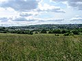
English: Apperley Bridge is a village within the metropolitan borough of the City of Bradford, in West Yorkshire, England. It is on the Leeds and Liverpool Canal north-east of the city, near the boundary with the City of Leeds. Apperley Bridge railway station closed in 1965 and reopened in 2015.
Subcategories
This category has the following 9 subcategories, out of 9 total.
Media in category "Apperley Bridge"
The following 64 files are in this category, out of 64 total.
-
 1-4 Waterloo Crescent, Apperley.jpg 1,280 × 853; 649 KB
-
 5 Laburnum Place, Apperley Bridge.jpg 1,704 × 2,272; 943 KB
-
 Agricultural diversification ? (2296033279).jpg 2,560 × 1,920; 4.64 MB
-
 Airedale Line.jpg 3,456 × 1,839; 5.89 MB
-
 Apperley Bridge Carwash - geograph.org.uk - 4606393.jpg 1,024 × 768; 104 KB
-
 Apperley Bridge Hand Car Wash on Harrogate Road - geograph.org.uk - 3986798.jpg 1,600 × 1,064; 564 KB
-
 Apperley Bridge to Esholt (33801692883).jpg 6,000 × 4,000; 10.71 MB
-
 Apperley Bridge to Esholt (34481098141).jpg 6,000 × 4,000; 11.01 MB
-
 Apperley Bridge to Esholt (34611599835).jpg 6,000 × 4,000; 9.91 MB
-
 Apperley Bridge, 'The Hollies', Woodlands Drive - geograph.org.uk - 3180175.jpg 3,456 × 2,304; 6.46 MB
-
 Apperley Bridge, Little Park - geograph.org.uk - 3180141.jpg 3,456 × 2,304; 4 MB
-
 Apperley Cottage.jpg 685 × 1,024; 195 KB
-
 Backs of houses on Parkin Lane, Apperley Bridge - geograph.org.uk - 4462814.jpg 2,272 × 1,704; 999 KB
-
 Beck - Tenterfields - geograph.org.uk - 2448381.jpg 480 × 640; 91 KB
-
 Bottom Farm Barn-2-1200.jpg 1,200 × 900; 230 KB
-
 Bridleway heading North from Apperley Bridge - geograph.org.uk - 3855933.jpg 4,320 × 3,240; 5.14 MB
-
 Bridleway leading to Apperley Bridge - geograph.org.uk - 3855929.jpg 4,320 × 3,240; 5.82 MB
-
 Brookhouse Gardens, Apperley Bridge - geograph.org.uk - 4606373.jpg 800 × 600; 126 KB
-

-
 Crane out - geograph.org.uk - 3363190.jpg 1,600 × 1,200; 365 KB
-

-
 Entrance to the Crag Road United football ground - geograph.org.uk - 3704963.jpg 2,000 × 1,438; 1.13 MB
-
 Field with pylon - geograph.org.uk - 5429643.jpg 1,024 × 576; 493 KB
-

-
 Fields south of Apperley Bridge - geograph.org.uk - 3529715.jpg 640 × 480; 91 KB
-
 Flooded Fields at Apperley Bridge - geograph.org.uk - 5621909.jpg 1,600 × 1,200; 443 KB
-
 Footpath - Apperley Road - geograph.org.uk - 2448261.jpg 480 × 640; 91 KB
-

-
 Garden gate - geograph.org.uk - 794472.jpg 482 × 640; 180 KB
-
 Grazing in the sunshine - geograph.org.uk - 794491.jpg 640 × 480; 206 KB
-
 Houses on Waterloo Crescent - geograph.org.uk - 3986788.jpg 1,600 × 1,064; 632 KB
-
 Housing on site of former warehouse - geograph.org.uk - 4606382.jpg 1,024 × 768; 113 KB
-
 JCT 600 Offices - Apperley Lane - geograph.org.uk - 687593.jpg 640 × 458; 59 KB
-
 Old lamp post, Laburnum Place, Apperley Bridge - geograph.org.uk - 4462805.jpg 1,384 × 2,272; 683 KB
-
 Ordnance Survey Cut Mark - geograph.org.uk - 5393674.jpg 4,000 × 3,000; 5.08 MB
-
-
 Playing Fields, Apperley Bridge - geograph.org.uk - 3106166.jpg 1,024 × 682; 155 KB
-

-
 Railway underpass, Walk Hill - geograph.org.uk - 5050938.jpg 1,024 × 768; 267 KB
-

-
 Rivet benchmark at Mitchell Bridge - geograph.org.uk - 2992475.jpg 2,048 × 1,536; 510 KB
-
 Roundhead Fold - Cavalier Drive - geograph.org.uk - 2449200.jpg 640 × 480; 58 KB
-

-
 Sports ground, Apperley Bridge - geograph.org.uk - 129040.jpg 640 × 480; 63 KB
-
 Stone (2296756366).jpg 1,920 × 2,560; 1.74 MB
-
 Stone on the old Apperley Bridge - geograph.org.uk - 3704972.jpg 1,500 × 2,000; 1.4 MB
-
 Strafford Way - Tenterfields - geograph.org.uk - 2448375.jpg 640 × 480; 63 KB
-
 The Queens, Apperley Lane, Rawdon (geograph 2359128).jpg 640 × 480; 115 KB
-
 Toby's Tea Room, Bottom Farm, from canal towpath - geograph.org.uk - 4694188.jpg 1,882 × 1,464; 641 KB
-
 Track - Harrogate Road - geograph.org.uk - 2447892.jpg 480 × 640; 98 KB
-
 Trough (2295957713).jpg 2,560 × 1,920; 1.56 MB
-
 View from end of Little Park - geograph.org.uk - 3529142.jpg 640 × 480; 129 KB
-
 Waterfront Mews - Tenterfields - geograph.org.uk - 2449188.jpg 640 × 480; 70 KB
-
 Waterloo Crescent - Parkin Lane - geograph.org.uk - 2447966.jpg 640 × 480; 83 KB
-
 Waterloo Crescent, Apperley Bridge - geograph.org.uk - 4462831.jpg 2,265 × 1,381; 824 KB
-
 Woodhill Rise - Cavalier Drive - geograph.org.uk - 2449204.jpg 640 × 480; 66 KB
-
 Woodland bridleway - geograph.org.uk - 2937481.jpg 640 × 413; 155 KB
-
 A pair of semis - geograph.org.uk - 441964.jpg 640 × 433; 125 KB
-
 A658, Apperley Bridge - geograph.org.uk - 752974.jpg 640 × 480; 57 KB
-
 Apperley Gardens - geograph.org.uk - 687640.jpg 640 × 430; 54 KB
-
-
 Farm entrance, Apperley Bridge - geograph.org.uk - 129049.jpg 450 × 600; 69 KB
-

-


.jpg)


.jpg)
.jpg)
.jpg)


,_built_ca_1865.jpg)


.jpg)


.jpg)


.jpg)


