Category:Appledram
English: Appledram or Apuldram is a small parish on the north eastern upper reach of Chichester Harbour about two miles (3 km) south-west of the centre of Chichester in West Sussex, England.
civil parish in Chichester, West Sussex, England | |||||
| Upload media | |||||
| Instance of | |||||
|---|---|---|---|---|---|
| Location | Chichester, West Sussex, South East England, England | ||||
| Population |
| ||||
 | |||||
Subcategories
This category has the following 3 subcategories, out of 3 total.
Media in category "Appledram"
The following 200 files are in this category, out of 299 total.
(previous page) (next page)-
 A brown bear in Sussex - geograph.org.uk - 3973635.jpg 1,536 × 1,152; 1.31 MB
-
 A rude shock - geograph.org.uk - 789175.jpg 640 × 480; 82 KB
-
 A sunken path from the coast at Apuldram - geograph.org.uk - 3973577.jpg 1,152 × 1,536; 1.62 MB
-
 A286, looking north - geograph.org.uk - 4680118.jpg 640 × 426; 59 KB
-
 A286, south of Cutfield Bridge - geograph.org.uk - 4680120.jpg 640 × 426; 80 KB
-
 Appledram Lane (South) - geograph.org.uk - 6444513.jpg 1,600 × 1,068; 507 KB
-
 Appledram Lane (south) north to Chichester - geograph.org.uk - 3312586.jpg 4,000 × 3,000; 3.6 MB
-
 Appledram Manor - geograph.org.uk - 5503226.jpg 1,024 × 768; 277 KB
-
 Appledram, canal - geograph.org.uk - 4090216.jpg 1,024 × 768; 234 KB
-
 Appledram, Cutfield Bridge - geograph.org.uk - 4090232.jpg 1,024 × 768; 208 KB
-
 Appledram, dried-up ditch - geograph.org.uk - 4089957.jpg 1,024 × 768; 205 KB
-
 Appledram, farm buildings - geograph.org.uk - 4090010.jpg 1,024 × 768; 137 KB
-
 Appledram, field margin - geograph.org.uk - 4089987.jpg 1,024 × 768; 181 KB
-
 Appledram, Lane End Cottage - geograph.org.uk - 4090019.jpg 1,024 × 768; 156 KB
-
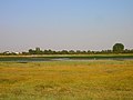
 Appledram, maize field - geograph.org.uk - 4089971.jpg 1,024 × 768; 242 KB
-
 Appledram, oat field - geograph.org.uk - 4089940.jpg 1,024 × 768; 174 KB
-
 Appledram, oat field - geograph.org.uk - 4089948.jpg 1,024 × 768; 199 KB
-
 Appledram, path - geograph.org.uk - 4089999.jpg 1,024 × 768; 200 KB
-
 Appledram, stubble field - geograph.org.uk - 4090026.jpg 1,024 × 768; 156 KB
-
 Appledram, tracks - geograph.org.uk - 4089964.jpg 1,024 × 768; 206 KB
-
 Approaching Dell Quay Road - geograph.org.uk - 6444315.jpg 1,600 × 1,099; 487 KB
-
 Apuldram Manor - geograph.org.uk - 2765695.jpg 1,024 × 680; 237 KB
-
 Apuldram Manor Farm Marsh - geograph.org.uk - 4405354.jpg 800 × 530; 388 KB
-
 Apuldram Manor Farm Marsh - geograph.org.uk - 4405355.jpg 800 × 530; 533 KB
-
 Apuldram MMB 01 Dell Quay.jpg 4,155 × 2,427; 4.71 MB
-
 Avenue of Black Poplars - geograph.org.uk - 3657471.jpg 1,000 × 1,333; 1.38 MB
-
 Barn at New Barn - geograph.org.uk - 6381703.jpg 3,339 × 2,227; 7.72 MB
-
 Bend in the path - geograph.org.uk - 5503220.jpg 1,024 × 768; 209 KB
-
 Boat at Dell Quay - geograph.org.uk - 4284896.jpg 2,671 × 4,000; 8 MB
-
 Boat lift - geograph.org.uk - 4405349.jpg 530 × 800; 308 KB
-
 Boat Yard at Apuldram - geograph.org.uk - 3312626.jpg 4,000 × 3,000; 3.53 MB
-
 Boat yard at Dell Quay - geograph.org.uk - 1021736.jpg 640 × 480; 184 KB
-
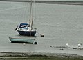 Boats and birds, Dell Quay - geograph.org.uk - 3206759.jpg 1,373 × 1,000; 1.01 MB
-
 Boats at Dell Quay - geograph.org.uk - 4284772.jpg 4,000 × 2,671; 6.56 MB
-
 Boats at Dell Quay - geograph.org.uk - 4284807.jpg 4,000 × 2,671; 7.29 MB
-
 Boats at Dell Quay - geograph.org.uk - 4284832.jpg 4,240 × 2,832; 5.34 MB
-
 Boats at Dell Quay - geograph.org.uk - 4284838.jpg 4,240 × 2,832; 3.97 MB
-
 Boats at Dell Quay - geograph.org.uk - 4284856.jpg 3,890 × 2,597; 6.59 MB
-
 Boats galore in Chichester Marina - geograph.org.uk - 3659724.jpg 1,394 × 1,000; 1.23 MB
-
 Boats off Dell Quay - geograph.org.uk - 3119555.jpg 640 × 480; 101 KB
-
 Boats on the mud, Fishbourne Channel - geograph.org.uk - 3119538.jpg 640 × 480; 89 KB
-
 Bottoms up at Dell Quay - geograph.org.uk - 3312641.jpg 4,000 × 3,000; 3.31 MB
-
 Bows on the quay, Dell Quay - geograph.org.uk - 1745412.jpg 480 × 640; 110 KB
-
 Brent Geese near Dell Quay - geograph.org.uk - 1743757.jpg 640 × 480; 120 KB
-
 Building by entrance to Chichester Marina - geograph.org.uk - 790880.jpg 640 × 480; 119 KB
-
 Business units on the A286 near Apuldram - geograph.org.uk - 3311718.jpg 4,000 × 3,000; 3.25 MB
-
 Chichester Canal - geograph.org.uk - 4670918.jpg 640 × 426; 121 KB
-
 Chichester Canal - geograph.org.uk - 4670919.jpg 640 × 426; 101 KB
-
 Chichester Canal - geograph.org.uk - 4680109.jpg 640 × 426; 132 KB
-
 Chichester Canal - geograph.org.uk - 4680122.jpg 640 × 426; 86 KB
-
 Chichester Canal - geograph.org.uk - 4680134.jpg 640 × 426; 100 KB
-
 Chichester Canal - geograph.org.uk - 4680139.jpg 640 × 426; 84 KB
-
 Chichester Canal - geograph.org.uk - 4680145.jpg 640 × 426; 95 KB
-
 Chichester Canal - geograph.org.uk - 6384145.jpg 3,180 × 2,121; 7.62 MB
-
 Chichester Canal ^ New Lipchis Way - geograph.org.uk - 4680131.jpg 640 × 426; 80 KB
-
 Chichester Canal ^ New Lipchis Way - geograph.org.uk - 4680136.jpg 640 × 426; 96 KB
-
 Chichester Channel - geograph.org.uk - 6382251.jpg 3,339 × 2,227; 7.51 MB
-
 Chichester Channel - geograph.org.uk - 6382256.jpg 3,896 × 2,598; 7.57 MB
-
 Chichester Marina - geograph.org.uk - 3119638.jpg 640 × 480; 96 KB
-
 Chichester Marina - geograph.org.uk - 3586621.jpg 2,065 × 1,000; 1.41 MB
-
 Chichester Marina - geograph.org.uk - 3625755.jpg 640 × 427; 67 KB
-
 Chichester Marina - geograph.org.uk - 4405301.jpg 800 × 548; 342 KB
-
 Chichester Marina - geograph.org.uk - 4405306.jpg 800 × 530; 405 KB
-
 Chichester Marina - geograph.org.uk - 4405314.jpg 800 × 530; 454 KB
-
 Chichester Marina - geograph.org.uk - 4405324.jpg 800 × 530; 426 KB
-
 Chichester Marina - geograph.org.uk - 4405336.jpg 530 × 800; 371 KB
-
 Chichester Marina - geograph.org.uk - 4405338.jpg 800 × 530; 347 KB
-
 Chichester Marina - geograph.org.uk - 6382746.jpg 3,737 × 2,492; 7.79 MB
-
 Chichester Marina - geograph.org.uk - 6382754.jpg 4,055 × 2,705; 7.7 MB
-
 Chichester Marina - geograph.org.uk - 6382762.jpg 3,896 × 2,598; 7.65 MB
-
 Chichester Marina - geograph.org.uk - 6382766.jpg 4,055 × 2,705; 7.8 MB
-
 Chichester Marina Channel - geograph.org.uk - 3659729.jpg 1,353 × 1,000; 1.08 MB
-
 Chichester Marina lock - geograph.org.uk - 3659734.jpg 1,000 × 1,333; 1.06 MB
-
 Chichester Marina Lock - geograph.org.uk - 6382750.jpg 4,373 × 2,917; 7.76 MB
-
 Chichester Marina Lock in use - geograph.org.uk - 4580244.jpg 1,115 × 1,000; 862 KB
-
 Chichester Ship Canal at Cutfield Bridge - geograph.org.uk - 3973673.jpg 1,536 × 1,152; 1.28 MB
-
 Chichester Ship Canal east of the A286 - geograph.org.uk - 4726795.jpg 1,333 × 1,000; 1.3 MB
-
 Church of St. Mary, Appledram - geograph.org.uk - 5503164.jpg 1,024 × 768; 262 KB
-
 Corner of marina near Salterns Copse - geograph.org.uk - 2767263.jpg 1,024 × 768; 326 KB
-
 Cross roads on Dell Quay Road - geograph.org.uk - 3312654.jpg 4,000 × 3,000; 3.41 MB
-
 Crouchers restaurant - geograph.org.uk - 3973667.jpg 1,536 × 1,152; 989 KB
-
 Crown ^ Anchor, Dell Quay from coastal path - geograph.org.uk - 4580257.jpg 1,333 × 1,000; 1 MB
-
 Curiosity on road to Chichester Marina - geograph.org.uk - 790889.jpg 640 × 480; 148 KB
-
 Cutfield Bridge - geograph.org.uk - 4680116.jpg 640 × 426; 130 KB
-
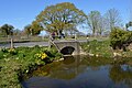 Cutfield Bridge - geograph.org.uk - 4680127.jpg 640 × 426; 97 KB
-
 Cutfield Bridge - geograph.org.uk - 4726799.jpg 1,333 × 1,000; 1.43 MB
-
 Cutfield Bridge - geograph.org.uk - 6384149.jpg 3,657 × 2,439; 7.57 MB
-
 Cutfield Bridge - geograph.org.uk - 6444015.jpg 1,600 × 1,064; 702 KB
-
 Dell Quay - geograph.org.uk - 3973614.jpg 1,536 × 1,152; 1,001 KB
-
 Dell Quay - geograph.org.uk - 4090095.jpg 1,024 × 768; 141 KB
-
 Dell Quay - geograph.org.uk - 4284753.jpg 4,000 × 2,671; 7.66 MB
-
 Dell Quay - geograph.org.uk - 4284884.jpg 4,000 × 2,671; 7.69 MB
-
 Dell Quay - geograph.org.uk - 4284887.jpg 4,000 × 2,671; 7.52 MB
-
 Dell Quay - geograph.org.uk - 4284891.jpg 3,944 × 2,633; 7.39 MB
-
 Dell Quay - geograph.org.uk - 4783115.jpg 1,600 × 1,200; 968 KB
-
 Dell Quay - geograph.org.uk - 5503210.jpg 1,024 × 768; 129 KB
-
 Dell Quay - geograph.org.uk - 6444353.jpg 1,600 × 1,142; 472 KB
-
 Dell Quay at low tide - geograph.org.uk - 1021979.jpg 640 × 480; 226 KB
-
 Dell Quay House, Converted Windmill - geograph.org.uk - 1195686.jpg 478 × 640; 102 KB
-
 Dell Quay information board - geograph.org.uk - 4783009.jpg 3,285 × 2,488; 2.7 MB
-
 Dell Quay Road - geograph.org.uk - 4284581.jpg 4,000 × 2,671; 6.55 MB
-
 Dell Quay Road east to the A286 - geograph.org.uk - 3312647.jpg 4,000 × 3,000; 3.73 MB
-
 Dell Quay, boat storage - geograph.org.uk - 4090038.jpg 1,024 × 768; 194 KB
-
 Dell Quay, coastline - geograph.org.uk - 4090124.jpg 1,024 × 768; 142 KB
-
 Dell Quay, footbridge - geograph.org.uk - 4090141.jpg 1,024 × 768; 194 KB
-
 Dell Quay, kissing gate - geograph.org.uk - 4090112.jpg 1,024 × 768; 190 KB
-
 Dell Quay, permissive footpath - geograph.org.uk - 4090119.jpg 1,024 × 768; 200 KB
-
 Dell Quay, saltmarsh - geograph.org.uk - 4090135.jpg 1,024 × 768; 141 KB
-
 Dell Quay.jpg 1,280 × 1,024; 468 KB
-
 Dinghies, Dell Quay - geograph.org.uk - 1745552.jpg 640 × 480; 81 KB
-

-
 Entrance drive for Chichester Marina - geograph.org.uk - 3973676.jpg 1,536 × 1,152; 1.24 MB
-
 Entrance to Mile Pond Farm - geograph.org.uk - 3311703.jpg 4,000 × 3,000; 3.47 MB
-
 Field by Fishbourne Channel - geograph.org.uk - 4783056.jpg 1,600 × 1,200; 901 KB
-
 Field with bales at New Barn - geograph.org.uk - 2765859.jpg 1,024 × 700; 173 KB
-
 Fishbourne Channel - geograph.org.uk - 4783025.jpg 1,600 × 1,200; 591 KB
-
 Fishbourne Channel - geograph.org.uk - 5198139.jpg 2,592 × 1,936; 1.56 MB
-
 Fishbourne Channel - geograph.org.uk - 5487818.jpg 1,024 × 768; 237 KB
-
 Fishbourne Channel, Chichester Harbour - geograph.org.uk - 5503193.jpg 1,024 × 768; 215 KB
-
 Flooded Field - geograph.org.uk - 6381660.jpg 3,578 × 2,386; 7.63 MB
-
 Flooded road to Apuldram Manor Farm and Apuldram Church - geograph.org.uk - 3312588.jpg 4,000 × 3,000; 3.56 MB
-
 Flooded Track - geograph.org.uk - 6381575.jpg 4,214 × 2,811; 7.71 MB
-
 Flooded Track - geograph.org.uk - 6381610.jpg 5,089 × 3,394; 7.73 MB
-
 Flooded Track - geograph.org.uk - 6381619.jpg 3,816 × 2,545; 7.64 MB
-
 Flooded Track - geograph.org.uk - 6381659.jpg 3,657 × 2,439; 7.67 MB
-
 Footpath 179 to Apuldram - geograph.org.uk - 3312583.jpg 4,000 × 3,000; 3.39 MB
-
 Footpath 37 approaching Salterns Copse - geograph.org.uk - 3313512.jpg 4,000 × 3,000; 3.69 MB
-
 Footpath beside Fishbourne Channel - geograph.org.uk - 3973592.jpg 1,152 × 1,536; 1.4 MB
-
 Footpath from Apuldram to Fishbourne Channel - geograph.org.uk - 2765677.jpg 1,024 × 768; 277 KB
-
 Footpath from Chichester Marina to Dell Quay - geograph.org.uk - 3659715.jpg 1,333 × 1,000; 1.55 MB
-
 Footpath from Dells Quay - geograph.org.uk - 4783016.jpg 1,600 × 1,200; 619 KB
-
 Footpath south to Dell Quay - geograph.org.uk - 3973589.jpg 1,152 × 1,536; 1.38 MB
-
 Footpath to Apuldram - geograph.org.uk - 1122909.jpg 640 × 480; 95 KB
-
 Footpath to Apuldram - geograph.org.uk - 4783040.jpg 1,600 × 1,200; 1.52 MB
-
 Footpath to Apuldram church - geograph.org.uk - 3972074.jpg 1,536 × 1,152; 1.53 MB
-
 Footpath to Fishbourne - geograph.org.uk - 4783060.jpg 1,600 × 1,200; 873 KB
-
 Footpath to Fishbourne - geograph.org.uk - 5503178.jpg 1,024 × 768; 190 KB
-
 Footpath to the church, Appledram - geograph.org.uk - 5503168.jpg 1,024 × 768; 240 KB
-
 Footpath to the shore - geograph.org.uk - 5487815.jpg 1,024 × 768; 243 KB
-
 Force 4 Chandlery - geograph.org.uk - 4284540.jpg 4,240 × 2,832; 6.25 MB
-
 Ford on River Lavant - geograph.org.uk - 3119505.jpg 640 × 480; 189 KB
-
 Forest of masts, Chichester Marina - geograph.org.uk - 3625764.jpg 640 × 427; 97 KB
-
 Former Apuldram Aerodrome - geograph.org.uk - 6381116.jpg 3,981 × 2,654; 7.78 MB
-
 Former Apuldram Aerodrome - geograph.org.uk - 6381117.jpg 3,419 × 2,280; 7.76 MB
-
 Fourteenth century encaustic tiles - geograph.org.uk - 3657604.jpg 3,817 × 2,424; 5.39 MB
-
 Framed view into flower field - geograph.org.uk - 4579762.jpg 1,250 × 1,000; 1.04 MB
-
 Gate on Salterns Way - geograph.org.uk - 3141003.jpg 640 × 480; 131 KB
-
 Good balance required - geograph.org.uk - 3659701.jpg 1,460 × 1,000; 1.31 MB
-
 History of Dell Quay - geograph.org.uk - 4783122.jpg 1,521 × 1,600; 951 KB
-
 Hollow by the shore - geograph.org.uk - 5503175.jpg 1,024 × 768; 326 KB
-

-

-
 Landing stage and Fishbourne Channel - geograph.org.uk - 5503205.jpg 1,024 × 768; 170 KB
-
 Leaving Chichester Marina - geograph.org.uk - 4767493.jpg 1,599 × 2,398; 436 KB
-
 Leaving Salterns Copse - geograph.org.uk - 6444135.jpg 1,600 × 1,114; 644 KB
-
 Leaving the Marina - geograph.org.uk - 6444091.jpg 1,600 × 1,129; 548 KB
-
 Lock gates opening at Chichester Marina - geograph.org.uk - 3313542.jpg 4,000 × 3,000; 3.38 MB
-
 Lone sailor returning from Chichester Channel - geograph.org.uk - 3313537.jpg 4,000 × 3,000; 3.53 MB
-
 Looking east across Fishbourne Channel - geograph.org.uk - 2755708.jpg 1,024 × 768; 215 KB
-
 Looking out over Chichester Marina Lock - geograph.org.uk - 2767282.jpg 1,024 × 768; 190 KB
-

-
 Low tide at Dells Quay - geograph.org.uk - 4782993.jpg 1,600 × 1,200; 946 KB
-
 Main channel in Chichester Marina - geograph.org.uk - 3313525.jpg 4,000 × 3,000; 3.56 MB
-
 Mast of yachts at Dell Quay boatyard - geograph.org.uk - 1022008.jpg 640 × 480; 188 KB
-
 Moored boats in Chichester Marina - geograph.org.uk - 3625759.jpg 640 × 427; 86 KB
-
 Mud and boats at Dell Quay - geograph.org.uk - 3973606.jpg 1,536 × 1,152; 1.32 MB
-
 New Lipchis Way - geograph.org.uk - 4670927.jpg 640 × 426; 95 KB
-
 New Lipchis Way by the disused Chichester Canal - geograph.org.uk - 3314447.jpg 4,000 × 3,000; 3.57 MB
-
 Notice board at the corner of Salterns Copse - geograph.org.uk - 3313519.jpg 4,000 × 3,000; 3.33 MB
-

-
 Old foundations - geograph.org.uk - 5503188.jpg 1,024 × 768; 289 KB
-
 One Out. One In - geograph.org.uk - 3770350.jpg 2,048 × 3,072; 2.25 MB
-
 Only the keel remains in the Fishbourne Channel - geograph.org.uk - 3312618.jpg 4,000 × 3,000; 3.45 MB
-
 Outside seating at the Crown and Anchor - geograph.org.uk - 1021982.jpg 640 × 480; 212 KB
-
 Paddock near Apuldram church - geograph.org.uk - 1024242.jpg 640 × 480; 189 KB
-

-
 Path junction - geograph.org.uk - 6444498.jpg 1,600 × 1,085; 539 KB
-
 Path through Salterns Copse - geograph.org.uk - 2767248.jpg 1,024 × 768; 324 KB
-
 Path to Apuldram - geograph.org.uk - 1022993.jpg 640 × 480; 230 KB
-
 Path to Apuldram Church - geograph.org.uk - 4285657.jpg 2,671 × 4,000; 7.41 MB
-
 Path to Apuldram Manor Farm - geograph.org.uk - 1021721.jpg 640 × 480; 296 KB
-
 Path to Crouchers - geograph.org.uk - 2970529.jpg 2,048 × 1,536; 674 KB
-
 Path to Cutfield Bridge - geograph.org.uk - 2969560.jpg 2,048 × 1,536; 668 KB
-
 Path to Fishbourne - geograph.org.uk - 4783036.jpg 1,600 × 1,200; 1.62 MB
-
 Path to Fishbourne - geograph.org.uk - 4783045.jpg 1,600 × 1,200; 972 KB
-
 Peaceful morning at Dell Quay - geograph.org.uk - 1086913.jpg 640 × 428; 157 KB
-
 Peaceful morning at Dell Quay - geograph.org.uk - 1086918.jpg 640 × 427; 131 KB
-
 Peaceful morning at Dell Quay - geograph.org.uk - 1086922.jpg 640 × 427; 116 KB
-
 Peter Catlett Memorial Hide - geograph.org.uk - 4405364.jpg 800 × 530; 512 KB
-
 Pipe near Cutfield Bridge - geograph.org.uk - 790881.jpg 640 × 480; 139 KB
-
 Pools by Chichester Marina - geograph.org.uk - 3659689.jpg 1,406 × 1,000; 1.3 MB
-
 Private keep off at Dell Quay - geograph.org.uk - 1747235.jpg 640 × 480; 109 KB
-
 Public House on the A286 - geograph.org.uk - 2768934.jpg 1,024 × 768; 147 KB
-
 Rainbow over Fishbourne Channel - geograph.org.uk - 4783094.jpg 1,600 × 1,200; 793 KB
-
 Receding tide in the Fishbourne Channel - geograph.org.uk - 3312600.jpg 4,000 × 3,000; 3.36 MB
-
 Reedbeds by River Lavant - geograph.org.uk - 4783078.jpg 1,600 × 1,200; 804 KB
-
 Riding lesson at Apuldram - geograph.org.uk - 2765684.jpg 1,024 × 649; 221 KB
-
 River Lavant Entering Fishbourne Channel - geograph.org.uk - 523374.jpg 640 × 478; 103 KB
-

-
 Road from Chichester Marina - geograph.org.uk - 4670926.jpg 640 × 426; 85 KB


_-_geograph.org.uk_-_6444513.jpg)
_north_to_Chichester_-_geograph.org.uk_-_3312586.jpg)


