Category:April 2011 in the East Riding of Yorkshire
Ceremonial counties of England: Bedfordshire · Berkshire · Buckinghamshire · Cambridgeshire · Cheshire · Cornwall · Cumbria · Derbyshire · Devon · Dorset · Durham · East Riding of Yorkshire · East Sussex · Essex · Gloucestershire · Greater London · Greater Manchester · Hampshire · Hertfordshire · Isle of Wight · Kent · Lancashire · Leicestershire · Lincolnshire · Merseyside · Norfolk · North Yorkshire · Northamptonshire · Northumberland · Nottinghamshire · Oxfordshire · Rutland · Shropshire · Somerset · South Yorkshire · Staffordshire · Suffolk · Surrey · Tyne and Wear · Warwickshire · West Midlands · West Sussex · West Yorkshire · Wiltshire · Worcestershire
City-counties: Bristol ·
Former historic counties:
Other former counties:
City-counties: Bristol ·
Former historic counties:
Other former counties:
Deutsch: Bilder, die im April 2011 in the East Riding of Yorkshire aufgenommen worden sind. Bitte beachten Sie, dass dies weder das Datum des Uploads noch das Datum des Scannens eines Fotos ist.
English: Images/pictures taken in the East Riding of Yorkshire during April 2011. Note this is not the date of the upload, nor the date a photo was scanned.
Español: Fotografías o imágenes tomadas en the East Riding of Yorkshire durante abril 2011. No es la fecha de subida ni escaneo, sino la fecha en que las fotografías o imágenes se crearon.
Esperanto: Bildoj faritaj en the East Riding of Yorkshire en aprilo 2011. Tio ne estas la dato, kiam la bildoj estis alŝutitaj aŭ skanitaj.
Français : Photographies ou images prises en the East Riding of Yorkshire durant avril 2011. Ce n'est pas la date du téléchargement ou du scan.
Galego: Fotografías ou imaxes tomadas en the East Riding of Yorkshire durante abril 2011. Non é a data de subida nin escaneamento, senón a data na que se crearon as fotografías ou imaxes.
Italiano: Fotografie o immagini scattate a the East Riding of Yorkshire nel aprile 2011. Nota bene: la data non si riferisce né a quella di upload né a quella in cui la foto è stata digitalizzata.
Norsk bokmål: Bilder tatt i the East Riding of Yorkshire i løpet av april 2011. Merk at dette ikke er datoen for opplasting, eller når et bilde har blitt skannet.
Norsk nynorsk: Bilete teke i the East Riding of Yorkshire i løpet av april 2011. Merk at dette ikkje er datoen for opplasting, eller når eit bilete har vorte skanna.
Русский: Изображения, сделанные в the East Riding of Yorkshire в течение апрель 2011 (не дата загрузки изображения).
Українська: Зображення, зроблені в the East Riding of Yorkshire протягом квітень 2011. Зауважте, що це не дата завантаження чи дата сканування фотографії.
| April 2010 | ← | April 2011 | → | April 2012 | |||||||
| Jan | Feb | Mar | Apr | May | Jun | Jul | Aug | Sep | Oct | Nov | Dec |
| 16 | 29 | 82 | 46 | 84 | 30 | 58 | 28 | 28 | 51 | 50 | 43 |
|---|---|---|---|---|---|---|---|---|---|---|---|
Subcategories
This category has only the following subcategory.
Media in category "April 2011 in the East Riding of Yorkshire"
The following 45 files are in this category, out of 45 total.
-
 B1228 towards Howden (geograph 2348288).jpg 1,600 × 1,200; 614 KB
-
 Badgers Wood, Cottingham - panoramio.jpg 1,100 × 643; 330 KB
-
 Beverley Wikivoyage Banner.jpg 2,200 × 318; 309 KB
-
 Boothferry Golf Course (geograph 2347743).jpg 2,592 × 1,944; 1.22 MB
-
 Breighton Road heading north (geograph 2348222).jpg 1,600 × 1,200; 638 KB
-
 Castle Hill Hospital grounds - panoramio.jpg 1,200 × 805; 789 KB
-
 Castle Hill Hospital, Outpatients entrance.jpg - panoramio.jpg 1,200 × 800; 472 KB
-
 Council Office Building, Cottingham - panoramio.jpg 1,100 × 733; 367 KB
-
 Daffodils on Green Lane, Cottingham - panoramio.jpg 800 × 1,200; 684 KB
-
 Drainage ditch near Waterloo Farm (geograph 2348284).jpg 1,600 × 1,200; 939 KB
-
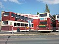 East Yorkshire Bus Depot, Pocklington - geograph.org.uk - 2387724.jpg 1,600 × 1,200; 416 KB
-

-

-
 Ennerdale liffting bridges.jpg 1,024 × 768; 446 KB
-
 Farm buildings off the B1228 (geograph 2348287).jpg 1,600 × 1,200; 309 KB
-
 Farmland near Waterloo Farm (geograph 2348282).jpg 1,600 × 1,200; 661 KB
-
 Farmland off Wood Lane (geograph 2348190).jpg 1,600 × 1,200; 637 KB
-
 Farmland, Intake farm (geograph 2348202).jpg 640 × 480; 86 KB
-
 Farmland, Wressle (geograph 2348211).jpg 1,600 × 1,200; 669 KB
-
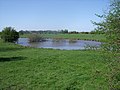 Fishing pond north of Wressle (geograph 2348219).jpg 1,600 × 1,200; 568 KB
-
 Footpath towards Breighton (geograph 2348280).jpg 1,600 × 1,200; 477 KB
-
 Haltemprice Crematorium - panoramio.jpg 1,200 × 800; 585 KB
-
 Hospital door.jpg 2,827 × 3,488; 3.35 MB
-
 Main Street, Wressle (geograph 2348214).jpg 1,600 × 1,200; 566 KB
-
 Making charcoal, Millington Wood - panoramio.jpg 1,200 × 800; 378 KB
-
 Millington Wood - panoramio.jpg 1,200 × 800; 607 KB
-
 Millington Wood 2 - panoramio.jpg 1,200 × 811; 830 KB
-
 Minor road towards Spaldington (geograph 2347750).jpg 1,600 × 1,200; 739 KB
-
 Newsholme Farm (geograph 2348196).jpg 1,600 × 954; 261 KB
-
 Salt end jetties 2.jpg 1,024 × 768; 289 KB
-
 Salt end jetties.jpg 1,024 × 273; 126 KB
-
 Sea of trees - panoramio.jpg 1,216 × 419; 246 KB
-
 Stamford Bridge at dusk - geograph.org.uk - 2364236.jpg 640 × 480; 70 KB
-
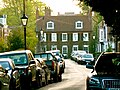
 The Barn in Melbourne - geograph.org.uk - 2364203.jpg 640 × 480; 103 KB
-
 The Folly, Castle Hill Hospital - panoramio.jpg 1,100 × 735; 502 KB
-
 The Rose and Crown pub, Little Driffield (geograph 2387226).jpg 800 × 600; 216 KB
-
 Track to Castle Farm, Wressle (geograph 2348217).jpg 1,600 × 1,200; 749 KB
-
 Track to Grange Farm Cottages (geograph 2348206).jpg 1,600 × 1,200; 395 KB
-
 Wansford Bridge, near Driffield, E Yorks (geograph 2371056).jpg 640 × 459; 199 KB
-
 Westwood golfers - panoramio.jpg 2,200 × 502; 440 KB
-
 Westwood Road Beverley.jpg 4,000 × 3,000; 3.95 MB
-
 William Bradley Memorial Statue, Market Weighton - geograph.org.uk - 2387651.jpg 1,600 × 1,200; 537 KB
-
 Wood Lane towards Wressle (geograph 2348193).jpg 1,600 × 1,200; 542 KB
-
 Wood Lane towards Wressle (geograph 2348198).jpg 1,600 × 1,200; 422 KB
-
 Wressle-Castle-29042011.jpg 3,456 × 2,304; 6.18 MB
.jpg)

.jpg)
.jpg)


.jpg)


.jpg)
.jpg)
.jpg)
.jpg)
.jpg)
.jpg)
.jpg)


.jpg)


.jpg)
.jpg)


.jpg)
.jpg)
.jpg)
.jpg)


.jpg)
.jpg)
