Category:Ardlui
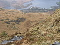
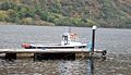
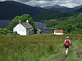
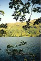
English: Ardlui (Àird Laoigh in Gaelic) is a hamlet in Argyll and Bute, Scotland. It is located at the head of Loch Lomond. It is on the A82 road between Crianlarich and Glasgow and Ardlui railway station is on the West Highland Line between Glasgow Queen Street and Oban or Fort William.
village in Argyll and Bute, Scotland, UK  | |||||
| Upload media | |||||
| Instance of | |||||
|---|---|---|---|---|---|
| Location |
| ||||
 | |||||
Subcategories
This category has the following 3 subcategories, out of 3 total.
Media in category "Ardlui"
The following 70 files are in this category, out of 70 total.
-
 "Reflections" from Ardlui - geograph.org.uk - 1768603.jpg 1,600 × 1,200; 326 KB
-
 Across Strath Dubh-uisage - geograph.org.uk - 405364.jpg 640 × 480; 131 KB
-
 Approaching Loch Lomond - geograph.org.uk - 214932.jpg 640 × 480; 190 KB
-
 Ardlui banner.jpg 2,450 × 350; 380 KB
-
 Ardlui from Stob an Fhithich - geograph.org.uk - 405425.jpg 640 × 480; 144 KB
-
 Ardlui Hotel, Ardlui, Loch Lomond, Scotland.jpg 4,422 × 2,524; 4.07 MB
-
 Ardlui Marina, boat lift, Loch Lomond, Scotland.jpg 4,408 × 3,172; 5.29 MB
-
 Ardlui Marina, Loch Lomond, Scotland.jpg 4,576 × 2,648; 4.89 MB
-
 Ardlui Phonebox - geograph.org.uk - 206459.jpg 640 × 480; 112 KB
-
 Ardlui Pier - geograph.org.uk - 1016074.jpg 618 × 640; 134 KB
-
 Ardlui to Ardleish ferry at the Marina, Loch Lomond, Scotland.jpg 4,563 × 2,642; 5.07 MB
-
 Ardlui, Argyll and Bute.jpg 640 × 480; 160 KB
-

-
 Church near Ardlui - geograph.org.uk - 3277893.jpg 1,600 × 1,200; 460 KB
-
 Converted church at Ardlui - geograph.org.uk - 2044432.jpg 3,648 × 2,736; 2.33 MB
-
 Doune, Loch Lomond - geograph.org.uk - 686634.jpg 640 × 480; 84 KB
-
 Loch Lomond - geograph.org.uk - 53457.jpg 436 × 640; 121 KB
-
 Loch Lomond at Stuckendroin - geograph.org.uk - 5361539.jpg 640 × 299; 68 KB
-
 Loch Lomond from Cnap Mor - geograph.org.uk - 5660058.jpg 5,343 × 3,005; 4.95 MB
-
 Loch Sloy - geograph.org.uk - 31651.jpg 640 × 480; 51 KB
-
 Lochan on Ben Vane - geograph.org.uk - 31648.jpg 640 × 480; 53 KB
-
 Perched rock - geograph.org.uk - 31649.jpg 640 × 480; 65 KB
-
 Phone box at Ardlui - geograph.org.uk - 2034891.jpg 480 × 640; 220 KB
-
 The Old Ardlui Church, Loch Lomond and the Trossachs, Scotland.jpg 4,596 × 2,796; 5.14 MB
-
 The West Highland Way - geograph.org.uk - 22223.jpg 480 × 640; 83 KB
-

-

-
 West Highland Way - Beinglas Farm.jpg 2,592 × 1,456; 1.51 MB
-
 West Highland Way in Glen Falloch - geograph.org.uk - 142857.jpg 640 × 480; 85 KB
-
 A rowan tree on Ben Vorlich - geograph.org.uk - 240527.jpg 640 × 427; 72 KB
-
 Allt a' Chnoic - geograph.org.uk - 415294.jpg 640 × 480; 172 KB
-
 Ardlui Marina and Holiday Home Park - geograph.org.uk - 553384.jpg 640 × 480; 104 KB
-
 Beinn Dubh - geograph.org.uk - 31650.jpg 640 × 480; 65 KB
-
 Below Beinn Ducteach - geograph.org.uk - 590670.jpg 640 × 480; 113 KB
-
 Ben Vorlich (Lomond) - geograph.org.uk - 1456731.jpg 640 × 480; 60 KB
-
 Coire Creagach - geograph.org.uk - 108097.jpg 640 × 437; 45 KB
-
 Culvert Under the A82 - geograph.org.uk - 184149.jpg 480 × 640; 155 KB
-
 Descending Ben Vorlich - geograph.org.uk - 108105.jpg 640 × 437; 53 KB
-
 Easterly slope of Little Hills - geograph.org.uk - 404642.jpg 640 × 480; 88 KB
-
 Gleann Uaine - geograph.org.uk - 415275.jpg 640 × 480; 201 KB
-
 Glen Kinglas - geograph.org.uk - 415268.jpg 640 × 480; 172 KB
-
 Hillside above Allt na Lairige reservoir - geograph.org.uk - 489573.jpg 640 × 480; 142 KB
-
 Hillside below Cruach - geograph.org.uk - 590639.jpg 640 × 480; 139 KB
-

-
 Hillside towards Loch Lomond - geograph.org.uk - 406005.jpg 640 × 480; 152 KB
-
 Hillside towards Loch Lomond and Ardlui - geograph.org.uk - 590493.jpg 640 × 480; 131 KB
-
 Inveruglas Water - geograph.org.uk - 31655.jpg 640 × 480; 74 KB
-
 Little Hills - geograph.org.uk - 290495.jpg 640 × 426; 71 KB
-
 Loch Sloy - geograph.org.uk - 405332.jpg 640 × 480; 124 KB
-
 Loch Sloy - geograph.org.uk - 405344.jpg 640 × 480; 117 KB
-
 Loch Sloy Dam from slopes of Ben Vane - geograph.org.uk - 9468.jpg 640 × 427; 95 KB
-
 Lochan nam Muc - geograph.org.uk - 590663.jpg 640 × 480; 147 KB
-
 Lochans east of Maol Meadhonach - geograph.org.uk - 431527.jpg 640 × 480; 138 KB
-
 Neart nan Gleann - geograph.org.uk - 31654.jpg 640 × 480; 70 KB
-
 On the Ascent of Ben Vorlich - geograph.org.uk - 108102.jpg 640 × 437; 44 KB
-
 Pulpit Rock, Loch Lomond, 2004.jpg 640 × 480; 150 KB
-
 Pylons Proceed Across the Hillside - geograph.org.uk - 286310.jpg 640 × 480; 80 KB
-
 Sloy Dam Spillway and Outlet Valve - geograph.org.uk - 54294.jpg 480 × 640; 90 KB
-
 Stob an Fhithich - geograph.org.uk - 405419.jpg 640 × 480; 118 KB
-
 Stob nan Eighrach hillside - geograph.org.uk - 590656.jpg 640 × 480; 125 KB
-
 Stob-nan Coinnich - geograph.org.uk - 53459.jpg 640 × 362; 73 KB
-
 Strath Dubh-uisage - geograph.org.uk - 405401.jpg 640 × 480; 129 KB
-
 Strath Dubh-uisage - geograph.org.uk - 405408.jpg 640 × 480; 133 KB
-
 Stuc na Nughinn - geograph.org.uk - 404648.jpg 640 × 480; 91 KB
-
 The feed into Loch Sloy - geograph.org.uk - 405325.jpg 640 × 480; 162 KB
-
 The head of Loch Sloy - geograph.org.uk - 405316.jpg 640 × 480; 135 KB
-
 Towards Maol Breac - geograph.org.uk - 431531.jpg 640 × 480; 149 KB
-
 Towards the head of Loch Sloy - geograph.org.uk - 405338.jpg 640 × 480; 137 KB
-
 Track and water pipeline - geograph.org.uk - 415286.jpg 640 × 480; 164 KB
-
 West Highland Way, Loch Lomond - geograph.org.uk - 686646.jpg 640 × 480; 108 KB


_-_geograph.org.uk_-_1456731.jpg)


