Category:Arwarton
English: Arwarton is a civil parish in the Babergh district, in the county of Suffolk, England. In 2011 it had a population of 126.

civil parish in Babergh, Suffolk, England | |||||
| Upload media | |||||
| Instance of | |||||
|---|---|---|---|---|---|
| Location | Babergh, Suffolk, East of England, England | ||||
 | |||||
Subcategories
This category has the following 3 subcategories, out of 3 total.
E
- Erwarton Ness (7 F)
S
- Shop Corner (1 F)
Media in category "Arwarton"
The following 85 files are in this category, out of 85 total.
-
 A seat with a view - geograph.org.uk - 2736184.jpg 1,024 × 768; 213 KB
-
 Almshouses - geograph.org.uk - 3699384.jpg 1,024 × 768; 220 KB
-
 Behind the bank of the Stour River - geograph.org.uk - 1283111.jpg 640 × 447; 95 KB
-
 Brick garden wall at Hill House - geograph.org.uk - 6109903.jpg 6,000 × 4,000; 6.22 MB
-
 Buildings and fields at Hill House Farm - geograph.org.uk - 4422601.jpg 1,024 × 768; 373 KB
-
 Collecting the grain - geograph.org.uk - 1432900.jpg 640 × 378; 76 KB
-
 Copse near Ness Farm - geograph.org.uk - 2565342.jpg 3,068 × 1,896; 2.07 MB
-
 Crop contrasts - geograph.org.uk - 1284557.jpg 640 × 452; 81 KB
-
 Crosspaths, like a crossroads only paths - geograph.org.uk - 4422624.jpg 1,024 × 768; 485 KB
-
 Dead tree on footpath - geograph.org.uk - 2565297.jpg 3,648 × 2,736; 2.52 MB
-
 Entering Erwarton - geograph.org.uk - 3699362.jpg 768 × 1,024; 178 KB
-
 Erwarton Hall through the Jacobean Gateway - geograph.org.uk - 4422665.jpg 1,024 × 768; 343 KB
-
 Erwarton Ness - geograph.org.uk - 3699411.jpg 1,024 × 768; 219 KB
-
 Erwarton Ness - geograph.org.uk - 5366639.jpg 640 × 480; 235 KB
-
 Erwarton village - geograph.org.uk - 5366641.jpg 640 × 480; 224 KB
-
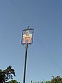 Erwarton village sign - geograph.org.uk - 4291934.jpg 480 × 651; 71 KB
-
 Ewarton church - geograph.org.uk - 5611572.jpg 640 × 428; 120 KB
-
 Farm outbuildings near Erwarton Hall - geograph.org.uk - 1282529.jpg 640 × 429; 112 KB
-
 Farm track heading north - geograph.org.uk - 2565320.jpg 2,736 × 3,648; 3.99 MB
-

-
 Field with alpacas - geograph.org.uk - 2565383.jpg 3,088 × 1,909; 2.49 MB
-
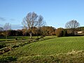 Fields and ditches - geograph.org.uk - 5611559.jpg 640 × 480; 135 KB
-
 Flowering Cherry at Shop Corner - geograph.org.uk - 4422608.jpg 1,024 × 768; 340 KB
-
 Footpath down from Rat Hill - geograph.org.uk - 4422598.jpg 1,024 × 768; 398 KB
-
 Footpath entrance - geograph.org.uk - 2566169.jpg 3,264 × 2,040; 2.8 MB
-
 Footpath Junction - geograph.org.uk - 3699392.jpg 1,024 × 768; 291 KB
-
 Footpath near Shotley - geograph.org.uk - 4873584.jpg 3,264 × 2,176; 1,001 KB
-
 Footpath Sign - geograph.org.uk - 3699396.jpg 1,024 × 768; 170 KB
-
 Garden wall around Hill House Farm - geograph.org.uk - 4422605.jpg 1,024 × 768; 454 KB
-
 Gate And Footpath - geograph.org.uk - 3699343.jpg 1,024 × 768; 317 KB
-
 Gate on footpath - geograph.org.uk - 2565290.jpg 3,648 × 2,736; 4.81 MB
-
 Great spreading oak tree - geograph.org.uk - 1282602.jpg 640 × 487; 175 KB
-
 Harvested field - geograph.org.uk - 1432902.jpg 640 × 490; 116 KB
-
 Harvesting the wheat - geograph.org.uk - 1432894.jpg 640 × 398; 67 KB
-
 Hedgerow, wood and oil barrel - geograph.org.uk - 660265.jpg 640 × 480; 193 KB
-
 HT electricity cables across farmland - geograph.org.uk - 4422641.jpg 1,024 × 768; 265 KB
-
 I only wanted to walk down to the river - geograph.org.uk - 4422617.jpg 1,024 × 768; 444 KB
-
 Inviting start to a footpath - geograph.org.uk - 1282689.jpg 640 × 459; 106 KB
-
 Llamas grazing below Erwarton Hall - geograph.org.uk - 6104960.jpg 6,000 × 4,000; 6.78 MB
-
 Looking over fields to Erwarton Church - geograph.org.uk - 2565314.jpg 3,420 × 2,114; 1.83 MB
-

-
 Meadow - geograph.org.uk - 3699338.jpg 1,024 × 768; 190 KB
-
 Ness Farm - geograph.org.uk - 5366640.jpg 640 × 480; 251 KB
-
 Newly-sown cereal crop on the edge of Erwarton - geograph.org.uk - 6109910.jpg 6,000 × 4,000; 7.51 MB
-
 Oaks on the boundary - geograph.org.uk - 2618335.jpg 3,648 × 2,255; 2.75 MB
-
 Old sweet chestnut tree - geograph.org.uk - 1282586.jpg 480 × 640; 169 KB
-
 Pig farming - geograph.org.uk - 1432892.jpg 640 × 446; 84 KB
-
 Pigs in a field - geograph.org.uk - 4873566.jpg 3,264 × 2,176; 799 KB
-
 Ploughed fields near Erwarton - geograph.org.uk - 6109924.jpg 6,000 × 4,000; 6.29 MB
-
 Private Road - No Footpath - geograph.org.uk - 4422614.jpg 1,024 × 768; 459 KB
-
 Recently harvested cornfield - geograph.org.uk - 2565002.jpg 3,648 × 2,736; 3.3 MB
-
 Reeds and oil-seed rape - geograph.org.uk - 1283126.jpg 640 × 435; 69 KB
-
 Remains of an old jetty - geograph.org.uk - 3699419.jpg 1,024 × 768; 233 KB
-
 Reservoir and River Stour - geograph.org.uk - 4873525.jpg 3,264 × 2,176; 913 KB
-
 Reservoir near Hill House Farm - geograph.org.uk - 2618329.jpg 3,522 × 2,177; 2.01 MB
-
 Reservoir near Hill House farm - geograph.org.uk - 4873511.jpg 3,264 × 2,176; 1.09 MB
-
 Reservoir with wildlife - geograph.org.uk - 4873534.jpg 3,264 × 2,176; 775 KB
-
 River Stour - geograph.org.uk - 3699439.jpg 1,024 × 768; 136 KB
-
 River Stour from Erwarton Churchyard - geograph.org.uk - 1851813.jpg 631 × 457; 41 KB
-
 River Stour from Erwarton Churchyard - geograph.org.uk - 1851822.jpg 638 × 461; 37 KB
-

-
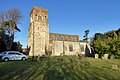
 St.Mary's church. Erwarton - geograph.org.uk - 6104978.jpg 6,000 × 4,000; 5.77 MB
-
 Stour and Orwell walk - geograph.org.uk - 4873558.jpg 3,264 × 2,176; 965 KB
-
 Stour and Orwell walk - geograph.org.uk - 4873579.jpg 3,264 × 2,176; 1.13 MB
-
 Stour and Orwell walk - geograph.org.uk - 4873586.jpg 3,264 × 2,176; 1.02 MB
-
 Stour and Orwell Walk - Warren Bottom - geograph.org.uk - 4873546.jpg 3,264 × 2,176; 750 KB
-
 Stour And Orwell Wall - geograph.org.uk - 3699356.jpg 1,024 × 768; 177 KB
-
 Substantial housing near Shop Corner - geograph.org.uk - 2619697.jpg 3,492 × 2,158; 1.79 MB
-
 Sugar beet, Rat Hill - geograph.org.uk - 5611562.jpg 640 × 428; 72 KB
-
 The end of the lane from Erwarton - geograph.org.uk - 1282484.jpg 640 × 451; 119 KB
-
 The former Queen's Head pub, Erwarton - geograph.org.uk - 6109917.jpg 4,790 × 3,193; 4.27 MB
-
 The gatehouse of Erwarton Hall - geograph.org.uk - 6104925.jpg 5,625 × 3,751; 4.15 MB
-
 The plaque on the Long Barn, Erwarton - geograph.org.uk - 4422653.jpg 1,024 × 768; 390 KB
-
 The Sir Phillip Parker Long Bar(n) - geograph.org.uk - 4422650.jpg 1,024 × 768; 366 KB
-
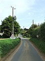
 The Street, Erwarton - geograph.org.uk - 4422639.jpg 640 × 480; 83 KB
-
 The winding way - geograph.org.uk - 4422603.jpg 1,024 × 768; 597 KB
-
 Track by little tree-lined stream - geograph.org.uk - 1282706.jpg 640 × 476; 133 KB
-
 Tree-lined lane to Ness Farm, Erwarton - geograph.org.uk - 6109925.jpg 6,000 × 4,000; 5.83 MB
-
 Trees on field boundary - geograph.org.uk - 2566120.jpg 3,648 × 2,736; 4.04 MB
-
 Twentieth century housing - geograph.org.uk - 2566153.jpg 3,648 × 2,736; 3.19 MB
-
 Veteran trees on Erwarton Walk - geograph.org.uk - 6104892.jpg 6,000 × 4,000; 6.75 MB
-
 View north from Rat Hill - geograph.org.uk - 6109898.jpg 6,000 × 4,000; 6.57 MB
-
 View over field to Erwarton - geograph.org.uk - 1371418.jpg 640 × 480; 87 KB
-
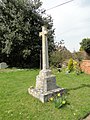 War Memorial in Erwarton churchyard - geograph.org.uk - 4422647.jpg 768 × 1,024; 521 KB
-
 Wheat field harvest - geograph.org.uk - 1432901.jpg 640 × 457; 94 KB


_-_geograph.org.uk_-_4422650.jpg)


