Category:Asfordby
English: Asfordby is a village and civil parish in the Melton district of Leicestershire, to the west of Melton Mowbray on the A6006 road. (→Asfordby)
Nederlands: Asfordby is een dorp en parish in Leicestershire in Engeland. Het ligt iets ten westen van Melton Mowbray. Naast Asfordby behoren ook Asfordby Valley en Asfordby Hill tot dezelfde parish. Tussen 1984 en 1993 werd in Asfordby een diepe kolenmijn gebouwd. Deze werd in 1997 gesloopt door geologische moeilijkheden en een lage steenkoolprijs. (→Asfordby)
Polski: Asfordby – wieś w Anglii, w hrabstwie Leicestershire, w dystrykcie Melton. Leży 19 km na północny wschód od miasta Leicester i 151 km na północ od Londynu. Miejscowość liczy 3107 mieszkańców. (→Asfordby)

village in Melton, Leicestershire, England  | |||||
| Upload media | |||||
| Instance of | |||||
|---|---|---|---|---|---|
| Location | Melton, Leicestershire, East Midlands, England | ||||
 | |||||
Subcategories
This category has the following 3 subcategories, out of 3 total.
A
- Ashfordby All Saints (4 F)
- Asfordby Hill (2 F)
W
Media in category "Asfordby"
The following 200 files are in this category, out of 350 total.
(previous page) (next page)-
 159 Main Street Asfordby - geograph.org.uk - 5208704.jpg 1,280 × 960; 376 KB
-
 90 and 92 Main Street, Asfordby - geograph.org.uk - 5208685.jpg 1,280 × 960; 297 KB
-
 A bend in the River Wreake - geograph.org.uk - 3149518.jpg 3,264 × 2,448; 2.87 MB
-

-

-
 A6006 Melton Road at Asfordby Valley - geograph.org.uk - 3148706.jpg 1,379 × 1,014; 513 KB
-
 All Saints Church at the end of the road - geograph.org.uk - 6163983.jpg 683 × 1,024; 122 KB
-
 Allotments in Asfordby - geograph.org.uk - 3148895.jpg 3,037 × 2,320; 2.62 MB
-
 Animal pen and track - geograph.org.uk - 2788823.jpg 640 × 554; 74 KB
-
 Asfordby Amateurs Sports Club - geograph.org.uk - 3078682.jpg 640 × 480; 78 KB
-

-
 Asfordby Business Park - geograph.org.uk - 3167698.jpg 3,264 × 2,448; 3.44 MB
-

-
 Asfordby Cross - geograph.org.uk - 5208692.jpg 997 × 1,280; 303 KB
-
 Asfordby Crown Pub - geograph.org.uk - 2758345.jpg 640 × 480; 162 KB
-
 Asfordby electricity sub station - geograph.org.uk - 3148039.jpg 3,264 × 2,448; 2.97 MB
-
 Asfordby Horseshoes Pub - geograph.org.uk - 2758363.jpg 640 × 480; 112 KB
-
 Asfordby station site geograph-3237902-by-Ben-Brooksbank.jpg 2,306 × 1,362; 2.77 MB
-

-
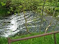 Asfordby weir - geograph.org.uk - 638005.jpg 640 × 480; 122 KB
-
 At Holwell reservoir pumping station - geograph.org.uk - 2357588.jpg 640 × 427; 93 KB
-
 Bench mark, St Bartholomew's Church, Welby - geograph.org.uk - 5209399.jpg 960 × 1,280; 443 KB
-
 Bench mark, Welby Lane bridge - geograph.org.uk - 5208777.jpg 1,280 × 960; 346 KB
-
 Bench mark^, All Saints Church, Asfordby - geograph.org.uk - 5208313.jpg 960 × 1,280; 516 KB
-

-
 Benchmark on outbuilding at Saxelby Road Farm - geograph.org.uk - 6164357.jpg 683 × 1,024; 282 KB
-
 Benchmark on Station Lane bridge - geograph.org.uk - 6090688.jpg 1,024 × 683; 228 KB
-
 Benchmark on ^23 Welbey Road - geograph.org.uk - 6080881.jpg 1,024 × 683; 307 KB
-
 Benchmark on ^31 Melton Road - geograph.org.uk - 6163352.jpg 1,024 × 683; 220 KB
-
 Benchmark on ^49 Main Street (Hair Amore) - geograph.org.uk - 6164271.jpg 672 × 1,024; 169 KB
-
 Benchmark on ^52 Main Street - geograph.org.uk - 6163502.jpg 1,024 × 683; 276 KB
-
 Bottom of tower of All Saints Church - geograph.org.uk - 6163935.jpg 1,024 × 675; 212 KB
-
 Brick and concrete structure by track - geograph.org.uk - 5925166.jpg 640 × 427; 105 KB
-
 Brick wall along Welby Lane - geograph.org.uk - 3167619.jpg 3,264 × 2,448; 3.05 MB
-
 Bridge along Welby Lane - geograph.org.uk - 3167708.jpg 3,264 × 2,448; 3.98 MB
-
 Bridge on Welby Lane - geograph.org.uk - 5208774.jpg 1,280 × 960; 505 KB
-
 Bridge over a brook - geograph.org.uk - 5925144.jpg 640 × 475; 98 KB
-
 Bridge over a brook - geograph.org.uk - 5925167.jpg 640 × 476; 96 KB
-

-
 Bridge taking Station Lane over River Wreake - geograph.org.uk - 6090719.jpg 1,024 × 635; 177 KB
-
 Brook Crescent, Asfordby Valley - geograph.org.uk - 5208718.jpg 1,280 × 917; 386 KB
-
 Byway heading towards Asfordby Valley - geograph.org.uk - 3162988.jpg 2,100 × 2,410; 2.3 MB
-
 Byway to Asfordby Valley - geograph.org.uk - 3162974.jpg 3,264 × 2,448; 2.95 MB
-
 Byway to Kirby Bellars - geograph.org.uk - 3162980.jpg 3,264 × 2,448; 3.64 MB
-

-
 Cattle near the Welby Osier Beds - geograph.org.uk - 3147984.jpg 2,510 × 1,873; 1.98 MB
-
 Chimney on the Asfordby Business Park - geograph.org.uk - 3167733.jpg 2,438 × 2,908; 2.6 MB
-
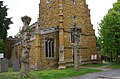
 Church of All Saints, Asfordby - geograph.org.uk - 5208300.jpg 960 × 1,280; 559 KB
-
 Church of All Saints, Asfordby - geograph.org.uk - 5208305.jpg 960 × 1,280; 434 KB
-
 Church of All Saints, Asfordby - geograph.org.uk - 5208306.jpg 1,280 × 960; 389 KB
-
 Church of All Saints, Asfordby - geograph.org.uk - 5208308.jpg 960 × 1,280; 326 KB
-
 Church of All Saints, Asfordby - geograph.org.uk - 5208311.jpg 1,280 × 954; 482 KB
-
 Church of St Bartholomew, Welby - geograph.org.uk - 5209397.jpg 1,280 × 895; 361 KB
-
 Church of St Bartholomew, Welby - geograph.org.uk - 5209402.jpg 1,280 × 960; 390 KB
-
 Church of St Bartholomew, Welby - geograph.org.uk - 5209405.jpg 960 × 1,280; 430 KB
-
 Class 08 shunter at Asfordby test centre - geograph.org.uk - 5208743.jpg 1,280 × 960; 491 KB
-
 Countryside near Asfordby Hill - geograph.org.uk - 3162993.jpg 2,402 × 1,956; 1.87 MB
-
 Countryside near Kirby Bellars - geograph.org.uk - 3162929.jpg 2,597 × 1,796; 1.95 MB
-
 Curious cattle at a gate - geograph.org.uk - 5925145.jpg 640 × 467; 64 KB
-
 Cycle Route 48 turning up Saxelby Road, Asfordby - geograph.org.uk - 5632608.jpg 3,776 × 2,520; 3.86 MB
-
 Datestone, 159 Main Street Asfordby - geograph.org.uk - 5208706.jpg 1,280 × 960; 324 KB
-

-

-

-
 Derelict building in field - geograph.org.uk - 2631395.jpg 640 × 520; 85 KB
-

-

-
 Downstream from Washstones Bridge - geograph.org.uk - 3349580.jpg 640 × 487; 95 KB
-
 Driveway of Sandlands Farm - geograph.org.uk - 1300998.jpg 640 × 479; 91 KB
-

-
 Edge of Asfordby B Solar Farm - geograph.org.uk - 5925146.jpg 640 × 445; 90 KB
-
 Entering Asfordby - geograph.org.uk - 5632604.jpg 3,776 × 2,520; 4.48 MB
-
 Entering Asfordby Valley - geograph.org.uk - 5632600.jpg 3,776 × 2,520; 4.3 MB
-
 Entrance to Asfordby B Solar Farm - geograph.org.uk - 5925153.jpg 640 × 477; 63 KB
-
 Entrance to Asfordby Business Park - geograph.org.uk - 5208780.jpg 1,280 × 960; 617 KB
-
 Entrance to Asfordby Farm - geograph.org.uk - 2631398.jpg 640 × 470; 76 KB
-
 Farm storage area - geograph.org.uk - 3146457.jpg 2,574 × 1,789; 1.93 MB
-
 Farm track near the Welby Osier Beds - geograph.org.uk - 3146442.jpg 2,381 × 1,899; 1.73 MB
-
 Farmland near Asfordby - geograph.org.uk - 3148909.jpg 3,098 × 2,308; 2.94 MB
-
 Farmland near Asfordby Business Park - geograph.org.uk - 3146586.jpg 1,831 × 1,395; 1,014 KB
-
 Farmland near Welby Osier Beds - geograph.org.uk - 3147281.jpg 3,264 × 2,448; 3.33 MB
-
 Farmland on the edge of Asfordby - geograph.org.uk - 3149511.jpg 1,734 × 1,278; 1,013 KB
-
 Farmland on the site of the former Asfordby coal mine - geograph.org.uk - 3147277.jpg 3,264 × 2,448; 3.14 MB
-
 Farmland south of Loughborough Road - geograph.org.uk - 3167864.jpg 2,775 × 1,884; 2.51 MB
-
 Farmland, Sandlands Farm - geograph.org.uk - 3078693.jpg 640 × 480; 102 KB
-
 Field behind Asfordby houses - geograph.org.uk - 2631399.jpg 640 × 461; 67 KB
-

-
 Field entrance off the A6006 - geograph.org.uk - 3078676.jpg 640 × 480; 109 KB
-
 Field near to Asfordby Farm - geograph.org.uk - 2788824.jpg 640 × 413; 42 KB
-
 Field north of Hoby Road - geograph.org.uk - 5614895.jpg 640 × 454; 110 KB
-
 Fields and woodland east of Glebe Farm - geograph.org.uk - 3146879.jpg 2,749 × 1,758; 2.14 MB
-
 Fields north of Loughborough Road - geograph.org.uk - 2631387.jpg 640 × 458; 69 KB
-
 Fields north of Loughborough Road - geograph.org.uk - 2631388.jpg 640 × 467; 81 KB
-

-
 Fields north of Welby Lane - geograph.org.uk - 5925188.jpg 640 × 448; 60 KB
-
 Fields off Loughborough Road - geograph.org.uk - 5455223.jpg 640 × 427; 73 KB
-
 Flooded field adjacent to Hoby Lane - geograph.org.uk - 1300996.jpg 640 × 393; 60 KB
-
 Flow valve control wheel - geograph.org.uk - 2360309.jpg 480 × 640; 169 KB
-
 Footbridge across the River Wreake - geograph.org.uk - 3156901.jpg 3,264 × 2,448; 2.94 MB
-
 Footbridge across the River Wreake - geograph.org.uk - 3156912.jpg 3,264 × 2,448; 3.65 MB
-
 Footpath along the River Wreake - geograph.org.uk - 3149524.jpg 3,264 × 2,448; 3.63 MB
-
 Footpath gates - geograph.org.uk - 2631400.jpg 640 × 462; 122 KB
-

-

-
 Footpath to Asfordby - geograph.org.uk - 2631401.jpg 640 × 525; 140 KB
-
 Footpath to Asfordby - geograph.org.uk - 2631402.jpg 640 × 461; 116 KB
-
 Footpath to Asfordby - geograph.org.uk - 5180924.jpg 640 × 534; 126 KB
-
 Footpath to Asfordby Valley - geograph.org.uk - 2631403.jpg 491 × 640; 104 KB
-
 Footpath to Welby Village - geograph.org.uk - 3146524.jpg 2,557 × 2,035; 2.02 MB
-
 Footpath towards Melton Mowbray - geograph.org.uk - 2000462.jpg 640 × 475; 65 KB
-
 Footpath towards Welby Village - geograph.org.uk - 3146891.jpg 1,647 × 1,735; 1.1 MB
-
 Footpath towards Welby Village - geograph.org.uk - 3146905.jpg 2,931 × 2,383; 2.74 MB
-

-
 Former Melton Sailing Club clubhouse - geograph.org.uk - 5180928.jpg 640 × 454; 72 KB
-
 Former Methodist chapel, Asfordby - geograph.org.uk - 5208699.jpg 1,280 × 960; 384 KB
-
 Frisby Flood Storage Reservoir - geograph.org.uk - 5180921.jpg 640 × 439; 95 KB
-
 Frisby Lakes - geograph.org.uk - 5180911.jpg 640 × 478; 61 KB
-
 Frisby signal box and level crossing - geograph.org.uk - 5180912.jpg 640 × 438; 75 KB
-
 Garden wall to the Old Rectory - geograph.org.uk - 5208303.jpg 1,280 × 960; 687 KB
-
 Gate into field - geograph.org.uk - 5925170.jpg 640 × 463; 61 KB
-

-

-
 Gateway at Holwell Reservoir - geograph.org.uk - 3167636.jpg 3,264 × 2,448; 3.03 MB
-
 Grange Cottage - geograph.org.uk - 3111675.jpg 640 × 481; 111 KB
-
 Grange Cottage - geograph.org.uk - 3111676.jpg 640 × 466; 103 KB
-
 Grange Cottage garden - geograph.org.uk - 3111677.jpg 640 × 440; 113 KB
-
 Grange Cottage, Welby - geograph.org.uk - 5208792.jpg 1,280 × 960; 681 KB
-
 Grassland and trees - geograph.org.uk - 3147030.jpg 3,264 × 2,448; 4.01 MB
-
 Grassland near Glebe Farm - geograph.org.uk - 3146816.jpg 2,896 × 2,275; 2.68 MB
-
 Grassland near Glebe Farm - geograph.org.uk - 3146863.jpg 2,474 × 2,060; 1.91 MB
-

-
 Hand wheel, Holwell pumping station - geograph.org.uk - 2357593.jpg 640 × 427; 163 KB
-
 Heading towards Asfordby Valley along Melton Road - geograph.org.uk - 3148694.jpg 2,359 × 1,981; 1.92 MB
-
 Hoby Lane flooded - geograph.org.uk - 1300997.jpg 640 × 480; 99 KB
-
 Hoby Road - geograph.org.uk - 3078705.jpg 640 × 480; 76 KB
-
 Hoby Road heading west - geograph.org.uk - 3078687.jpg 640 × 480; 69 KB
-
 Hoby Road near Red Lodge Farm - geograph.org.uk - 3148905.jpg 3,264 × 1,968; 2.43 MB
-
 Hoby Road towards Asfordby - geograph.org.uk - 5614896.jpg 640 × 475; 101 KB
-
 Hoby Road towards Hoby - geograph.org.uk - 5614897.jpg 640 × 455; 95 KB
-
 Holwell Angling Club notice - geograph.org.uk - 2357537.jpg 640 × 480; 129 KB
-
 Holwell Reservoir - geograph.org.uk - 2357555.jpg 640 × 427; 89 KB
-
 Holwell reservoir - geograph.org.uk - 2357577.jpg 640 × 427; 80 KB
-
 Holwell Reservoir pumping station - geograph.org.uk - 3167625.jpg 3,264 × 2,448; 3.29 MB
-
 Holwell Works - geograph.org.uk - 5208722.jpg 1,280 × 828; 311 KB
-
 Holwell Works - geograph.org.uk - 5208736.jpg 1,280 × 960; 482 KB
-
 Holwell Works - geograph.org.uk - 5208752.jpg 1,280 × 920; 337 KB
-
 Holwell Works site - geograph.org.uk - 5208726.jpg 1,280 × 960; 451 KB
-
 Holwell Works site - geograph.org.uk - 5208749.jpg 1,280 × 960; 650 KB
-
 Holwell Works, main entrance - geograph.org.uk - 5208730.jpg 1,280 × 960; 306 KB
-
 Holwell Works, slag tip - geograph.org.uk - 5208767.jpg 1,280 × 859; 266 KB
-
 Holwell Works, view from Welby Road - geograph.org.uk - 5208757.jpg 1,280 × 885; 312 KB
-
 Houses of Welby Road at South Street junction - geograph.org.uk - 6080885.jpg 1,024 × 683; 149 KB
-
 Houses on Main Road - geograph.org.uk - 3078446.jpg 640 × 480; 68 KB
-
 Houses on Main Street at Ridings Close junction - geograph.org.uk - 6163541.jpg 1,024 × 742; 149 KB
-
 Huge pile of manure by the track - geograph.org.uk - 3146467.jpg 3,223 × 2,148; 2.74 MB
-

-
 Industrial site "reclaimed" - geograph.org.uk - 2360279.jpg 427 × 640; 172 KB
-

-

-

-

-

-

-
 Lake at the Celtic Lakes Resort - geograph.org.uk - 3156883.jpg 3,264 × 2,448; 3.39 MB
-
 Lake off Hoby Road - geograph.org.uk - 3078712.jpg 640 × 480; 91 KB
-

-
 Looking down the embankment - geograph.org.uk - 2360296.jpg 427 × 640; 168 KB
-

-
 Loughborough Road (A6006) - geograph.org.uk - 3078672.jpg 640 × 480; 81 KB
-
 Loughborough Road - geograph.org.uk - 2631390.jpg 640 × 467; 78 KB
-
 Loughborough Road at Grimston Gap - geograph.org.uk - 3167875.jpg 3,264 × 2,448; 3.27 MB
-
 Loughborough Road in Asfordby - geograph.org.uk - 3148872.jpg 2,102 × 1,971; 1.85 MB
-
 Loughborough Road westwards - geograph.org.uk - 2631404.jpg 640 × 472; 79 KB
-

-
 Main Road (A6006) - geograph.org.uk - 3078447.jpg 640 × 480; 67 KB
-
 Main Street, Asfordby - geograph.org.uk - 3078457.jpg 640 × 480; 67 KB
-
 Melton Mowbray Sailing Club - geograph.org.uk - 4931603.jpg 640 × 443; 75 KB
-
 Melton Mowbray Sailing Club lake - geograph.org.uk - 4931604.jpg 640 × 401; 85 KB
-
 Melton Road (A6006) heading west - geograph.org.uk - 3078445.jpg 640 × 480; 62 KB
-
 Melton Road bridge at Brook Crescent junction - geograph.org.uk - 6080899.jpg 1,024 × 683; 185 KB
-
 Melton Road in Asfordby Hill - geograph.org.uk - 3148662.jpg 2,023 × 1,575; 1.3 MB
-
 More pipework in the woodland - geograph.org.uk - 2360389.jpg 640 × 427; 159 KB
-
 Mud and Muck - geograph.org.uk - 1067590.jpg 640 × 489; 143 KB
-
 Muddy field near Welby Lane - geograph.org.uk - 3146416.jpg 2,387 × 1,925; 1.83 MB
-
 Muddy footpath through the trees - geograph.org.uk - 3146507.jpg 3,264 × 2,448; 2.99 MB
-
 Nature reclaiming an old industrial site - geograph.org.uk - 2360255.jpg 427 × 640; 174 KB
-
 New gateway and new building - geograph.org.uk - 2788829.jpg 640 × 443; 90 KB
-
 New houses along Loughborough Road - geograph.org.uk - 3148880.jpg 2,950 × 2,053; 2.48 MB
-
 New housing in Asfordby - geograph.org.uk - 3148887.jpg 2,516 × 1,963; 1.93 MB
-
 New trees and grassland - geograph.org.uk - 3147153.jpg 3,264 × 2,448; 3.18 MB
-
 Newly planted trees - geograph.org.uk - 3146991.jpg 3,264 × 2,448; 3.09 MB
-
 Nos. 65 and 67 Welby Road (Welby Villas) - geograph.org.uk - 6163273.jpg 1,024 × 683; 149 KB
-
 Nos.31 and 29 Melton Road - geograph.org.uk - 6163390.jpg 1,024 × 683; 158 KB
-

-

-

-

-

-

-
 Outbuilding at Saxelby Road Farm - geograph.org.uk - 6164379.jpg 1,024 × 683; 165 KB


_-_geograph.org.uk_-_6164271.jpg)


_-_geograph.org.uk_-_2357561.jpg)
_-_geograph.org.uk_-_2360322.jpg)


_-_geograph.org.uk_-_3078672.jpg)


_-_geograph.org.uk_-_3078447.jpg)


_heading_west_-_geograph.org.uk_-_3078445.jpg)


_-_geograph.org.uk_-_6163273.jpg)


