Category:Asgarby and Howell
English: Media related to the civil parish of Asgarby and Howell, in the North Kesteven district of Lincolnshire, England. It includes the villages of Asgarby and Howell.
civil parish in Lincolnshire, UK | |||||
| Upload media | |||||
| Instance of | |||||
|---|---|---|---|---|---|
| Named after | |||||
| Location | North Kesteven, Lincolnshire, East Midlands, England | ||||
 | |||||
Subcategories
This category has the following 3 subcategories, out of 3 total.
Media in category "Asgarby and Howell"
The following 56 files are in this category, out of 56 total.
-
 A view of St Andrew's Church, Asgarby - geograph.org.uk - 5533632.jpg 3,592 × 4,868; 5.27 MB
-
 A17 lay-by - geograph.org.uk - 4741229.jpg 640 × 480; 57 KB
-
 A17 north of Heckington - geograph.org.uk - 3647174.jpg 640 × 481; 43 KB
-
 Alongside Boughton Plantation - geograph.org.uk - 3154447.jpg 1,024 × 768; 213 KB
-
 Asgarby Road - geograph.org.uk - 4349747.jpg 640 × 480; 61 KB
-
 Asgarby St. Andrew's church - geograph.org.uk - 5604352.jpg 2,592 × 3,456; 2.35 MB
-
 Bend in the road towards Asgarby - geograph.org.uk - 4349752.jpg 640 × 480; 43 KB
-
 Beneath the wires - geograph.org.uk - 4461746.jpg 1,024 × 768; 86 KB
-
 Deer grazing south of Howell Fen Drove - geograph.org.uk - 4660477.jpg 1,024 × 683; 147 KB
-
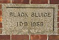 Detail on pumping station - geograph.org.uk - 702900.jpg 640 × 430; 77 KB
-
 Farm track, Boughton - geograph.org.uk - 4350658.jpg 640 × 480; 65 KB
-
 Farmland and hedgerow - geograph.org.uk - 4350669.jpg 640 × 480; 73 KB
-
 Farmland off the Asgarby road - geograph.org.uk - 4349749.jpg 640 × 480; 49 KB
-
 Flat farmland and pylon, Wash Dike - geograph.org.uk - 4350675.jpg 640 × 480; 66 KB
-
 Flat farmland, Boughton - geograph.org.uk - 4349755.jpg 640 × 480; 61 KB
-
 Flush Bracket OSBM G1478, Asgarby - geograph.org.uk - 5531990.jpg 960 × 1,280; 377 KB
-
 Heckington Eau (Drain) - geograph.org.uk - 4350678.jpg 640 × 480; 70 KB
-
 Horses at Asgarby - geograph.org.uk - 3631566.jpg 640 × 426; 92 KB
-
 Howell Fen - geograph.org.uk - 3154360.jpg 1,024 × 768; 227 KB
-
 Howell Fen - geograph.org.uk - 3154379.jpg 1,024 × 768; 231 KB
-
 Howell Fen - geograph.org.uk - 3154411.jpg 1,024 × 768; 221 KB
-
 Howell Fen Drove - geograph.org.uk - 2567833.jpg 1,280 × 960; 339 KB
-
 Howell Fen Drove, beet field and water supply - geograph.org.uk - 4660441.jpg 1,024 × 505; 133 KB
-

-
 Layby on Heckington Bypass - geograph.org.uk - 4938135.jpg 640 × 480; 374 KB
-
 Minor road beside drain - geograph.org.uk - 4350673.jpg 640 × 480; 60 KB
-
 Minor road heading towards Howell - geograph.org.uk - 4350654.jpg 640 × 480; 66 KB
-
 Minor road towards Heckington - geograph.org.uk - 4350676.jpg 640 × 480; 76 KB
-
 Minor road towards Howell - geograph.org.uk - 4350667.jpg 640 × 480; 65 KB
-
 Near Washdyke Bridge - geograph.org.uk - 3154546.jpg 1,024 × 768; 173 KB
-
 Oilseed rape and Ewerby church spire - geograph.org.uk - 4461760.jpg 1,024 × 768; 298 KB
-
 Paddock by Manor Farm, Howell - geograph.org.uk - 4660270.jpg 1,728 × 671; 292 KB
-

-

-
 Road into Howell - geograph.org.uk - 4350672.jpg 640 × 480; 109 KB
-
 Road Junction on Asgarby Road - geograph.org.uk - 2567714.jpg 1,280 × 960; 586 KB
-
 St Andrew's Church, Asgarby - geograph.org.uk - 5533642.jpg 3,665 × 4,907; 3.89 MB
-
 Straw stackyard off Howell Fen Road - geograph.org.uk - 4660400.jpg 640 × 267; 48 KB
-
 Stubble field and power lines - geograph.org.uk - 4349736.jpg 640 × 480; 57 KB
-
 Stubble field beside Asgarby Road - geograph.org.uk - 4349738.jpg 640 × 480; 84 KB
-
 The Beck, near Washdyke Bridge - geograph.org.uk - 2567845.jpg 1,280 × 960; 416 KB
-
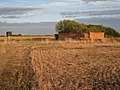 The remains of a farm in Howell Fen - geograph.org.uk - 3154367.jpg 1,024 × 768; 246 KB
-
 Track from Howell Fen Drove to Hodge Drain - geograph.org.uk - 2567797.jpg 1,280 × 960; 342 KB
-
 Track off lane, near Howell - geograph.org.uk - 2571891.jpg 1,280 × 960; 331 KB
-
 Track to Walks Farm - geograph.org.uk - 2567770.jpg 1,280 × 960; 269 KB
-
 Unknown Road near Asgarby - geograph.org.uk - 3631019.jpg 640 × 426; 93 KB
-
 View alongside a drain in Howell Fen - geograph.org.uk - 3154391.jpg 1,024 × 768; 189 KB
-
 View from Howell Fen Drove - geograph.org.uk - 3154427.jpg 1,024 × 768; 223 KB
-

-
 View towards Ewerby - geograph.org.uk - 3160420.jpg 1,024 × 768; 241 KB
-
 View towards Heckington - geograph.org.uk - 3160433.jpg 1,024 × 768; 177 KB
-
 View towards Heckington - geograph.org.uk - 3160442.jpg 1,024 × 768; 187 KB
-
 View towards South Kyme - geograph.org.uk - 3160480.jpg 1,024 × 768; 253 KB
-
 View towards Walk Farm - geograph.org.uk - 3160475.jpg 1,024 × 768; 184 KB
-
 Walks Farm across Heckington Eau - geograph.org.uk - 4659409.jpg 1,600 × 828; 339 KB
-


_-_geograph.org.uk_-_4350678.jpg)


