Category:Ashbourne, Derbyshire
town and civil parish in Derbyshire Dales district, Derbyshire, England  | |||||
| Upload media | |||||
| Instance of | |||||
|---|---|---|---|---|---|
| Location | Derbyshire Dales, Derbyshire, East Midlands, England | ||||
| official website | |||||
 | |||||
Subcategories
This category has the following 18 subcategories, out of 18 total.
A
- Ashbourne bandstand (2 F)
- Ashbourne railway station (7 F)
- Ashbourne Town Hall (12 F)
- Ashbourne tunnel (9 F)
- Ashbourne War Memorial Arch (6 F)
B
- Hill Boothby (1 F)
G
- Green Man, Ashbourne (13 F)
- The Grey House, Ashbourne (3 F)
H
- Ashbourne Hall (3 F)
J
- St John's Church, Ashbourne (10 F)
M
O
Q
R
- Royal Shrovetide Football (39 F)
Media in category "Ashbourne, Derbyshire"
The following 200 files are in this category, out of 381 total.
(previous page) (next page)-
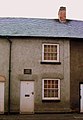
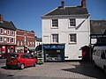
 13 Church Street, Ashbourne.jpg 1,024 × 768; 185 KB
-
 13 Sturston Road - Ashbourne.JPG 1,830 × 2,654; 429 KB
-
 14 Dig Street, Ashbourne.jpg 1,280 × 1,052; 1.15 MB
-
 18-22 Buxton Road, Ashbourne.jpg 3,883 × 2,971; 2.06 MB
-
 23 and 21 Church Street, Ashbourne - geograph.org.uk - 4938295.jpg 3,456 × 5,184; 6.2 MB
-
 24 and 26 Church Street, Ashbourne.jpg 5,184 × 3,456; 6.58 MB
-
 28 Church Street, Ashbourne.jpg 5,184 × 3,456; 5.22 MB
-
 31 Church Street, Ashbourne.jpg 5,184 × 3,456; 6.37 MB
-
 4 Victoria Square, Ashbourne.jpg 5,184 × 3,456; 5.83 MB
-
 53-57 Church Street, Ashbourne.jpg 5,184 × 3,456; 6.84 MB
-
 59 Church Street, Ashbourne.jpg 5,184 × 3,456; 6.94 MB
-
 59, Church Street, Ashbourne.jpg 4,000 × 3,000; 1.36 MB
-
 61a-53 Church Street, Ashbourne - geograph.org.uk - 5306599.jpg 1,280 × 939; 397 KB
-
 72 Church Street, Ashbourne.jpg 5,184 × 3,456; 7.32 MB
-
 A Big Christmas Present - geograph.org.uk - 3273776.jpg 768 × 1,024; 222 KB
-
 A house on St. John Street - geograph.org.uk - 5350770.jpg 1,333 × 2,000; 2.36 MB
-

-
 A temporary exhibition in Ashbourne - geograph.org.uk - 5361578.jpg 1,123 × 2,000; 1.03 MB
-
 A view of Ashbourne from the south east - geograph.org.uk - 2588838.jpg 3,648 × 2,736; 5.85 MB
-
 A view towards Ashbourne Market Place - geograph.org.uk - 5554578.jpg 1,200 × 1,600; 642 KB
-
 A. L. Hulme, Fishmongers, Ashbourne - geograph.org.uk - 5171135.jpg 3,285 × 2,097; 938 KB
-

-
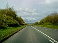
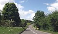
 A515 in Ashbourne - geograph.org.uk - 2389301.jpg 640 × 480; 60 KB
-
 A515 in Ashbourne - geograph.org.uk - 6012066.jpg 1,024 × 576; 132 KB
-
 A517 at Ashbourne boundary - geograph.org.uk - 5139234.jpg 640 × 481; 64 KB
-
 A52 approaching Ashbourne - geograph.org.uk - 1837363.jpg 640 × 480; 99 KB
-
 A52 at Ashbourne - geograph.org.uk - 1837367.jpg 640 × 480; 50 KB
-

-
 A52 past Ashbourne - geograph.org.uk - 1837366.jpg 640 × 480; 68 KB
-
 Acorn of Ashbourne - geograph.org.uk - 5499075.jpg 1,280 × 931; 948 KB
-
 Aerial view of Ashbourne - geograph.org.uk - 5470465.jpg 2,000 × 1,333; 2.18 MB
-
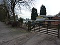
 Alders Farm - geograph.org.uk - 944379.jpg 640 × 480; 87 KB
-
 Alley in Ashbourne - geograph.org.uk - 3635182.jpg 426 × 640; 93 KB
-
 Alley in Ashbourne - geograph.org.uk - 5554630.jpg 1,200 × 1,600; 593 KB
-
 An interesting bicycle - geograph.org.uk - 5350776.jpg 1,333 × 2,000; 2.68 MB
-
 Ashbourn - panoramio (1).jpg 4,608 × 3,456; 4.88 MB
-
 Ashbourn - panoramio (4).jpg 4,608 × 3,456; 4.85 MB
-
 Ashbourn - panoramio (5).jpg 4,608 × 3,456; 4.03 MB
-
 Ashbourn - panoramio (6).jpg 4,608 × 3,456; 4.8 MB
-
 Ashbourn - panoramio (8).jpg 4,608 × 3,456; 4.24 MB
-
 Ashbourn banner.jpg 4,608 × 658; 1.01 MB
-
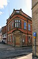
 Ashbourne & District, former Council Offices - geograph.org.uk - 2294858.jpg 2,879 × 1,969; 851 KB
-
 Ashbourne - Buxton Road, View northwest - geograph.org.uk - 3289335.jpg 1,024 × 768; 190 KB
-
 Ashbourne - geograph.org.uk - 8771.jpg 640 × 480; 110 KB
-
 Ashbourne - Lloyds Bank - geograph.org.uk - 1579532.jpg 640 × 480; 69 KB
-
 Ashbourne - Old Police Station - geograph.org.uk - 1836433.jpg 1,600 × 1,200; 424 KB
-
 Ashbourne - panoramio (2).jpg 4,608 × 3,456; 4.98 MB
-
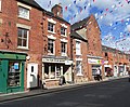
 Ashbourne - Shops on Church Street - geograph.org.uk - 1579541.jpg 640 × 480; 101 KB
-
 Ashbourne - Shops on Dig Street - geograph.org.uk - 1579535.jpg 640 × 480; 104 KB
-
 Ashbourne - St John's St - geograph.org.uk - 5233538.jpg 5,184 × 2,920; 5.23 MB
-
 Ashbourne - St Johns Street - geograph.org.uk - 1844623.jpg 1,600 × 1,200; 402 KB
-
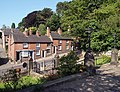
 Ashbourne - terrace on Sturston Road - geograph.org.uk - 1836441.jpg 1,600 × 1,182; 369 KB
-
 Ashbourne - View northeast along Church Street - geograph.org.uk - 3289301.jpg 1,024 × 768; 169 KB
-
 Ashbourne - View northeast along St John Street - geograph.org.uk - 3289319.jpg 1,024 × 768; 225 KB
-
 Ashbourne boarded up shops1.jpg 2,576 × 1,473; 884 KB
-
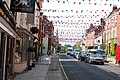
 Ashbourne bunting - geograph.org.uk - 6248034.jpg 4,160 × 3,120; 2.58 MB
-
 Ashbourne Bus Station - geograph.org.uk - 3544394.jpg 3,906 × 2,872; 1.95 MB
-
 Ashbourne Bus Station - geograph.org.uk - 5306724.jpg 1,280 × 960; 477 KB
-
 Ashbourne bypass - geograph.org.uk - 2389281.jpg 640 × 480; 67 KB
-
 Ashbourne bypass - geograph.org.uk - 5670555.jpg 2,000 × 1,333; 1.73 MB
-
 Ashbourne End of The Tissington Trail - geograph.org.uk - 1876397.jpg 4,224 × 2,816; 5.63 MB
-
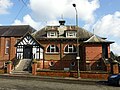
 Ashbourne Fire Station - geograph.org.uk - 773801.jpg 640 × 480; 126 KB
-
 Ashbourne from the north - geograph.org.uk - 5554611.jpg 1,600 × 1,200; 556 KB
-
 Ashbourne from the south - geograph.org.uk - 1348153.jpg 640 × 426; 54 KB
-
 Ashbourne Gingerbread Shop - geograph.org.uk - 5306607.jpg 1,280 × 960; 374 KB
-
 Ashbourne Green (298276 7c910e72-by-John-Poyser).jpg 640 × 480; 114 KB
-
 Ashbourne Leisure Centre - geograph.org.uk - 2294864.jpg 3,648 × 2,736; 3.97 MB
-
 Ashbourne Library - Compton Street, Ashbourne (15123295970).jpg 4,288 × 2,416; 846 KB
-
 Ashbourne Library - Compton Street, Ashbourne (15123419428).jpg 4,288 × 3,216; 3.51 MB
-
 Ashbourne Library - Compton Street, Ashbourne (15123445457).jpg 4,288 × 3,216; 1.2 MB
-
 Ashbourne Library - Compton Street, Ashbourne (15306834211).jpg 4,288 × 3,216; 1.39 MB
-
 Ashbourne Library - Compton Street, Ashbourne - foundation stone (15123426878).jpg 4,288 × 3,216; 3.56 MB
-
 Ashbourne Library, interior (2) - geograph.org.uk - 3462629.jpg 4,608 × 3,072; 5.55 MB
-
 Ashbourne Library, interior - geograph.org.uk - 3462620.jpg 4,608 × 3,072; 5.43 MB
-
-
 Ashbourne Market Place - geograph.org.uk - 5350780.jpg 2,000 × 1,333; 2.41 MB
-
 Ashbourne Market Place - geograph.org.uk - 6262369.jpg 2,000 × 1,330; 1.77 MB
-
 Ashbourne Market Place - geograph.org.uk - 876318.jpg 640 × 480; 54 KB
-
 Ashbourne Market Place geograph-4095248-by-Ben-Brooksbank.jpg 2,170 × 1,414; 4.35 MB
-
 Ashbourne Masonic Hall photo taken 31May20.jpg 4,102 × 2,721; 2.5 MB
-
 Ashbourne Methodist Church - geograph.org.uk - 6262361.jpg 2,000 × 1,330; 2.06 MB
-

-
 Ashbourne Railway Station (Site Of.) - geograph.org.uk - 2482139.jpg 800 × 450; 65 KB
-
 Ashbourne rooftops - geograph.org.uk - 1119935.jpg 640 × 343; 40 KB
-
 Ashbourne Time - geograph.org.uk - 4137539.jpg 600 × 800; 107 KB
-
 Ashbourne Town Crier - geograph.org.uk - 2294839.jpg 2,713 × 2,306; 1.25 MB
-
 Ashbourne's Terracotta Army - geograph.org.uk - 5819994.jpg 1,500 × 2,000; 2.21 MB
-
 Ashbourne, Derbys. - geograph.org.uk - 3624512.jpg 3,419 × 2,323; 1.67 MB
-

-
 Ashbourne, Derbyshire market square - geograph.org.uk - 5835568.jpg 4,048 × 2,209; 2.49 MB
-
 Ashbourne, Royal Shrovetide outside 'the bridge'.jpg 3,488 × 2,616; 2.17 MB
-
 Ashbourne.jpg 960 × 568; 92 KB
-
 ATS tyre depot Ashbourne - geograph.org.uk - 1119914.jpg 640 × 480; 54 KB
-

-
 Bellevue Road, Ashbourne, Derbys. - geograph.org.uk - 5794954.jpg 3,020 × 3,622; 3.58 MB
-
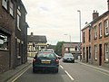
 Belper Road Ashbourne - geograph.org.uk - 3531041.jpg 640 × 514; 110 KB
-
 Belper road entering Ashbourne - geograph.org.uk - 3531037.jpg 640 × 377; 60 KB
-
 Bench mark, 1 Church Street, Ashbourne - geograph.org.uk - 5306578.jpg 1,280 × 1,280; 434 KB
-
 Bench mark, Ashbourne Town Hall - geograph.org.uk - 5306586.jpg 1,280 × 960; 519 KB
-
 Bench mark, Dovehouse Green - geograph.org.uk - 5306597.jpg 1,280 × 960; 524 KB
-
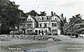 Birdsgrove House near Ashbourne postcard.jpg 1,600 × 1,000; 253 KB
-

-

-
 Bowling Green Inn - geograph.org.uk - 5497944.jpg 1,280 × 858; 752 KB
-
 Brick built terraced cottages, Mayfield Road - geograph.org.uk - 2769409.jpg 3,648 × 2,736; 4.44 MB
-
 Bridge on Compton Street Ashbourne - geograph.org.uk - 703117.jpg 640 × 427; 268 KB
-
 Bridge over Henmore Brook - geograph.org.uk - 5498945.jpg 1,280 × 1,042; 1.15 MB
-

-
 Bridge over Henmore Brook, Ashbourne - geograph.org.uk - 2294832.jpg 3,648 × 2,736; 5.51 MB
-
 Buildings facing market place, Ashbourne - geograph.org.uk - 4213871.jpg 1,920 × 1,261; 523 KB
-
 Buildings on Compton Street - geograph.org.uk - 5499006.jpg 1,280 × 716; 628 KB
-

-
 Buxton Hill - geograph.org.uk - 5350785.jpg 2,000 × 1,333; 2.3 MB
-
 Buxton Road - geograph.org.uk - 5007772.jpg 5,184 × 3,456; 1.87 MB
-
 Buxton Road - geograph.org.uk - 5496803.jpg 1,280 × 1,013; 952 KB
-
 Buxton Road 1 in 7 - geograph.org.uk - 5496697.jpg 1,280 × 960; 1.07 MB
-
 Buxton Road, Ashbourne - geograph.org.uk - 5306592.jpg 1,280 × 960; 324 KB
-
 Buxton Road, Ashbourne, Derbys. - geograph.org.uk - 3620542.jpg 4,032 × 2,587; 2.48 MB
-
 Buxton Road, Ashbourne, Derbys. - geograph.org.uk - 3620548.jpg 3,526 × 3,005; 1.77 MB
-
 C W Sellors Fine Jewellery.jpg 1,280 × 960; 142 KB
-
 Car show-room, and petrol station, Derby Road, Ashbourne - geograph.org.uk - 2588850.jpg 3,648 × 2,736; 4.45 MB
-
 Catherine Booth memorial - geograph.org.uk - 1723605.jpg 472 × 640; 129 KB
-
 Catherine Booth, Ashbourne - geograph.org.uk - 2017605.jpg 1,600 × 1,200; 487 KB
-
 Causing a splash - geograph.org.uk - 4029583.jpg 800 × 654; 170 KB
-
 Cemetery at Ashbourne - geograph.org.uk - 2769419.jpg 3,648 × 2,736; 5.7 MB
-
 Century Hall - Ashbourne - geograph.org.uk - 1455859.jpg 640 × 425; 81 KB
-
 Century Hall, Ashbourne - geograph.org.uk - 5704125.jpg 640 × 480; 80 KB
-
 Century Hall, Station Road, Ashbourne - geograph.org.uk - 5306602.jpg 1,280 × 960; 371 KB
-
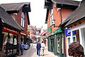
 Church St Ashbourne - geograph.org.uk - 4880723.jpg 640 × 480; 88 KB
-
 Church Street , Ashbourne - geograph.org.uk - 2188241.jpg 3,264 × 2,448; 3.81 MB
-
 Church Street - Ashbourne - geograph.org.uk - 1455845.jpg 640 × 425; 81 KB
-
 Church Street - geograph.org.uk - 1830084.jpg 640 × 480; 70 KB
-
 Church Street - geograph.org.uk - 3635195.jpg 640 × 426; 104 KB
-
 Church Street Ashbourne - geograph.org.uk - 1759189.jpg 3,264 × 2,448; 3.47 MB
-
 Church Street Ashbourne - geograph.org.uk - 5430107.jpg 1,600 × 1,200; 509 KB
-
 Church Street Ashbourne - geograph.org.uk - 5454276.jpg 2,000 × 1,333; 1.93 MB
-
 Church Street Ashbourne - geograph.org.uk - 5536865.jpg 2,000 × 1,333; 2.01 MB
-
 Church Street in Ashbourne - geograph.org.uk - 2630781.jpg 1,500 × 1,000; 241 KB
-
 Church Street, Ashbourne (5453365692).jpg 1,944 × 1,296; 536 KB
-
 Church Street, Ashbourne - geograph.org.uk - 2188232.jpg 3,264 × 2,448; 3.16 MB
-
 Church Street, Ashbourne - geograph.org.uk - 2188248.jpg 3,264 × 2,448; 3.37 MB
-
 Church Street, Ashbourne - geograph.org.uk - 2440037.jpg 800 × 600; 272 KB
-
 Church Street, Ashbourne - geograph.org.uk - 4741919.jpg 1,280 × 851; 265 KB
-
 Church Street, Ashbourne - geograph.org.uk - 4743803.jpg 851 × 1,280; 264 KB
-
 Church Street, Ashbourne - geograph.org.uk - 5306605.jpg 1,280 × 983; 283 KB
-
 Church Street, Ashbourne - geograph.org.uk - 5704121.jpg 640 × 480; 101 KB
-
 Church Street, Ashbourne, Derbys. - geograph.org.uk - 3623320.jpg 3,593 × 2,596; 2.15 MB
-
 Clifton Road, Ashbourne, Derbys. - geograph.org.uk - 3624334.jpg 2,949 × 2,246; 1.44 MB
-
 Clockmaker's Workshop, Ashbourne - geograph.org.uk - 5894950.jpg 640 × 480; 82 KB
-
 Coach & Horses - geograph.org.uk - 5214788.jpg 1,280 × 912; 240 KB
-
 Compton Area, Ashbourne, Derbys. - geograph.org.uk - 3624490.jpg 3,243 × 1,774; 1.19 MB
-
 Compton Street - Ashbourne - geograph.org.uk - 1455839.jpg 640 × 425; 68 KB
-
 Corner of Market Place, Ashbourne - geograph.org.uk - 1879352.jpg 3,648 × 2,736; 2.49 MB
-
 Corner shop, Springfield Avenue, Ashbourne - geograph.org.uk - 2588845.jpg 3,648 × 2,736; 4.31 MB
-
 Cottages on Derby Road, Ashbourne - geograph.org.uk - 2588856.jpg 2,430 × 1,824; 1,000 KB
-
 Coxon's Yard, Ashbourne - geograph.org.uk - 4213924.jpg 1,920 × 2,597; 688 KB
-
 Crossing the A52 Asbourne bypass - geograph.org.uk - 3611776.jpg 533 × 800; 81 KB
-
 Crossing the Henmore, Ashbourne - geograph.org.uk - 1716702.jpg 3,264 × 2,448; 4.54 MB
-
 Croxon's Yard Vicinity, Ashbourne, Derbys. - geograph.org.uk - 5794967.jpg 2,956 × 3,942; 3.02 MB
-
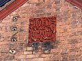 Datestone, former gasworks building, Ashbourne - geograph.org.uk - 5307348.jpg 1,280 × 960; 454 KB
-
 Demolished St Oswald's Hospital in Ashbourne - geograph.org.uk - 3917228.jpg 3,708 × 2,472; 1.84 MB
-
 Derby road Sturston Road junction - geograph.org.uk - 2508811.jpg 640 × 488; 76 KB
-
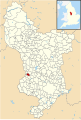 Derbyshire UK parish map highlighting Ashbourne.svg 888 × 1,308; 2.34 MB
-
 Dig Street - geograph.org.uk - 5498887.jpg 1,280 × 843; 784 KB
-
 Digging up a field for housing - geograph.org.uk - 5728057.jpg 1,280 × 960; 427 KB
-
 Dip in the trail - geograph.org.uk - 944073.jpg 640 × 480; 101 KB
-
 Disused George VI postbox - geograph.org.uk - 5497930.jpg 1,280 × 960; 1.33 MB
-
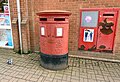 Double postbox (DE6 801 and DE6 1404) - geograph.org.uk - 5499054.jpg 1,280 × 870; 974 KB
-
 Dove Service Station, Mayfield Road - geograph.org.uk - 2769404.jpg 3,648 × 2,736; 4.58 MB
-
-
 Down'Ards Goal.jpg 4,000 × 3,000; 3.88 MB
-
 Dwelling on Derby Road - geograph.org.uk - 3686201.jpg 3,840 × 2,772; 1.89 MB
-
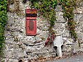
 Edward VII Post Box - geograph.org.uk - 5454275.jpg 1,333 × 2,000; 2.39 MB
-
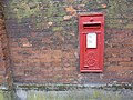 Edward VII post box, Church Street - geograph.org.uk - 2769445.jpg 3,648 × 2,736; 5.88 MB
-
 Entering Ashbourne on the A515 - geograph.org.uk - 2389291.jpg 640 × 480; 46 KB
-
 Farm buildings, Mayfield Road - geograph.org.uk - 2769398.jpg 3,648 × 2,736; 5.73 MB
-
 Flag-bedecked Dig Street - geograph.org.uk - 3917943.jpg 3,872 × 2,592; 3.38 MB
-
 Flats in Ashbourne - geograph.org.uk - 5350761.jpg 2,000 × 1,333; 2.44 MB
-
 Footpath to George Street - geograph.org.uk - 4851715.jpg 1,280 × 960; 436 KB
-
 Footpath to Sainsbury's - geograph.org.uk - 5214760.jpg 1,280 × 853; 549 KB
-
 Footpath to St John's Street - geograph.org.uk - 2630792.jpg 1,500 × 1,000; 264 KB
-
 Former Ashbourne Council Offices - geograph.org.uk - 5498966.jpg 1,280 × 1,974; 1.52 MB
-
 Former Ashbourne Council Offices - geograph.org.uk - 6262378.jpg 2,000 × 3,008; 3.29 MB
-
 Former Ashbourne Council Offices, architectural detail - geograph.org.uk - 5499012.jpg 1,280 × 2,098; 2.09 MB
-
 Former bus garage, Ashbourne - geograph.org.uk - 5306722.jpg 1,280 × 960; 275 KB
-
 Former gasworks building, Ashbourne - geograph.org.uk - 5307349.jpg 1,280 × 916; 349 KB
-
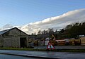
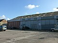
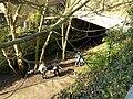
 Former Railway Goods Shed, Ashbourne.jpg 640 × 480; 54 KB
-

-
 Garden wall at Lloyds Bank, Ashbourne.jpg 4,000 × 3,000; 4.7 MB
-
 General View - geograph.org.uk - 362846.jpg 640 × 480; 78 KB
-
 Georgian street in Ashbourne - geograph.org.uk - 2389311.jpg 640 × 480; 76 KB
-
 Gingerbread Shop, Ashbourne.jpg 1,280 × 884; 883 KB
-

-
 Going into the dark - geograph.org.uk - 5306600.jpg 1,280 × 960; 661 KB
-
 Henmoor Brook, Ashbourne, Derbys. - geograph.org.uk - 3624554.jpg 2,838 × 3,837; 2.26 MB
-
 Henmore Brook - Ashbourne - geograph.org.uk - 1455833.jpg 640 × 440; 109 KB
-
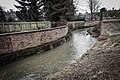
 Henmore Brook - geograph.org.uk - 5007777.jpg 5,184 × 3,456; 1.7 MB
-
 Henmore Brook - geograph.org.uk - 5498930.jpg 1,280 × 960; 1.23 MB
-
 Henmore Brook - geograph.org.uk - 5499039.jpg 1,280 × 960; 1.05 MB
-
 Henmore Brook - geograph.org.uk - 5721791.jpg 640 × 427; 130 KB


.jpg)
.jpg)
.jpg)
.jpg)
.jpg)


.jpg)


.jpg)

.jpg)
.jpg)
.jpg)
.jpg)
.jpg)
_-_geograph.org.uk_-_3462629.jpg)


_-_geograph.org.uk_-_2482139.jpg)


.jpg)


.jpg)


_-_geograph.org.uk_-_5499054.jpg)


