Category:Aspley Heath
village and civil parish in the Central Bedfordshire district of Bedfordshire, England | |||||
| Upload media | |||||
| Instance of | |||||
|---|---|---|---|---|---|
| Location | Central Bedfordshire, Bedfordshire, East of England, England | ||||
| Different from | |||||
 | |||||
English: Aspley Heath is a village and civil parish in the Central Bedfordshire district of Bedfordshire, England. According to the 2001 census the parish had a population of 573. The village is nearby Aspley Guise and Woburn. It also borders Woburn Sands village and parish, which is in the borough of Milton Keynes in Buckinghamshire.
Subcategories
This category has only the following subcategory.
A
Media in category "Aspley Heath"
The following 74 files are in this category, out of 74 total.
-
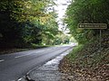 A5130 near Woburn - geograph.org.uk - 3190602.jpg 640 × 480; 116 KB
-
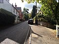
 Another view of Sandy Lane - geograph.org.uk - 4452903.jpg 3,264 × 2,448; 2.74 MB
-
 Around Aspley Heath - geograph.org.uk - 5148031.jpg 480 × 640; 59 KB
-
 Around Aspley Heath - geograph.org.uk - 5148033.jpg 640 × 480; 99 KB
-
 Around Old Wavendon Heath - geograph.org.uk - 5147987.jpg 640 × 480; 102 KB
-
 Around Old Wavendon Heath - geograph.org.uk - 5147988.jpg 640 × 480; 81 KB
-
 Around Old Wavendon Heath - geograph.org.uk - 5147989.jpg 640 × 480; 115 KB
-
 Around Old Wavendon Heath - geograph.org.uk - 5147996.jpg 640 × 480; 123 KB
-
 Around Old Wavendon Heath - geograph.org.uk - 5147998.jpg 480 × 640; 124 KB
-
 Around Old Wavendon Heath - geograph.org.uk - 5147999.jpg 480 × 640; 87 KB
-
 Around Old Wavendon Heath - geograph.org.uk - 5148001.jpg 480 × 640; 104 KB
-
 Around Old Wavendon Heath - geograph.org.uk - 5148002.jpg 640 × 480; 92 KB
-
 Around Old Wavendon Heath - geograph.org.uk - 5148005.jpg 640 × 480; 121 KB
-
 Around Old Wavendon Heath - geograph.org.uk - 5148007.jpg 480 × 640; 126 KB
-
 Around Old Wavendon Heath - geograph.org.uk - 5148010.jpg 480 × 640; 129 KB
-
 Around Old Wavendon Heath - geograph.org.uk - 5148013.jpg 640 × 480; 114 KB
-
 Around Old Wavendon Heath - geograph.org.uk - 5148014.jpg 640 × 480; 105 KB
-
 Around Woburn Sands - geograph.org.uk - 5148028.jpg 480 × 640; 96 KB
-
 Aspley Heath car park - geograph.org.uk - 5147985.jpg 640 × 480; 101 KB
-
 Aspley Hill - geograph.org.uk - 2339358.jpg 640 × 430; 78 KB
-
 Aspley Hill at Woburn Sands - geograph.org.uk - 5237584.jpg 5,184 × 3,456; 6.72 MB
-
 Bench on the bridleway to Wavendon Heath - geograph.org.uk - 3017730.jpg 1,600 × 1,068; 679 KB
-
 Bridleway and cycle track in New Wavendon Hetah - geograph.org.uk - 3017756.jpg 1,200 × 1,600; 661 KB
-
 Bridleway in New Wavendon Heath - geograph.org.uk - 3017748.jpg 1,200 × 1,600; 763 KB
-
 Bridleway towards Horsemoor Farm - geograph.org.uk - 3017734.jpg 1,200 × 1,600; 706 KB
-
 Construction on Sandy Lane - geograph.org.uk - 4452896.jpg 3,264 × 2,448; 3.71 MB
-
 Cuckoo Pint leaves - geograph.org.uk - 367497.jpg 640 × 480; 197 KB
-
 Edgewick Farm - geograph.org.uk - 5148024.jpg 640 × 480; 120 KB
-
 Fenced lane - geograph.org.uk - 367495.jpg 640 × 389; 165 KB
-
 Fenced lane meets Woburn Road - geograph.org.uk - 371505.jpg 640 × 383; 199 KB
-
 Fir Tree Inn, Woburn Sands - geograph.org.uk - 5237587.jpg 5,202 × 3,465; 3.91 MB
-

-

-
 Fuller's Earth Lodge - geograph.org.uk - 5147990.jpg 480 × 640; 107 KB
-
 Fuller's Earth Lodge - geograph.org.uk - 5147991.jpg 640 × 480; 144 KB
-
 Fuller's Earth Lodge - geograph.org.uk - 5147992.jpg 640 × 480; 98 KB
-
 Fuller's Earth Lodge - geograph.org.uk - 5147993.jpg 640 × 480; 94 KB
-
 Green lane to Aspley Heath - geograph.org.uk - 870578.jpg 640 × 480; 130 KB
-
 Heath Lane, Aspley Heath - geograph.org.uk - 5148044.jpg 640 × 480; 121 KB
-
 Heath Lane, Aspley Heath - geograph.org.uk - 5148046.jpg 640 × 480; 110 KB
-
 Heath Lane, Aspley Heath - geograph.org.uk - 5148048.jpg 640 × 480; 93 KB
-
 Longslade Cottage - geograph.org.uk - 3312167.jpg 640 × 480; 62 KB
-
 Looking through the woods to Kiln Ground - geograph.org.uk - 373536.jpg 640 × 480; 204 KB
-
 Milton Keynes Boundary Walk, Aspley Woods - geograph.org.uk - 373548.jpg 640 × 480; 186 KB
-
 Mini roundabout on Woburn Road, Woburn Sands - geograph.org.uk - 3073633.jpg 1,600 × 1,200; 553 KB
-
 Near Longslade Cottage - geograph.org.uk - 5204117.jpg 640 × 640; 164 KB
-
 New build - geograph.org.uk - 5148034.jpg 640 × 480; 82 KB
-
 Off Werth Drive - geograph.org.uk - 5148039.jpg 480 × 640; 115 KB
-
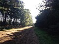
 Old Wavendon Heath - geograph.org.uk - 1323677.jpg 640 × 427; 255 KB
-
 On New Wavendon Heath - geograph.org.uk - 5204107.jpg 640 × 640; 123 KB
-
 On New Wavendon Heath - geograph.org.uk - 5204108.jpg 640 × 640; 135 KB
-
 On New Wavendon Heath - geograph.org.uk - 5204109.jpg 640 × 640; 116 KB
-
 On New Wavendon Heath - geograph.org.uk - 5204110.jpg 640 × 640; 123 KB
-
 On New Wavendon Heath - geograph.org.uk - 5204112.jpg 640 × 640; 109 KB
-
 On New Wavendon Heath - geograph.org.uk - 5204114.jpg 640 × 640; 146 KB
-
 On New Wavendon Heath - geograph.org.uk - 5204116.jpg 640 × 640; 162 KB
-
 On New Wavendon Heath - geograph.org.uk - 5204123.jpg 640 × 640; 144 KB
-
 On New Wavendon Heath - geograph.org.uk - 5204124.jpg 640 × 640; 167 KB
-
 On New Wavendon Heath - geograph.org.uk - 5204125.jpg 640 × 640; 122 KB
-
 On New Wavendon Heath - geograph.org.uk - 5204128.jpg 640 × 640; 142 KB
-
 On New Wavendon Heath - geograph.org.uk - 5204134.jpg 640 × 640; 158 KB
-
 On New Wavendon Heath - geograph.org.uk - 5204136.jpg 640 × 640; 169 KB
-
 Parking area on Newport Road, Aspley Heath - geograph.org.uk - 6199760.jpg 2,034 × 1,526; 2.48 MB
-
 Path across Wavendon Heath - geograph.org.uk - 3017733.jpg 1,200 × 1,600; 641 KB
-
 Path near Woburn - geograph.org.uk - 5204122.jpg 640 × 640; 154 KB
-
 Path up to Hundreds Farm - geograph.org.uk - 3017766.jpg 1,600 × 1,067; 666 KB
-
 Road towards Bow Brickhill - geograph.org.uk - 836068.jpg 640 × 480; 118 KB
-
 Sandy Lane, Woburn Sands - geograph.org.uk - 4452886.jpg 3,264 × 2,448; 3.95 MB
-
 Stile into New Wavendon Heath - geograph.org.uk - 367435.jpg 640 × 624; 202 KB
-
 The Fir Tree Inn and High Street, Woburn Sands - geograph.org.uk - 3851595.jpg 4,320 × 3,240; 3.69 MB
-
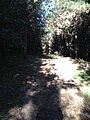
 Track through New Wavendon Heath - geograph.org.uk - 367427.jpg 640 × 470; 171 KB
-
 Werth Drive - geograph.org.uk - 5148038.jpg 640 × 480; 115 KB
-
 Woburn Sands Telephone Exchange (1) - geograph.org.uk - 2983882.jpg 3,072 × 2,304; 1.79 MB
-
 Woburn Sands Telephone Exchange (2) - geograph.org.uk - 2983904.jpg 640 × 480; 99 KB


_-_geograph.org.uk_-_2983882.jpg)
_-_geograph.org.uk_-_2983904.jpg)