Category:Assembly constituency maps of Indian States and Union Territories
Deutsch: Diese Kategorie enthält Wahlkreiskarten der einzelnen indischen Bundesstaaten und Unionsterritorien für die Wahlen zu den Regionalparlamenten (sofern welche existieren).
English: This category includes constituency maps of Indian states and Union Territories for local legislative assembly (Vidhan Sabha) elections.
These files can be used as templates for creating election maps.
These files can be used as templates for creating election maps.
Subcategories
This category has the following 6 subcategories, out of 6 total.
M
Media in category "Assembly constituency maps of Indian States and Union Territories"
The following 59 files are in this category, out of 59 total.
-
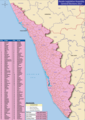 2021 Kerala Legislative Assembly Election Map.png 1,258 × 1,780; 1.03 MB
-
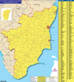 2021 Tamil Nadu Legislative Assembly Election Map.png 1,600 × 1,780; 1.67 MB
-
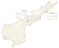
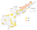
 Andhra Pradesh Vidhan Sabha constituency map.svg 512 × 439; 1.59 MB
-
 Assembly constituencies in Gurdaspur lokshaba constituency.png 302 × 211; 25 KB
-
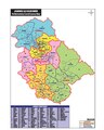 J&K AC map new.pdf 1,122 × 1,406; 968 KB
-
 J&K AC new formatted.png 904 × 945; 83 KB
-
 KERALA CONSTITUENCIES WITH DISTRICT BOUNDARIES.svg 2,105 × 2,980; 3.01 MB
-
 Legislative assembly constituencies in Kerala.svg 3,283 × 3,725; 2.47 MB
-
-
 Legislative Assembly constituencies of Kerala (blank).svg 580 × 1,102; 1.56 MB
-
 Legislative Assembly constituencies of Mizoram (blank).svg 657 × 791; 345 KB
-
 Legislative Assembly constituencies of Tripura (blank).svg 453 × 681; 1.02 MB
-
 Puducherry Electoral Constituencies Map.svg 1,493 × 813; 590 KB
-
 Map of Assembly Constituencies of Punjab, India in 2022.jpg 2,948 × 4,102; 1.71 MB
-
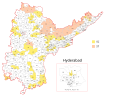
 Telangana Vidhan Sabha constituency map.svg 512 × 508; 502 KB
-
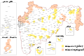 Vidhan Sabha constituencies in Maharashtra ta.svg 1,468 × 980; 5.94 MB
-
 Vidhan Sabha constituencies in Tripura.jpg 1,225 × 2,165; 453 KB
-
 Vidhan Sabha constituencies of Madhya Pradesh (blank).svg 1,281 × 1,000; 6.93 MB
-
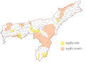
 Wahlkreise zur Vidhan Sabha von Andhra Pradesh (2008-2014).svg 1,182 × 947; 928 KB
-
 Wahlkreise zur Vidhan Sabha von Andhra Pradesh (2014-).svg 974 × 787; 363 KB
-
 Wahlkreise zur Vidhan Sabha von Arunachal Pradesh.svg 1,032 × 509; 164 KB
-
 Wahlkreise zur Vidhan Sabha von Assam-as.svg 978 × 729; 1.13 MB
-
 Wahlkreise zur Vidhan Sabha von Assam-bn.svg 978 × 729; 1.13 MB
-
 Wahlkreise zur Vidhan Sabha von Assam.svg 978 × 729; 673 KB
-
 Wahlkreise zur Vidhan Sabha von Bihar.svg 1,280 × 953; 2.63 MB
-
 Wahlkreise zur Vidhan Sabha von Chhattisgarh.svg 913 × 1,024; 3.16 MB
-
 Wahlkreise zur Vidhan Sabha von Delhi.svg 871 × 934; 216 KB
-
 Wahlkreise zur Vidhan Sabha von Goa.svg 600 × 680; 642 KB
-
 Wahlkreise zur Vidhan Sabha von Gujarat gu.svg 1,420 × 1,080; 6.66 MB
-
 Wahlkreise zur Vidhan Sabha von Gujarat.svg 1,420 × 1,080; 6.66 MB
-
 Wahlkreise zur Vidhan Sabha von Haryana.svg 650 × 768; 2.59 MB
-
 Wahlkreise zur Vidhan Sabha von Himachal Pradesh.svg 743 × 741; 1.28 MB
-
 Wahlkreise zur Vidhan Sabha von Jammu & Kashmir (2014).svg 1,048 × 817; 770 KB
-
 Wahlkreise zur Vidhan Sabha von Jharkhand.svg 944 × 768; 1.77 MB
-
 Wahlkreise zur Vidhan Sabha von Karnataka.svg 1,232 × 1,310; 2.14 MB
-
 Wahlkreise zur Vidhan Sabha von Kerala.svg 845 × 1,150; 1.55 MB
-
 Wahlkreise zur Vidhan Sabha von Madhya Pradesh.png 2,453 × 1,853; 881 KB
-
 Wahlkreise zur Vidhan Sabha von Madhya Pradesh.svg 1,281 × 1,000; 4.34 MB
-
 Wahlkreise zur Vidhan Sabha von Maharashtra mr.svg 1,468 × 980; 4.31 MB
-
 Wahlkreise zur Vidhan Sabha von Maharashtra.svg 1,468 × 980; 4.31 MB
-
 Wahlkreise zur Vidhan Sabha von Manipur.svg 706 × 750; 1.59 MB
-
 Wahlkreise zur Vidhan Sabha von Meghalaya.svg 1,102 × 512; 233 KB
-
 Wahlkreise zur Vidhan Sabha von Mizoram.svg 657 × 791; 104 KB
-
 Wahlkreise zur Vidhan Sabha von Nagaland.svg 700 × 650; 333 KB
-
 Wahlkreise zur Vidhan Sabha von Odisha.svg 1,044 × 831; 686 KB
-
 Wahlkreise zur Vidhan Sabha von Puducherry.svg 750 × 900; 209 KB
-
 Wahlkreise zur Vidhan Sabha von Punjab.svg 610 × 650; 3.38 MB
-
 Wahlkreise zur Vidhan Sabha von Rajasthan.svg 1,120 × 1,020; 1,019 KB
-
 Wahlkreise zur Vidhan Sabha von Sikkim.svg 632 × 679; 58 KB
-
 Wahlkreise zur Vidhan Sabha von Tamil Nadu.svg 1,262 × 1,206; 5.64 MB
-
 Wahlkreise zur Vidhan Sabha von Telangana.svg 862 × 739; 231 KB
-
 Wahlkreise zur Vidhan Sabha von Tripura.svg 600 × 730; 283 KB
-
 Wahlkreise zur Vidhan Sabha von Uttar Pradesh.svg 1,369 × 1,338; 9.57 MB
-
 Wahlkreise zur Vidhan Sabha von Uttarakhand.svg 825 × 750; 566 KB
-
 Wahlkreise zur Vidhan Sabha von Westbengalen-bn.svg 1,018 × 1,262; 6.08 MB
-
 Wahlkreise zur Vidhan Sabha von Westbengalen.svg 1,091 × 1,310; 6.05 MB
-
 West Bengal Legislative Assembly General Election 2021 -Phase wise.svg 1,269 × 1,278; 9.29 MB
-
 আসামের বিধানসভা কেন্দ্র.svg 978 × 729; 1.11 MB
-
 ত্রিপুরার বিধানসভা কেন্দ্র.svg 600 × 730; 1.04 MB


.svg)
.svg)


.svg)


_(blank).svg)
.svg)
.svg)
.svg)
.svg)