Category:Asthall
village and civil parish in West Oxfordshire, England .JPG) | |||||
| Upload media | |||||
| Instance of | |||||
|---|---|---|---|---|---|
| Location | West Oxfordshire, Oxfordshire, South East England, England | ||||
| Located in or next to body of water | |||||
| Population |
| ||||
| Area |
| ||||
 | |||||
Subcategories
This category has the following 4 subcategories, out of 4 total.
Media in category "Asthall"
The following 123 files are in this category, out of 123 total.
-
 'Palladian Way' footpath approaching a copse - geograph.org.uk - 5284553.jpg 1,024 × 683; 232 KB
-
 'Stonefold' beside minor road north of Worsham - geograph.org.uk - 5278124.jpg 1,024 × 683; 231 KB
-
-
 'The Valley' - geograph.org.uk - 5252000.jpg 1,024 × 683; 172 KB
-
 A country seat - geograph.org.uk - 3985601.jpg 640 × 480; 146 KB
-

-

-

-
 Approaching Asthall Leigh from the southwest - geograph.org.uk - 5251990.jpg 1,024 × 683; 207 KB
-

-

-
 Avenue of trees at Asthall - geograph.org.uk - 1155090.jpg 451 × 640; 197 KB
-
 Old Crown Cottage, Asthall Leigh - geograph.org.uk - 790972.jpg 640 × 427; 102 KB
-

-
 Road closed at Asthall - geograph.org.uk - 1155082.jpg 640 × 440; 129 KB
-
 Tree lined lane at Asthall - geograph.org.uk - 791008.jpg 640 × 427; 129 KB
-
 Asthall and St Nicholas' church - geograph.org.uk - 3929385.jpg 4,320 × 3,240; 3.36 MB
-
 Asthall church - geograph.org.uk - 5878163.jpg 1,024 × 768; 213 KB
-
 Asthall Manor - geograph.org.uk - 5462312.jpg 3,532 × 2,354; 1.85 MB
-
 Asthall Manor - geograph.org.uk - 5879136.jpg 1,024 × 768; 194 KB
-
 Asthall, Oxfordshire - geograph.org.uk - 317837.jpg 640 × 480; 103 KB
-
 Asthall, St. Nicholas' Church - geograph.org.uk - 5462150.jpg 4,179 × 2,787; 3.64 MB
-
 Asthall, St. Nicholas' Church - geograph.org.uk - 5462306.jpg 4,272 × 2,848; 2.7 MB
-
-

-

-
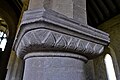
 Asthall, St. Nicholas' Church, Capital - geograph.org.uk - 5462175.jpg 4,352 × 2,902; 2.46 MB
-
-

-

-

-

-

-

-

-
-

-

-

-

-
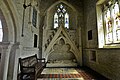
 Asthall, St. Nicholas' Church, The Cornwell Chantry entrance - geograph.org.uk - 5462282.jpg 3,879 × 2,586; 1.75 MB
-
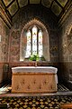
 Asthall, St. Nicholas' Church, The font - geograph.org.uk - 5462277.jpg 4,871 × 3,247; 2.71 MB
-
 Asthall, St. Nicholas' Church, The organ - geograph.org.uk - 5462161.jpg 5,319 × 3,547; 3.09 MB
-

-
 Benchmark on 'Old Cottage' - geograph.org.uk - 5251969.jpg 683 × 1,024; 210 KB
-
 Benchmark on 'The Cottage', Worsham - geograph.org.uk - 5284489.jpg 683 × 1,024; 229 KB
-
 Benchmark on 'The Valley' - geograph.org.uk - 5251997.jpg 1,024 × 683; 259 KB
-
 Benchmark on Asthall Barrow Farm - geograph.org.uk - 5284164.jpg 683 × 1,024; 236 KB
-
-
 Benchmark on Worsham Turn Cottage - geograph.org.uk - 5289799.jpg 683 × 1,024; 318 KB
-
 Bend in road near Bangry Bottom - geograph.org.uk - 5251777.jpg 1,024 × 683; 299 KB
-
 Bridge over River Windrush - geograph.org.uk - 4416364.jpg 640 × 480; 145 KB
-
 Burford Road (B4047) - geograph.org.uk - 2512929.jpg 640 × 480; 59 KB
-
 Burford Road near the A40 - geograph.org.uk - 4017012.jpg 1,500 × 646; 100 KB
-
 Country lane junction - geograph.org.uk - 3985614.jpg 640 × 480; 127 KB
-
 Derelict shed - geograph.org.uk - 2462089.jpg 640 × 480; 90 KB
-
 Derelict shed near Dodds Farm - geograph.org.uk - 2462106.jpg 640 × 480; 126 KB
-

-
 Entering Field Assarts - geograph.org.uk - 3985625.jpg 640 × 480; 109 KB
-

-
 Farmhouse at Asthall Barrow Farm, Burford Road - geograph.org.uk - 5284177.jpg 1,024 × 683; 200 KB
-
 Field Assarts, Oxfordshire - geograph.org.uk - 1850038.jpg 3,008 × 2,000; 1.54 MB
-
 Field beside the River Windrush - geograph.org.uk - 5879161.jpg 1,024 × 768; 247 KB
-
 Green triangle junction in Field Assarts - geograph.org.uk - 6286016.jpg 1,920 × 1,280; 1.24 MB
-
 Holywell Barn - geograph.org.uk - 5238036.jpg 4,000 × 3,000; 4.81 MB
-

-
 Junction on the A40 - geograph.org.uk - 1516075.jpg 640 × 427; 49 KB
-
 Junction to the B4047 on the A40 near Asthall - geograph.org.uk - 3577752.jpg 1,548 × 1,128; 720 KB
-
 Junctions ahead on Burford Road - geograph.org.uk - 2512931.jpg 640 × 480; 68 KB
-
 Kitesbridge Farm - geograph.org.uk - 5238043.jpg 3,879 × 2,719; 6.29 MB
-
 Lane to Asthall - geograph.org.uk - 4416336.jpg 640 × 480; 105 KB
-
 Lane to Asthall Leigh and beyond - geograph.org.uk - 3985595.jpg 640 × 480; 147 KB
-
 Lane to Minster Lovell - geograph.org.uk - 3985587.jpg 640 × 480; 179 KB
-
 May blossom - geograph.org.uk - 3985607.jpg 640 × 480; 145 KB
-

-
 Old Cottage - geograph.org.uk - 5251973.jpg 1,024 × 683; 223 KB
-
 Path nearing Asthall Farm - geograph.org.uk - 2777625.jpg 640 × 480; 70 KB
-

-
 Postbox at Field Assarts - geograph.org.uk - 1850034.jpg 3,008 × 2,000; 1.46 MB
-
 River Windrush - geograph.org.uk - 2777605.jpg 640 × 480; 96 KB
-
 River Windrush - geograph.org.uk - 2777618.jpg 640 × 480; 97 KB
-
 River Windrush - geograph.org.uk - 2777629.jpg 640 × 480; 73 KB
-
 River Windrush - geograph.org.uk - 4416383.jpg 640 × 480; 138 KB
-
 Road from Asthall to Swinbrook - geograph.org.uk - 791023.jpg 640 × 427; 99 KB
-
 Road near Stonelands - geograph.org.uk - 1155072.jpg 640 × 427; 137 KB
-
 Road sign at Asthall Leigh - geograph.org.uk - 1550477.jpg 640 × 426; 46 KB
-
 Roundabout A40 and B4047, east of Burford - geograph.org.uk - 860742.jpg 640 × 480; 108 KB
-
 Sheds and pens for free range chickens - geograph.org.uk - 3055921.jpg 3,648 × 2,736; 2.11 MB
-
-

-
 Snow near Asthall - geograph.org.uk - 1155076.jpg 640 × 431; 105 KB
-
 St Nicholas' church, Asthall - geograph.org.uk - 2706369.jpg 2,592 × 1,944; 1.49 MB
-
 Stone cottage in Asthall Leigh - geograph.org.uk - 3929342.jpg 4,320 × 3,240; 3.41 MB
-
 Swan Cottages - geograph.org.uk - 5251809.jpg 1,024 × 683; 177 KB
-
 The lane from Minster Lovell to Asthall Leigh - geograph.org.uk - 3001933.jpg 2,592 × 1,944; 1.92 MB
-
 The lane to Asthall - geograph.org.uk - 2706366.jpg 2,592 × 1,944; 1.35 MB
-

-
 The Maytime Inn, Asthall - geograph.org.uk - 3161205.jpg 640 × 479; 98 KB
-
 The Maytime Inn, Asthall - geograph.org.uk - 5856572.jpg 1,600 × 1,200; 665 KB
-
 The River Windrush at Worsham - geograph.org.uk - 3001913.jpg 2,592 × 1,944; 1.73 MB
-
 The road from Worsham - geograph.org.uk - 3001920.jpg 2,592 × 1,944; 1.95 MB
-
 The road into Asthall from the east - geograph.org.uk - 860801.jpg 640 × 480; 136 KB
-
 The Swinbrook - Asthall Leigh - Worsham junction - geograph.org.uk - 3001924.jpg 2,592 × 1,944; 1.65 MB
-
 The Windmill Restaurant, Asthall - geograph.org.uk - 4199800.jpg 1,396 × 1,000; 964 KB
-
 Un-named lane crossroads with Riding Lane and Akeman Street - geograph.org.uk - 3059582.jpg 3,648 × 2,736; 1.88 MB
-
 Un-named lane south of Oak Pollard - geograph.org.uk - 3055915.jpg 3,648 × 2,736; 2.46 MB
-
 View across the fields - geograph.org.uk - 1516087.jpg 640 × 427; 46 KB
-
 Watertanks opposite Little Kilkenny - geograph.org.uk - 294657.jpg 427 × 640; 60 KB
-
 West Oxfordshire , Grassy Field - geograph.org.uk - 6113453.jpg 6,000 × 4,000; 7.46 MB
-
 West Oxfordshire , The A40 - geograph.org.uk - 6113454.jpg 6,000 × 4,000; 7.85 MB
-
 Woods and fields in the Windrush Valley - geograph.org.uk - 4017021.jpg 1,500 × 861; 85 KB
-
 Worsham Source works - geograph.org.uk - 2777612.jpg 640 × 480; 98 KB
-
 Worsham Turn Cottage - geograph.org.uk - 5289807.jpg 1,024 × 683; 185 KB
-
-
 A40 Witney bypass - geograph.org.uk - 293490.jpg 640 × 427; 58 KB
-
 Bekstone Quarry - geograph.org.uk - 294661.jpg 640 × 427; 65 KB
-
 Bridge near Asthall - geograph.org.uk - 327323.jpg 640 × 427; 101 KB
-
 Disused quarry - geograph.org.uk - 327333.jpg 640 × 480; 132 KB
-
 Footpath and hedge, Stonelands - geograph.org.uk - 346864.jpg 640 × 425; 147 KB
-
 Kitesbridge Farm - geograph.org.uk - 327325.jpg 640 × 480; 133 KB
-
 Kitesbridge Farm - geograph.org.uk - 327331.jpg 640 × 480; 131 KB
-
 Stonefold - geograph.org.uk - 308499.jpg 640 × 480; 78 KB
-
 Windmill Carvery and Restaurant - geograph.org.uk - 293485.jpg 640 × 427; 76 KB


.jpg)


_heading_towards_Minster_Lovell_-_geograph.org.uk_-_5277578.jpg)


_-_geograph.org.uk_-_2512929.jpg)


