Category:Astley, Shropshire
English: Astley is a small village and parish in Shropshire, England. The official 2001 census recorded 454 people living in the parish and 116 in the village itself.
village and civil parish in Shropshire, UK  | |||||
| Upload media | |||||
| Instance of | |||||
|---|---|---|---|---|---|
| Location | Shropshire, West Midlands, England | ||||
 | |||||
Subcategories
This category has the following 2 subcategories, out of 2 total.
A
- St Mary's Church, Astley (11 F)
U
- Upper Battlefield (8 F)
Media in category "Astley, Shropshire"
The following 45 files are in this category, out of 45 total.
-
 A49 at Braidway Grange - geograph.org.uk - 2869100.jpg 640 × 480; 60 KB
-
 A49 crosses the Shropshire Way - geograph.org.uk - 2869103.jpg 640 × 480; 65 KB
-
 A49 enters Upper Battlefield - geograph.org.uk - 2869093.jpg 640 × 480; 47 KB
-
 A49 northbound at Braidway Grange - geograph.org.uk - 2959906.jpg 640 × 480; 81 KB
-
 Astley Court - geograph.org.uk - 2594714.jpg 1,600 × 1,200; 294 KB
-
 Battlefield Farm Lane, Battlefield - geograph.org.uk - 3578713.jpg 3,488 × 2,616; 3.16 MB
-
 Bings Farm. - geograph.org.uk - 623299.jpg 640 × 480; 104 KB
-
 Bridleway past Wheatley Farm - geograph.org.uk - 3953684.jpg 1,142 × 857; 332 KB
-
 Bridleway south of Wheatley - geograph.org.uk - 3953676.jpg 1,044 × 783; 458 KB
-
 Cereal field near Coppice Farm - geograph.org.uk - 5944961.jpg 1,024 × 768; 239 KB
-
 Cottages in Astley - geograph.org.uk - 2895666.jpg 1,142 × 857; 316 KB
-
 Country road approaching Ebury Hill - geograph.org.uk - 5944957.jpg 1,024 × 768; 228 KB
-

-
 Dog in the Lane, Upper Astley - geograph.org.uk - 590351.jpg 640 × 480; 196 KB
-
 Gravestone Edward Bonner - geograph.org.uk - 2690544.jpg 2,448 × 3,264; 1.34 MB
-
 Grazing near Battlefield Farm - geograph.org.uk - 6097578.jpg 800 × 561; 60 KB
-
 Greenhouse and nursery at The Hatch - geograph.org.uk - 2895526.jpg 1,142 × 857; 340 KB
-

-
 Hatch Lane, Astley - geograph.org.uk - 2895655.jpg 1,142 × 857; 344 KB
-
 Houses between Astley and Hadnall - geograph.org.uk - 2895671.jpg 1,142 × 857; 224 KB
-
 Houses on Shrewsbury Road - geograph.org.uk - 4885725.jpg 3,810 × 2,440; 1.5 MB
-

-
 Please use the other entrance - geograph.org.uk - 1036682.jpg 640 × 480; 111 KB
-
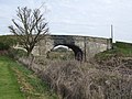 Railway Bridge at Battlefield Farm - geograph.org.uk - 1826326.jpg 640 × 480; 283 KB
-
 Roadside at Battlefield Grange - geograph.org.uk - 4885709.jpg 3,218 × 2,414; 898 KB
-
 Stream that needs a little TLC. - geograph.org.uk - 655581.jpg 640 × 480; 118 KB
-
 The old vicarage at Astley - geograph.org.uk - 2895649.jpg 1,142 × 857; 429 KB
-
 The Red Postbox. - geograph.org.uk - 623341.jpg 640 × 480; 132 KB
-
 Wheatle Farm Track - geograph.org.uk - 2423155.jpg 800 × 600; 151 KB
-
 Wheatley Farm from the south - geograph.org.uk - 3953680.jpg 1,142 × 857; 315 KB
-
 Along the straight and narrow - geograph.org.uk - 774480.jpg 640 × 426; 69 KB
-
 Cottage at Ebreywood. - geograph.org.uk - 623283.jpg 640 × 480; 89 KB
-
 Do as the sign says - geograph.org.uk - 701889.jpg 640 × 480; 91 KB
-
 Ebury Hill. - geograph.org.uk - 623267.jpg 640 × 480; 110 KB
-
 Entrance and drive to Astley House - geograph.org.uk - 590363.jpg 612 × 460; 209 KB
-
 Farm at Bings Heath - geograph.org.uk - 5256.jpg 640 × 480; 50 KB
-
 Footpath at Bings Heath - geograph.org.uk - 774477.jpg 640 × 426; 150 KB
-
 Hadnall - geograph.org.uk - 4743.jpg 640 × 480; 80 KB
-

-
 Hatch Lane looking north. - geograph.org.uk - 655573.jpg 640 × 480; 82 KB
-
 Houses beside a lane. - geograph.org.uk - 655580.jpg 640 × 480; 53 KB
-
 Shawbury Heath - geograph.org.uk - 346505.jpg 640 × 480; 141 KB
-
 Silver Birches at Shawbury Heath - geograph.org.uk - 701892.jpg 640 × 480; 114 KB
-

-
 The Red Phonebox. - geograph.org.uk - 623293.jpg 480 × 640; 108 KB


