Category:Auchinleck (civil parish)
Scottish parish in East Ayrshire, Scotland, UK | |||||
| Upload media | |||||
| Instance of | |||||
|---|---|---|---|---|---|
| Part of |
| ||||
| Named after | |||||
| Location |
| ||||
| Population |
| ||||
| Area |
| ||||
 | |||||
Subcategories
This category has the following 4 subcategories, out of 4 total.
A
C
L
Media in category "Auchinleck (civil parish)"
The following 200 files are in this category, out of 798 total.
(previous page) (next page)-
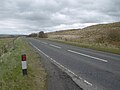
 A 76, a long straight, crossing Lugar Water - geograph.org.uk - 2005285.jpg 1,024 × 770; 111 KB
-
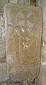
 A Hammerman Lies Here - geograph.org.uk - 6028816.jpg 496 × 640; 168 KB
-
 A Park in Cumnock - geograph.org.uk - 4715165.jpg 640 × 427; 140 KB
-
 A70 approaching Stonebriggs - geograph.org.uk - 4448067.jpg 640 × 360; 28 KB
-
 A70 approaching Thornwood Drive - geograph.org.uk - 4447815.jpg 640 × 414; 74 KB
-
 A70 at track below Green Knowe - geograph.org.uk - 4448111.jpg 640 × 373; 39 KB
-

-
 A70 by turning to opencast mines - geograph.org.uk - 4448059.jpg 640 × 352; 32 KB
-
 A70 east of Boghead - geograph.org.uk - 4000112.jpg 640 × 437; 75 KB
-
 A70 east of Lugar - geograph.org.uk - 3135339.jpg 1,200 × 797; 512 KB
-
 A70 eastbound by farm track - geograph.org.uk - 4000055.jpg 640 × 379; 35 KB
-
 A70 from Boghead - geograph.org.uk - 4448085.jpg 640 × 348; 40 KB
-
 A70 Muirkirk Road entering Lugar - geograph.org.uk - 3999853.jpg 640 × 407; 98 KB
-
 A70 Muirkirk Road westbound - geograph.org.uk - 3518352.jpg 640 × 481; 84 KB
-
 A70 near Cronberry - geograph.org.uk - 3135351.jpg 1,200 × 797; 383 KB
-
 A70 near Welltrees - geograph.org.uk - 4000102.jpg 640 × 436; 42 KB
-
 A70 running down to Welltrees Bridge - geograph.org.uk - 4448076.jpg 640 × 418; 38 KB
-
 A70 south of Cronberry - geograph.org.uk - 3516880.jpg 640 × 480; 65 KB
-
 A70 west of Boghead - geograph.org.uk - 3516878.jpg 640 × 480; 70 KB
-
 A70 westbound at Carbellow - geograph.org.uk - 3516879.jpg 640 × 481; 61 KB
-

-
 A70, Boghead - geograph.org.uk - 5224354.jpg 1,024 × 768; 267 KB
-
 A70, Boghead - geograph.org.uk - 5224403.jpg 1,024 × 768; 296 KB
-
 A70, Carbellow - geograph.org.uk - 5224172.jpg 1,024 × 768; 300 KB
-
 A70, Muirkirk Road - geograph.org.uk - 5224152.jpg 1,024 × 768; 454 KB
-
 A70, Stonebriggs - geograph.org.uk - 5224229.jpg 1,024 × 768; 287 KB
-
 A70, Welltrees Bridge - geograph.org.uk - 5224347.jpg 1,024 × 768; 292 KB
-
 A76 at bridge over Barony Road - geograph.org.uk - 3518418.jpg 640 × 480; 74 KB
-
 A76 near Darnlaw - geograph.org.uk - 3518427.jpg 640 × 481; 63 KB
-
 Abandoned farmhouse at High Dalblair - geograph.org.uk - 5621497.jpg 4,608 × 3,456; 5.12 MB
-
 Above Bankend - geograph.org.uk - 5224024.jpg 1,024 × 768; 330 KB
-
 Adam Bridge - geograph.org.uk - 5556134.jpg 1,024 × 768; 258 KB
-
 Adam Bridge over the Lugar Water - geograph.org.uk - 3436588.jpg 3,264 × 2,448; 6.63 MB
-
 Adam Bridge, Dumfries House Estate - geograph.org.uk - 5557587.jpg 1,024 × 768; 351 KB
-
 Air shaft - geograph.org.uk - 5165730.jpg 2,592 × 1,944; 2.46 MB
-
 Airds Moss - geograph.org.uk - 5224554.jpg 1,024 × 768; 347 KB
-
 Airds Moss from the air - geograph.org.uk - 5786565.jpg 1,024 × 717; 292 KB
-
 Alongside the Old Racecourse - geograph.org.uk - 5101955.jpg 2,592 × 1,944; 2.33 MB
-

-

-
 Approaching junction for Wallaceton - geograph.org.uk - 3999983.jpg 640 × 494; 85 KB
-
 Approaching the Entrance to the Walled Garden - geograph.org.uk - 5088210.jpg 1,920 × 1,280; 1.72 MB
-
 Arch, Queen Elizabeth Walled Garden - geograph.org.uk - 5492194.jpg 2,592 × 1,728; 3.62 MB
-
 Arch, Queen Elizabeth Walled Garden - geograph.org.uk - 5492195.jpg 2,592 × 1,728; 4.41 MB
-
 Arches, Queen Elizabeth Walled Garden - geograph.org.uk - 5492308.jpg 2,592 × 1,728; 3.45 MB
-
 Arches, Queen Elizabeth Walled Garden - geograph.org.uk - 5492311.jpg 2,592 × 1,728; 1.59 MB
-
 Arriving at Auchinleck - geograph.org.uk - 5185645.jpg 1,920 × 1,280; 1.76 MB
-
 Artic at The Avenue - geograph.org.uk - 5185655.jpg 1,920 × 1,280; 2.23 MB
-
 Assault Course and Maze - geograph.org.uk - 5185539.jpg 1,920 × 1,280; 2.02 MB
-
 At Home Farm - geograph.org.uk - 5185532.jpg 1,920 × 1,280; 1.95 MB
-
 Auchinleck - Barony Road - geograph.org.uk - 4670708.jpg 1,024 × 768; 126 KB
-
 Auchinleck - Church Hill crossroads - geograph.org.uk - 4670712.jpg 1,024 × 768; 121 KB
-
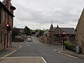
 Auchinleck - Main Street - geograph.org.uk - 4670715.jpg 1,024 × 768; 113 KB
-
 Auchinleck Academy - geograph.org.uk - 5226664.jpg 640 × 480; 49 KB
-
 Auchinleck by pass from Pennyland - geograph.org.uk - 3475734.jpg 640 × 436; 48 KB
-
 Auchinleck bypass crosses the railway line - geograph.org.uk - 4670699.jpg 1,024 × 768; 91 KB
-

-
 Auchinleck Castle - geograph.org.uk - 4820360.jpg 3,264 × 2,448; 3.32 MB
-
 Auchinleck castle - geograph.org.uk - 6368138.jpg 2,568 × 4,667; 3.8 MB
-
 Auchinleck castle sentry post - geograph.org.uk - 6322408.jpg 4,822 × 3,780; 6.65 MB
-
 Auchinleck Castle Site - geograph.org.uk - 6127914.jpg 640 × 462; 158 KB
-
 Auchinleck castle well - geograph.org.uk - 6322402.jpg 5,184 × 3,678; 6.3 MB
-
 Auchinleck castle well - geograph.org.uk - 6322411.jpg 4,817 × 3,888; 7.05 MB
-
 Auchinleck Estate (geograph 7211763).jpg 4,977 × 3,732; 5.98 MB
-
 Auchinleck Highhouse horralls and engine-house - geograph.org.uk - 4809833.jpg 2,592 × 1,944; 2.21 MB
-
 Auchinleck Main Street - geograph.org.uk - 6340782.jpg 2,592 × 1,944; 2.31 MB
-
 Auchinleck Main Street - geograph.org.uk - 6340787.jpg 2,592 × 1,944; 2.29 MB
-
 Auchinleck Main Street - geograph.org.uk - 6340794.jpg 2,592 × 1,944; 2.29 MB
-
 Auchinleck Main Street - geograph.org.uk - 6340802.jpg 2,592 × 1,944; 2.38 MB
-
 Auchinleck Main Street - geograph.org.uk - 6340815.jpg 2,048 × 1,536; 1.22 MB
-
 Auchinleck Main Street in the snow - geograph.org.uk - 4818343.jpg 2,592 × 1,944; 2.35 MB
-
 Auchinleck Old House (remains of) - geograph.org.uk - 6340671.jpg 4,828 × 3,888; 7.26 MB
-
 Auchinleck Old House - geograph.org.uk - 6127877.jpg 640 × 447; 132 KB
-
 Auchinleck Old House - geograph.org.uk - 6340676.jpg 5,113 × 3,597; 6.67 MB
-
 Auchinleck Old House - geograph.org.uk - 6340686.jpg 5,092 × 3,662; 7.02 MB
-
 Auchinleck Old House - geograph.org.uk - 6340693.jpg 5,060 × 3,678; 7.03 MB
-
 Auchinleck Old House - geograph.org.uk - 6340700.jpg 4,924 × 3,770; 6.3 MB
-
 Auchinleck Old House - geograph.org.uk - 6340710.jpg 4,176 × 2,523; 3.77 MB
-
 Auchinleck Old House - geograph.org.uk - 6340717.jpg 5,184 × 3,888; 7.34 MB
-
 Auchinleck Old House - geograph.org.uk - 6340732.jpg 4,941 × 3,749; 7.39 MB
-
 Auchinleck Outskirts - geograph.org.uk - 6029269.jpg 640 × 425; 69 KB
-
 Auchinleck Parish Church - geograph.org.uk - 4625154.jpg 1,920 × 1,280; 1.31 MB
-
 Auchinleck Parish Church - geograph.org.uk - 4625161.jpg 1,847 × 1,225; 460 KB
-
 Auchinleck Parish Church - geograph.org.uk - 4625164.jpg 1,280 × 1,920; 1.47 MB
-
 Auchinleck Parish Church - geograph.org.uk - 4625176.jpg 1,920 × 1,280; 1.27 MB
-
 Auchinleck Parish Church - geograph.org.uk - 4625187.jpg 1,920 × 1,280; 1.59 MB
-
 Auchinleck Parish Church Graveyard - geograph.org.uk - 4625179.jpg 1,920 × 1,280; 2.04 MB
-
 Auchinleck Parish Church Graveyard - geograph.org.uk - 4625182.jpg 1,920 × 1,280; 1.81 MB
-
 Auchinleck Parish Church Graveyard - geograph.org.uk - 4625190.jpg 1,920 × 1,280; 2.09 MB
-
 Auchinleck Parish Church Graveyard - geograph.org.uk - 4625191.jpg 1,920 × 1,280; 1.89 MB
-
 Auchinleck railway station - geograph.org.uk - 4670719.jpg 3,264 × 2,448; 2.24 MB
-
 Auchinleck War Memorial - geograph.org.uk - 6028811.jpg 463 × 640; 142 KB
-
 Auchinleck, Main Street - geograph.org.uk - 4145087.jpg 1,024 × 768; 148 KB
-
 Autumn at the Pond - geograph.org.uk - 5982364.jpg 2,976 × 1,984; 1.98 MB
-
 Autumn at the Pond - geograph.org.uk - 5982367.jpg 2,976 × 1,984; 4.84 MB
-
 Autumn Colour at Home Farm - geograph.org.uk - 5185528.jpg 1,920 × 1,280; 1.9 MB
-
 Autumn Colours - geograph.org.uk - 5185415.jpg 1,280 × 1,920; 3.07 MB
-
 Autumn Trees - geograph.org.uk - 5185567.jpg 1,920 × 1,280; 2.94 MB
-
 Autumn, Waterside Wood - geograph.org.uk - 5185463.jpg 1,920 × 1,280; 3.19 MB
-
 B705 at Auchinleck boundary - geograph.org.uk - 4575069.jpg 640 × 480; 61 KB
-
 Baird Memorial Cairn, Wardlaw Hill - geograph.org.uk - 4217602.jpg 1,600 × 1,067; 465 KB
-
 Barglachan Farm - geograph.org.uk - 6029300.jpg 640 × 434; 75 KB
-
 Barony A Frame Park - geograph.org.uk - 4625323.jpg 1,920 × 1,280; 1.94 MB
-
 Barony bing - geograph.org.uk - 2650087.jpg 640 × 426; 85 KB
-
 Barony Road - geograph.org.uk - 5185642.jpg 1,920 × 1,280; 2.15 MB
-
 Barony Road - geograph.org.uk - 6029229.jpg 640 × 428; 118 KB
-
 Barony Road leading to Ochiltree - geograph.org.uk - 4625273.jpg 1,920 × 1,280; 2.37 MB
-
 Barony Road to Auchinleck - geograph.org.uk - 4625270.jpg 1,920 × 1,280; 2.16 MB
-
 Barony Road, Auchinleck - geograph.org.uk - 5185641.jpg 1,849 × 1,189; 466 KB
-
 Barrhill Road - geograph.org.uk - 5224026.jpg 800 × 600; 94 KB
-
 Bellow Water, Welltrees Bridge - geograph.org.uk - 5224346.jpg 1,024 × 768; 292 KB
-
 Belvedere Folly - geograph.org.uk - 5088378.jpg 1,920 × 1,280; 1.55 MB
-
 Belvedere Folly - geograph.org.uk - 5088381.jpg 1,920 × 1,280; 1 MB
-
 Belvedere Folly, Dumfries House - geograph.org.uk - 4745931.jpg 2,173 × 3,372; 2.23 MB
-
 Belvedere Folly, Dumfries House - geograph.org.uk - 4745938.jpg 3,069 × 2,097; 2.06 MB
-
 Berryhill No.2 Coal Pit - geograph.org.uk - 5164085.jpg 2,592 × 1,944; 2.42 MB
-
 Berryhill No.3 Ironstone Pit - geograph.org.uk - 5160870.jpg 2,592 × 1,944; 2.2 MB
-
 Berryhill No.3 Ironstone Pit - geograph.org.uk - 5160887.jpg 640 × 480; 111 KB
-
 Big Bend On The B7036 - geograph.org.uk - 6119320.jpg 640 × 469; 124 KB
-
 Big Pot and Old Tree, Queen Elizabeth Garden - geograph.org.uk - 5492121.jpg 2,592 × 1,728; 3.31 MB
-
 Bing by Rigg Road - geograph.org.uk - 5265267.jpg 1,024 × 683; 299 KB
-
 Bing, Cronberry - geograph.org.uk - 5224156.jpg 1,024 × 768; 296 KB
-
 Bing, Happoch Hill - geograph.org.uk - 5227164.jpg 1,024 × 768; 308 KB
-
 Birnieknowe Farm - geograph.org.uk - 6028855.jpg 640 × 432; 81 KB
-
 Birnieknowe View - geograph.org.uk - 6028859.jpg 640 × 432; 105 KB
-
 Blackcroft Bridge - geograph.org.uk - 5124278.jpg 4,000 × 3,000; 4.62 MB
-
 Blackside Hills, from Cronberry - geograph.org.uk - 4752671.jpg 2,443 × 1,404; 3.1 MB
-
 Blackston - geograph.org.uk - 5227122.jpg 1,024 × 768; 266 KB
-
 Boswell Mausoleum, Auchinleck - geograph.org.uk - 4625168.jpg 1,920 × 1,280; 1.47 MB
-
 Boswell Mausoleum, Auchinleck - geograph.org.uk - 4625185.jpg 1,920 × 1,280; 1.36 MB
-

-
 Braehead Place, Lugar - geograph.org.uk - 4009847.jpg 640 × 435; 80 KB
-
 Bridge on The Avenue, Dumfries House estate - geograph.org.uk - 2673815.jpg 2,000 × 1,435; 1.03 MB
-
 Bridge over a railway trackbed - geograph.org.uk - 5227170.jpg 1,024 × 768; 273 KB
-
 Bridge over Bellow Water near Cronberry - geograph.org.uk - 3746546.jpg 1,600 × 1,067; 678 KB
-
 Bridge over Gass Water - geograph.org.uk - 4217731.jpg 5,184 × 3,456; 7.77 MB
-
 Bridge Over The Dippol Burn - geograph.org.uk - 6127860.jpg 640 × 449; 134 KB
-
 Bridge over the Gass Water - geograph.org.uk - 5563918.jpg 5,184 × 3,888; 7.43 MB
-
 Bridge over the Gass Water - geograph.org.uk - 5611869.jpg 4,608 × 3,456; 6.28 MB
-
 Bridge over the railway near Auchinleck - geograph.org.uk - 3135275.jpg 1,200 × 797; 387 KB
-
 Bulrushes, Dumfries House Estate - geograph.org.uk - 5492055.jpg 2,592 × 1,728; 4.5 MB
-
 Bus Shelter by A70 near Cronberry - geograph.org.uk - 3746529.jpg 5,184 × 3,456; 7.33 MB
-
 Bus stop at Peesweep Brae - geograph.org.uk - 4447819.jpg 640 × 378; 59 KB
-
 Bus Stop, Barony Road - geograph.org.uk - 5185631.jpg 1,920 × 1,280; 2.41 MB
-
 Business Premises at Lugar - geograph.org.uk - 4715142.jpg 640 × 398; 96 KB
-
 Bute Road, Holyhead - geograph.org.uk - 5227120.jpg 1,024 × 768; 323 KB
-
 Cairn on Wardlaw Hill - geograph.org.uk - 3906300.jpg 1,024 × 768; 160 KB
-
 Cairn on Wardlaw Hill - geograph.org.uk - 4217617.jpg 1,600 × 1,067; 500 KB
-
 Cairn on West Foredibban Hill - geograph.org.uk - 4236139.jpg 5,184 × 3,456; 7.36 MB
-
 Cairn on West Foredibban Hill - geograph.org.uk - 4236140.jpg 1,600 × 1,067; 466 KB
-
 Car Park at the Barony A Frame Park - geograph.org.uk - 4625310.jpg 1,920 × 1,280; 1.72 MB
-
 Carbellow Farm - geograph.org.uk - 4448052.jpg 640 × 424; 36 KB
-
 Carbellow Farm on A70 - geograph.org.uk - 4000045.jpg 640 × 406; 38 KB
-
 Carbellow No. 3 Pit - geograph.org.uk - 5224170.jpg 1,024 × 768; 279 KB
-
 Carbellow No.3 ironstone pit - geograph.org.uk - 5189029.jpg 2,592 × 1,944; 2.03 MB
-
 Carbellow No.3 ironstone pit - geograph.org.uk - 5189030.jpg 2,592 × 1,944; 2.25 MB
-
 Cat's Cleugh beyond the Glenmuir Water - geograph.org.uk - 4681647.jpg 800 × 600; 121 KB
-
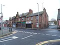
 Centre of Auchinleck - geograph.org.uk - 5227090.jpg 1,024 × 768; 280 KB
-
 Children's Play Area at the Barony A Frame Park - geograph.org.uk - 4625288.jpg 1,920 × 1,280; 1.81 MB
-
 Children's Play Area at the Barony A Frame Park - geograph.org.uk - 4625320.jpg 1,920 × 1,280; 1.76 MB
-
 Chinese Bridge, Dumfries House - geograph.org.uk - 5492043.jpg 2,530 × 1,648; 1.49 MB
-
 Chinese Bridge, Dumfries House - geograph.org.uk - 5492045.jpg 2,592 × 1,728; 1.27 MB
-
 Chinese Bridge, Dumfries House - geograph.org.uk - 5492324.jpg 2,592 × 1,728; 3.35 MB
-
 Chinese Bridge, Dumfries House - geograph.org.uk - 5492331.jpg 2,592 × 1,728; 3.33 MB
-
 Chinese Bridge, Dumfries House Estate - geograph.org.uk - 5163797.jpg 1,920 × 1,280; 2.21 MB
-
 Chinese Bridge, Dumfries House Estate - geograph.org.uk - 5556198.jpg 768 × 1,024; 299 KB
-
 Church Hill, Auchinleck - geograph.org.uk - 4625118.jpg 1,920 × 1,280; 1.44 MB
-
 Church Street, Auchinleck - geograph.org.uk - 6029259.jpg 640 × 428; 76 KB
-
 Clear felled area - geograph.org.uk - 4199146.jpg 800 × 600; 376 KB
-
 Coal Road, Auchinleck - geograph.org.uk - 4625125.jpg 1,863 × 1,185; 397 KB
-
 Colliery Bing - geograph.org.uk - 2650404.jpg 640 × 426; 44 KB
-
 Colour at the Lake - geograph.org.uk - 5824973.jpg 2,976 × 1,984; 4.74 MB
-
 Common No 11 bing - geograph.org.uk - 5227575.jpg 1,024 × 768; 483 KB
-
 Common No.11 - geograph.org.uk - 5181771.jpg 2,592 × 1,944; 2 MB
-
 Common No.11 - geograph.org.uk - 5181774.jpg 2,592 × 1,944; 2.44 MB
-
 Common No.12 - geograph.org.uk - 5165720.jpg 2,592 × 1,944; 2.43 MB
-
 Common No.15 Ironstone Pit - geograph.org.uk - 5160915.jpg 2,592 × 1,944; 2.41 MB
-
 Common No.7 - geograph.org.uk - 5165710.jpg 2,592 × 1,944; 2.38 MB
-
 Commondyke Spoil Heap - geograph.org.uk - 6029327.jpg 640 × 420; 120 KB
-
 Commondyke Station - geograph.org.uk - 6341820.jpg 4,040 × 3,340; 4.45 MB
-
 Compost System, Education Garden - geograph.org.uk - 5492180.jpg 2,592 × 1,728; 1,016 KB
-
 Coos - geograph.org.uk - 5139109.jpg 2,592 × 1,944; 2.32 MB
-
 Corner of Church Hill ^ Main Street, Auchinleck - geograph.org.uk - 3745950.jpg 5,184 × 3,456; 7.13 MB
-
 Craigston Plantation - geograph.org.uk - 5265268.jpg 1,024 × 683; 300 KB
-
 Cronberry - geograph.org.uk - 4027499.jpg 2,592 × 1,944; 1.58 MB
-
 Cronberry - geograph.org.uk - 5224155.jpg 1,024 × 768; 250 KB
-
 Cronberry Crossing - geograph.org.uk - 5189028.jpg 2,592 × 1,944; 2.36 MB
-
 Crossing The Railway Line - geograph.org.uk - 6029250.jpg 640 × 470; 100 KB
-
 Crossing the River Ayr near Greenock Mains - geograph.org.uk - 6296296.jpg 4,608 × 3,456; 5.03 MB
-
 Cumnock from the air - geograph.org.uk - 5402402.jpg 640 × 615; 184 KB
-
 Cumnock from the air - geograph.org.uk - 5402429.jpg 640 × 480; 157 KB
-
 Cutout sculpture at the Barony A-frame site - geograph.org.uk - 2673992.jpg 1,500 × 2,000; 978 KB
-
 Dalfad farmhouse - geograph.org.uk - 4027490.jpg 2,592 × 1,944; 1.76 MB
-
 Damp Places Near Auchinleck - geograph.org.uk - 6029214.jpg 640 × 405; 90 KB
-
 Dangerous Bridge Over The Dippol Burn - geograph.org.uk - 6127867.jpg 640 × 424; 138 KB
-
 Darnlaw farm bridge over A76 - geograph.org.uk - 3475718.jpg 640 × 395; 54 KB
-
 De'il's back door - geograph.org.uk - 2132046.jpg 1,600 × 1,200; 281 KB
-
 Deer Cave - geograph.org.uk - 4818772.jpg 3,264 × 2,448; 3.56 MB
-
 Demolition site, Lugar - geograph.org.uk - 5224139.jpg 1,024 × 768; 380 KB
-
 Derelict Coal Merchant's Premises, Lugar - geograph.org.uk - 3746478.jpg 1,600 × 1,067; 542 KB


.jpg)


_-_geograph.org.uk_-_6340671.jpg)


&filefrom=Derelict+Coal+Merchant%27s+Premises%2C+Lugar+-+geograph.org.uk+-+3746482.jpg#mw-category-media)