Category:August 2006 in East Sussex
Deutsch: Bilder, die im August 2006 in East Sussex aufgenommen worden sind. Bitte beachten Sie, dass dies weder das Datum des Uploads noch das Datum des Scannens eines Fotos ist.
English: Images/pictures taken in East Sussex during August 2006. Note this is not the date of the upload, nor the date a photo was scanned.
Español: Fotografías o imágenes tomadas en East Sussex durante agosto 2006. No es la fecha de subida ni escaneo, sino la fecha en que las fotografías o imágenes se crearon.
Esperanto: Bildoj faritaj en East Sussex en aŭgusto 2006. Tio ne estas la dato, kiam la bildoj estis alŝutitaj aŭ skanitaj.
Français : Photographies ou images prises en East Sussex durant août 2006. Ce n'est pas la date du téléchargement ou du scan.
Galego: Fotografías ou imaxes tomadas en East Sussex durante agosto 2006. Non é a data de subida nin escaneamento, senón a data na que se crearon as fotografías ou imaxes.
Italiano: Fotografie o immagini scattate a East Sussex nel agosto 2006. Nota bene: la data non si riferisce né a quella di upload né a quella in cui la foto è stata digitalizzata.
Norsk bokmål: Bilder tatt i East Sussex i løpet av august 2006. Merk at dette ikke er datoen for opplasting, eller når et bilde har blitt skannet.
Norsk nynorsk: Bilete teke i East Sussex i løpet av august 2006. Merk at dette ikkje er datoen for opplasting, eller når eit bilete har vorte skanna.
Русский: Изображения, сделанные в East Sussex в течение август 2006 (не дата загрузки изображения).
Українська: Зображення, зроблені в East Sussex протягом серпень 2006. Зауважте, що це не дата завантаження чи дата сканування фотографії.
| August 2005 | ← | August 2006 | → | August 2007 | |||||||
| Jan | Feb | Mar | Apr | May | Jun | Jul | Aug | Sep | Oct | Nov | Dec |
| 7 | 7 | 7 | 37 | 16 | 21 | 22 | 49 | 11 | 19 | 11 | 19 |
|---|---|---|---|---|---|---|---|---|---|---|---|
Media in category "August 2006 in East Sussex"
The following 49 files are in this category, out of 49 total.
-
 Keere Street, Lewes - geograph.org.uk - 225192.jpg 480 × 640; 86 KB
-
 A Lane in Burwash - geograph.org.uk - 227580.jpg 640 × 480; 123 KB
-
 Alder Wood, High Weald - geograph.org.uk - 227507.jpg 640 × 480; 117 KB
-
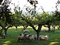
 Apple Orchard by Holton Farm - geograph.org.uk - 227528.jpg 640 × 480; 175 KB
-
 Apple Orchard by Mottynsden Farm - geograph.org.uk - 227520.jpg 640 × 480; 138 KB
-
 Barcombe, dismantled railway line - geograph.org.uk - 223449.jpg 640 × 480; 128 KB
-
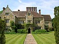
 Bateman's, The East Front - geograph.org.uk - 227589.jpg 640 × 480; 118 KB
-
 Batemans 1.jpg 1,600 × 1,200; 429 KB
-
 Batemans front.JPG 2,592 × 1,944; 975 KB
-
 Battle of Britain Memorial, near Burwash - geograph.org.uk - 227539.jpg 640 × 480; 169 KB
-
 Beach Huts at Seaford - geograph.org.uk - 223441.jpg 640 × 426; 113 KB
-
 Bodiam Castle - geograph.org.uk - 1276125.jpg 640 × 480; 70 KB
-
 Burwash Weald on the A265 - geograph.org.uk - 227499.jpg 640 × 480; 116 KB
-
 Burwashstreet.jpeg 640 × 480; 140 KB
-
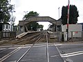 Cooksbridge Railway Station.jpg 640 × 480; 93 KB
-
 Cooksbridge, The Malthouse - geograph.org.uk - 223494.jpg 640 × 395; 98 KB
-
 Dairy Farming, Holton Farm - geograph.org.uk - 227525.jpg 640 × 480; 136 KB
-
 Dudwell Valley - geograph.org.uk - 227485.jpg 640 × 480; 137 KB
-
 Dudwell Valley, South-west of Bateman's - geograph.org.uk - 227491.jpg 640 × 480; 119 KB
-
 Dudwell Valley, South-west of Burwash - geograph.org.uk - 227487.jpg 640 × 480; 164 KB
-
 East End Burwash - geograph.org.uk - 227573.jpg 640 × 480; 116 KB
-
 Footpath North-east of Woodlands Farm - geograph.org.uk - 227511.jpg 640 × 480; 171 KB
-
 Glyndebourne 1.jpg 3,840 × 2,160; 3.74 MB
-
 Glyndebourne 2.jpg 3,840 × 2,160; 3.79 MB
-
 Glyndebourne 3.jpg 3,840 × 2,160; 4.22 MB
-
 Gorsey Down car park - geograph.org.uk - 215267.jpg 640 × 480; 83 KB
-
 High Wood - geograph.org.uk - 227490.jpg 640 × 480; 160 KB
-
 High Wood, High Weald - geograph.org.uk - 227488.jpg 640 × 480; 181 KB
-
 JCB Fastrac 8250.jpg 1,600 × 1,200; 363 KB
-
 Oast House Weather Vane - geograph.org.uk - 227501.jpg 480 × 640; 75 KB
-
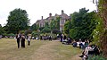
 Playing Field, Cardinal Newman School - geograph.org.uk - 216659.jpg 640 × 479; 105 KB
-
 Rampyndene, Burwash High Street - geograph.org.uk - 227564.jpg 640 × 480; 137 KB
-
 Ripening Apples, near Burwash - geograph.org.uk - 227543.jpg 640 × 480; 125 KB
-
 Ripening Apples, near Burwash - geograph.org.uk - 227548.jpg 640 × 480; 150 KB
-
 Rose and Crown, Burwash - geograph.org.uk - 227576 (cropped).jpg 422 × 422; 95 KB
-
 Rose and Crown, Burwash - geograph.org.uk - 227576.jpg 640 × 480; 129 KB
-
 Rose and Crown, Burwash - geograph.org.uk - 629657.jpg 640 × 426; 97 KB
-
 Seafordhuts.JPG 640 × 426; 71 KB
-
-
 The Oast House, Bateman's - geograph.org.uk - 227593.jpg 640 × 480; 153 KB
-
 The Oast House, Burwash Weald - geograph.org.uk - 227496.jpg 480 × 640; 113 KB
-
 The Oast House, Mottynsden Farm - geograph.org.uk - 227551.jpg 640 × 480; 145 KB
-
 The old water Mill at Batemans - geograph.org.uk - 629655.jpg 640 × 426; 89 KB
-
 The Watermill, Bateman's - geograph.org.uk - 227599.jpg 640 × 480; 129 KB
-
 War Memorial, Burwash - geograph.org.uk - 227568.jpg 640 × 480; 134 KB
-
 West End Burwash - geograph.org.uk - 227585.jpg 640 × 480; 135 KB
-
 Wheat Field on the High Weald - geograph.org.uk - 227514.jpg 640 × 480; 115 KB
-
 Wheel Inn, Burwash Weald - geograph.org.uk - 227495.jpg 640 × 480; 112 KB
-
 Willingford Farm - geograph.org.uk - 227492.jpg 640 × 480; 144 KB


.jpg)


