Category:August 2006 in Highland (council area)
Council areas (municipalities) of Scotland: Aberdeenshire · Argyll and Bute · Clackmannanshire · Edinburgh · Highland ·
Deutsch: Bilder, die im August 2006 in Highland (council area) aufgenommen worden sind. Bitte beachten Sie, dass dies weder das Datum des Uploads noch das Datum des Scannens eines Fotos ist.
English: Images/pictures taken in Highland (council area) during August 2006. Note this is not the date of the upload, nor the date a photo was scanned.
Español: Fotografías o imágenes tomadas en Highland (council area) durante agosto 2006. No es la fecha de subida ni escaneo, sino la fecha en que las fotografías o imágenes se crearon.
Esperanto: Bildoj faritaj en Highland (council area) en aŭgusto 2006. Tio ne estas la dato, kiam la bildoj estis alŝutitaj aŭ skanitaj.
Français : Photographies ou images prises en Highland (council area) durant août 2006. Ce n'est pas la date du téléchargement ou du scan.
Galego: Fotografías ou imaxes tomadas en Highland (council area) durante agosto 2006. Non é a data de subida nin escaneamento, senón a data na que se crearon as fotografías ou imaxes.
Italiano: Fotografie o immagini scattate a Highland (council area) nel agosto 2006. Nota bene: la data non si riferisce né a quella di upload né a quella in cui la foto è stata digitalizzata.
Norsk bokmål: Bilder tatt i Highland (council area) i løpet av august 2006. Merk at dette ikke er datoen for opplasting, eller når et bilde har blitt skannet.
Norsk nynorsk: Bilete teke i Highland (council area) i løpet av august 2006. Merk at dette ikkje er datoen for opplasting, eller når eit bilete har vorte skanna.
Русский: Изображения, сделанные в Highland (council area) в течение август 2006 (не дата загрузки изображения).
Українська: Зображення, зроблені в Highland (council area) протягом серпень 2006. Зауважте, що це не дата завантаження чи дата сканування фотографії.
| August 2005 | ← | August 2006 | → | August 2007 | |||||||
| Jan | Feb | Mar | Apr | May | Jun | Jul | Aug | Sep | Oct | Nov | Dec |
| 103 | 83 | 37 | 40 | 103 | 36 | 81 | 67 | 37 | 23 | 19 | 83 |
|---|---|---|---|---|---|---|---|---|---|---|---|
Subcategories
This category has the following 3 subcategories, out of 3 total.
Media in category "August 2006 in Highland (council area)"
The following 64 files are in this category, out of 64 total.
-
 Mey - geograph.org.uk - 243132.jpg 640 × 480; 76 KB
-
 A bend in the A836 - geograph.org.uk - 257847.jpg 640 × 480; 55 KB
-
 A832 in Slattadale Forest - geograph.org.uk - 218232.jpg 640 × 480; 162 KB
-
 Across Loch Nevis - geograph.org.uk - 219694.jpg 640 × 480; 154 KB
-
 Am Meallan or Oldshoremore Beach - geograph.org.uk - 369942.jpg 640 × 480; 86 KB
-
 Ard Neackie - geograph.org.uk - 238145.jpg 640 × 480; 60 KB
-
 Attadalestation.jpg 2,848 × 2,136; 1.69 MB
-
 Auchmithie Harbour - geograph.org.uk - 222220.jpg 640 × 391; 248 KB
-
 Beach at Sango Bay - geograph.org.uk - 1563462.jpg 640 × 480; 53 KB
-
 Beach at Sango Bay - geograph.org.uk - 1563932.jpg 640 × 480; 79 KB
-
 Bench-Kilt Rock.JPG 1,952 × 2,592; 1.59 MB
-
 Bright yellow fungi - geograph.org.uk - 231747.jpg 640 × 480; 136 KB
-
 Bullocks at Cantray - geograph.org.uk - 216009.jpg 640 × 480; 186 KB
-
 Caledonian Canal (Corpach).JPG 2,592 × 1,952; 1.67 MB
-
 Caledonian Canal - geograph.org.uk - 662022.jpg 640 × 480; 74 KB
-
 Cattle Grid on A832 - geograph.org.uk - 218224.jpg 640 × 480; 211 KB
-
 Coastline near Reiff - geograph.org.uk - 149057.jpg 640 × 426; 180 KB
-
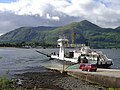 CorranFerry.JPG 2,592 × 1,944; 2.25 MB
-
 Cul a' Bhogha, Ardmair, Evening Sun - geograph.org.uk - 232977.jpg 640 × 384; 79 KB
-
 East coast of Rona - geograph.org.uk - 231010.jpg 428 × 640; 62 KB
-
 Foreshore at Sandside Bay - geograph.org.uk - 240309.jpg 640 × 480; 98 KB
-

-

-
 Gairloch Harbour at An Ard - geograph.org.uk - 216821.jpg 640 × 480; 162 KB
-
 Gate Post, Across Strathspey Railway - geograph.org.uk - 227896.jpg 640 × 480; 126 KB
-
 Glas Eilean in Loch Gairloch - geograph.org.uk - 218615.jpg 640 × 480; 134 KB
-
 Glen coe.jpg 1,041 × 211; 38 KB
-
 Glen Golly - geograph.org.uk - 248808.jpg 640 × 480; 51 KB
-
 Inner Sound - geograph.org.uk - 278282.jpg 640 × 480; 45 KB
-
 Kilmarie Beach - geograph.org.uk - 215482.jpg 640 × 480; 194 KB
-
 Kilmuir Kirk and war memorial. - geograph.org.uk - 226053.jpg 640 × 426; 90 KB
-
 Knock Castle - geograph.org.uk - 232983.jpg 480 × 640; 202 KB
-
 Level Crossing, Dalfaber Drive - geograph.org.uk - 243994.jpg 640 × 384; 97 KB
-
 Lineside Hut, Speyside Railway - geograph.org.uk - 244307.jpg 640 × 384; 105 KB
-
 Loch and Lochan - geograph.org.uk - 216005.jpg 640 × 480; 72 KB
-
 Loch Duich - geograph.org.uk - 214877.jpg 640 × 480; 212 KB
-
 Loch Duich shoreline - geograph.org.uk - 214876.jpg 640 × 480; 182 KB
-
 Mailbox-Kilmuir.JPG 1,952 × 2,592; 1.45 MB
-
 Mallaig bahnhof.jpeg 1,024 × 768; 174 KB
-

-
 Plockton Railway Station. - geograph.org.uk - 234030.jpg 640 × 480; 76 KB
-
 Polin Beach (Bagh a Phollain) - geograph.org.uk - 221739.jpg 600 × 450; 145 KB
-
 Polin Beach - geograph.org.uk - 221745.jpg 600 × 450; 131 KB
-
 Portskerra Jetty - geograph.org.uk - 257053.jpg 640 × 480; 100 KB
-
 Portskerra memorial - geograph.org.uk - 257050.jpg 640 × 480; 116 KB
-
 Portskerra Memorial - geograph.org.uk - 257051.jpg 640 × 480; 124 KB
-
 Railway Crossing, Speyside Railway - geograph.org.uk - 228143.jpg 640 × 480; 96 KB
-
 Roadside Well - geograph.org.uk - 237493.jpg 640 × 480; 122 KB
-
 Sandside Bay - geograph.org.uk - 240306.jpg 640 × 480; 63 KB
-
 ScotlandGlenCoe.jpg 2,048 × 1,536; 709 KB
-
 Seaward facing houses of Saltburn. - geograph.org.uk - 226050.jpg 640 × 426; 90 KB
-
 Small Sandy Inlet, Clachtoll Bay - geograph.org.uk - 238195.jpg 640 × 480; 90 KB
-
 Southern tip of Sanday - geograph.org.uk - 304172.jpg 640 × 408; 112 KB
-
 Strath Melness - geograph.org.uk - 369985.jpg 640 × 480; 97 KB
-
 Sunrise at Sango Bay - geograph.org.uk - 371048.jpg 640 × 480; 111 KB
-
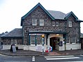
 The Old Railway Station, Aviemore - geograph.org.uk - 243989.jpg 640 × 384; 110 KB
-
 Un-Named Sandy Inlet, South of Clachtoll - geograph.org.uk - 239051.jpg 640 × 480; 111 KB
-
 Urquhart Castle Loch Ness, Scottish Highlands - panoramio.jpg 1,553 × 1,165; 999 KB
-
 Altnabad - geograph.org.uk - 248802.jpg 640 × 480; 105 KB
-
 Crossing, Speyside Railway - geograph.org.uk - 244389.jpg 640 × 384; 100 KB
-
 Kearvaig Beach and Cathedral Rock - geograph.org.uk - 370008.jpg 640 × 480; 93 KB
-
 Small Lochan - geograph.org.uk - 238215.jpg 640 × 480; 125 KB
-
 Small Lochan - geograph.org.uk - 238216.jpg 640 × 480; 118 KB
-
 Track to country cottage off the A830. - geograph.org.uk - 256847.jpg 640 × 480; 103 KB


.JPG)


_-_geograph.org.uk_-_221739.jpg)


