Category:Averham
Cebuano: Averham maoy parokya sa Hiniusang Gingharian. Ang Averham nahimutang sa kondado sa Nottinghamshire ug apil sa nasod sa Inglatera, sa habagatan-sidlakang bahin sa nasod, km sa amihanan sa ulohang dakbayan London. (→Averham)
English: Averham /ˈɛərəm/ is a village and civil parish in the Newark and Sherwood district of Nottinghamshire, England. According to the 2001 census it had a population of 187, increasing to 294 at the 2011 Census. The village is just west of Newark-on-Trent. Staythorpe Power Station is south-west of the village. (→Averham)
Nederlands: Averham /ˈɛərəm/ is een plaats en civil parish in het Engelse graafschap Nottinghamshire. (→Averham)
Polski: Averham /ˈɛərəm/ – wieś w Anglii, w hrabstwie Nottinghamshire, w dystrykcie Newark and Sherwood. Leży 24 km na północny wschód od miasta Nottingham i 182 km na północ od Londynu. (→Averham)
Svenska: Averham är en parish i Storbritannien. Den ligger i grevskapet Nottinghamshire och riksdelen England, i den sydöstra delen av landet, km norr om huvudstaden London. (→Averham)

village in Nottinghamshire, England, UK  | |||||
| Upload media | |||||
| Instance of | |||||
|---|---|---|---|---|---|
| Location | Newark and Sherwood, Nottinghamshire, East Midlands, England | ||||
 | |||||
Subcategories
This category has the following 2 subcategories, out of 2 total.
A
- St Michael's Church, Averham (24 F)
R
Media in category "Averham"
The following 134 files are in this category, out of 134 total.
-
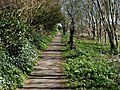
 A geographer's path^ - geograph.org.uk - 4736073.jpg 600 × 800; 168 KB
-
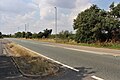
 A612 near Micklebarrow Hill - geograph.org.uk - 3331343.jpg 2,256 × 1,504; 773 KB
-
 A612 road junction with A617 - geograph.org.uk - 3519480.jpg 640 × 375; 60 KB
-
 A612 towards junction with the A617 - geograph.org.uk - 2657479.jpg 1,600 × 1,200; 387 KB
-

-
 A617 at Averham - geograph.org.uk - 5851584.jpg 1,600 × 1,067; 437 KB
-
 A617 at Averham turn - geograph.org.uk - 5134012.jpg 640 × 480; 35 KB
-
 A617 at Junction with A612 near Averham - geograph.org.uk - 4207753.jpg 640 × 480; 316 KB
-
 A617 lay-by - geograph.org.uk - 2200419.jpg 1,024 × 768; 126 KB
-
 A617 Passing Flash Farm - geograph.org.uk - 4207746.jpg 640 × 480; 313 KB
-
 A617 towards junction with A612 - geograph.org.uk - 3331438.jpg 1,600 × 1,067; 388 KB
-
 A617 towards Mansfield - geograph.org.uk - 2656860.jpg 1,600 × 1,200; 362 KB
-
 A617 towards Mansfield - geograph.org.uk - 2657484.jpg 1,600 × 1,200; 496 KB
-
 A617, Averham - geograph.org.uk - 4207762.jpg 640 × 480; 288 KB
-

-
 Averham Church Water Fishing Club - geograph.org.uk - 1599850.jpg 640 × 479; 88 KB
-
 Averham Park - geograph.org.uk - 1101554.jpg 640 × 480; 83 KB
-
 Averham Park - geograph.org.uk - 3306162.jpg 3,208 × 2,365; 1.37 MB
-
 Averham Park - geograph.org.uk - 5293718.jpg 1,024 × 768; 125 KB
-
 Averham Viaduct - geograph.org.uk - 3137048.jpg 1,280 × 960; 209 KB
-
 Averham Village turning from A617 - geograph.org.uk - 3519484.jpg 640 × 349; 38 KB
-
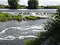
 Averham weir - geograph.org.uk - 1599690.jpg 640 × 479; 73 KB
-
 Averham Weir - geograph.org.uk - 2778236.jpg 3,648 × 2,736; 2.93 MB
-
 Averham Weir - geograph.org.uk - 2863906.jpg 1,024 × 768; 177 KB
-
 Averham Weir - geograph.org.uk - 2989836.jpg 3,648 × 2,736; 2.7 MB
-
 Averham weir - geograph.org.uk - 3137088.jpg 1,280 × 960; 342 KB
-
 Averham Weir - geograph.org.uk - 4735451.jpg 800 × 600; 94 KB
-
 Averham weir at Upper Water Mouth - geograph.org.uk - 4882497.jpg 800 × 583; 178 KB
-
 Averham, A617 - geograph.org.uk - 4207764.jpg 640 × 480; 254 KB
-
 Bend in the path - geograph.org.uk - 5298248.jpg 1,024 × 768; 150 KB
-
 Bird on a pole - geograph.org.uk - 3137092.jpg 960 × 1,280; 353 KB
-
 Bridge over Rundell Dyke - geograph.org.uk - 2989594.jpg 3,648 × 2,736; 2.6 MB
-
 Bridge over Rundell Dyke - geograph.org.uk - 3137046.jpg 1,280 × 960; 394 KB
-
 Bridleway to Cheveral Wood - geograph.org.uk - 3306119.jpg 3,648 × 2,736; 3.94 MB
-
 Busy on the River Trent - geograph.org.uk - 3112246.jpg 1,280 × 960; 235 KB
-

-

-
 Cormorant on the Trent - geograph.org.uk - 2989850.jpg 3,648 × 2,736; 2.11 MB
-
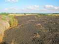
 Corn field near Averham Park - geograph.org.uk - 3306815.jpg 3,533 × 2,633; 3.47 MB
-
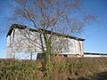 Corrugated iron shed - geograph.org.uk - 3899058.jpg 1,024 × 768; 281 KB
-
 Crossing Averham Viaduct - geograph.org.uk - 3137075.jpg 1,280 × 735; 208 KB
-
 Crossing the River Trent - geograph.org.uk - 3137122.jpg 1,280 × 960; 251 KB
-
 East end of Averham Weir - geograph.org.uk - 3961865.jpg 1,024 × 768; 210 KB
-
 Eastbound A617 - geograph.org.uk - 4207749.jpg 640 × 480; 279 KB
-
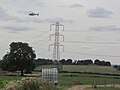
 Electricity pylons and sub station - geograph.org.uk - 4882077.jpg 800 × 534; 146 KB
-
 Entrance to Averham Park Equestrian Centre - geograph.org.uk - 3331339.jpg 2,256 × 1,504; 986 KB
-
 Entrance to Micklebarrow House - geograph.org.uk - 3331348.jpg 2,256 × 1,504; 505 KB
-
 Entrance to Private Gallops - geograph.org.uk - 3330586.jpg 2,256 × 1,504; 1.19 MB
-
 Equestrian centre - geograph.org.uk - 1044244.jpg 640 × 480; 108 KB
-
 Escapee heifers near Averham Park - geograph.org.uk - 5818604.jpg 533 × 800; 120 KB
-
 Farm track doubling as a footpath - geograph.org.uk - 5293713.jpg 1,024 × 768; 116 KB
-
 Farm track off the A617 - geograph.org.uk - 2656865.jpg 1,600 × 1,200; 451 KB
-
 Farm track south of Park Leys - geograph.org.uk - 3306098.jpg 3,648 × 2,736; 3.64 MB
-
 Farmland at Averham - geograph.org.uk - 5851577.jpg 1,600 × 970; 359 KB
-
 Farmland near Averham - geograph.org.uk - 2656963.jpg 1,600 × 1,200; 661 KB
-
 Farmland near Averham - geograph.org.uk - 4153015.jpg 546 × 640; 151 KB
-
 Farmland near the River Trent - geograph.org.uk - 2656874.jpg 1,600 × 1,200; 545 KB
-
 Farmland next to the River Trent - geograph.org.uk - 4882412.jpg 800 × 566; 127 KB
-
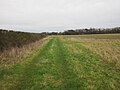
 Farmland off the A612 - geograph.org.uk - 2657474.jpg 1,600 × 1,200; 459 KB
-
 Farmland, Micklebarrow Hill - geograph.org.uk - 2657481.jpg 1,600 × 1,200; 374 KB
-
 Footbridge on the path to Averham Flash Farm - geograph.org.uk - 5298240.jpg 1,024 × 768; 246 KB
-
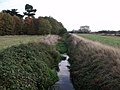
 Footpath alongside Rundell Dyke - geograph.org.uk - 2862697.jpg 1,024 × 768; 176 KB
-
 Footpath to Averham Park - geograph.org.uk - 3899067.jpg 1,024 × 768; 171 KB
-
 Geographer finds a tricky square to picture... - geograph.org.uk - 4738037.jpg 3,072 × 1,728; 1.81 MB
-
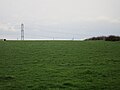 Grass field and pylon - geograph.org.uk - 5293716.jpg 1,024 × 768; 112 KB
-
-
 Hedgerow near Rundell Dyke - geograph.org.uk - 2656969.jpg 1,600 × 1,200; 482 KB
-

-
 Hilltop dung heap south of Park Leys - geograph.org.uk - 3306100.jpg 3,480 × 2,586; 3.36 MB
-
 Horse gallops, Averham Park - geograph.org.uk - 2657487.jpg 1,600 × 1,200; 626 KB
-
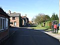
 House at corner of Staythorpe Road and Pinfold Lane, Averham - geograph.org.uk - 4738034.jpg 3,072 × 1,728; 1.25 MB
-
 House on Staythorpe Road, Averham - geograph.org.uk - 2656957.jpg 1,600 × 1,200; 495 KB
-
 It's 50 for a reason - geograph.org.uk - 4207785.jpg 640 × 480; 263 KB
-
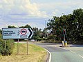
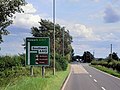
 Junction of A612 and A617 - geograph.org.uk - 5818594.jpg 800 × 533; 100 KB
-

-
 Layby on the A617 near Averham - geograph.org.uk - 4207756.jpg 640 × 480; 256 KB
-
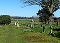
 Lych gate, Averham (geograph 6763651).jpg 1,024 × 768; 258 KB
-
 Manor Cottage Barn - geograph.org.uk - 4736074.jpg 800 × 600; 86 KB
-

-
 Medieval stained glass, St Michael's church, Averham - geograph.org.uk - 4807775.jpg 1,688 × 3,824; 6.19 MB
-
-

-
 North along the Trent Valley Way - geograph.org.uk - 4882446.jpg 800 × 549; 145 KB
-
 NOTICE NOTICE Notice^ - geograph.org.uk - 1049268.jpg 640 × 480; 66 KB
-
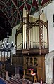 Organ, St Michael's church, Averham - geograph.org.uk - 4808351.jpg 3,017 × 4,712; 5.49 MB
-
-
 Permissive path near Kelham - geograph.org.uk - 5298243.jpg 1,024 × 768; 177 KB
-
 Pheasant rearing pens near the River Trent - geograph.org.uk - 2656878.jpg 1,600 × 1,200; 788 KB
-
 Pinfold Lane - geograph.org.uk - 2989587.jpg 3,648 × 2,736; 2.31 MB
-
 Pinfold Lane, Averham - geograph.org.uk - 2656947.jpg 1,600 × 1,200; 395 KB
-
-
 Power in Trust - geograph.org.uk - 1599191.jpg 640 × 426; 69 KB
-

-

-
 Railway bridge and power station at Staythorpe - geograph.org.uk - 2989820.jpg 3,648 × 2,736; 2.38 MB
-
 Railway bridge over the Trent (Kelham branch) - geograph.org.uk - 2862726.jpg 1,024 × 768; 210 KB
-
 Railway bridge over the Trent - geograph.org.uk - 2989827.jpg 3,648 × 2,736; 3.25 MB
-
 Railway viaduct crossing the River Trent - geograph.org.uk - 4882438.jpg 800 × 577; 177 KB
-
 Railway viaduct near Averham and Staythorpe - geograph.org.uk - 4738049.jpg 3,072 × 1,728; 1.48 MB
-
 Railway viaduct next to the River Trent - geograph.org.uk - 4882430.jpg 800 × 544; 152 KB
-
 Rectory Farm near the River Trent - geograph.org.uk - 4882095.jpg 800 × 516; 92 KB
-
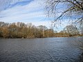
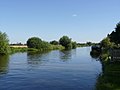
 River Trent - geograph.org.uk - 2682516.jpg 640 × 427; 71 KB
-
 River Trent at Farndon - geograph.org.uk - 2778275.jpg 3,648 × 2,736; 2.58 MB
-
 River Trent near Farndon - geograph.org.uk - 3112242.jpg 1,280 × 960; 130 KB
-
 River Trent north of Farndon - geograph.org.uk - 2778254.jpg 3,648 × 2,736; 2.73 MB
-
 River Trent south of Averham - geograph.org.uk - 2989809.jpg 3,648 × 2,736; 3.64 MB
-
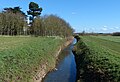
 Rundell Dyke - geograph.org.uk - 2989600.jpg 3,648 × 2,736; 3.21 MB
-
-
 Rundell Dyke, near Averham - geograph.org.uk - 2634849.jpg 1,280 × 960; 355 KB
-
 Sir William Sutton and wife, Averham church - geograph.org.uk - 4806979.jpg 3,696 × 2,448; 2.13 MB
-
 St Michael's church, Averham - geograph.org.uk - 4738035.jpg 3,072 × 1,728; 1.35 MB
-
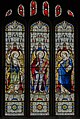 Stained glass window, St Michael's church, Averham - geograph.org.uk - 4807981.jpg 2,616 × 3,896; 7.58 MB
-
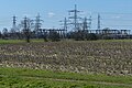
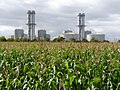 Staythorpe Power Station - geograph.org.uk - 3137084.jpg 1,280 × 960; 355 KB
-
 Staythorpe Power Station - geograph.org.uk - 4882460.jpg 800 × 573; 149 KB
-
 Staythorpe Power Station, Staythorpe - geograph.org.uk - 4153020.jpg 640 × 448; 146 KB
-
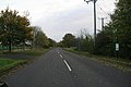
 Staythorpe Road in Averham - geograph.org.uk - 4881703.jpg 800 × 508; 106 KB
-
 Stile and wire fence - geograph.org.uk - 5298250.jpg 1,024 × 768; 183 KB
-

-
 The A617 approaching Kelham - geograph.org.uk - 4736076.jpg 800 × 600; 92 KB
-
 The Old Rectory, Averham.jpg 1,024 × 768; 249 KB
-
 The Trent Valley Way approaching Averham - geograph.org.uk - 2989804.jpg 3,648 × 2,736; 2.54 MB
-
 Track at Averham Park Equestrian Centre - geograph.org.uk - 5818597.jpg 800 × 533; 107 KB
-
 Track down Micklebarrow Hill - geograph.org.uk - 1101528.jpg 640 × 480; 125 KB
-
 Track to Averham Park Farm - geograph.org.uk - 2657491.jpg 1,600 × 1,200; 649 KB
-

-
 Train crossing the Trent - geograph.org.uk - 2989832.jpg 3,648 × 2,736; 3.23 MB
-
 Tree in the mist, near Kelham - geograph.org.uk - 4738031.jpg 3,072 × 1,728; 1.44 MB
-
 Trent Valley Way next to the River Trent - geograph.org.uk - 4882126.jpg 800 × 528; 106 KB
-

-
 Turn right - geograph.org.uk - 5298238.jpg 1,024 × 768; 141 KB
-
 View across the Trent - geograph.org.uk - 2862710.jpg 1,024 × 768; 221 KB
-
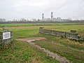
 View towards Staythorpe C power station - geograph.org.uk - 5298237.jpg 1,024 × 768; 161 KB
-

-


.jpg)


_-_geograph.org.uk_-_2862726.jpg)


