Category:Avery Point Light
| Object location | | View all coordinates using: OpenStreetMap |
|---|
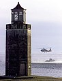
lighthouse in Connecticut, United States  Post-renovations view in 2014 | |||||
| Upload media | |||||
| Instance of | |||||
|---|---|---|---|---|---|
| Made from material | |||||
| Location | Groton, Southeastern Connecticut Planning Region, Connecticut | ||||
| Street address |
| ||||
| Operator |
| ||||
| Heritage designation |
| ||||
| Service entry |
| ||||
| Service retirement |
| ||||
| Inception |
| ||||
| Source of energy | |||||
| Height |
| ||||
 | |||||
Media in category "Avery Point Light"
The following 6 files are in this category, out of 6 total.
-
 Avery Point Light House in Groton, CT 01.jpg 5,472 × 3,648; 2.66 MB
-
 Avery Point Light House in Groton, CT 02.jpg 3,648 × 5,472; 2.57 MB
-
 Avery Point Lighthouse 2000.jpg 1,500 × 1,965; 588 KB
-
 Avery Point lighthouse panorama.jpg 2,336 × 1,656; 3.86 MB
-
 Avery Point Lighthouse, June 2014.JPG 3,240 × 4,320; 2.44 MB
-
 Light Signal FI G 4s.gif 200 × 200; 4 KB


