Category:Avon Estuary, Devon
Subcategories
This category has the following 2 subcategories, out of 2 total.
A
- Aveton Gifford Tidal Road (24 F)
- Avon Estuary Walk (24 F)
Media in category "Avon Estuary, Devon"
The following 73 files are in this category, out of 73 total.
-
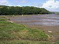
 Aveton Gifford Bridge - geograph.org.uk - 585718.jpg 640 × 480; 112 KB
-
 Aveton Gifford Weir - geograph.org.uk - 585713.jpg 640 × 480; 119 KB
-
 Aveton Gifford, near North Efford - geograph.org.uk - 632485.jpg 640 × 427; 190 KB
-
 Aveton Gifford, River Avon - geograph.org.uk - 632490.jpg 640 × 427; 147 KB
-
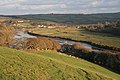
 Avon estuary - geograph.org.uk - 1509874.jpg 640 × 480; 26 KB
-
 Avon estuary - geograph.org.uk - 1509944.jpg 640 × 453; 43 KB
-
 Avon estuary - geograph.org.uk - 1510191.jpg 640 × 480; 53 KB
-
 Avon estuary - geograph.org.uk - 1510241.jpg 640 × 481; 74 KB
-
 Avon estuary - geograph.org.uk - 1510584.jpg 640 × 480; 96 KB
-
 Avon estuary - geograph.org.uk - 1510600.jpg 640 × 447; 77 KB
-
 Avon Estuary - geograph.org.uk - 1557505.jpg 640 × 480; 77 KB
-
 Avon Estuary - geograph.org.uk - 286524.jpg 640 × 480; 66 KB
-
 Avon Estuary - geograph.org.uk - 585729.jpg 640 × 480; 102 KB
-
 Avon Estuary - geograph.org.uk - 585749.jpg 640 × 480; 122 KB
-
 Avon Estuary - geograph.org.uk - 585764.jpg 640 × 480; 116 KB
-
 Avon estuary at Bantham - geograph.org.uk - 586280.jpg 640 × 480; 105 KB
-
 Avon Estuary at Doctor's Wood.jpg 4,176 × 2,848; 5.44 MB
-
 Avon Estuary near Aveton Gifford.jpg 3,948 × 2,757; 4.78 MB
-
 Avon Estuary near Bantham.jpg 4,084 × 2,848; 3.62 MB
-
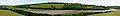 Avon Estuary pano.jpg 19,389 × 2,552; 21.22 MB
-
 Avon Estuary Walk - geograph.org.uk - 1590051.jpg 640 × 480; 94 KB
-
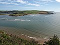 Avon Mouth - geograph.org.uk - 1476956.jpg 640 × 480; 74 KB
-
 Bantham - geograph.org.uk - 1513284.jpg 640 × 451; 76 KB
-
 Bantham - geograph.org.uk - 1513295.jpg 640 × 418; 76 KB
-
 Bantham - geograph.org.uk - 1514473.jpg 640 × 480; 90 KB
-
 Bantham Valley, Beach and Car Park - geograph.org.uk - 1435404.jpg 640 × 427; 91 KB
-
 Bantham, Devon geograph-4100124-by-Ben-Brooksbank.jpg 2,400 × 1,543; 5.01 MB
-
 Beach west of Sharpland Point - geograph.org.uk - 1476877.jpg 480 × 640; 92 KB
-
 Bigbury, near Milburn Orchard - geograph.org.uk - 632486.jpg 640 × 427; 174 KB
-
 Bigbury, River Avon - geograph.org.uk - 632487.jpg 640 × 427; 273 KB
-
 Bigbury, towards Aveton Gifford - geograph.org.uk - 632489.jpg 640 × 427; 182 KB
-
 Bigbury, towards Green Well - geograph.org.uk - 632481.jpg 640 × 427; 152 KB
-
 Bigbury, Villa Crusoe - geograph.org.uk - 632475.jpg 640 × 427; 175 KB
-
 Boats on the Avon - geograph.org.uk - 1509811.jpg 640 × 414; 49 KB
-
 Boats on the Avon estuary - geograph.org.uk - 1510232.jpg 640 × 480; 67 KB
-
 Bridge over the Creek - geograph.org.uk - 1573529.jpg 640 × 426; 97 KB
-
 Burgh Island from Bantham at sunset.jpg 4,088 × 2,768; 3.49 MB
-
 Burgh Island Hotel-11689353595.jpg 4,592 × 3,056; 2.82 MB
-
 Creek by the Avon - geograph.org.uk - 1510262.jpg 640 × 446; 75 KB
-
 Creek near Aveton Gifford.jpg 3,692 × 2,749; 4.36 MB
-
 Creek near Milburn Orchard - geograph.org.uk - 1574698.jpg 640 × 426; 88 KB
-
 Doctor's Wood and the Avon Estuary - geograph.org.uk - 326492.jpg 640 × 480; 79 KB
-
 Entrance to Stiddicombe Creek - geograph.org.uk - 585746.jpg 640 × 480; 69 KB
-
 Estuary of River Avon at Bantham, South Devon (21397516401).jpg 4,288 × 3,216; 3.78 MB
-
 Lime Kiln - geograph.org.uk - 585725.jpg 640 × 480; 156 KB
-
 Little egret near Aveton Gifford.jpg 1,800 × 1,296; 1.42 MB
-
 Looking West from Bantham at Sunset - geograph.org.uk - 340535.jpg 640 × 480; 78 KB
-
 Micha the Boxer dog on holiday at Bantham, South Devon (21389219245).jpg 3,216 × 4,288; 3.67 MB
-
 Mist on the Avon estuary (2) - geograph.org.uk - 1509863.jpg 640 × 433; 17 KB
-
 Mist on the Avon estuary - geograph.org.uk - 1509841.jpg 640 × 480; 54 KB
-
 Murray's Rock and Avon Mouth - geograph.org.uk - 169447.jpg 640 × 250; 138 KB
-
 North Efford - geograph.org.uk - 585721.jpg 640 × 480; 120 KB
-
 Panorama view on Burgh Island, Devon, England.jpg 1,024 × 768; 289 KB
-

-
 River Avon - geograph.org.uk - 1589954.jpg 640 × 480; 80 KB
-
 River Avon - geograph.org.uk - 1589976.jpg 640 × 480; 103 KB
-
 River Avon - geograph.org.uk - 1590032.jpg 640 × 480; 82 KB
-
 River Avon - geograph.org.uk - 1590090.jpg 640 × 480; 96 KB
-
 River Avon - geograph.org.uk - 586291.jpg 640 × 480; 167 KB
-

-
 River Avon, Bantham - geograph.org.uk - 413401.jpg 640 × 480; 69 KB
-
 Rocky outcrop, Bigbury beach - geograph.org.uk - 971669.jpg 640 × 480; 63 KB
-
 Seaside farming - geograph.org.uk - 1513148.jpg 640 × 445; 89 KB
-
 Sharpland Point - geograph.org.uk - 1476899.jpg 480 × 640; 101 KB
-
 Sharpland Point - geograph.org.uk - 1557524.jpg 640 × 480; 49 KB
-
 The Estuary of the River Avon - geograph.org.uk - 31333.jpg 640 × 461; 102 KB
-

-
 Thurlestone, Bantham Ham - geograph.org.uk - 632484.jpg 640 × 411; 137 KB
-
 Thurlestone, Jenkins Quay, Bantham - geograph.org.uk - 1551511.jpg 640 × 427; 457 KB
-
 Thurlestone, near Stiddicombe Wood - geograph.org.uk - 632479.jpg 640 × 427; 138 KB
-
 Thurlestone, River Avon - geograph.org.uk - 632477.jpg 640 × 427; 142 KB
-
 Tidal Creek near Aveton Gifford - geograph.org.uk - 1573544.jpg 640 × 426; 98 KB
-
 Tidal Road - geograph.org.uk - 1759365.jpg 2,816 × 2,112; 2.29 MB


.jpg)


.jpg)
_-_geograph.org.uk_-_1509863.jpg)


