Category:Aynho
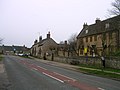
English: Aynho (formerly spelt Aynhoe) is a village and civil parish in South Northamptonshire, England, on the edge of the Cherwell valley about to the east, it is one of the two southernmost villages in Northamptonshire.
village and civil parish in Northamptonshire, United Kingdom  | |||||
| Upload media | |||||
| Instance of | |||||
|---|---|---|---|---|---|
| Location | West Northamptonshire, Northamptonshire, East Midlands, England | ||||
| Located in or next to body of water | |||||
| Population |
| ||||
| Area |
| ||||
| Said to be the same as | Aynho (Wikimedia duplicated page, civil parish) | ||||
 | |||||
Subcategories
This category has the following 9 subcategories, out of 9 total.
A
- Aynho Junction (11 F)
- Aynho Park railway station (2 F)
- Aynhoe Park (8 F)
B
- Bridges in Aynho (3 F)
C
- Cartwright Hotel, Aynho (4 F)
M
S
T
- Transport in Aynho (6 F)
Media in category "Aynho"
The following 171 files are in this category, out of 171 total.
-
 6 Roundtown, Aynho.jpg 4,032 × 3,024; 5.09 MB
-

-
 A pair of houses on The Glebe (geograph 3420352).jpg 1,024 × 683; 252 KB
-
 Unknown tower - geograph.org.uk - 453307.jpg 469 × 640; 79 KB
-
 Upper Aynho Grounds - geograph.org.uk - 453237.jpg 640 × 344; 70 KB
-
 Upper Aynho Grounds sign - geograph.org.uk - 453254.jpg 640 × 640; 137 KB
-
 Aynho Bridge - geograph.org.uk - 3887195.jpg 1,024 × 768; 126 KB
-
 Aynho Cottages - geograph.org.uk - 4766717.jpg 1,600 × 1,200; 453 KB
-
 Aynho footpath - geograph.org.uk - 5333238.jpg 640 × 480; 117 KB
-
 Aynho footpath - geograph.org.uk - 5333240.jpg 640 × 480; 78 KB
-
 Aynho Junction - geograph.org.uk - 4803801.jpg 2,000 × 1,500; 630 KB
-
 Aynho Park Lodge - geograph.org.uk - 437134.jpg 640 × 453; 135 KB
-
 Aynho railway station (closed) - geograph.org.uk - 4691042.jpg 800 × 459; 68 KB
-
 Aynho village entrance signs - geograph.org.uk - 2836412.jpg 640 × 480; 87 KB
-
 Aynho Village Hall - geograph.org.uk - 3887150.jpg 1,024 × 768; 134 KB
-
 Aynho Weir footbridge - geograph.org.uk - 4516243.jpg 1,024 × 730; 259 KB
-

-
 Aynho Weir Lock No 33 along the Oxford Canal - geograph.org.uk - 4516256.jpg 1,024 × 716; 268 KB
-
 Aynho Wharf - geograph.org.uk - 2700316.jpg 640 × 480; 74 KB
-
 Aynho Wharf - geograph.org.uk - 3887211.jpg 1,024 × 768; 109 KB
-
 Aynho Wharf - geograph.org.uk - 464108.jpg 640 × 480; 116 KB
-
 Aynho, Little Lane (geograph 3887158).jpg 1,024 × 768; 218 KB
-
 Aynho, Oxford Canal - geograph.org.uk - 3887189.jpg 1,024 × 768; 124 KB
-
 Aynho.JPG 1,280 × 960; 458 KB
-
 Aynhoe Park Lodge at a bend in the B4100 - geograph.org.uk - 3420391.jpg 1,024 × 683; 205 KB
-
 Ayno Wharf Oxford Canal - geograph.org.uk - 3292626.jpg 2,081 × 1,415; 970 KB
-
 B4031 Station Road crossing the Oxford Canal - geograph.org.uk - 4516381.jpg 1,024 × 776; 237 KB
-
 B4031 towards Clifton village - geograph.org.uk - 4516385.jpg 1,024 × 734; 235 KB
-
 B4031 towards Croughton - geograph.org.uk - 6281794.jpg 800 × 600; 147 KB
-
 B4100 Banbury Road where it passes over the M40 - geograph.org.uk - 3417739.jpg 1,024 × 683; 163 KB
-
 B4100 Bridge, M40 - geograph.org.uk - 2686758.jpg 640 × 430; 52 KB
-
 B4100 towards Adderbury - geograph.org.uk - 6281334.jpg 800 × 616; 136 KB
-
 B4100 towards Adderbury - geograph.org.uk - 6281749.jpg 800 × 600; 115 KB
-
 B4100 towards Aynho - geograph.org.uk - 6281781.jpg 800 × 600; 195 KB
-
 B4100 towards Bicester - geograph.org.uk - 6281787.jpg 800 × 596; 201 KB
-
 Barn conversion on Banbury Road (geograph 3419982).jpg 1,024 × 683; 194 KB
-
 Barn End, Aynho.jpg 4,032 × 3,024; 5.06 MB
-
 Belchers Lift Bridge - geograph.org.uk - 2058544.jpg 640 × 424; 74 KB
-
 Benchmark on a barn conversion on Banbury Road (geograph 3419956).jpg 683 × 1,024; 279 KB
-

-
 Benchmark on Oxford Canal Bridge 188 - geograph.org.uk - 3419766.jpg 683 × 1,024; 285 KB
-
 Benchmark on The Village Hall - geograph.org.uk - 3420277.jpg 683 × 1,024; 275 KB
-
 Benchmark on ^33 The Glebe - geograph.org.uk - 3420332.jpg 643 × 1,024; 180 KB
-
 Benchmark on ^5 Blacksmiths Hill - geograph.org.uk - 3420013.jpg 683 × 1,024; 305 KB
-
 Benchmark on ^6 The Square - geograph.org.uk - 3420243.jpg 683 × 1,024; 288 KB
-
 Beneath the bridge, Aynho Wharf - geograph.org.uk - 5645095.jpg 1,024 × 768; 176 KB
-
 Boats on the Oxford Canal - geograph.org.uk - 3619449.jpg 4,320 × 3,240; 4.04 MB
-
 Bridge 188, Aynho Weir Lock Bridge - geograph.org.uk - 4516265.jpg 1,024 × 725; 242 KB
-

-
 Bridge 190, Aynho Bridge - geograph.org.uk - 4516295.jpg 1,024 × 789; 265 KB
-
 Bridge 190, Oxford Canal - geograph.org.uk - 3475395.jpg 4,000 × 3,000; 4.81 MB
-
 Bridge under railway, Aynho Wharf - geograph.org.uk - 1892190.jpg 1,600 × 1,200; 1.45 MB
-
 Bridleway past small copse - geograph.org.uk - 453171.jpg 640 × 640; 196 KB
-
 Bridleway towards College farm - geograph.org.uk - 5887289.jpg 1,600 × 1,066; 512 KB
-
 Bus stop and on Croughton Road, Aynho - geograph.org.uk - 6281777.jpg 800 × 600; 101 KB
-

-
 Car sales on Aynho Road - geograph.org.uk - 6281332.jpg 640 × 480; 74 KB
-

-
 Church Walk, Aynho.jpg 4,685 × 3,513; 5.93 MB
-
 College Fields, Aynho - geograph.org.uk - 1892920.jpg 1,600 × 1,055; 1.1 MB
-
 Cottages on Roundtown, Aynho - geograph.org.uk - 6281754.jpg 800 × 600; 118 KB
-
 County Bridge - geograph.org.uk - 150150.jpg 640 × 480; 192 KB
-
 County Bridge - geograph.org.uk - 464076.jpg 640 × 480; 116 KB
-
 Croughton Farmland - geograph.org.uk - 6055036.jpg 1,600 × 1,200; 385 KB
-
 Defibrillator on the village hall, Aynho - geograph.org.uk - 6281775.jpg 658 × 800; 169 KB
-
 Entering Croughton - geograph.org.uk - 6281799.jpg 800 × 600; 186 KB
-

-
 Farmland - geograph.org.uk - 3366296.jpg 640 × 430; 40 KB
-

-
 Farmland near Aynho Fields - geograph.org.uk - 6281778.jpg 800 × 600; 112 KB
-
 Farmland next to the River Cherwell - geograph.org.uk - 4516249.jpg 1,024 × 669; 204 KB
-
 Farmland north of the B4100 - geograph.org.uk - 3308283.jpg 1,024 × 768; 198 KB
-
 Farmland off Aynho Road - geograph.org.uk - 6281337.jpg 800 × 600; 128 KB
-
 Farmland south of Aynho Junction - geograph.org.uk - 3366289.jpg 640 × 430; 37 KB
-
 Farmland, Aynho Junction - geograph.org.uk - 4520942.jpg 640 × 426; 41 KB
-
 Field entrance off the B4100 - geograph.org.uk - 6281784.jpg 800 × 600; 148 KB
-
 Fishpond near Aynho (geograph 1892925).jpg 1,600 × 1,200; 1.6 MB
-
 Footpath to Aynho - geograph.org.uk - 2700358.jpg 640 × 480; 83 KB
-
 Footpath to Croughton - geograph.org.uk - 5887179.jpg 1,600 × 1,066; 414 KB
-
 Footpath to Souldern - geograph.org.uk - 2700354.jpg 640 × 480; 104 KB
-
 Footpath to the towpath, Aynho Wharf - geograph.org.uk - 5645091.jpg 1,024 × 768; 217 KB
-
 Ford at Souldern Mill - geograph.org.uk - 2772087.jpg 9,632 × 3,961; 4.55 MB
-
 Ford at Souldern Mill - geograph.org.uk - 3297352.jpg 6,455 × 2,636; 5.32 MB
-
 Former station building at Aynho - geograph.org.uk - 4737647.jpg 2,000 × 1,500; 693 KB
-
 Gateway to Aynhoe Park House - geograph.org.uk - 3731554.jpg 1,500 × 999; 170 KB
-
 Grazing towards Warren Farm - geograph.org.uk - 6281796.jpg 800 × 600; 72 KB
-
 Great Western Arms (2015) - geograph.org.uk - 4691052.jpg 1,600 × 1,384; 395 KB
-
 House in The Square (geograph 3420261).jpg 1,024 × 683; 191 KB
-
 Houses on Blacksmiths Hill (geograph 3420095).jpg 1,024 × 683; 218 KB
-
 Houses on Roundtown - geograph.org.uk - 3731575.jpg 1,500 × 999; 133 KB
-
 Houses, Roundtown, Aynho - geograph.org.uk - 5429093.jpg 1,024 × 768; 142 KB
-
 Information regarding the village stocks (geograph 2319579).jpg 1,600 × 1,200; 586 KB
-
 Little Lane in Aynho (geograph 3731538).jpg 1,500 × 999; 223 KB
-
 Long boats at Aynho wharf on the Oxford Canal - geograph.org.uk - 3619445.jpg 4,320 × 3,240; 4.26 MB
-
 Looking north along the Oxford Canal - geograph.org.uk - 4516275.jpg 1,024 × 722; 306 KB
-
 Looking north along the Oxford Canal - geograph.org.uk - 4516289.jpg 1,024 × 701; 183 KB
-

-
 M40 - geograph.org.uk - 4520947.jpg 640 × 426; 38 KB
-
 M40 about to cross a minor stream - geograph.org.uk - 3022761.jpg 640 × 480; 68 KB
-
 M40 Aynho Road crosses - geograph.org.uk - 3125633.jpg 3,108 × 2,116; 1.17 MB
-
 M40 heading south - geograph.org.uk - 2686764.jpg 640 × 430; 49 KB
-
 M40 motorway - B4100 bridge, Aynho - geograph.org.uk - 3022768.jpg 640 × 480; 68 KB
-
 M40 motorway at Lower Aynho - geograph.org.uk - 3022763.jpg 640 × 480; 69 KB
-
 M40 motorway crosses Station Road - geograph.org.uk - 3022765.jpg 640 × 480; 64 KB
-
 M40 motorway in cutting near Aynho - geograph.org.uk - 3022767.jpg 640 × 480; 63 KB
-
 M40 nears Wharf Lane bridge - geograph.org.uk - 2829666.jpg 640 × 482; 32 KB
-
 M40 northbound - geograph.org.uk - 3224292.jpg 640 × 480; 41 KB
-
 M40 west of Aynho - geograph.org.uk - 2829665.jpg 640 × 482; 30 KB
-
 M40, Aynho Road Bridge - geograph.org.uk - 3296993.jpg 640 × 480; 370 KB
-
 Minor road from Clifton to Aynho - geograph.org.uk - 1891556.jpg 1,600 × 1,200; 676 KB
-
 Morel's used cars - geograph.org.uk - 437167.jpg 640 × 321; 71 KB
-
 Narrowboats moored along the Oxford Canal - geograph.org.uk - 4516382.jpg 1,024 × 753; 214 KB
-
 New plantation - geograph.org.uk - 5333266.jpg 640 × 480; 83 KB
-

-
 Oilseed rape and the M40, near Aynho - geograph.org.uk - 1892230.jpg 1,600 × 1,200; 948 KB
-
 Ordnance Survey Drawings - Barford St. John (OSD 224).jpg 4,000 × 2,086; 2.59 MB
-
 Oxford Canal - geograph.org.uk - 2700307.jpg 640 × 480; 89 KB
-
 Oxford Canal and weir bridge from Bridge 188 - geograph.org.uk - 3419908.jpg 683 × 1,024; 178 KB
-
 Oxford Canal Bridge 188 - geograph.org.uk - 3419789.jpg 683 × 1,024; 211 KB
-
 Oxford canal, Aynho Wharf - geograph.org.uk - 380601.jpg 640 × 480; 129 KB
-
 Pestouse Woods - geograph.org.uk - 5887287.jpg 1,600 × 1,066; 345 KB
-
 Pontings, Nell Bridge - geograph.org.uk - 437161.jpg 640 × 481; 108 KB
-
 Pool beside County Bridge - geograph.org.uk - 464087.jpg 640 × 480; 109 KB
-
 Rutted Bridleway - geograph.org.uk - 5333257.jpg 640 × 480; 85 KB
-
 Setting out from Aynho on the path to Souldern - geograph.org.uk - 2736720.jpg 1,024 × 768; 313 KB
-
 Sign for the Cartwright Arms, Aynho - geograph.org.uk - 6281766.jpg 708 × 800; 74 KB
-
 Souldern Mill - geograph.org.uk - 5333263.jpg 640 × 480; 81 KB
-
 Spring blossom in Aynho (geograph 2319596).jpg 1,023 × 1,024; 380 KB
-
 Station road drops steeply into the Cherwell valley - geograph.org.uk - 3619438.jpg 4,320 × 3,240; 5.17 MB
-
 Stocks, Aynho - geograph.org.uk - 5645132.jpg 1,024 × 768; 265 KB
-
 Stubble field off the B4031 - geograph.org.uk - 6281791.jpg 800 × 600; 120 KB
-
 Thatched cottage on Blacksmiths Hill (geograph 3731514).jpg 1,500 × 999; 295 KB
-
 The Cartwright Arms, Aynho - geograph.org.uk - 6281764.jpg 800 × 600; 104 KB
-
 The Great Western Arms - geograph.org.uk - 464103.jpg 640 × 480; 126 KB
-
 The Great Western Arms, Aynho - geograph.org.uk - 1670751.jpg 856 × 1,280; 185 KB
-
 The M40 heading southbound - geograph.org.uk - 4962384.jpg 1,500 × 1,125; 110 KB
-
 The Oxford Canal at Aynho Wharf - geograph.org.uk - 5429106.jpg 1,024 × 768; 141 KB
-
 The Oxford Canal south of Aynho Wharf - geograph.org.uk - 5645124.jpg 1,024 × 768; 274 KB
-
 The Oxford Canal, south of Aynho Wharf - geograph.org.uk - 5645097.jpg 1,024 × 768; 204 KB
-
 The Village Hall - geograph.org.uk - 3420318.jpg 1,024 × 683; 162 KB
-
 Towards Lower Aynho - geograph.org.uk - 5333259.jpg 640 × 480; 96 KB
-
 Towards Lower Aynho - geograph.org.uk - 5333260.jpg 640 × 480; 68 KB
-
 Towards Rainsborough Camp - geograph.org.uk - 5333241.jpg 640 × 480; 82 KB
-
 Track to Nellbridge Farm, Aynho Wharf - geograph.org.uk - 1892209.jpg 1,600 × 1,200; 1.41 MB
-
 Track to Walton Grounds - geograph.org.uk - 6281741.jpg 800 × 550; 171 KB
-
 Trees at Aynho Park Lodge - geograph.org.uk - 437137.jpg 479 × 640; 103 KB
-
 Trigpoint on the field boundary - geograph.org.uk - 5887288.jpg 1,600 × 1,066; 339 KB
-
 View towards Smanhill Covert and beyond - geograph.org.uk - 4384497.jpg 1,024 × 768; 174 KB
-
 Village hall, Aynho - geograph.org.uk - 6281770.jpg 800 × 577; 97 KB
-
 Village Stocks at Aynho (geograph 2319571).jpg 2,253 × 1,679; 1.39 MB
-
 Walton Grounds Triangulation Point - geograph.org.uk - 5333248.jpg 480 × 640; 96 KB
-
 Warren Farm with Pesthouse woods behind - geograph.org.uk - 5887206.jpg 1,600 × 1,066; 373 KB
-
 Weir at Aynho Wharf - geograph.org.uk - 1671527.jpg 856 × 1,280; 224 KB
-
 Wisteria Cottage, Aynho.jpg 3,024 × 4,032; 4.86 MB
-
 Woodland east of Aynho Junction - geograph.org.uk - 4520939.jpg 640 × 261; 27 KB
-
 Bridleway heading north - geograph.org.uk - 437154.jpg 640 × 640; 154 KB
-
 Bridleway past Lower Aynho Grounds - geograph.org.uk - 447526.jpg 640 × 480; 107 KB
-
 Bridleway to Padbury's Bottom - geograph.org.uk - 453276.jpg 640 × 463; 96 KB
-
 Farmland near Aynho - geograph.org.uk - 246349.jpg 640 × 421; 41 KB
-
 Field SE of County Bridge - geograph.org.uk - 464084.jpg 640 × 480; 93 KB
-
 Footpath to Souldern - geograph.org.uk - 453318.jpg 640 × 480; 135 KB
-
 Footpaths - geograph.org.uk - 453161.jpg 640 × 640; 121 KB
-
 Four way junction - geograph.org.uk - 437143.jpg 640 × 480; 124 KB
-
 Gateway to Upper Aynho Grounds - geograph.org.uk - 453243.jpg 640 × 454; 90 KB
-
 Junction of lane to Charlton - geograph.org.uk - 453217.jpg 640 × 441; 104 KB
-
 Lake at Nell Bridge nr Banbury - geograph.org.uk - 722481.jpg 640 × 480; 108 KB
-
 Nell Bridge Farm, Aynho - geograph.org.uk - 150144.jpg 640 × 480; 223 KB
-
 Pond in Padbury's Bottom - geograph.org.uk - 453294.jpg 640 × 480; 170 KB
-
 Sign in Padbury's Bottom - geograph.org.uk - 453288.jpg 480 × 640; 168 KB
-
 Signpost on Charlton Road - geograph.org.uk - 437145.jpg 640 × 484; 108 KB
-
 The Warren farm gatehouse - geograph.org.uk - 453203.jpg 640 × 400; 89 KB


.jpg)


_-_geograph.org.uk_-_4691042.jpg)


.jpg)


.jpg)


.jpg)


.jpg)


_-_geograph.org.uk_-_4691052.jpg)
.jpg)
.jpg)


.jpg)
.jpg)


.jpg)


.jpg)


.jpg)


.jpg)


