Category:B4031 road (England)

road in England | |||||
| Upload media | |||||
| Instance of |
| ||||
|---|---|---|---|---|---|
| Location | England | ||||
| Transport network |
| ||||
| |||||
Media in category "B4031 road (England)"
The following 22 files are in this category, out of 22 total.
-
 Aynho Park Halt (site remains) geograph-3244279-by-Ben-Brooksbank.jpg 2,387 × 1,523; 4.45 MB
-
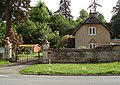 Aynho Park Lodge - geograph.org.uk - 437134.jpg 640 × 453; 135 KB
-
 St Annes Residential Home Clifton - geograph.org.uk - 23190.jpg 640 × 480; 98 KB
-
 County Bridge - geograph.org.uk - 150150.jpg 640 × 480; 192 KB
-
 County Bridge - geograph.org.uk - 464076.jpg 640 × 480; 116 KB
-
-

-
 Junction of Mill Close and the B4031 - geograph.org.uk - 973036.jpg 640 × 480; 53 KB
-

-

-

-

-
 Old Milestone by the B4031, Iron Down Hill (geograph 6061039).jpg 1,329 × 1,772; 392 KB
-

-
 Pool beside County Bridge - geograph.org.uk - 464087.jpg 640 × 480; 109 KB
-
 The Duke of Cumberlands Head - geograph.org.uk - 1583088.jpg 640 × 480; 82 KB
-

-

-
 Trees at Aynho Park Lodge - geograph.org.uk - 437137.jpg 479 × 640; 103 KB
-
 B4031 Astwick - geograph.org.uk - 436177.jpg 640 × 480; 108 KB
-
 B4031 S bend - geograph.org.uk - 436172.jpg 640 × 480; 81 KB
-
 Barley Mow Farm - geograph.org.uk - 344097.jpg 640 × 480; 78 KB
_geograph-3244279-by-Ben-Brooksbank.jpg)


.jpg)


.jpg)


