Category:Badgworth
English: Badgworth is a village and civil parish southwest of Axbridge in the Sedgemoor district of Somerset, England.
village in Sedgemoor, Somerset, England, UK  | |||||
| Upload media | |||||
| Instance of | |||||
|---|---|---|---|---|---|
| Location | Sedgemoor, Somerset, South West England, England | ||||
| Said to be the same as | Badgworth (Wikimedia duplicated page, civil parish) | ||||
 | |||||
Subcategories
This category has the following 2 subcategories, out of 2 total.
B
S
Media in category "Badgworth"
The following 64 files are in this category, out of 64 total.
-
 A field near Rose Farm - geograph.org.uk - 2543791.jpg 2,592 × 1,944; 1.08 MB
-
 A van on the A38, passing a layby - geograph.org.uk - 5459964.jpg 640 × 480; 162 KB
-
 A38 at Biddisham Bridge - geograph.org.uk - 3619225.jpg 640 × 419; 56 KB
-
 A38 heading north east - geograph.org.uk - 4251714.jpg 640 × 480; 60 KB
-
 A38 near Badgworth - geograph.org.uk - 3049315.jpg 640 × 427; 66 KB
-
 A38 towards Bristol - geograph.org.uk - 4251715.jpg 640 × 480; 38 KB
-
 Allerton Moor Rhyne - geograph.org.uk - 2546910.jpg 2,592 × 1,944; 1.61 MB
-
 Allerton Moor Rhyne - geograph.org.uk - 3866548.jpg 1,024 × 768; 184 KB
-
 Badgworth Grange - geograph.org.uk - 3866009.jpg 1,024 × 768; 126 KB
-
 Bristol Road (A38) - geograph.org.uk - 3455825.jpg 640 × 480; 90 KB
-
 Bristol Road (A38), Tarnock - geograph.org.uk - 3455828.jpg 640 × 480; 69 KB
-
 Cottage on Church Lane - geograph.org.uk - 3865990.jpg 1,024 × 768; 123 KB
-
 Cottages on Quarrylands Lane - geograph.org.uk - 3866566.jpg 1,024 × 768; 156 KB
-
 Down Rhyne - geograph.org.uk - 3455850.jpg 640 × 480; 64 KB
-
 Drainage channel on Allerton Moor - geograph.org.uk - 3866560.jpg 1,024 × 768; 159 KB
-
 Farmland, Tarnock - geograph.org.uk - 3455826.jpg 640 × 480; 62 KB
-
 Field access bridge, Meadow Farm - geograph.org.uk - 3892969.jpg 1,024 × 768; 175 KB
-
 Field at Prowses Steining - geograph.org.uk - 4804931.jpg 1,024 × 768; 227 KB
-
 Field entrance off Bristol Road - geograph.org.uk - 3455823.jpg 640 × 480; 87 KB
-
 Field near Haven Farm - geograph.org.uk - 2543770.jpg 2,592 × 1,944; 1.39 MB
-
 Former school, Badgworth - geograph.org.uk - 3866564.jpg 1,024 × 768; 175 KB
-
 Grazing sheep, Fletcher's Lane - geograph.org.uk - 3893417.jpg 1,024 × 768; 211 KB
-
 Green Farm - geograph.org.uk - 3864531.jpg 1,024 × 768; 255 KB
-
 Homestead Farm - geograph.org.uk - 3866720.jpg 1,024 × 773; 149 KB
-
 House at Long Acre - geograph.org.uk - 3866568.jpg 1,024 × 726; 124 KB
-
 Houses on Biddisham Lane - geograph.org.uk - 3864583.jpg 1,024 × 769; 134 KB
-
 Kirklea Farm, Badgworth - geograph.org.uk - 3866533.jpg 1,024 × 768; 192 KB
-
 Lay-by near Badgworth Bow Farm - geograph.org.uk - 5975935.jpg 1,200 × 1,600; 1.05 MB
-
 Lay-by on the A38 near Badgworth - geograph.org.uk - 2543760.jpg 2,592 × 1,944; 987 KB
-
 Livestock building, Meadow Farm - geograph.org.uk - 3893400.jpg 1,024 × 768; 202 KB
-
 New wooden house, Biddisham - geograph.org.uk - 5759992.jpg 1,024 × 775; 260 KB
-
 Newly built cattle shed, Tarnock - geograph.org.uk - 3893408.jpg 1,024 × 768; 211 KB
-
 Old Toll House, Badgworth - geograph.org.uk - 6115012.jpg 800 × 600; 219 KB
-
 On the A36 - geograph.org.uk - 4144070.jpg 4,000 × 2,664; 6.33 MB
-
 Orchard by the A38 - geograph.org.uk - 5513067.jpg 3,072 × 2,048; 1.42 MB
-
 Outbuildings, Manor Farm - geograph.org.uk - 3864519.jpg 1,024 × 768; 181 KB
-
 Paddons - geograph.org.uk - 3893427.jpg 1,024 × 803; 164 KB
-
 Plash Rhyne - geograph.org.uk - 3893732.jpg 1,024 × 769; 255 KB
-
 Pond at New Homestead Farm - geograph.org.uk - 5642462.jpg 1,024 × 768; 231 KB
-
 Poultry sheds on Biddisham Lane - geograph.org.uk - 3864559.jpg 1,024 × 768; 195 KB
-
 Poultry sheds, Meadow Farm - geograph.org.uk - 3864525.jpg 1,024 × 768; 178 KB
-
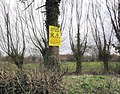 Protest sign, Badgworth - geograph.org.uk - 3866539.jpg 1,024 × 805; 320 KB
-
 Resting cow and the Mendip Hills - geograph.org.uk - 4812186.jpg 1,024 × 768; 155 KB
-
 Rhyne on Allerton Moor - geograph.org.uk - 5642473.jpg 1,024 × 768; 212 KB
-
 River Axe - geograph.org.uk - 3864553.jpg 1,024 × 768; 162 KB
-
 River Axe - geograph.org.uk - 5759974.jpg 1,024 × 768; 203 KB
-
 River Axe and Crook Peak - geograph.org.uk - 5759981.jpg 1,024 × 768; 185 KB
-
 Riverside Farm - geograph.org.uk - 3864549.jpg 1,024 × 753; 150 KB
-
 Rose Farm - geograph.org.uk - 3893421.jpg 1,024 × 797; 159 KB
-
 Sharp bend near Prowses Steining - geograph.org.uk - 3893646.jpg 1,024 × 768; 214 KB
-
 Signs for industrial estate - geograph.org.uk - 5446084.jpg 640 × 480; 165 KB
-
 Slade Lane - geograph.org.uk - 4812187.jpg 1,024 × 768; 217 KB
-
 Tanyard Farm Nurseries, Lower Weare - geograph.org.uk - 93511.jpg 640 × 426; 99 KB
-
 Tarnock Garage - geograph.org.uk - 3455821.jpg 640 × 480; 61 KB
-
 The A38 at Tarnock - geograph.org.uk - 4298147.jpg 3,264 × 2,448; 3.26 MB
-
 The Downs - geograph.org.uk - 3049269.jpg 640 × 398; 51 KB
-

-
 Traffic on the A38 - geograph.org.uk - 5446088.jpg 640 × 480; 228 KB
-
 View towards Paddons and the Mendip Hills - geograph.org.uk - 4804936.jpg 1,024 × 768; 193 KB
-
 View towards Rose Farm - geograph.org.uk - 4665010.jpg 1,024 × 768; 157 KB
-
 Farm Buildings - geograph.org.uk - 93526.jpg 640 × 426; 111 KB
-
 Lay-By - geograph.org.uk - 93408.jpg 640 × 426; 115 KB
-
 New Moon Inn - geograph.org.uk - 93505.jpg 640 × 426; 130 KB
-
 Plash Rhyne - geograph.org.uk - 93525.jpg 640 × 426; 110 KB


_-_geograph.org.uk_-_3455825.jpg)
,_Tarnock_-_geograph.org.uk_-_3455828.jpg)


