Category:Bagworth
village in United Kingdom  | |||||
| Upload media | |||||
| Instance of | |||||
|---|---|---|---|---|---|
| Location | Bagworth and Thornton, Hinckley and Bosworth, Leicestershire, East Midlands, England | ||||
| official website | |||||
 | |||||
Media in category "Bagworth"
The following 62 files are in this category, out of 62 total.
-

-

-

-
-
 Bagworth and Ellistown railway station.jpg 640 × 300; 77 KB
-
 Bagworth Colliery, 1990.jpg 3,252 × 1,688; 3.53 MB
-
 Bagworth Working Men's Club - geograph.org.uk - 2188435.jpg 1,024 × 762; 219 KB
-

-
 BagworthMinerStatue.JPG 1,024 × 768; 237 KB
-
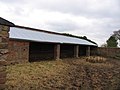
 Barn with holes in sides - geograph.org.uk - 159272.jpg 640 × 480; 69 KB
-
 Boardwalk near Bagworth - geograph.org.uk - 953416.jpg 480 × 640; 90 KB
-

-
 Coal train from Nailstone Colliery arriving at Bagworth. Nigel Tout, 10.7.67.jpg 3,234 × 2,195; 3.43 MB
-
 Electricity sub-station - geograph.org.uk - 159279.jpg 640 × 480; 84 KB
-

-
 Leicestershire countryside - geograph.org.uk - 542720.jpg 640 × 458; 130 KB
-
 Manor Wood - geograph.org.uk - 953493.jpg 640 × 480; 93 KB
-
 Manor Wood, South East of Bagworth - geograph.org.uk - 953502.jpg 640 × 480; 78 KB
-
 Mining statue - geograph.org.uk - 542284.jpg 640 × 608; 142 KB
-

-
 Station Terrace, Bagworth - geograph.org.uk - 261698.jpg 640 × 427; 74 KB
-
 Stormy weather and pylons - geograph.org.uk - 1201893.jpg 640 × 431; 55 KB
-

-
 The exchange sidings at Bagworth, looking towards Coalville, Nigel Tout.jpg 3,177 × 1,689; 2.59 MB
-
 Welcome to Bagworth - geograph.org.uk - 542356.jpg 640 × 462; 107 KB
-
 A view towards Bagworth - geograph.org.uk - 542278.jpg 640 × 492; 116 KB
-
 Approaching Bagworth - geograph.org.uk - 542269.jpg 640 × 406; 85 KB
-
 B585 Bagworth Road - geograph.org.uk - 159314.jpg 640 × 480; 73 KB
-
 Baegworde - geograph.org.uk - 174544.jpg 640 × 480; 108 KB
-
 Bagworth Lane - geograph.org.uk - 239886.jpg 640 × 480; 117 KB
-
-
 Barlestone Road - geograph.org.uk - 174534.jpg 640 × 451; 61 KB
-
 Barlestone Road, Bagworth - geograph.org.uk - 542272.jpg 640 × 444; 96 KB
-
 Cattle shed^^ - geograph.org.uk - 159311.jpg 640 × 480; 76 KB
-
 Cross Hills Baptist Church - geograph.org.uk - 239887.jpg 640 × 480; 98 KB
-
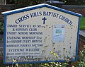 Cross Hills Baptist Church Noticeboard - geograph.org.uk - 239889.jpg 640 × 509; 103 KB
-
 Entrance to Ashley's Wood - geograph.org.uk - 513403.jpg 640 × 465; 118 KB
-
 Farmland south of Bagworth - geograph.org.uk - 542275.jpg 640 × 475; 92 KB
-
 Flowers on Station Road, Bagworth - geograph.org.uk - 542349.jpg 640 × 392; 136 KB
-
 Footpath near Bagworth, Leicestershire - geograph.org.uk - 542277.jpg 640 × 509; 139 KB
-
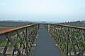
 Footpath over the railway - geograph.org.uk - 261699.jpg 640 × 416; 94 KB
-
 Footpath to Bagworth Wood - geograph.org.uk - 261700.jpg 640 × 427; 74 KB
-
 Former Inn - geograph.org.uk - 159276.jpg 640 × 435; 70 KB
-
 Grange Road, Leicestershire - geograph.org.uk - 542655.jpg 640 × 477; 104 KB
-
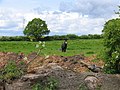 Grazing - geograph.org.uk - 174526.jpg 640 × 480; 102 KB
-
 Ivanhoe Line railway bridge - geograph.org.uk - 239892.jpg 640 × 436; 102 KB
-
 Lake - geograph.org.uk - 174542.jpg 640 × 480; 89 KB
-
 Old station yard - geograph.org.uk - 261702.jpg 640 × 427; 81 KB
-
 Ploughed field - geograph.org.uk - 159312.jpg 640 × 480; 64 KB
-
 Relight my fire - geograph.org.uk - 416251.jpg 640 × 480; 89 KB
-
 Single track railway at Bagworth - geograph.org.uk - 261703.jpg 640 × 427; 73 KB
-
 Station Road and Wood Road Junction - geograph.org.uk - 542365.jpg 640 × 409; 89 KB
-
 Station Road near Bagworth - geograph.org.uk - 542358.jpg 555 × 640; 115 KB
-
 Station Road, Bagworth - geograph.org.uk - 542280.jpg 640 × 441; 93 KB
-
 Station Road, Bagworth - geograph.org.uk - 542342.jpg 640 × 383; 100 KB
-
 Terraced Houses - geograph.org.uk - 174541.jpg 640 × 479; 79 KB
-

-
 The Ivanhoe Way, Bagworth - geograph.org.uk - 542262.jpg 540 × 640; 129 KB
-
 The Limes - geograph.org.uk - 542652.jpg 640 × 609; 149 KB
-
 The Maynard - geograph.org.uk - 542354.jpg 640 × 381; 83 KB
-
-
 Village Hall - geograph.org.uk - 174540.jpg 640 × 470; 83 KB


