Category:Baie de Somme
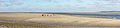
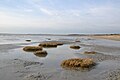
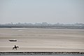
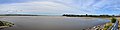
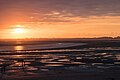
English: The "Bay of the Somme" is the place where the river Somme (which gives its name to the department) flows into the English Channel
| Object location | | View all coordinates using: OpenStreetMap |
|---|
This is the category of the protected area listed at WDPA under the ID 145815
|
Bay at the Somme estuary (Picardy, France)  | |||||
| Upload media | |||||
| Instance of | |||||
|---|---|---|---|---|---|
| Part of | |||||
| Located in protected area |
| ||||
| Location | Somme, Hauts-de-France, Metropolitan France, France | ||||
| Heritage designation |
| ||||
| Inflows | |||||
| Different from | |||||
 | |||||
Subcategories
This category has the following 20 subcategories, out of 20 total.
Media in category "Baie de Somme"
The following 64 files are in this category, out of 64 total.
-
 (1) Bai de Somme, Boote, Küste, Ebbe.jpg 2,048 × 1,536; 701 KB
-
 (5) Bai de Somme, Boote, Küste, Ebbe.jpg 2,048 × 1,536; 784 KB
-
 (6) Bai de Somme, Boote, Küste, Ebbe.jpg 2,048 × 1,536; 767 KB
-
 Baie de Somme (13).JPG 4,912 × 1,080; 1.27 MB
-
 Baie de Somme (14).JPG 2,592 × 1,944; 1.24 MB
-
 Baie de Somme (2).JPG 4,912 × 1,080; 1.07 MB
-
 Baie de Somme (28000246502).jpg 3,569 × 1,271; 3.57 MB
-
 Baie de Somme (3).JPG 2,592 × 1,944; 1.76 MB
-
 Baie de Somme (4).JPG 1,944 × 2,592; 1.82 MB
-
 Baie de Somme (48325805277).jpg 3,915 × 5,872; 11.2 MB
-
 Baie de Somme (5).JPG 4,912 × 1,080; 1.42 MB
-
 Baie de Somme (6).JPG 2,592 × 1,393; 1.07 MB
-
 Baie de Somme (7).JPG 2,592 × 1,944; 1.5 MB
-
 Baie de Somme (plage).jpg 3,648 × 2,736; 937 KB
-
 Baie de Somme - near Noyelles-sur-Mer-3330-33.jpg 12,383 × 3,149; 23.83 MB
-
 Baie de Somme - near Noyelles-sur-Mer-3334-36.jpg 12,710 × 3,097; 27.65 MB
-
 Baie de Somme 01.jpg 5,472 × 3,648; 4.86 MB
-
 Baie de Somme 02.jpg 5,472 × 3,648; 4.77 MB
-
 Baie de Somme 03.jpg 5,472 × 3,648; 4.69 MB
-
 Baie de Somme 04.jpg 5,472 × 3,648; 4.78 MB
-
 Baie de Somme 05.jpg 5,472 × 3,648; 5.09 MB
-
 Baie de Somme at Le Crotoy-3168-70.jpg 11,869 × 3,274; 19.49 MB
-
 Baie de Somme at Le Hourdel-3177-79.jpg 11,662 × 3,163; 17.36 MB
-
 Baie de Somme at Le Hourdel-3183-86.jpg 12,790 × 2,932; 25.66 MB
-
 Baie de Somme at Le Hourdel-3206-09.jpg 13,986 × 3,278; 24.77 MB
-
 Baie de Somme at Le Hourdel-3214-21.jpg 27,585 × 3,228; 50.56 MB
-
 Baie de Somme à marée basse.jpg 2,816 × 1,880; 1.84 MB
-
 Baie de somme.jpg 3,161 × 2,371; 1.2 MB
-
 Baie de Somme1.JPG 3,872 × 2,592; 6.16 MB
-
 Bord de mer, près du marais du Crotoy.jpg 3,456 × 2,304; 2.22 MB
-
 Chalet de Blanquetaque, Maison Ramsar - Port-le-Grand.jpg 4,896 × 3,672; 3.31 MB
-
 Champs en baie de Somme.jpg 4,608 × 3,072; 4.3 MB
-
 Cheval dans la Baie de la Somme.jpg 5,184 × 3,456; 4.32 MB
-
-
 Intertidal zone, the Bay of Somme, France.jpg 2,048 × 1,536; 317 KB
-
 La baie de somme (8723050961).jpg 4,739 × 2,422; 2.66 MB
-
 Le Crotoy 035.JPG 3,264 × 2,448; 2.88 MB
-
 Le Crotoy enbaie de Somme.jpg 4,608 × 3,072; 4.19 MB
-
 Le Crotoy panoramic.jpg 8,257 × 2,097; 1.41 MB
-
 Le Hourdel, Baye de la Somme -1778.jpg 5,184 × 3,456; 11.4 MB
-
 Manessier.Sables.jpg 2,367 × 1,565; 640 KB
-
 Mollieres baie de Somme.JPG 2,048 × 1,360; 1.11 MB
-
 Morning over Baye de la Somme -3148.jpg 5,154 × 2,715; 7.57 MB
-
 Moules à linterieur.jpg 4,608 × 3,072; 2.94 MB
-
 Moéson deul Béie d'Sonme.JPG 2,288 × 1,712; 771 KB
-
 Observation phoques Hourdel 2.jpg 2,304 × 3,456; 2.3 MB
-
 Observation phoques Hourdel 3.jpg 3,456 × 2,304; 2.04 MB
-
 Observation phoques Hourdel 4.jpg 3,456 × 2,304; 1.97 MB
-
 Observation phoques Hourdel.jpg 3,456 × 2,304; 2.26 MB
-
 On The Beach (180479661).jpeg 2,048 × 1,365; 599 KB
-
 On The Beach (180479871).jpeg 2,048 × 1,365; 495 KB
-
 Phare du Hourdel R01.jpg 4,844 × 3,440; 10.43 MB
-
 Phare du Hourdel R02.jpg 3,068 × 5,029; 10.16 MB
-
 Phare du Hourdel R03.jpg 2,901 × 4,448; 8.11 MB
-
 Phoques Baie de Somme.jpg 3,456 × 2,304; 2.01 MB
-
 Photographer and seals (13021785994).jpg 2,911 × 1,336; 784 KB
-
 Pêcheurs à pieds en Baie de Somme.jpg 3,872 × 2,592; 3.67 MB
-
 Ripples, the Bay of Somme, France.jpg 2,048 × 1,536; 225 KB
-
 Somme - Baie de Somme 1935 L93.jpg 30,000 × 32,500; 129.71 MB
-
 Somme 209, Baye de la Somme.JPG 4,219 × 2,813; 6.22 MB
-
 Somme Bay, France.jpg 4,471 × 2,540; 3.49 MB
-
 St Firmin-lès-Crotoy 015 Base nautique.JPG 3,648 × 2,736; 2.14 MB
-
 St Valéry sur Somme.jpg 5,648 × 2,332; 2.89 MB
-
 Wolffia arrhiza - Baie de Somme.jpg 4,896 × 3,672; 6.24 MB
_Bai_de_Somme,_Boote,_K%C3%BCste,_Ebbe.jpg)
_Bai_de_Somme,_Boote,_K%C3%BCste,_Ebbe.jpg)
_Bai_de_Somme,_Boote,_K%C3%BCste,_Ebbe.jpg)
.JPG)
.JPG)
.JPG)
.jpg)
.JPG)
.JPG)
.jpg)


.jpg)


.jpeg)
.jpeg)


.jpg)


.JPG)
.JPG)
.jpg)
.JPG)