Category:Bakkerstraat 60, Arnhem
| Object location | | View all coordinates using: OpenStreetMap |
|---|
building in Arnhem, Netherlands  | |||||
| Upload media | |||||
| Instance of | |||||
|---|---|---|---|---|---|
| Location | Arnhem, Gelderland, Netherlands | ||||
| Street address |
| ||||
| Located on street | |||||
| Heritage designation |
| ||||
 | |||||
|
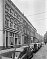
This is a category about rijksmonument number 8305
|
| Address |
|
Media in category "Bakkerstraat 60, Arnhem"
The following 3 files are in this category, out of 3 total.
-
 Arnhem - Bakkerstraat 60.jpg 1,944 × 2,592; 1.26 MB
-
 Voorgevels - Arnhem - 20025248 - RCE.jpg 965 × 1,200; 231 KB
-
 Voorgevels - Arnhem - 20025249 - RCE.jpg 957 × 1,200; 233 KB

