Category:Ballot measure maps of Maryland
States of the United States: Alabama · Alaska · Arizona · Arkansas · California · Colorado · Connecticut · Delaware · Florida · Georgia · Hawaii · Idaho · Illinois · Indiana · Iowa · Kansas · Kentucky · Louisiana · Maine · Maryland · Massachusetts · Michigan · Minnesota · Mississippi · Missouri · Montana · Nebraska · Nevada · New Hampshire · New Jersey · New Mexico · New York · North Carolina · North Dakota · Ohio · Oklahoma · Oregon · Pennsylvania · Rhode Island · South Carolina · South Dakota · Tennessee · Texas · Utah · Vermont · Virginia · Washington · West Virginia · Wisconsin · Wyoming
Media in category "Ballot measure maps of Maryland"
The following 4 files are in this category, out of 4 total.
-
 1992 Maryland Question 6 results by county.svg 744 × 405; 253 KB
-
 2012 Maryland Question 6 results map by county.svg 744 × 405; 223 KB
-
 2022 Maryland Question 4 results map by county.svg 744 × 405; 253 KB
-
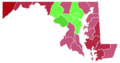 Maryland Question 6 breakdown by county.png 900 × 475; 24 KB


